

So if anyone’s been wondering where I’ve been (or why I haven’t been) on social media over the last month, we just got back from a 3 week adventure to the Pacific Northwestern US! It was pretty amazing, filled with volcanos, volcanic formations, and the Pacific Ocean. The weather was really quite good, too, except that it was 115 in NorCal and Mt. Hood decided to hide its head in the clouds. But, hey, you can’t have everything, and I think we made out pretty well considering.
(Affiliate links are present on this page.)
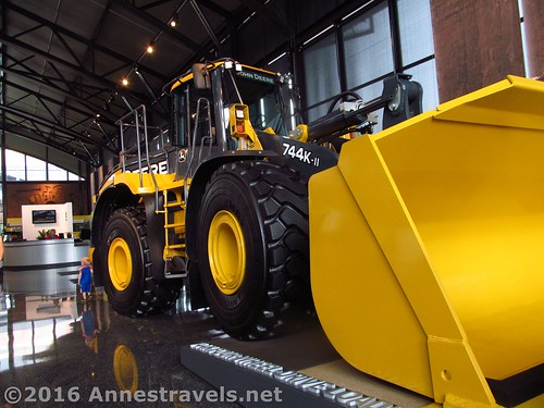
We started out by visiting the John Deere Pavilion in Moline, IL (almost in Iowa). Here we got to see big machinery, climb into a bulldozer and front end loader (not to mention a ginormous combine and more normal size big farm tractor). Let’s just say some of the younger (and older) members of my group had a terrific time!
Then we ended up having to get a tire fixed in Salt Lake City, UT. It just happened to be Pioneer Day, a state holiday celebrating the coming of the first Mormon Pioneers, so the people at the tire place directed us about 5 blocks away to see the parade (which is the 2nd largest parade in the country… or was it the 3rd largest?)

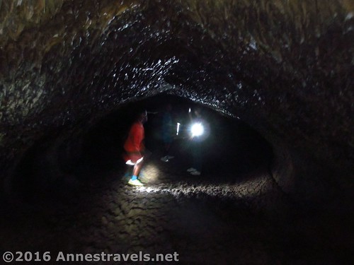
The next day we finally arrived at our first official destination, and explored some caves in Lava Beds National Monument in far northern California (it’s a good thing the caves were cool, because it was too hot to hike outside):
Eating supper at the Fleener Chimneys.
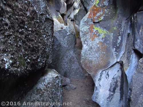
And the next morning we explored the “Big Crack”, a faultline that split, revealing a kind of rock slot canyon (pretty cool!)
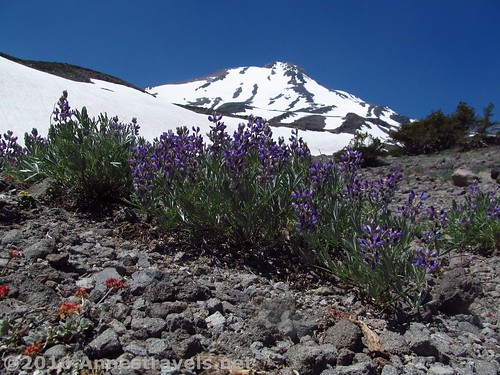
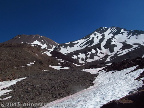
Then we headed down to Mt. Shasta, where we did two hikes, Brewer Creek (which I can’t call a trail, since we mostly followed unofficial social trails through stunning scenery)…
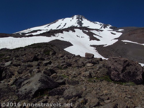
And a real trail up to the Horse Camp and Hidden Valley (which, honestly, is beyond belief spectacular).
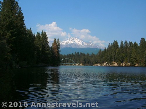
Being so hot, we were only too happy to find a lake we could jump into. The one we stumbled upon (Siskyou Lake) had a simply lovely view of Mt. Shasta from it.
Now, the one reason we were braving the 100+ degree heat (thankfully, up on the mountain it was slightly cooler) was because one of my group members wanted to visit a church in Redding. So we did that at the end of our first week, and enjoyed it a lot. But what we enjoyed nearly as much was driving over to the coast and the air suddenly being cool! Yes, I can live with 60 to 70 degree temps!
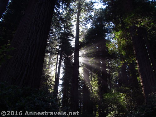
We hadn’t planned it, but since when we were driving right though, we stopped at Redwood National Park.
The Lady Bird Johnson Grove was a definite highlight…
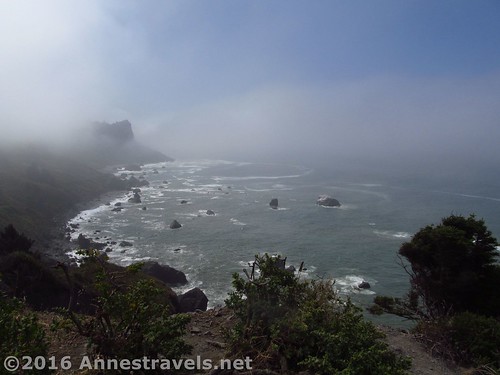
But we also stopped at the High Bluff Overlook…
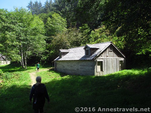
And “The Farm that Wasn’t”, an old WWII radar station built to look like a harmless seaside farm.
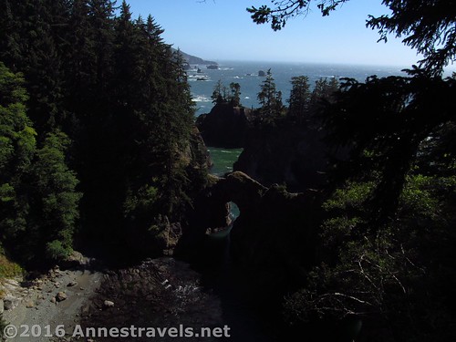
From there, it wasn’t a long drive up to the Samuel H. Boardman Scenic Corridor. Let me say here, I think it is one of the most scenic areas of US-101 in Oregon. Personal opinion, but the sea stacks, sea arches, blue-green ocean, towering trees, and so much more were absolutely stunning! (And Arch Rock was pretty cool, too!)
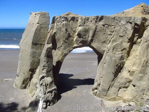
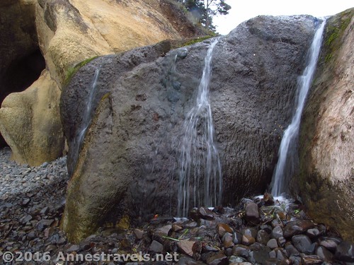
The next day, we walked Floras Beach. This is a sand beach, fairly deserted by Oregon standards (ok, by most standards) except for the nearby Flores Lake that was filled with kite surfers. My favorite part of the hike was a sea arch we found.
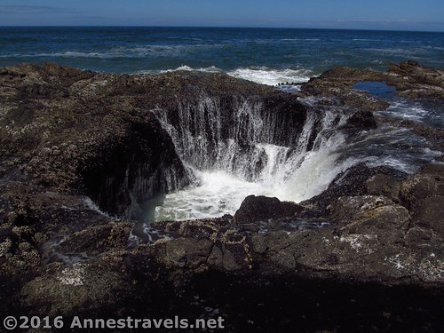
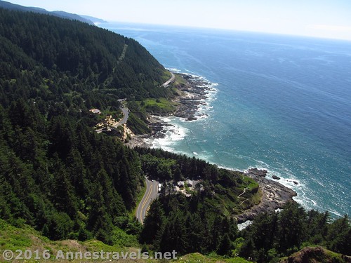
Continuing to move north, we hit Cape Perpetua, which was another definite favorite. The most famous thing about the Cape is Thor’s Well (a collapsed lava tube through which the sea glubs at low tide and sloshes upward at high tide), which we were able to see just after high tide (the best time to view it) in relative safety due to calm seas.
But the view from the headland above is also simply beautiful. And: I got to see my first whale ever!
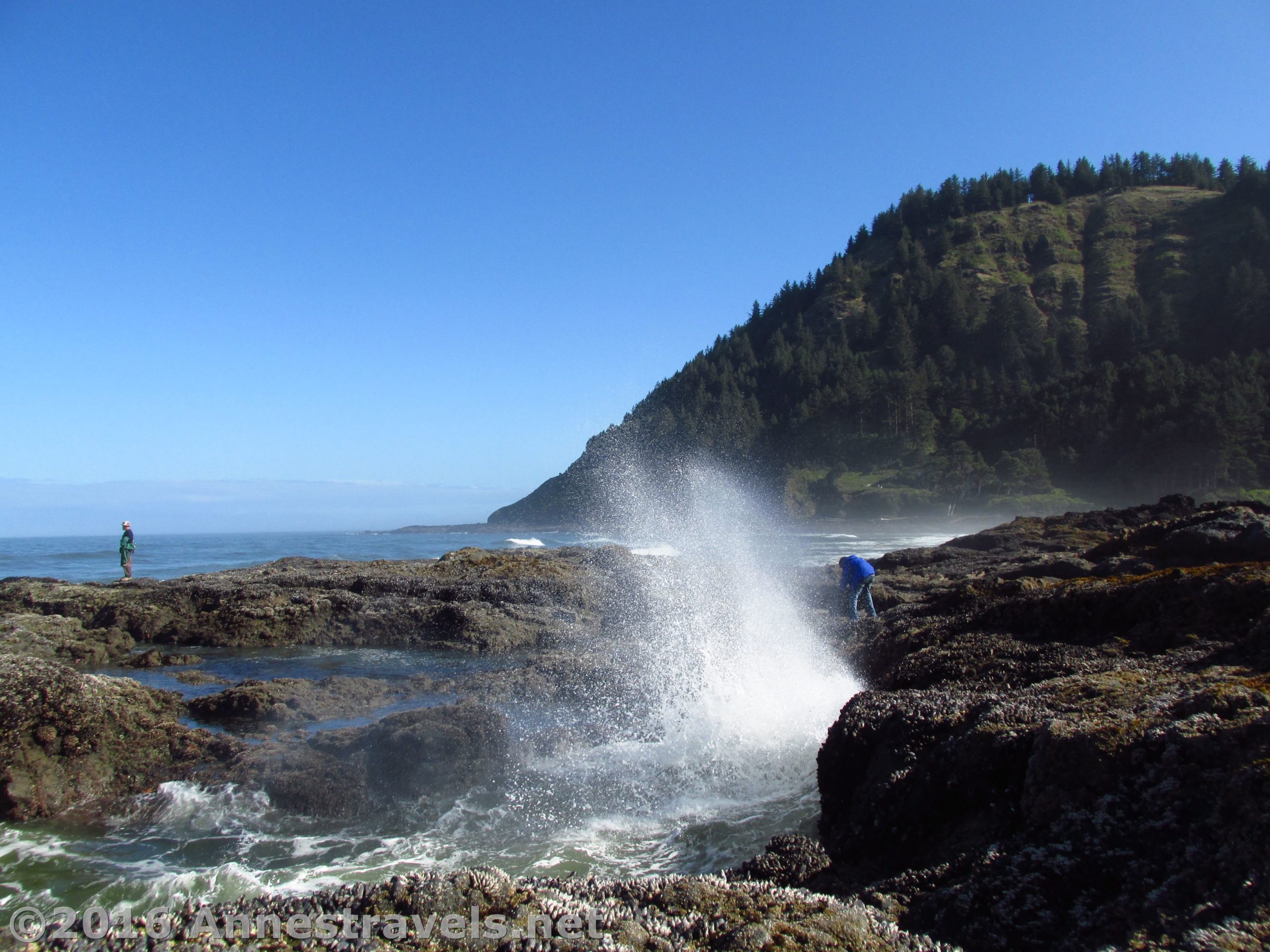
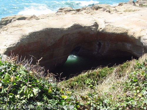
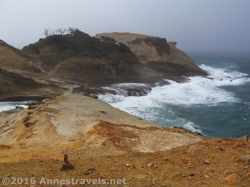
The next day, we wandered around a bit to find the Devil’s Punchbowl. It was well worth visiting at low tide, as we could scramble over the volcanic rock and tide pools to enter the Punchbowl through a sea arch, as well as sidle through a crack in a rock (a real cave passage) to get to the second sea arch entrance. How cool is that?
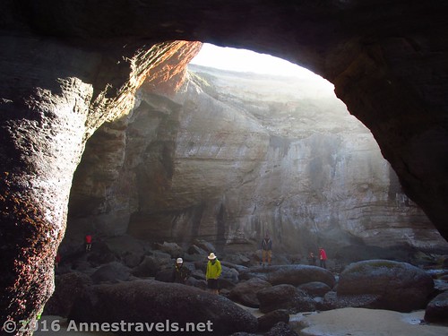
Later in the day, we came back to see the Punchbowl at high tide, when it’s full of water!
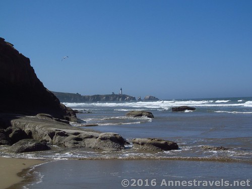
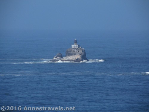
In between low tide and high tide, we walked Beverly Beach, with views toward the Yaquina Head Lighthouse.
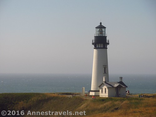
After that hike, we simply had to go and see the lighthouse, even though we were too late in the day for a tour (which was very nearly too small for my group, anyway).
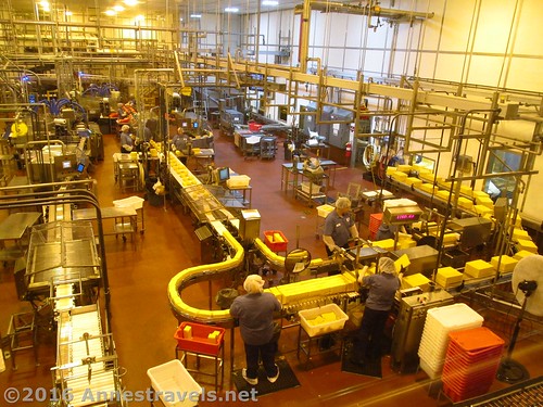
The next day we decided to take a break from beaches and went to the Tillamook Cheese Factory. All I can say is, I highly recommend it. Not only can you see cheese being made on the factory floor, but there’re free samples of cheese. Green cheese, anyone?
In the afternoon, we couldn’t resist seeing the churning water and jumping down the 240ft. sand dune at Cape Kiwanda.
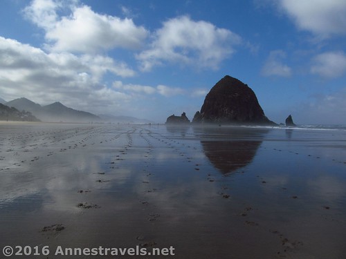
I think my group was tiring a bit of beach walks, but I pleaded to do one more – Cannon Beach. So we visited Hug Point…
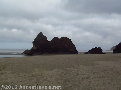
And Cannon Beach (where I got to see my first puffin on Haystack Rock!)
And since we were there, we visited Ecola State Park and hiked the Clatsop Loop (complete with views of a lighthouse ‘way out on a seastack and a WWII era bunker). We also visited Ecola Point.
The next day was our last on the coast, so we visited Fort Clatsop, where Lewis and Clark spent their winter on the Pacific Coast, and got to see a ranger shoot off a flintlock gun!

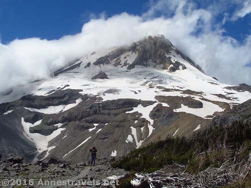
Well, I really wanted some more mountains, so we drove inland to Mt. Hood (hey, it’s on the way east, right?) The day we arrived was beautiful, as was the weather as we walked around Elk Meadows and headed up Gnarl Ridge. But by the time we got to the top, the mountain was wearing clouds for a hood (pun intended). The clouds did part for a moment just before we went down, and I can safely say this is one incredibly spectacular hike!
The next day was still cloudy, but we did the Old Vista Ridge Trail anyway to Owl Point. This is a well-maintained trail (minus some windfall) kept up by volunteers – the Forest Service has been trying to forget about this hiking trail for years; the first time I tried to hike it 2010, they’d piled logs at the trail junction. But this time, it was clear, and I’d do the trail again in a heartbeat if the weather was nice.
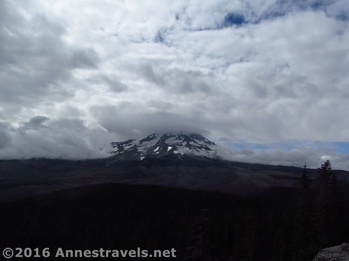
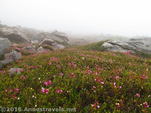
The next day’s weather was no better. We hiked the Mazama Trail to McNeil Point, which is supposed to have a fantastic view. I can’t vouch for that, but I can say it’s a great trail to take on a misty, rainy day – the meadows in the mist are awesome! (Not to mention the wildflowers and waterfalls!)
Well, with the weather so cloudy and with us running very short on time, we thought we’d stop at Yellowstone National Park on the way home – a couple younger members of the group had been asking, so, hey, why not?!?
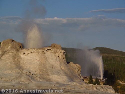
We spent a very enjoyable evening at the Upper Geyser Basin.
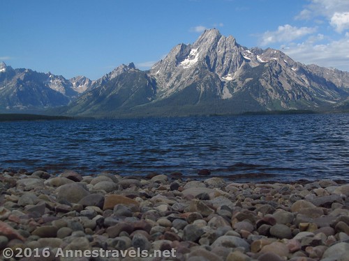
And the next morning, there were several of us who just couldn’t resist a hike in Grand Teton National Park. It turned out to be a phenomenal trail in terms of views; the Lakeshore Trail that begins from the Colter Bay Visitor Center.
After that, it was a “quick” drive down to Hobo Pool (a must if we’re going anywhere near it on our way home) before making tracks back east… but what a way to end the trip!
I’ll be posting about all my adventures in the upcoming weeks… stay tuned!
Zoom map in to browse individual hikes
This Week’s Featured Product!
Looking for even more trails along the Oregon Coast? Check out this guide, with a wide variety of trails, including the Oregon Coast Trail.


3 responses to “Sneak Peak: A Land of Volcanos and Oceans”
[…] have a few options: #1) Hike anyway (like the Owl Point or McNeil Point Trails on Mt. Hood, or Pyramid Peak in the Flat Tops of Colorado), #2) Wait it out (I never did post about […]
[…] a recent trip to the west coast, we decided at the last moment to stop in at Yellowstone National Park to take in the Upper Geyser […]
[…] July? Someone who really wanted to visit NorCal, I guess! Last summer we took a little detour through California on our way to the Oregon coast (and just about got fried from the 100F+ temps, but that’s another story). Our first […]