

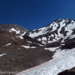
The Horse Camp on Mt. Shasta is quite the destination. The views are very nice, but beyond the fact that it’s a popular day hiking destination, it’s also a “parting of the ways” for many climbers ascending Mt. Shasta, as well as hikers on their way to destinations like Helen Lake, Green Butte (which I did from the Ski Bowl a few years back), and Hidden Valley. Why it’s called a Horse Camp, I’m not entirely sure. I didn’t see any horses, though there were some overnight backpackers and a historic stone cabin maintained by the Sierra Club. At any rate, it makes a pretty good short (3.6 mile RT) hike with some really nice views of Mt. Shasta.
Quick Stats for the Trail to the Mt. Shasta Horse Camp
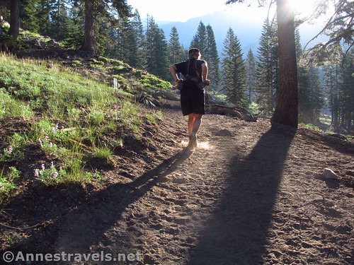
We started out extremely early one morning in late July – we’d slept at the “campground” (free) across the road from the Bunny Flat trailhead, which seemed to be what half the population of the town of Mt. Shasta was doing as well – without air conditioning, I bet most people would sleep better at the cooler higher elevation of the big mountain. We got an early start because we needed to be in Redding by about 6pm, so we wanted to get in our hike with time to spare.
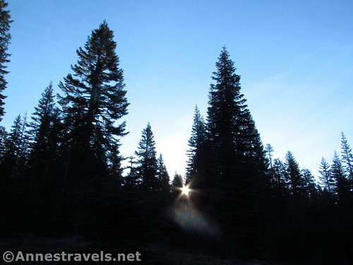
The trail begins from Bunny Flats. I’m not sure I took off from the exact trailhead – I was trying to give some hippies sleeping on a blanket near their car a wide birth (who really wants to be woken up at 4:30am?) There are a number of social trails, and one real trail heading up to a bench and viewpoint (with a nice view of Mt. Shasta), but it was pretty easy to locate the trail that headed upward into the forest.
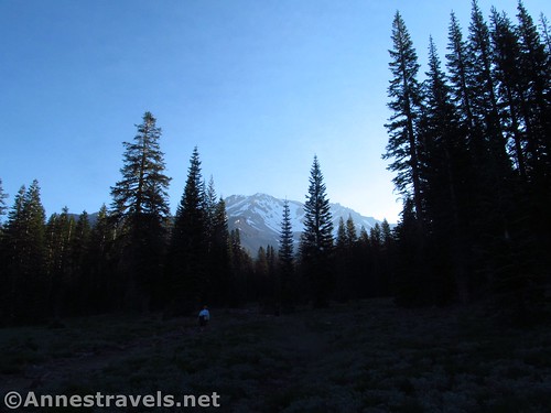
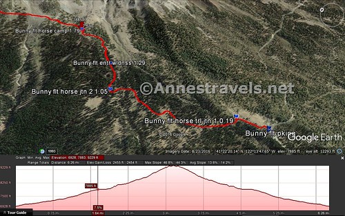
There are some nice peek-a-boo views of Shasta before the first trail junction at nearly mile 0.2. Turn left to follow the signs toward the Horse Camp. Continue upward though the forest to a second trail junction about mile 1.0; continue right toward the Horse Camp (the left trail goes down to the Sand Flat Trailhead, and while you could certainly start there, it’s lower elevation and the trail is slightly longer).
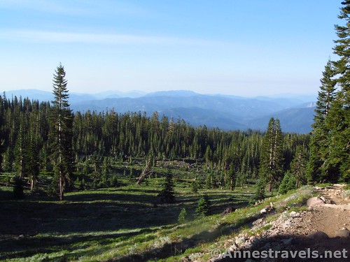
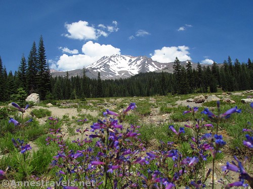
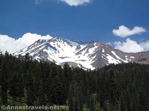
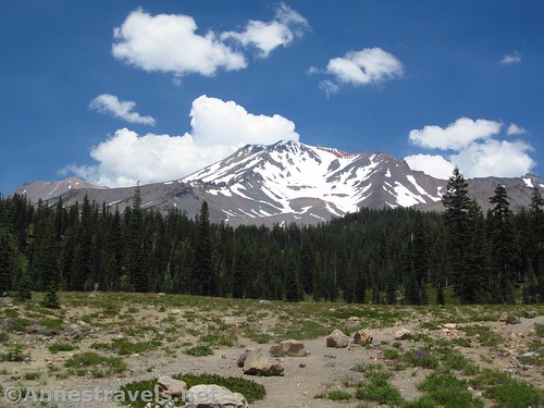
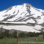
The trail (very dusty) from here wanders through forests and meadows. There are occasional views of the surrounding valleys and mountains, but not much in the line of Mt. Shasta until just before the Horse Camp about mile 1.8.
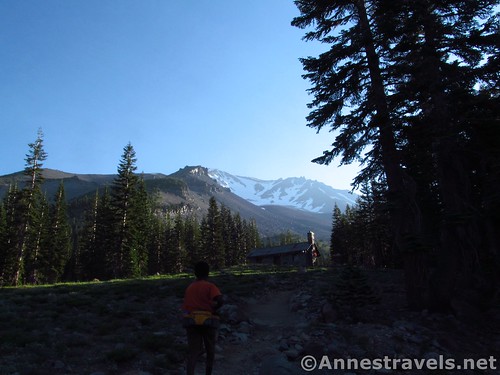
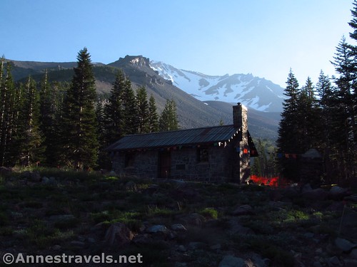
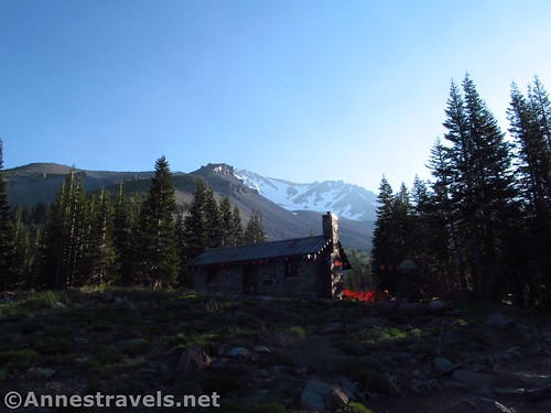
Then the views are pretty much jaw-dropping. The cabin is pretty idyllic-looking, and Mt. Shasta’s peak is stunning above it. Walk over and behind the cabin, and you can see the peak without the cabin in the way. Beautiful!
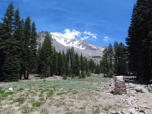
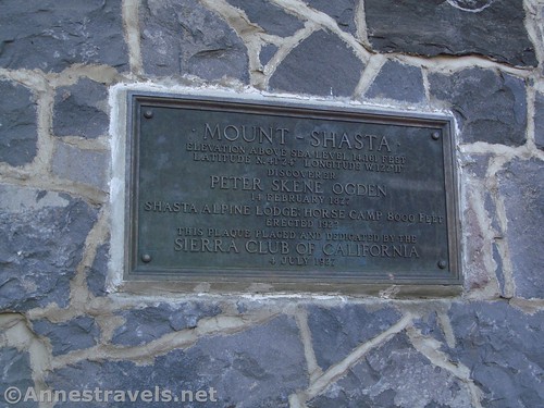
The cabin itself is run by the Sierra Club. There is a suggested use fee (not enforced), though since we just walked in and walked out, and didn’t use any of the facilities, we didn’t end up paying (our choice). Inside are some maps, news articles, and things you can check out. Also in the Horse Camp is a toilet, drinkable water, and campsites.
Overall, the Horse Camp makes a great day hiking destination if you’re looking for some great views of Mt. Hood but don’t want anything too long. It’s also a great stop along the way to other, even more impressive or exciting destinations… like Hidden Valley!
Round Trip Trail Length: 3.6 miles
Net Elevation Change: 1,031ft. (6,906ft. at the trailhead to 7,937ft. at the Horse Camp cabin)
Facilities: Primitive restrooms at the trailhead and Horse Camp; potable water at the Horse Camp
Fees: None. You are required to sign up for a free permit at the trailhead (not to be confused with the $$ permit for going over 10,000ft.)
Trail Notes: The trail is very, very dusty, so be prepared for asphyxiation if you’re near another hiker. Also note that much of the trail passes through land owned by the Sierra Club, so there are special restrictions and regulations (if you’re just a day hiker, and you know the meaning of “stay on designated trails”, you’re probably fine). In the summer, a Sierra Club volunteer hangs around the cabin, chatting with hikers, etc.
Trail 
![]()
![]()
Road
Signs ![]()
Scenery ![]()
Would I go 100 miles out of my way for this?
Overall Rating: ![]()
Key GPS Coordinates
Parking: 41.35382N / -122.23383W (41° 21′ 13.7514″ / -122° 14′ 1.7874″) (6,933ft.)
Trail Beginning: 41.35412N / -122.23331W (41° 21′ 14.8320″ / -122° 13′ 59.9160″) (6,906ft.) (0.0; ended 7.25)
Horse Trail Junction #1: 41.35643N / -122.23363W (41° 21′ 23.1480″ / -122° 14′ 1.0680″) (7,029ft.) (0.19)
Horse Trail Junction #2: 41.36554N / -122.23662W (41° 21′ 55.9440″ / -122° 14′ 11.8320″) (7,348ft.) (1.05)
Enter Wilderness: 41.36729N / -122.23326W (41° 22′ 2.2434″ / -122° 13′ 59.7360″) (7,494ft.) (1.29)
Horse Camp: 41.37225N / -122.22991W (41° 22′ 20.1000″ / -122° 13′ 47.6760″) (7,859ft.) (1.79)
Cabin: 41.37247N / -122.22979W (41° 22′ 20.8914″ / -122° 13′ 47.2434″) (7,937ft.) (left at 1.85; 5.4 on the way back)
The gpx file for hiking up to the Horse Camp, then to Hidden Valley, can be downloaded – please note that this and the GPS Coordinates are for reference only and should not be used as a sole resource when hiking this trail.
Download GPX File size: 182.1 KB Downloaded 559 times
(Note: I do my best to ensure that all downloads, the webpage, etc. are virus-free and accurate; however, I cannot be held responsible for any damage that might result, including but not limited to loss of data, damages to hardware, harm to users, from use of files, information, etc. from this website. Thanks!)
Getting to the Bunny Flats Trailhead (Horse Camp Trailhead)
From I-5, take Exit 738 toward the town of Mt. Shasta. Turn east toward Mt. Shasta (not Lake Siskiyou). Drive straight on W Lake Street for 0.9 miles, then take a slight left (it might as well be straight) onto N Washington Drive for about 11 miles to the Bunny Flats Trailhead. The trailhead is hard to miss; there’s a big quadruple restroom, not to mention a couple signs. A free “campground” is available across the road (watch out for the rough dirt road), although locals just lay out blankets and sleeping bags next to their cars at the trailhead.
Zoom map out to browse nearby hikes & places of interest
This Week’s Featured Product!
Finding out about hiking in the area around Mt. Shasta is challenging at best, and while this book has many trails in and around nearby Mt. Lassen, it also covers quite a number of trails on and around Shasta. (Affiliate links are present on this page.)


2 responses to “Early Morning at the Mt. Shasta Horse Camp”
[…] a real trail up to the Horse Camp and Hidden Valley (which, honestly, is beyond belief […]
[…] The trail begins as a fairly normal one, passing through forests up to a stone cabin at the Horse Camp. Then it literally takes off uphill, nearly vertically, passing through rock fields, over […]