
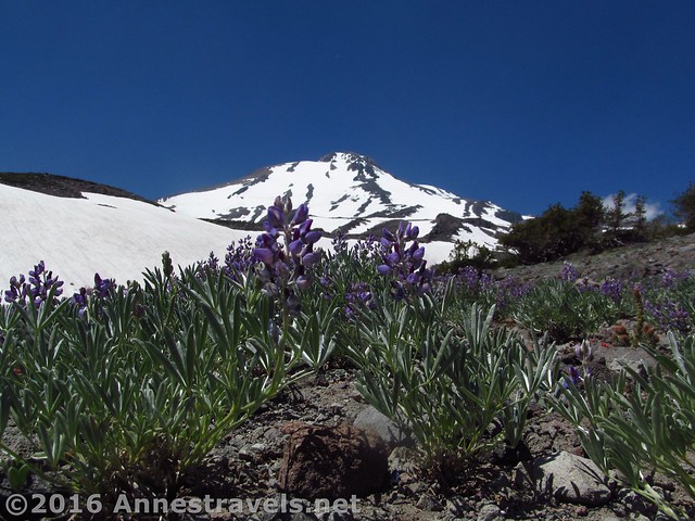
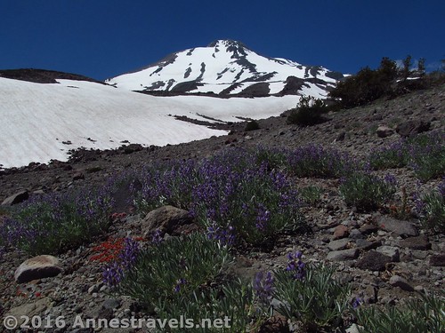
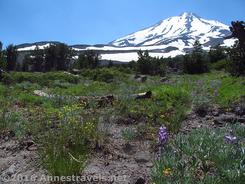
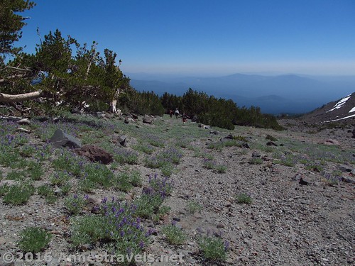
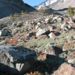
Lupines grow on the lower above-treeline slopes of Mt. Shasta below Butte 9000
Last week, we talked about taking the Brewer Creek Trail, then continuing up a social trail to Butte 9000 high on the side of Mt. Shasta (Butte 9000 isn’t its official title – in fact, you probably will have trouble locating the butte on a topo map – but it’s quite easy to see while hiking on the mountain and so much cooler to hike to a destination than just some-ol’-GPS-coordinate). We hiked up to the north side of the butte, but thought it would be easier (no snowfields) and more fun to hike down the south side of the butte to make for a loop hike. It turned out to be a great idea, as an old Jeep road runs most of the length of this valley, so it’s not a very difficult hike (save for some elevation gain!) And the views – wow!
Quick Stats
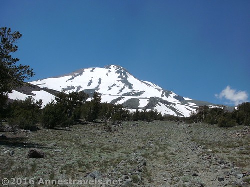
Who wouldn’t want a view like this? (That’s the old jeep road; easy to see and follow, but returning to its initial state.)
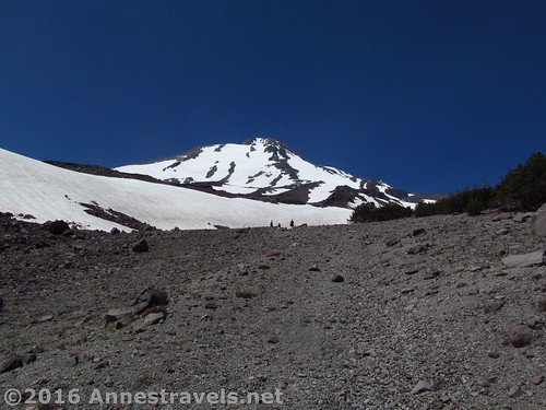
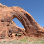
We headed down the south side of Butte 9000 – if you’re hiking up this way, it’s much more difficult to spot from this side (the north side is more sheer and visible), but still visible to the north above the treeline. If you get all the way up to where the road peters out, you’ve gone too far – simply head north to the ridgeline on the right and walk down the ridge to where it falls away steeply (sheer on the north side). This is Butte 9000.
Between Butte 9000 and the old jeep road – that’s the ridge you’d want to climb to the right (unfortunately, didn’t quite get a picture of what Butte 9000 looks like from this side)
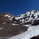
But if you’re coming down like us… Head more or less due south, aiming for the valley bottom (you’ll probably have to skirt the top of a snowfield; early in the season, you may have to cross snow in this section or others – I visited in late July). Before long, you’ll cross the old jeep road – head downhill (east) along the road.
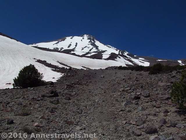
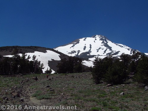
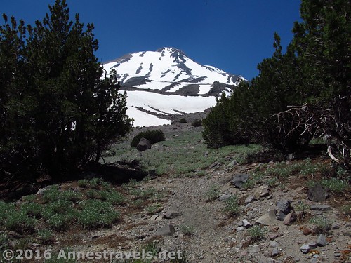
On the upper reaches of the old jeep road
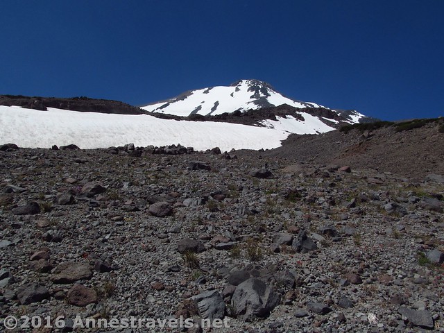
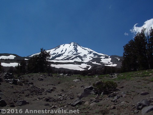
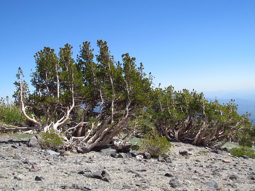
The old road winds its way down the valley, with spectacular vistas of Mt. Shasta behind you (be sure to turn around from time to time!) I loved the wildflowers and twisted trees along the way.
Wildflowers along the way
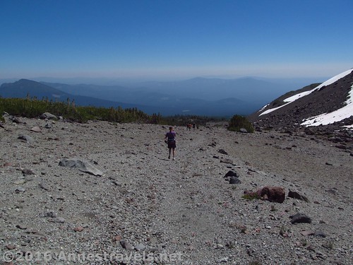
In fact, I just couldn’t stop taking pictures – the views were glorious!
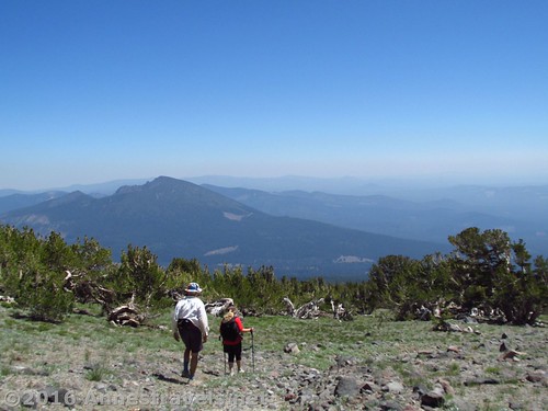
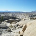
Views into the valley below
About 1.6 miles from leaving the top of Butte 9000, you’ll come to a place where the road takes a sharp turn to the left (right about the time it seems to really enter a mature forest that isn’t scrubby from harsh winters high on the mountain). Here we thought we’d turn right, off-trail, to follow the directions I’d found on the internet to Ash Creek Falls. This was a great idea, if you have all day, love off-trail hiking, and are in for a bit of an adventure. As it was, we were most of the way through our day and were not in the mood for yet another adventure. So when we got to a place where we were going to have to descend a very steep, wooded slope at least a hundred feet – maybe 200ft. – then up an equally steep, wooded slope, all without a trail, well, we gave up and decided we’d go back to the parking area!
Descending toward the lower reaches of the jeep road
If you do decide to go to Ash Creek Falls, the pictures of it are spectacular! You can get information on that here. (Actually, this is a really great website about hiking around Mt. Shasta – just be prepared to deal with directions like “hike for a short distance…” and find a trail going straight up for 1.5 miles, lol.)
The lower reaches of the jeep road are a bit more rutted, yet also a bit harder to follow
Back at the turn in the Jeep Road, we walked another 0.3 miles. At this point, we headed straight across a meadow and ended up right back at where the trail crosses Brewer Creek. How convenient was that?
Meadow wildflowers along the lower reaches of the jeep road
From there, it was a simple matter of following the trail 1.75 miles back to the parking area. It had been a truly lovely day, and even if we hadn’t gotten to the falls, we’d seen more spectacular vistas then we’d dreamed of seeing that day… and who can ask for more than that?
Descending the old jeep road
Round Trip Trail Length: 7.0 miles if you do the loop around Butte 9000; up and back along the Jeep road would be about 7.7 miles. I’d guess you’d be talking at least 8 miles to and back from Ash Creek Falls, though someone did it in 5.6 miles.
Lowest Elevation: 7,275ft. (trailhead)
Highest Elevation: 8,998ft. (Butte 9000)
Net Elevation Change: 1,723ft.
Facilities: Restrooms at the trailhead
Fees: None
Trail Notes: There is a lot of off-trail hiking on this route – be prepared! (And there aren’t any reliable water sources, so bring plenty – it gets pretty warm even this high in the summer!)
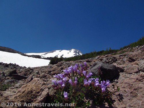
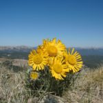
Davidson’s Panstemon just below Butte 9000
Key GPS Coordinates for the Alternate Route to Butte 9000
Parking: 41.43506N / -122.13295W (41° 26′ 6.216″ / -122° 7′ 58.6194″) (7,269ft.)
Trail Beginning: 41.43507N / -122.13314W (41° 26′ 6.252″ / -122° 7′ 59.3034″) (7,275ft.) (0.0; ended 7.75)
Enter Mt. Shasta Wilderness: 41.43321N / -122.13321W (41° 25′ 59.556″ / -122° 7′ 59.556″) (7,348ft.) (0.1)
Brewer Creek: 41.42110N / -122.14034W (41° 25′ 15.96″ / -122° 8′ 25.2234″) (7,861ft.) (1.75)
Top of Butte: 41.41714N / -122.15715W (41° 25′ 1.704″ / -122° 9′ 25.74″) (8,998ft.) (3.1)
Pick up Old Jeep Road (if going up, this is where you’d strike off the jeep road for the butte): 41.41584N / -122.15712W (41° 24′ 57.024″ / -122° 9′ 25.632″) (8,985ft.) (3.4)
Turned right toward Waterfall: 41.41698N / -122.13722W (41° 25′ 1.128″ / -122° 8′ 13.9914″) (7,970ft.) (4.7)
Turned Around: 41.41281N / -122.13561W (41° 24′ 46.116″ / -122° 8′ 8.1954″) (7,885ft.) (5.1)
Returned to the trail / road: 41.41692N / -122.13721W (41° 25′ 0.9114″ / -122° 8′ 13.9554″) (7,902ft.) (5.5)
Left the trail / road across meadow toward Brewer Creek: 41.41961N / -122.13822W (41° 25′ 10.5954″ / -122° 8′ 17.592″) (7,838ft.) (5.8)
Pick up Brewer Creek Trail again: 41.42073N / -122.14005W (41° 25′ 14.6274″ / -122° 8′ 24.18″) (7,855ft.) (6.00)
Brewer Creek: 41.42110N / -122.14034W (41° 25′ 15.96″ / -122° 8′ 25.2234″) (7,861ft.) (6.07)
The jeep road passes through a group of trees
The gpx file for the Brewer Creek Trail / Butte 9000 Loop can be downloaded – please note that this and the GPS Coordinates are for reference only and should not be used as a sole resource when hiking this trail.
Download GPX File size: 214.0 KB Downloaded 445 times
(Note: I do my best to ensure that all downloads, the webpage, etc. are virus-free and accurate; however, I cannot be held responsible for any damage that might result, including but not limited to loss of data, damages to hardware, harm to users, from use of files, information, etc. from this website. Thanks!)
Descending into the trees
Getting to the Brewer Creek Trailhead
From the North (US-97): From the town of Macdoel, take US-97S 23 miles. Turn left onto Forest Route 19 / Deer Mountain Road / Forest Route 42N12 and drive 15.7 miles. There are signs for Brewer Creek; keep following the signs for this or the signs to stay on Forest Route 19. Turn left for 0.4 miles, then continue straight for 1.5 miles. After this, you simply want to stay on the best-maintained, most main road. Here’s the more complicated directions: Turn left for 0.1 miles, then turn left for 2.9 miles; turn right for 1.1 miles, turn right for 1.9 miles, and you’ll be in the somewhat small parking area for the Brewer Creek Trailhead, with an outhouse and a sign kiosk.
Looking back up the old jeep road
From the North (I-5): Take Exit 766 toward Grenade / Gazelle. After 0.3 miles, turn left onto 99-97 Cutoff. Continue 18.6 miles, then turn left onto US-97 for 4.4 miles. Turn right onto Forest Route 19 / Deer Mountain Road / Forest Route 42N12, and follow the directions above to the trailhead. (Note: if you’d rather, you can take Exit 748 toward Weed / Klamath Falls for 0.3 miles, then turn left onto Chaparral Drive for 0.1 miles, turn right onto US-99 / N Weed Blvd for 0.5 miles. Turn left at the first cross street onto US-97N for 16.4 miles; turn right onto Forest Route 19 / Deer Mountain Road / Forest Route 42N12, and follow the directions above to the trailhead.)
Twisted trees along the jeep road
From the South (I-5): Take Exit 736 to merge onto CA-89S toward McCloud. After 13.2 miles, turn left onto Pilgrim Creek Road and drive 5.3 miles. Continue onto Forest Route 13 for 2.0 miles, then turn left onto Forest Route 19 for 9.5 miles. Turn left, following the signs for Brewer Creek. From here you’ll want to more or less follow the most used, most main-looking road, but the specific directions are this: After 1.9 miles, continue straight for 0.2 miles, then straight for 0.8 miles; turn left for 1.1 miles, then turn right for 1.9 miles to the trailhead.
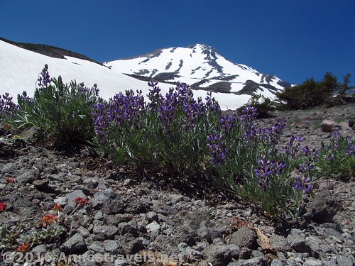
Lupines below Mt. Shasta
From the South (Lassen National Park): Take CA-44E / CA-89N 78 miles. Turn right onto Pilgrim Creek Road, and follow the directions (above) to the Brewer Creek Trailhead.
The dirt roads should be passable to most vehicles in the summer; however, in the spring, 4×4 may be required. The trailhead is popular with skiers, who tackle the trail even before the road fully thaws.
I highly recommend a GPS to get you through this route to the trailhead – there is a honeycomb of dirt roads out here.
Zoom map out to browse nearby hikes & places of interest
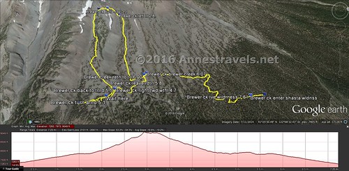
Visual trail map – the left side is the route down from Butte 9000 along the old jeep road. That little jut to the left was my trek toward Ash Creek Falls. The parking area is on the far right.
This Week’s Featured Product!
Looking for even more hikes in the Mt. Shasta area? Check out this book, with both known and lesser-visited trail options.
Pingback: Joy in the Wilderness - Anne's Travels
Pingback: Sneak Peak: A Land of Volcanos and Oceans - Anne's Travels
Pingback: Brewer Creek Trail to Butte 9000 - Anne's Travels