
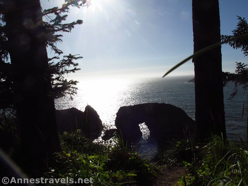
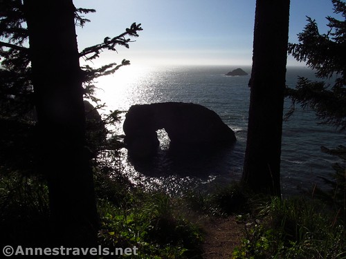
Arch Rock near sunset
Samuel H. Boardman State Scenic Corridor really is unique and beautiful, even among the beauty of the rest of the Oregon coastline. I didn’t do half as much there as I could have; just some exploration around the Natural Bridges Overlook and Thunder Rock Cove and then dinner at the Arch Rock Picnic Area. The picnic area is worth the stop whether you’re eating or not, because you really can see an arch made of rock – a sea stack with a pretty good hole in it that does look like an arch. It won’t give Delicate Arch a run for its proverbial money, but then again, this is free, and the 0.25 mile paved trail is short enough to warrant a stop even if you’re just driving through.
Quick Stats for the Arch Rock Picnic Area
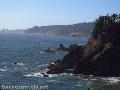
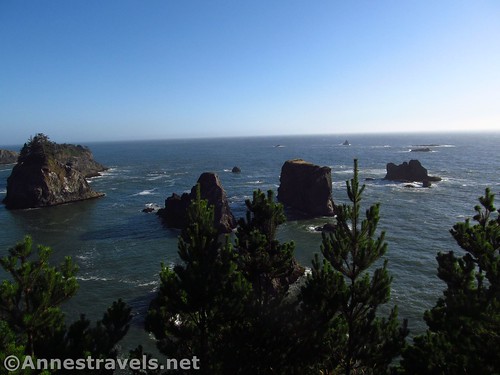
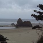
Views north of headlands and sea stacks
From the parking area, head down the paved trail (it’s a loop, so as long as you don’t make the mistake of ending up at the restrooms, you should be fine). I took the south loop first; not far from the parking area is a little spur to the left that will take you to an overlook of sea stacks and the coastline.
Views to the south
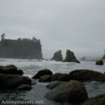
Continuing around the loop, it’s only 0.1 miles to the viewpoint where you can see Arch Rock. Unfortunately, it was so late in the day that the arch was totally silhouetted against the sun. Maybe some other day I’ll come earlier and get some better pictures of what the arch actually looks like. Even so, it was impressive.
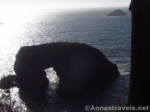
Closer up of Arch Rock
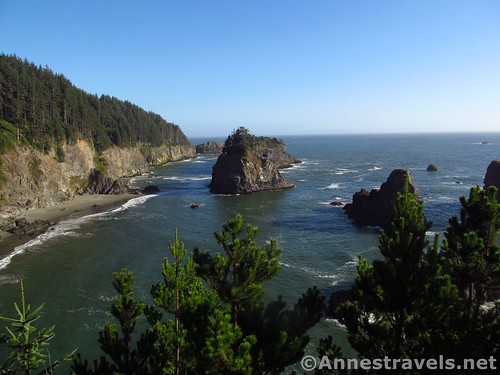
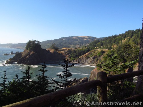
As the trail winds further around the end of the point, there are some nice views north toward more sea stacks and coastline. It’s very pretty, especially in the evening light.
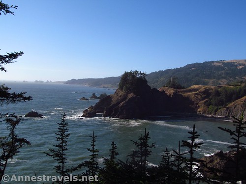
Looking north along the Arch Rock overlook
Return to the parking area about mile 0.25. I actually went around the loop twice, so ended up at about 0.5 miles overall.
More sea stacks. It’s easy to believe these used to be part of the headland
That’s it! Not a long trail, but the views are really quite good (and a lot easier to get to than along the Oregon Coast Trail that also goes through the park!)
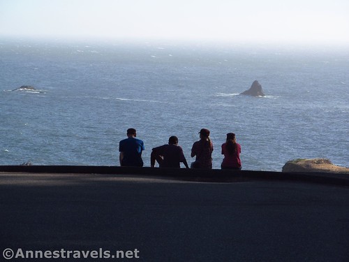
Enjoying views from the parking area
Round Trip Trail Length: 0.25 miles
Net Elevation Change: About 53ft (187ft. in the parking area to 134ft. on the Seastack Viewpoint)
Facilities: Picnic tables & a primitive restroom
Fees: None
Trail Notes: The trail is paved; however, it’s not really wheelchair accessible, and even strollers might have trouble on the humps and cracks made by tree roots. Views of the Arch Rock would be best in the late morning, though the coastline is very nice in the later afternoon. Also, the restrooms leave something to be desired…
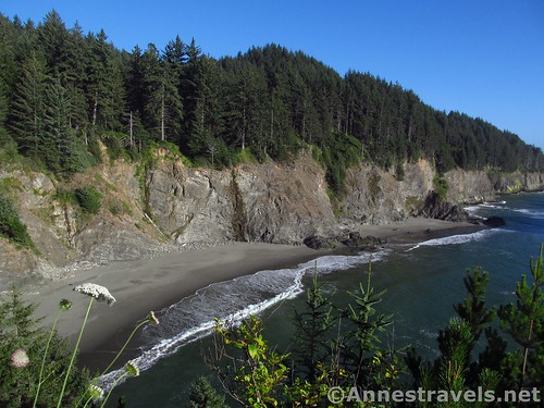
Cove just south of Arch Rock
Trail 
![]()
Road
Signs ![]()
Scenery ![]()
Would I go 100 miles out of my way for this? ![]()
![]()
Overall Rating: ![]()
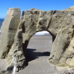
Arch Rock
Key GPS Coordinates for Arch Rock
Parking: 42.20514N / -124.37421W (42° 12′ 18.5040″ / -124° 22′ 27.1560″) (187ft.)
Trail Beginning: 42.20506N / -124.37448W (42° 12′ 18.2160″ / -124° 22′ 28.1280″) (173ft.) (0.0)
Seastack Viewpoint: 42.20459N / -124.37611W (42° 12′ 16.5240″ / -124° 22′ 33.9954″) (134ft.) (0.3)
Arch Viewpoint: 42.20531N / -124.37639W (42° 12′ 19.1154″ / -124° 22′ 35.0040″) (151ft.) (0.1)
End: 42.20522N / -124.37428W (42° 12′ 18.7914″ / -124° 22′ 27.4074″) (191ft.) (0.5)
Fence along the northern edge of the Arch Rock Overlook
The gpx file for Arch Rock can be downloaded – please note that this and the GPS Coordinates are for reference only and should not be used as a sole resource when hiking this trail.
Download GPX File size: 14.3 KB Downloaded 209 times
(Note: I do my best to ensure that all downloads, the webpage, etc. are virus-free and accurate; however, I cannot be held responsible for any damage that might result, including but not limited to loss of data, damages to hardware, harm to users, from use of files, information, etc. from this website. Thanks!)

Looking north from Arch Rock overlooks
Getting to Arch Rock
From Brookings, OR, drive north on US-101 12.5 miles to the access road for Arch Rock Picnic Area, on left.
Alternatively, from the north, from Gold Beach drive south on US-101 15 miles to the access road for Arch Rock Picnic Area, on right.
Zoom map out to browse nearby hikes & places of interest
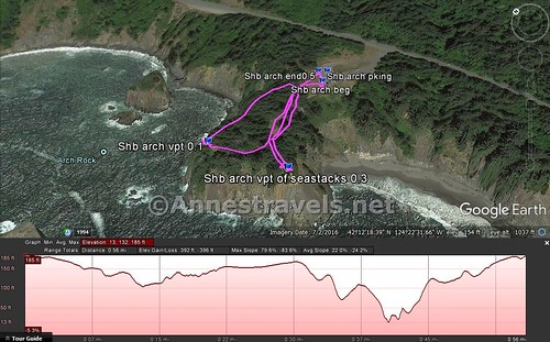
Visual trail map & elevation profile for the overlooks at the Arch Rock Picnic Area in Samuel H. Boardman State Scenic Corridor
This Week’s Featured Product!
Looking for more destinations along the Oregon coast? Check out this book for a mile-by-mile description of beaches, parks, forests, campgrounds, boat ramps, picnic areas, hiking, and more.

Pingback: Sneak Peak: A Land of Volcanos and Oceans - Anne's Travels