
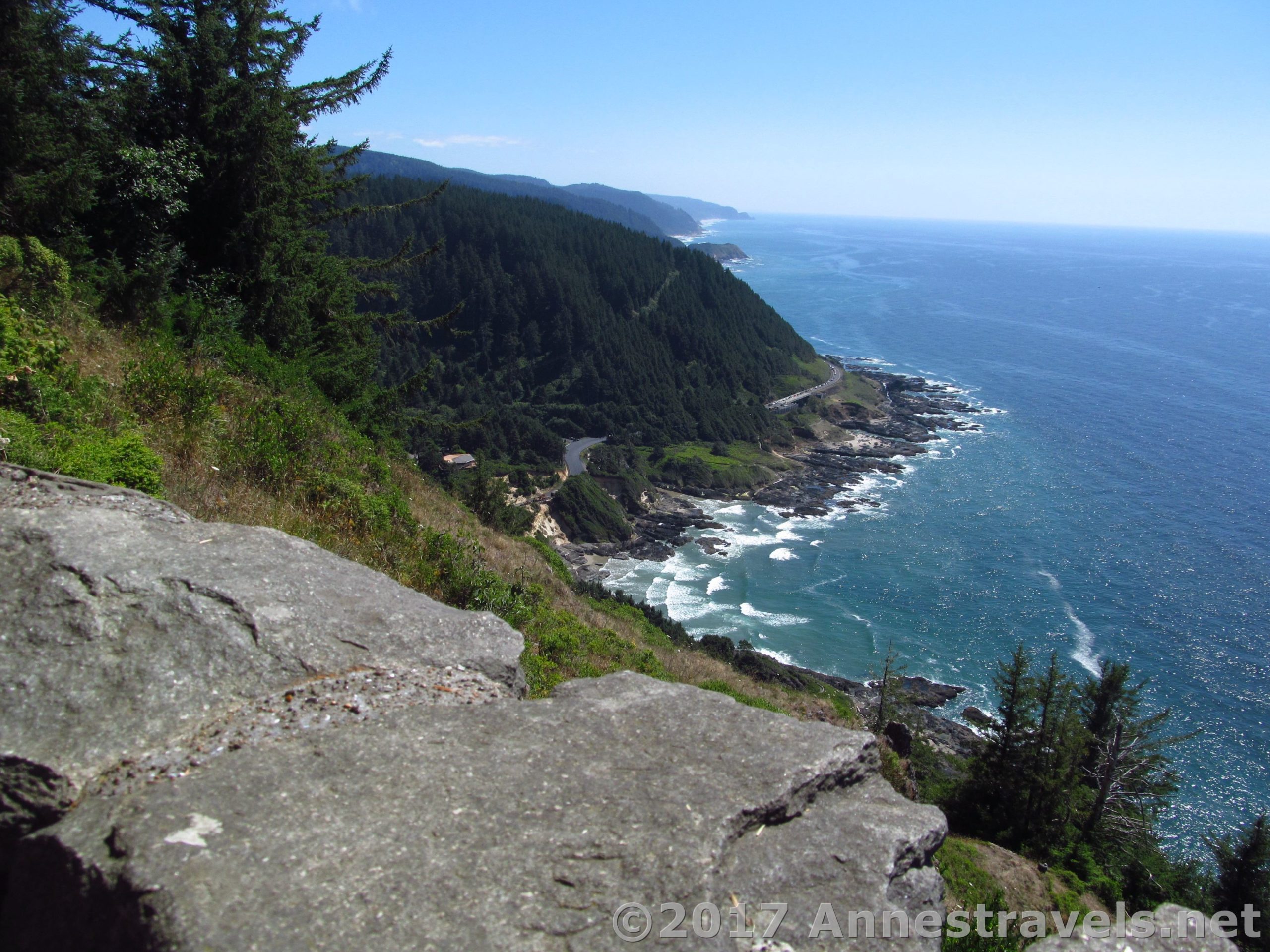

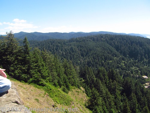
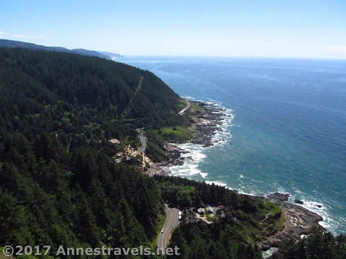
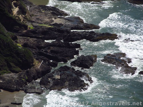
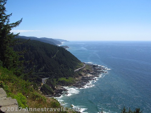
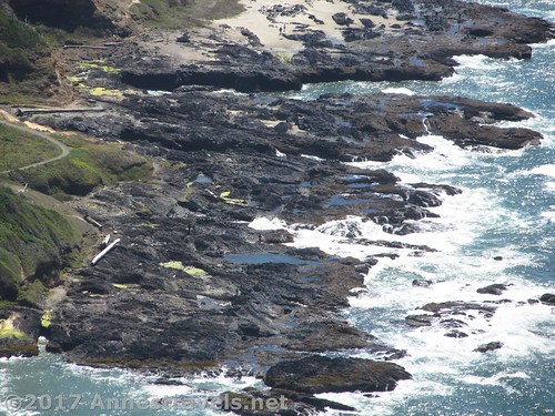
Cape Perpetua is a great place to visit. Thor’s Well and the surrounding volcanic tide pools and other oddities make it a must-do stop on a US-101 road trip. But I found the most remarkable – or at least the most beautiful – part of Cape Perpetua to be the views from the stone shelter atop the headland above the park proper. The Pacific Ocean, headland upon headland, a winding highway, misty mountains, whale sightings – need I say more?
Quick Stats
(Affiliate links are present on this page.)
You can drive or hike to the top of the headland (hiking is via the Saint Perpetua Trail, about 4 mile RT from the visitor center). Because it was getting late in the day, we opted to drive the steep paved road and park in the small parking area. As an added benefit, there are primitive restrooms and a few picnic tables (a great place to eat dinner and glue my hiking boot, which the sole had begun to separate from earlier in the morning).
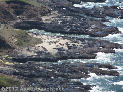
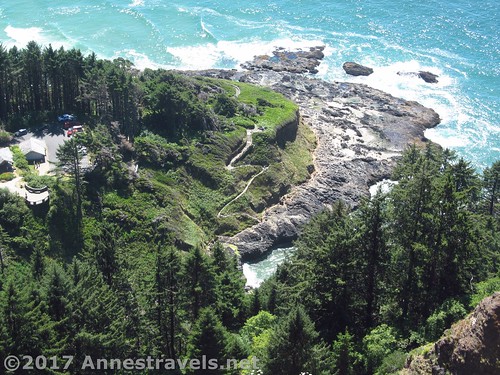
From the parking area, head down the trail a short distance to a viewing area. This gives the best view down on the rest of the park and is a reason in itself to stop by Cape Perpetua.
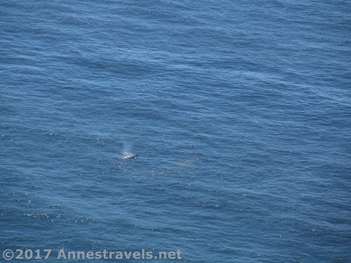
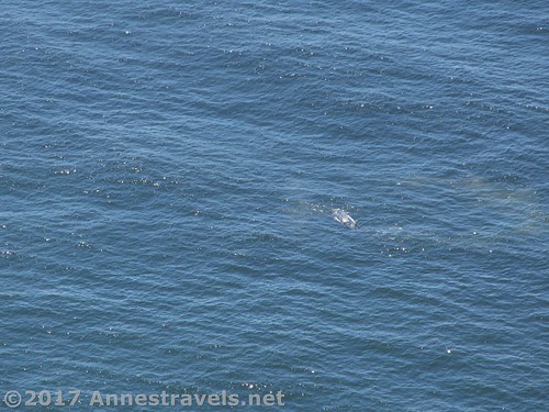
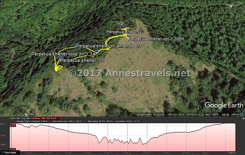
For another view (and maybe some whale sightings – in August we saw a few), continue down the trail known as the “Whispering Spruce Trail” (not toward the visitor center). About 0.1 miles from the first viewing area, the trail will split, with a “shelter” option and a “loop” option. You can go either direction (it really is a loop); I followed the path left toward the shelter.
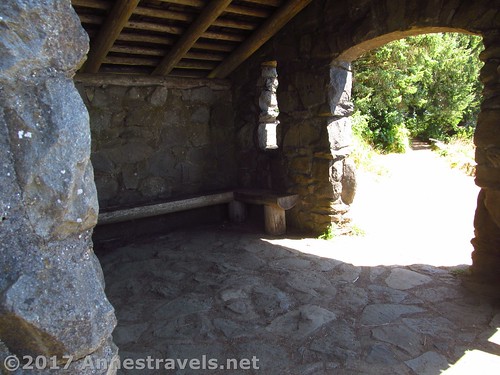
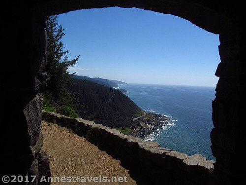
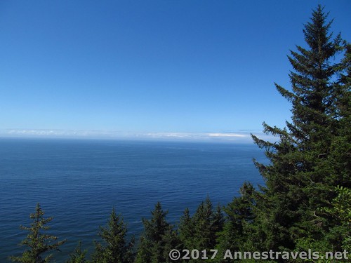
Arrive at the Stone Shelter a tenth of a mile later. The views here are more out to the ocean, but the shelter is interesting to look at, too – built by the CCC’s in the 1930s, you can see about 70 miles out to sea from here, and therefore it was used as an observation post during WWII, complete with a coastal defense gun. Today it’s just a fun place to hang out and look at the ocean or down on the rest of the park.
Complete the loop by exiting the Stone Shelter via its other entrance and following the trail back to the parking lot (don’t follow the Amanda Trail, which goes down the headland toward Yachats).
Overall, this isn’t a long trail (about 0.5 miles RT), but it offers some truly incredible scenery, and I’d have to say you shouldn’t leave Cape Perpetua without seeing the view!
Round Trip Trail Length: About 0.5 miles
Elevation Change: 56ft. (810ft. at the trailhead to 754ft. at the Stone Shelter)
Facilities: Primitive restrooms and picnic tables; the visitor center in the main section of the park has more facilities
Fees: $5 per vehicle per day. Northwest Forest Passes & Interagency Passes also accepted
Trail Notes: If it’s a nice day, just do it! You won’t regret the views. Oh, but you might want to keep a firm hand on young children, as there are some drop-offs near the viewpoints.
Trail 
![]()
Road ![]()
Signs ![]()
Scenery
Would I go 100 miles out of my way for this? ![]()
Overall Rating: ![]()
Key GPS Coordinates for the Cape Perpetua Headland
Shelter Trail Beginning: 44.28688N / -124.10800W (44° 17′ 12.7674″ / -124° 6′ 28.8000″) (810ft.) (0.0; return 0.52)
Shelter Viewpoint #1: 44.28662N / -124.10831W (44° 17′ 11.8314″ / -124° 6′ 29.9160″) (797ft.) (200ft.)
Shelter Loop Trail Junction: 44.28695N / -124.10937W (44° 17′ 13.0194″ / -124° 6′ 33.7314″) (776ft.) (0.14; returned 0.40)
CCC Stone Shelter: 44.28750N / -124.11000W (754ft.) (0.20)
Amanda Trail Junction: 44.28750N / -124.10930W (44° 17′ 15.0000″ / -124° 6′ 33.4800″) (770ft.) (0.3)
The gpx file for this part of Cape Perpetua’s Headland can be downloaded – please note that this and the GPS Coordinates are for reference only and should not be used as a sole resource when hiking this trail.
Download GPX File size: 18.5 KB Downloaded 580 times
(Note: I do my best to ensure that all downloads, the webpage, etc. are virus-free and accurate; however, I cannot be held responsible for any damage that might result, including but not limited to loss of data, damages to hardware, harm to users, from use of files, information, etc. from this website. Thanks!)
Getting to Cape Perpetua
From Yachats, OR, drive south on US-101S about 2.7 miles. Turn left following the brown signs that indicate “Cape Perpetua Day Use and Campground”. Immediately continue left, uphill, when the road splits. You will be driving on NFD-55. Stay on the paved road 1.7 miles to the parking area for the “Lookout”.
Or from Florence, OR, drive north on US-101N 22.3 miles, passing by the Cape Perpetua Visitor Center. Turn right following the brown signs that indicate “Cape Perpetua Day Use and Campground”. Immediately continue left, uphill, when the road splits. You will be driving on NFD-55. Stay on the paved road 1.7 miles to the parking area for the “Lookout”.
Zoom map out to browse nearby hikes & places of interest
This Week’s Featured Product!
Describing more than hikes, this book takes travelers along the Oregon Coast to places they may have heard of, or may never have heard of.


4 responses to “Incredible Coastal Views from Cape Perpetua’s Stone Shelter”
[…] forests and see sea life, incredible waves and volcanic oddities, and a truly inspiring view from the top of a headland. And all of that in less than 4 miles of hiking. Can you see why I loved visiting this […]
[…] the view from the headland above is also simply beautiful. And: I got to see my first whale […]
This is beautiful! I have a daughter that lives in Portland, OR and is an avid hiker like myself. I’m sending her your post. She would really like to do this!
I hope she has fun! This would be an awesome place to visit in the winter, too.