
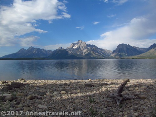
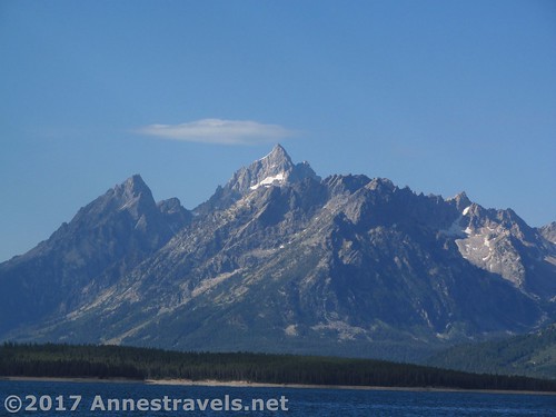
Views across Jackson Lake of the Teton Range from the Lakeshore Trail
On a recent trip to the west coast, we decided at the last moment to stop in at Yellowstone National Park to take in the Upper Geyser Basin. Well, that worked out great, but since we’d have to drive right through Grand Teton National Park, I begged to do one trail: the Lakeshore Trail in Colter Bay on Jackson Lake. It wasn’t long, I reasoned, only 2.6 miles RT, and some of my internet friends said it was amazing. And it’s the Tetons! What more reason do we need?
Quick Stats
(Affiliate links are present on this page.)
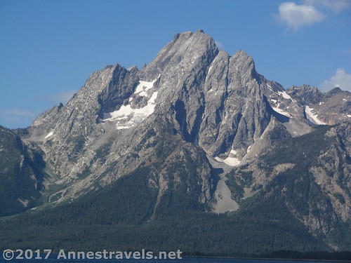
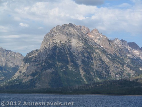
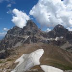
Mt. Moran
We pulled in very early in the morning (that’s one way to make sure you do your hike and still get home on time!) and headed off down the trail. I did the lower loop clockwise (heading down next to the visitor center toward the marina, but skirting the marina’s right side). The best reason for doing the loop this way is that the trailhead is easier to find, and you get the non-view portion of the hike out of the way first. However, going counter clockwise is better for views of Mt. Moran, and since the views are pretty epic, you just might want to go counter clockwise (the way I’ll tell you here, even though I didn’t do it this way).
These are the kinds of views that will be to your back if you hike the trail clockwise
So to hike the trail counter clockwise, walk right, away from the visitor center, then take the trail, on left, down to the amphitheater. Work your way around the back of the amphitheater, then follow the sign for the Lakeshore Trail (without lights). Follow the next sign toward the picnic area. At the next junction, turn left, away from the picnic area. You are now on the lower loop of the Lakeshore Trail.
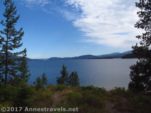
Views to the north
Walk on the smooth path along the lake shore, enjoying views over the lake. It’s not long before Mt. Moran begins to poke its head over the trees, and spectacular it is!
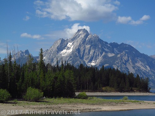
Mt. Moran
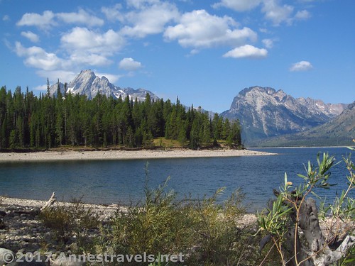
About 0.75 miles from the parking area, the trail will come to a rock causeway connecting the mainland to a small island. Turn right to cross the causeway, then turn left on the trail on the island (actually, you could turn either way, but I went left, and it worked out pretty well).
The causeway
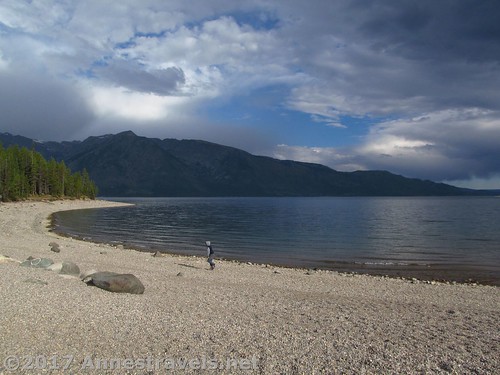
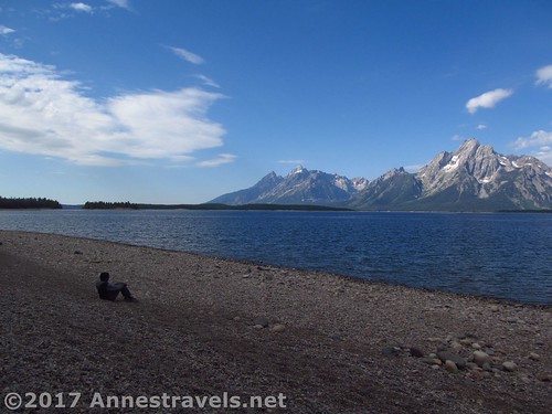
The trail works up the single hill on the trail, then emerges from the forest at a rocky lakeshore (very reminiscent of the shore of the Great Lakes). There are several social trails down to the lakeshore.
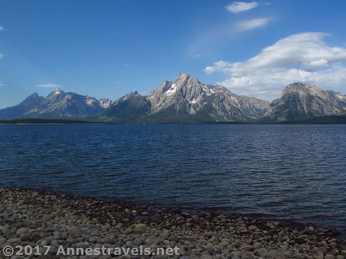
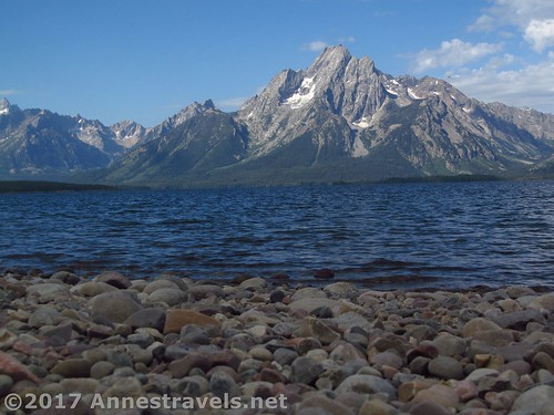
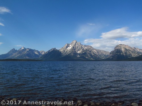
The Tetons from the lake shore
The views from the lakeshore are stunning! I can’t believe what this would look like in the spring with the snow still on the mountains; it would be gorgeous. Mountains include (but aren’t limited to) Teewinot, Mt. Moran, Traverse Peak, and Eagle’s Rest Peak.
Traverse Peak
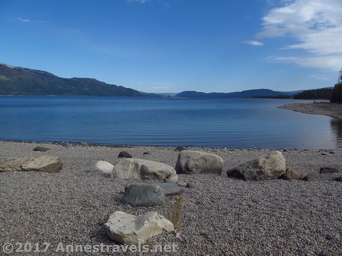
Wander along the lakeshore for a bit, then turn back into the forest to reaccess the trail. Return to the causeway and from there to the mainland.
Views north from the island
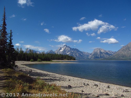
To complete the lower loop, continue straight (right) on the well-worn trail (not the near-social trail down to the lake). After 0.3 miles, turn left onto the paved path. Follow this trail back to the visitor center near the marina.

More views of the Tetons
Round Trip Trail Length: About 2.6 miles
Net Elevation Change: 32ft. (6,772ft. to 6,803ft.)
Facilities: Visitor services, restrooms, and so much more at the visitor center; campground and many more services nearby
Fees: $30 to enter Grand Teton National Park, valid 7 days. Also accepted are the $50 Yellowstone / Grand Teton 7-day pass, $60 Grand Teton Annual Pass, $80 Interagency / America the Beautiful Pass, $10 Interagency Senior Pass, free Interagency Access Pass, free Interagency Active Military Pass, free 4th Grader Pass, and free Interagency Volunteer Pass.
Trail Notes: This trail is beautiful, and really quite easy. Walk early in the morning for terrific views (morning views are better than afternoon views) and to avoid the crowds.
Perspective: Enjoying views of the Tetons
Trail 
![]()
Road
Signs ![]()
Scenery
Would I go 100 miles out of my way for this?
Overall Rating: 
Views along the lower loop of the trail
Key GPS Coordinates for the Lakeside Trail
Parking: 43.90382N / -110.64373W (43° 54′ 13.7520″ / -110° 38′ 37.4280″) (6,728 ft.)
Trailhead: 43.903625N, -110.643955W (43° 54′ 13.0494″/ -110° 38′ 38.2380″)
Other side of amphitheater: 43.90414N / -110.64505W (43° 54′ 14.9034″ / -110° 38′ 42.1794″) (6,799ft.)
Trail Junction 1 (toward picnic area): 43.90438N / -110.64541W (43° 54′ 15.7680″ / -110° 38′ 43.4754″) (6,792ft.) (0.1)
Trail Junction 2 (away from picnic area): 43.90454N / -110.64613W (43° 54′ 16.3434″ / -110° 38′ 46.0674″) (6,785ft.) (0.2)
Trail Junction 3 (causeway): 43.90092N / -110.65015W (43° 54′ 3.3114″ / -110° 39′ 0.5394″) (6,772ft.) (0.75)
Trail Junction 4 (island: 43.90060N / -110.65154W (43° 54′ 2.1594″ / -110° 39′ 5.5434″) (6,775ft.) (0.8)
Lakeshore: 43.89543N / -110.65477W (43° 53′ 43.5474″ / -110° 39′ 17.1714″) (6,771ft.) (1.4)
Trail Junction 5 (pavement): 43.90059N / -110.64754W (43° 54′ 2.1240″ / -110° 38′ 51.1440″) (6,781ft.) (2.4)
Trailhead beside the visitor center: 43.90351N / -110.64375W (43° 54′ 12.6354″ / -110° 38′ 37.4994″) (6,803 ft.) (0.0; ended 2.67)
Mt. Moran
The gpx file for the Lakesore Trail can be downloaded – please note that this and the GPS Coordinates are for reference only and should not be used as a sole resource when hiking this trail.
Download GPX File size: 85.4 KB Downloaded 526 times
(Note: I do my best to ensure that all downloads, the webpage, etc. are virus-free and accurate; however, I cannot be held responsible for any damage that might result, including but not limited to loss of data, damages to hardware, harm to users, from use of files, information, etc. from this website. Thanks!)
Teewinot Mountain
Getting to the Lakeshore Trailhead
From Moran Junction, drive north on US-191N / US-287N / US-89N, following signs for Jackson Lake and Yellowstone. Pay your fee (or flash your pass) at the Grand Teton Entrance Station 0.2 miles later, and continue north another 9.3 miles. Turn left at a sign indicating Colter Bay Junction and drive 0.9 miles; turn right following the signs for the Visitor Center, Amphitheatre, and Picnic Area. Park here and walk over toward the visitor center. If this parking area is full, there are more parking spaces along the road, etc.
One last view of the Tetons
Or from the southern entrance to Yellowstone National Park, head south on US-191S / US-287S / US-89S 17.7 miles. Turn right at the sign indicating “Colter Bay Junction” and follow the directions (above) to the parking area.
Zoom map out to browse nearby hikes & places of interest
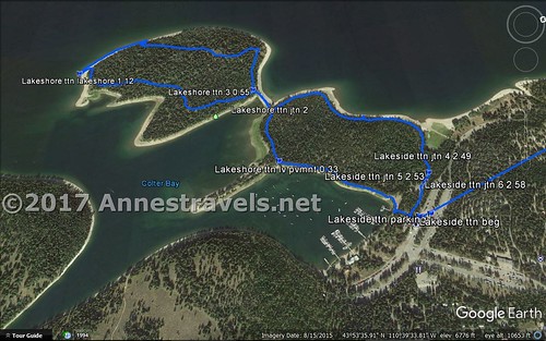
Visual Trail Map of the Lakeshore Trail from Colter Bay
This Week’s Featured Product!
This book details more easy day hikes in Grand Teton National Park, including trails great for families, wildlife viewing, scenery, and more.


Pingback: 12 Best Day Hikes in Grand Teton National Park - Anne's Travels
Pingback: Sneak Peak: A Land of Volcanos and Oceans - Anne's Travels