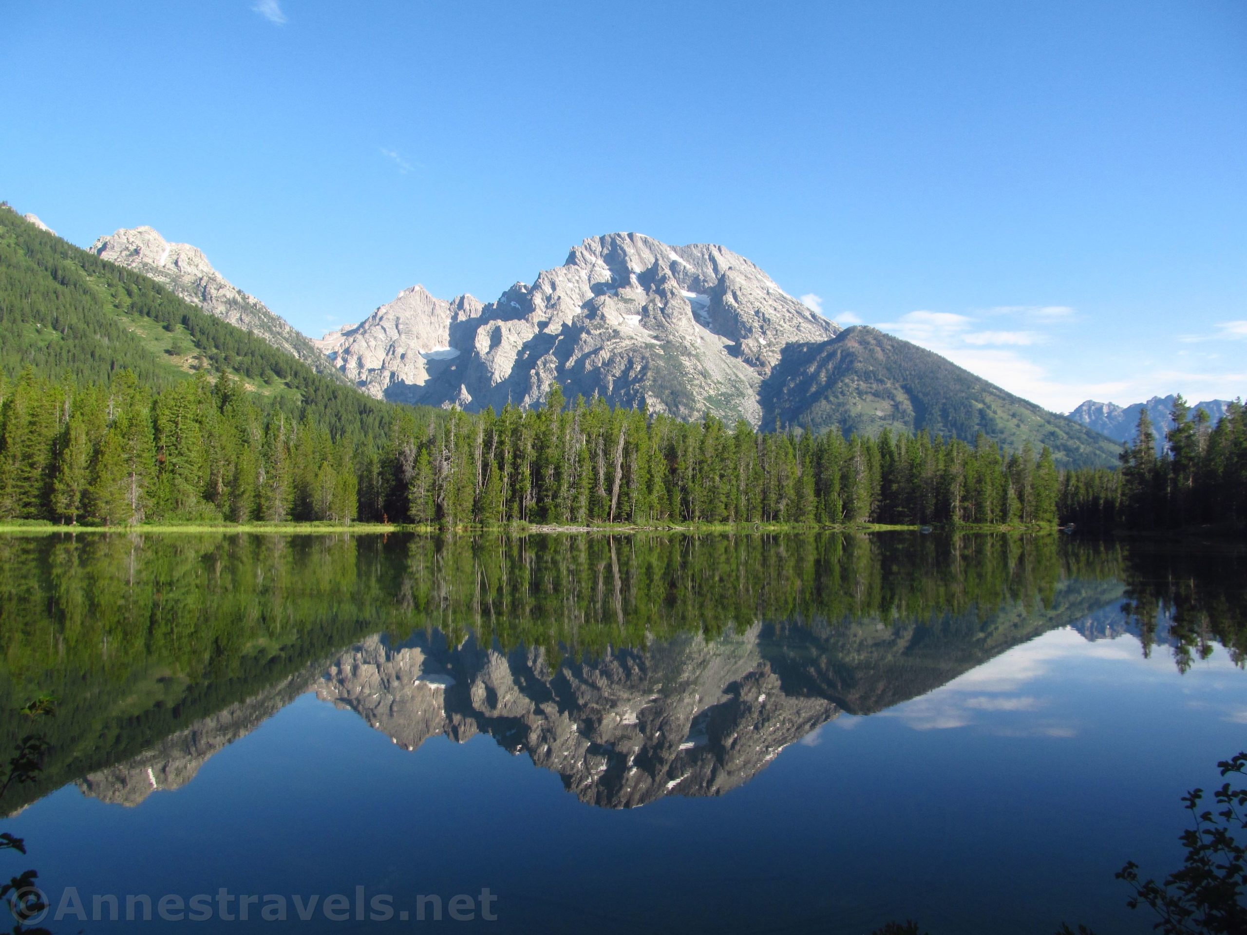

The Leigh Lake Trail in Grand Teton National Park is famous and with good reason. If you can get far enough (but not too far) along the trail, the views of the mountains reflected in the lake are just beautiful. It’s also a flat trail, so the hike is easy compared to some of the other trails in the park. My recommendation is to start in the very early morning – not only are the views best in the morning, but you’ll also miss out on the crowds, and you’ll be treated to glass-like reflections in both String and Leigh Lakes.
Quick Stats

The Leigh Lake Trail begins from the parking area near String Lake. The parking area fills up in the summer (String Lake is a favorite for families who spend the day swimming or picnicking along the lake’s shoreline) so you may want to arrive early. We arrived before breakfast, which is to say it was probably around 6am local time.

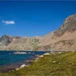
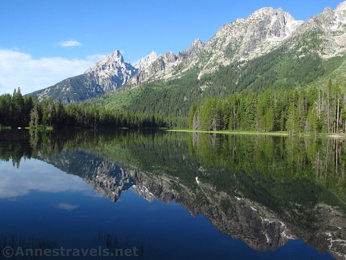
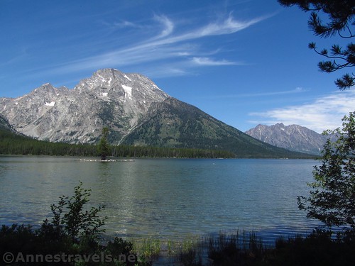
Follow the signs for Leigh Lake and follow the wide, well-used path as it traverses the shoreline of String Lake. In the early morning, before the swimmers, paddle boarders, and kayakers arrive, the lake is filled with reflections of Teewinot and Mt. St. John.

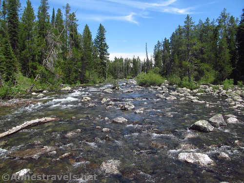
Continue up to the trail junction at 0.5 miles and continue straight another 0.4 miles to the junction at the head of String Lake. If you go straight (on the String Lake Trail) for a short distance, you can see the bridge over the Leigh Lake outlet. But to visit Leigh Lake, turn right, following the signs.
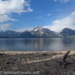
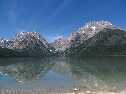
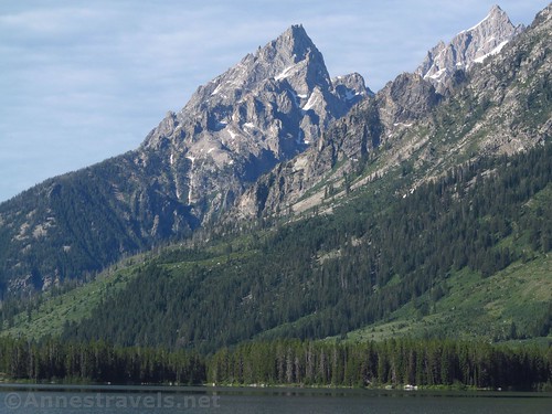
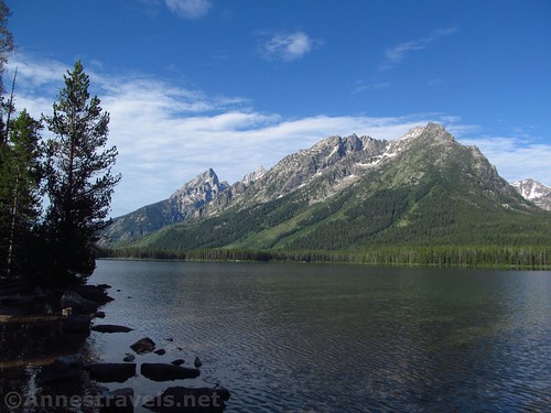
The trail traverses the shore of Leigh Lake with not much in the way of views until a swampy beach at mile 1.6. If you’re looking for the shortest hike possible, you could turn around here. However, I recommend that you continue to the pebble beach (mile 1.9), a sandy beach (mile 2.3), or to the sandy beach near the campsites (mile 2.4). This last area has by far the best views of Leigh Lake and nearby mountains (specifically, Mount St. John, Mount Woodring, and Mount Moran) on the trail. So it’s a great turn around spot for a 4.8 mile RT trek.
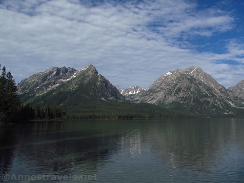
But I’d read that the trail goes further, so we kept hiking. There was another pebbly beach at mile 3.25, then the trail rose (slightly) to go through meadows and forest before arriving at the Bear Paw Lake Junction at mile 3.8. This is a four-way junction; straight goes toward Bearpaw Lake, right is toward a couple of campsites on the east side of Bearpaw Lake, and left goes toward the head of Leigh Lake.

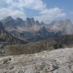
We turned left to go toward Leigh Lake. (Actually, the views toward Mt. Moran (straight ahead at the trail junction) and Eagles Rest Peak (to the right, toward Bear Paw Lake) are pretty good – to the left of Mt. Moran, you can also see Mount Woodring and Rockchuck Peak.) There is an old patrol cabin in the area, but it looked like people were camping there and might still have been asleep. At any rate, it was obvious they wanted no visitors, and we kept our distance.

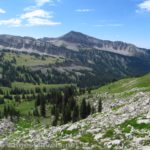
The views from the shoreline at the north end of Leigh Lake are not that “Teton”-ish; you could be in Minnesota or Maine or another of those states with big lakes surrounded by forests. There are a few blue mountains in the distance to the south and a glimpse toward the Tetons to the west, but other than that, it’s just you and the lake and the shoreline.

Still, it’s very peaceful. Not too many people come this far, so you’ll probably have the area to yourself.

We went back to the campground area, took a swim (no one around means it’s a lot easier to find somewhere to change into your bathing suit!), and then came back just about the time everyone who was on the Leigh Lake Trail that day to finally be hiking the trail. So we came back to a bit of a madhouse around String Lake.

I would have liked to have taken the String Lake Loop back to the van, but we were on a little bit of a time crunch due to the fact that we needed to make tracks toward home. Still, the very fact that we finally did the entirety of the Leigh Lake Trail after so many years was pretty neat.

Round Trip Trail Length: 4.8 to 8.0 miles out & back
Elevation Gain: 1,077ft. (6,867ft. to 6,924ft.)
Facilities: Restrooms and a picnic area with water at the trailhead
Fees: $35/vehicle/seven days. National Park & Federal Lands Passes and Grand Teton Annual Passes also accepted.
Trail Notes: The trail is quite flat (the elevation gain comes from many small ups and downs), but it’s not stroller-friendly. Be wary of roots, especially along String Lake. The area is frequented by families and people swimming. Campfires, vehicles, bicycles, and pets are not allowed on the trail; you must have a fishing license to go fishing in the lakes. The views are definitely best in the morning when the sun is shining on, rather than behind, the Tetons.
Trail 
![]()
![]()
Road ![]()
Signs
Scenery ![]()
Would I go 100 miles out of my way for this? ![]()
Overall Rating: ![]()

GPS Coordinates for Leigh Lake
Trailhead: 43.7886167°, -110.7305667° (N43° 47.317′ W110° 43.834′ / 43°47’19.0200″, -110°43’50.0400″) (6,709ft.) (0.0)
Trail Junction: 43.7924333°, -110.7256833° (N43° 47.546′ W110° 43.541′ / 43°47’32.7600″, -110°43’32.4600″) (6,879ft.) (0.51)
Trail Junction: 43.7968000°, -110.7282667° (N43° 47.808′ W110° 43.696′ / 43°47’48.4800″, -110°43’41.7600″) (6,883ft.) (0.89) (return 7.03)
Swampy beach: 43.8030500°, -110.7209167° (N43° 48.183′ W110° 43.255′ / 43°48’10.9800″, -110°43’15.3000″) (6,894ft.) (1.60)
Pebble beach: 43.8071000°, -110.7199500° (N43° 48.426′ W110° 43.197′ / 43°48’25.5600″, -110°43’11.8200″) (6,896ft.) (1.93)
Sandy beach: 43.8118667°, -110.7188167° (N43° 48.712′ W110° 43.129′ / 43°48’42.7200″, -110°43’07.7400″) (6,896ft.) (2.32)
Sandy beach & campsites: 43.8129667°, -110.7181333° (N43° 48.778′ W110° 43.088′ / 43°48’46.6800″, -110°43’05.2800″) (6,898ft.) (2.44) (return 5.52)
Pebble beach: 43.8224000°, -110.7207333° (N43° 49.344′ W110° 43.244′ / 43°49’20.6400″, -110°43’14.6400″) (6,895ft.) (3.24)
Bearpaw Lake Trail Junction: 43.8279333°, -110.7273333° (N43° 49.676′ W110° 43.640′ / 43°49’40.5600″, -110°43’38.4000″) (6,902ft.) (3.85)
Patrol Cabin: 43.8270667°, -110.7263500° (N43° 49.624′ W110° 43.581′ / 43°49’37.4400″, -110°43’34.8600″) (6,892ft.) (3.96)
North end of lake: 43.8266167°, -110.7271000° (N43° 49.597′ W110° 43.626′ / 43°49’35.8200″, -110°43’37.5600″) (6,889ft.) (4.03)
End: 43.7886667°, -110.7306500° (N43° 47.320′ W110° 43.839′ / 43°47’19.2000″, -110°43’50.3400″) (6,909ft.) (8.04)
The gpx file for Leigh Lake can be downloaded – please note that this and the GPS Coordinates are for reference only and should not be used as a sole resource when hiking this trail.
Download GPX File size: 107.5 KB Downloaded 450 times
(Note: I do my best to ensure that all downloads, the webpage, etc. are virus-free and accurate; however, I cannot be held responsible for any damage that might result, including but not limited to loss of data, damages to hardware, harm to users, from use of files, information, etc. from this website. Thanks!)

Getting to Leigh Lake
From the Jenny Lake Visitor Center, continue north on the park road. After 2.9 miles, turn left onto the Jenny Lake Road for 1.5 miles. Turn right on to the String Lake Road – the road will be marked. Drive to the end of the road (0.1 miles) and park in the parking area.
From Moran Junction, drive north on US-191/US-287. After 4 miles, turn left onto the Teton Park Road (a sign will point toward Signal Mountain and Jenny Lake). (This junction is 1 mile south of Jackson Lake Lodge). Drive 10 miles and turn right onto the Jenny Lake Road; after 1.5 miles turn right onto the String Lake Road. Drive to the end of the road (0.1 miles) and park in the parking area.

Zoom map out to browse nearby hikes & places of interest
This Week’s Featured Product!
Explore the Grand Tetons and beyond in this hiking book covering some of the best views in Wyoming. With 175 trail options, the hikes range from short strolls to long day treks through the wilderness.