
Sometimes there are just those hikes that you really try to see, yet it just never quite works out. Supposedly, the views are great, the trail is fine, and you just can’t wait to see it for yourself. But every time you try, something gets in the way. Such for me is Owl Point on the north side of Mt. Hood.
Quick Stats
(Affiliate links are present on this page.)
The views are (reportably) great, the trail really is not that difficult to hike, and from the first time we visited the Mt. Hood area, I thought it would make a great hike. (BTW – the third (yes, third) time we hiked to Owl Point, we finally got to see the views!)
Well, the first time we tried it, we ended up on the wrong trail, and hiked the New Vista Ridge Trail to the Timberline Trail (let’s just say the views weren’t up to snuff on Vista Ridge). Better armed with information (about the politics of the trail, as well as its location), the second time, Mt. Hood was socked in.
Oh well. Now we know where it is, and I can say, it’s definitely worth visiting… especially on a sunny day!
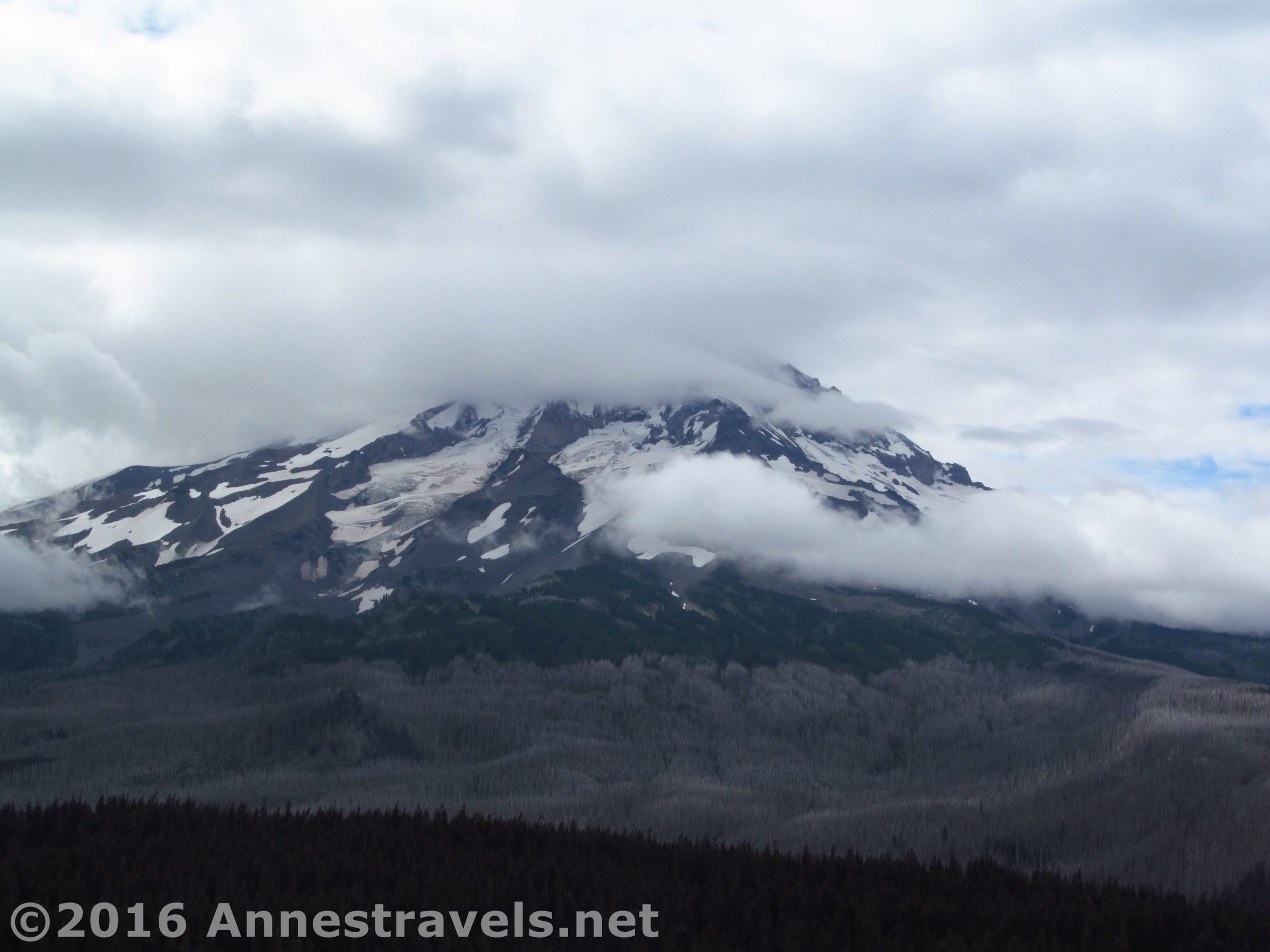
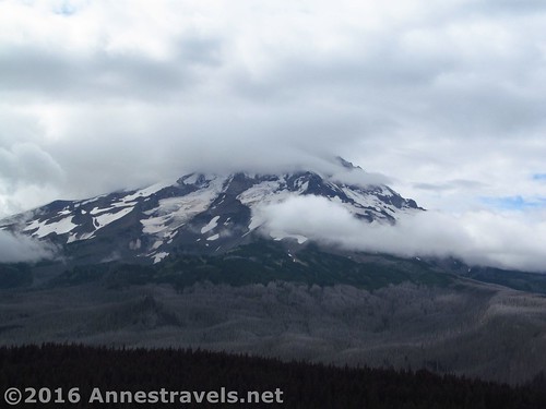
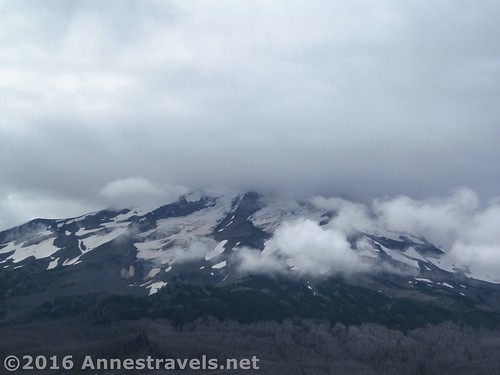
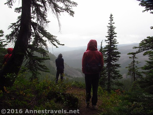
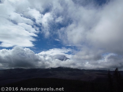
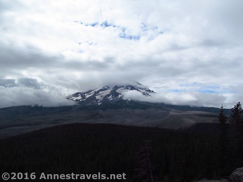
We’d been warned that the weather wasn’t supposed to be good that day, but we figured we’d try the trail anyway. And considering what the mountain looked like the rest of the day, we really did see more than we deserved, considering the weather report.
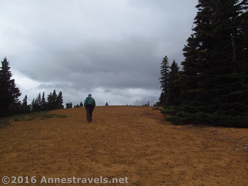
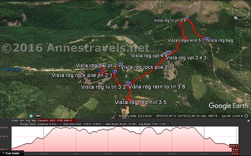
The trailhead is for the Vista Ridge Trail. Hike the trail (there’s only one, through the pines, though it isn’t immediately marked) 0.4 miles to the signboard indicating the Vista Ridge Trail. Turn left here to go north along the ridgeline – there may be sticks across the trail (more on that later), but really, there is a very real trail going in the opposite direction as the Vista Ridge Trail. This volunteer-maintained trail is the Old Vista Ridge Trail, the other official trail is sometimes termed the New Vista Ridge Trail.
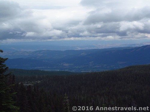
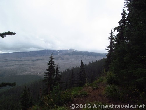
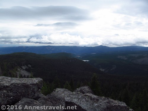
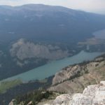
The trail winds through the trees – because it’s volunteer maintained, there may be fallen trees to hop over. (They’ll appreciate you if you remove windfall, though, instead of just stepping over or around it.) After another 0.8 miles, come to the social trail to the first viewpoint. This is just of the valley; not very exciting, though there might be peek-a-boo views toward Mt. Hood (honestly, I couldn’t tell; the mountain was pretty socked in). A tenth of a mile later is the short social trail to another viewpoint. This might have slightly better views in general, especially toward Mt. Hood, though it would still be pretty peek-a-boo.
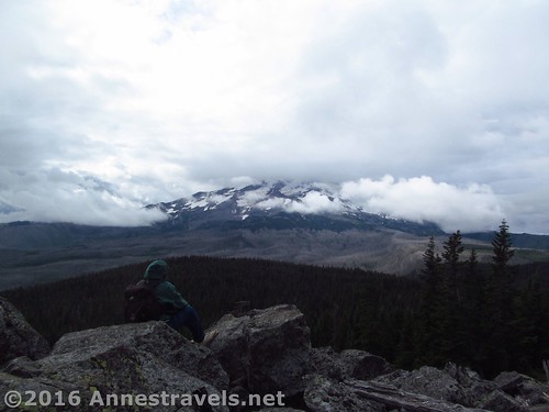
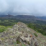
Another 0.8 miles later, come to a trail junction (with signs even!) Turn right to access the Rock Pile a few hundred feet from the main trail. The views from here would be pretty epic on a nice day, but realize that the Rock Pile is only for the sure-of-foot – there’s a reason it’s called the “rock pile”!
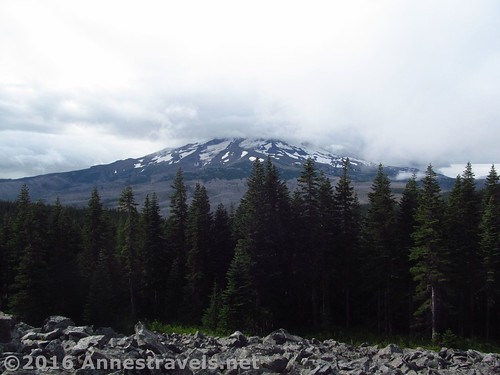
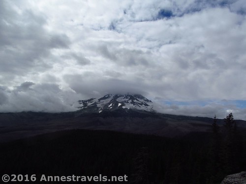
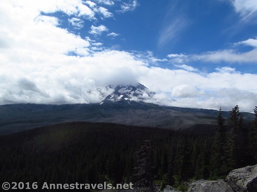
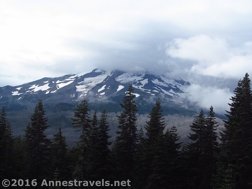
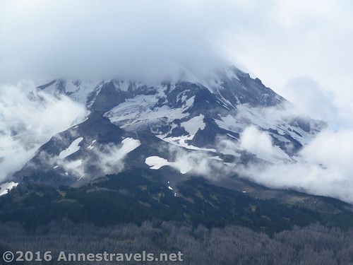
Return to the main trail and turn right following the signs toward Owl Point and Perry Lake. At 0.3 miles from the Rock Pile trail junction, arrive at another trail junction (with signs) and turn right along the 0.1 mile trail to the rocky Owl Point. From here, the views would be especially stunning, though we only had glimpses of Mt. Hood through the clouds.
We very much enjoyed reading the summit register. Apparently there used to be a trail to Perry Lake (there was a ranger station near there once), but for one reason or another, the National Forest decided it didn’t want a trail going along this section of the ridge. So while the National Forest tried to discourage the very memory of the trail – let alone people hiking the trail – volunteers kept the trail open and have lobbied for it to become an official trail again. Meanwhile, ORV groups have lobbied for a trail to be built through the area for their enjoyment. The situation has calmed a bit in recent years, since Obama created a wilderness that includes Vista Ridge, thereby barring ORVers from the area. The politics explain why there obviously has been many sets of sticks piled over the trail where it meets the (official) Vista Ridge Trail (including the first time we visited), and the number of times these sticks have been cleared away! (All this said, feel no shame to hike the trail – the Forest Service doesn’t bar people from the area; they’re just not thrilled with creating another trail.) Also in the summit register was a couple pictures identifying nearby peaks. Whoever takes care of this trail really loves it!
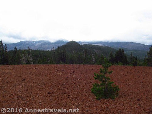
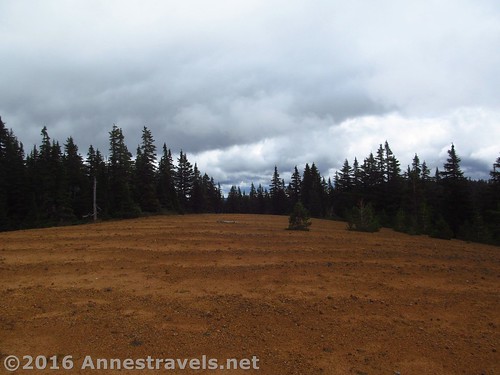
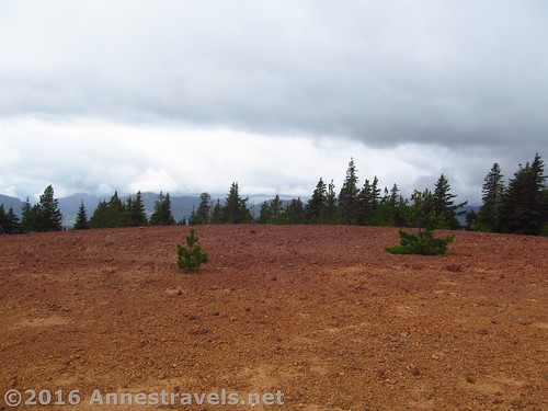
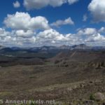
Perry Lake is 0.9 miles from the Owl Point trail junction. We weren’t feeling like a longer hike, so we turned back toward the parking area. However, I did want to check out Red Hill, which I’d read about on the Portland Hikers website (if you want to hike around Mt. Hood, that is one terrific site!) So after passing the trail to the Rock Pile, we descended into a meadow, then struck north, off-trail, down the meadow, sort of following a social trail / watercourse. It wasn’t long before we were back in the woods, following a sort of trail and tape tied to trees up a hill. Generally keep going north and you’ll eventually come out on a hilltop that is almost bare of trees. Walk west and you’ll suddenly find out how Red Hill got its name – while the rest of the hill is covered in yellow/orange cinders, the stones on the western side of the hill are definitely red!
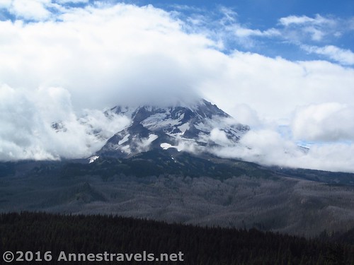
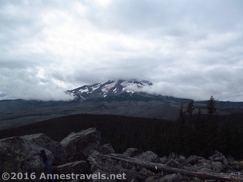
The views from here would be totally spectacular of Mt. Hood on a nice day. By now, we could barely even figure out where Hood was, its head was so deeply buried in the clouds. So we cut our losses and made our way back to the Old Vista Ridge Trail (round trip detour was about 0.6 miles RT).
Overall? Totally recommended on a nice day! As it was, we battled mist, rain, and clouds to see the clouds swirl over Mt. Hood. Still, now I know it’s worth going back…
Round Trip Trail Length: 5.7 miles with all detours (to the Rock Pile, Owl Point, and Red Hill)
Net Elevation Change: 423ft. (trailhead at 4,501ft. to Owl Point at 4,924ft.)
Facilities: None
Fees: None
Trail Notes: Be sure to turn left onto the Old Vista Ridge Trail before the sign requiring you to sign in / wilderness boundary – or you’ll be on the New Vista Ridge Trail.
Trail 
![]()
![]()
Road ![]()
![]()
Signs ![]()
![]()
![]()
![]()
Scenery
Would I go 100 miles out of my way for this?
Overall Rating: 
![]()
Key GPS Coordinates
Parking: 45.442947N / -121.729169W (45°26’34.6100″ / -121°43’45.0100″) (4,501ft.)
Trail Beginning: 45.442925N / -121.728994W (45°26’34.5300″ / -121°43’44.3800″) (4,501ft.) (0.0; ended 5.7)
Vista Ridge Trail / Old Vista Ridge Trail Junction: 45.439917N / -121.722422W (45°26’23.7000″ / -121°43’20.7200″) (4,619ft.) (0.4; return 5.2)
Viewpoint #1: 45.450736N / -121.725486W (45°27’2.6500″ / -121°43’31.7500″) (4,895ft.) (1.2)
Viewpoint #2: 45.450100N / -121.725717W (45°27’0.3600″ / -121°43’32.5800″) (4,908ft.) (1.3)
Rock Pile Trail Junction: 45.456850N / -121.721078W (45°27’24.6600″ / -121°43’15.8800″) (4,862ft.) (2.1)
Rock Pile: 45.455392N / -121.720686W (45°27’19.4100″ / -121°43’14.4700″) (4,892ft.) (2.1; left 2.3)
Owl Point Trail Junction: 45.457872N / -121.719061W (45°27’28.3400″ / -121°43’8.6200″) (4,898ft.) (2.6)
Owl Point: 45.457181N / -121.718214W (45°27’25.8500″ / -121°43’5.5700″) (4,924ft.) (2.7)
Left trail to find Red Hill: 45.457214N / -121.724158W (45°27’25.9700″ / -121°43’26.9700″) (4,800ft.) (3.2)
Red Hill: 45.458500N / -121.727972W (45°27’30.6000″ / -121°43’40.7000″) (4,921ft.) (3.5)
Returned to Trail: 45.457172N / -121.724161W (45°27’25.8200″ / -121°43’26.9800″) (4,806ft.) (3.8)
The gpx file for Owl Point can be downloaded – please note that this and the GPS Coordinates are for reference only and should not be used as a sole resource when hiking this trail.
Download GPX File size: 106.7 KB Downloaded 522 times
(Note: I do my best to ensure that all downloads, the webpage, etc. are virus-free and accurate; however, I cannot be held responsible for any damage that might result, including but not limited to loss of data, damages to hardware, harm to users, from use of files, information, etc. from this website. Thanks!)
Getting to the Trailhead for Owl Point
From I-84, take Exit 62 to Hood River. Turn right onto Westcliff Drive, then make an immediate right onto Country Club Road. The road will parallel I-84 for a short distance, then turn south. At the T, turn left onto Barret Drive for about 1 mile; turn right onto Tucker Road (there will be a gas station and grocery store at this junction). Tucker Road crosses a bridge and passes a fruit market; soon afterward, turn right onto Dee Highway for 7 miles to an abounded mill site in Dee. Take the right fork onto Lost Lake Highway and follow the signs for Lost Lake. At crossroads, be sure to stay on Lost Lake Highway; you may have to turn a few times to stay on the right road. The road will change names to Forest Road 13 when it enters the national forest. When Lolo Pass Road turns left about 11 miles from Dee, follow it, turning left off of Lost Lake Highway. After 3.2 miles, turn left at the fork to ascend, following the signs for the Vista Ridge Trailhead. Follow the switchbacks upward; 0.8 miles later, stay left on NF-16 for 4.6 miles, then take a sharp right up NF-1650 3.2 miles to the trailhead. It’s a little over 30 miles from Hood River to the trailhead, but you won’t be able to go fast on a number of those miles – the road is paved until NF-16, but it’s nearly one lane in many places and the crazy curves will keep your speed down. Plan an hour or more travel time.
Alternatively, if you’re coming from the south, from OR-35 in the town of Mt. Hood, turn onto Cooper Spur Road (OR-281) next to the Mt. Hood Country Store. Drive 1.8 miles; turn right to stay on OR-281N for another 5.8 miles. Take a sharp left onto Lost Lake Road near the old sawmill in Dee. Follow the directions (above) to the trailhead.
Honestly, I don’t know how we ever found the trailhead the first time without a GPS. But those directions should get you there, GPS or not. In fact, we made a wrong turn or two on this visit, and the GPS cheerfully took us over hill and dale (literally!), but it got us there!
Zoom map out to browse nearby hikes & places of interest
This Week’s Featured Product!
While not exhaustive in covering Mt. Hood, this guide does include some of Mt. Hood’s best trails, including Cooper Spur, Lookout Mountain, and McNeil Point.


5 responses to “Owl Point in the Clouds”
[…] we’re on the topic of things hiding in the clouds and mist (last week I talked about hiking to Owl Point to see the clouds shifting around Mt. Hood), let’s visit a view I didn’t know existed until […]
[…] next day was still cloudy, but we did the Old Vista Ridge Trail anyway to Owl Point. This is a well-maintained trail (minus some windfall) kept up by volunteers – the Forest […]
[…] summer, the weather wasn’t working out so well at Mt. Hood, so we were looking for alternative places to visit on the trip home. A couple members of the […]
[…] swirl around Mt. Hood as seen from Owl Point, […]
[…] Notes: This is an incredible view; my personal favorite of Mt. Hood other than Cooper Spur (with Owl Point being close in there, too.) However, be prepared for crossing Newton Creek (no bridge, though you […]