
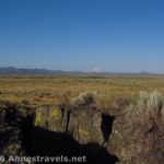
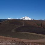
Where to go if you want a picnic supper in Lava Beds National Monument? While there are a few picnic areas in the park (namely, near the visitor center), there are a few tables in a more natural setting near the Fleener Chimneys, north of the visitor center. While you’re there, the chimneys themselves are also worth a quick little walk up to see.
Fleener Chimneys Trail Quick Stats
(Affiliate links are present on this page.)
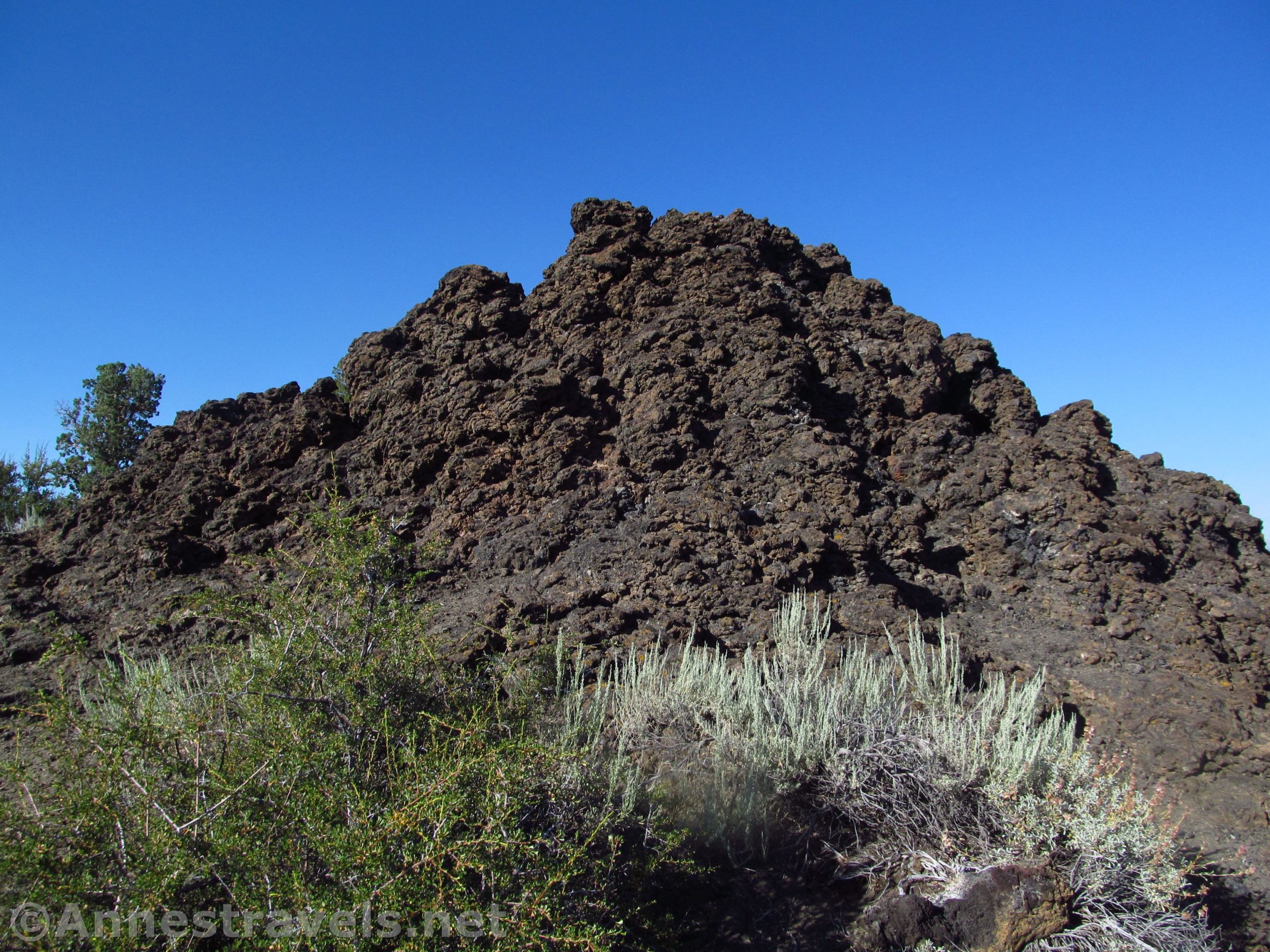
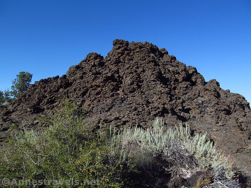
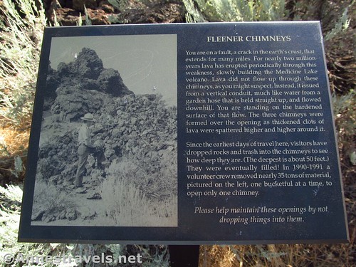
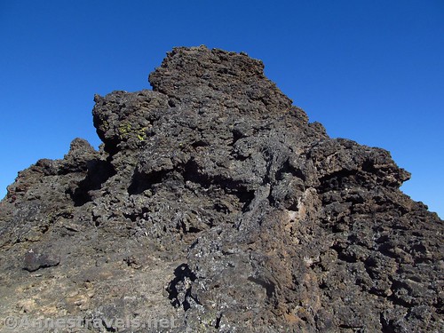
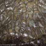
The chimneys were formed when lava flowed in a tube below the surface of the ground. Like a garden hose with a leak, the lava popped up in globs to the surface, creating the chimneys around each hole in the hose, so to speak.
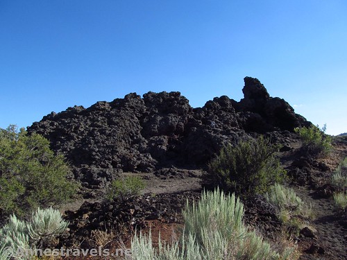
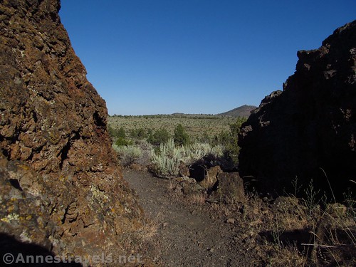
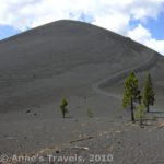
The trail is paved, first skirting the left side of the picnic area, then turning uphill toward the chimneys. After ascending a number of stone steps, the trail becomes dirt.
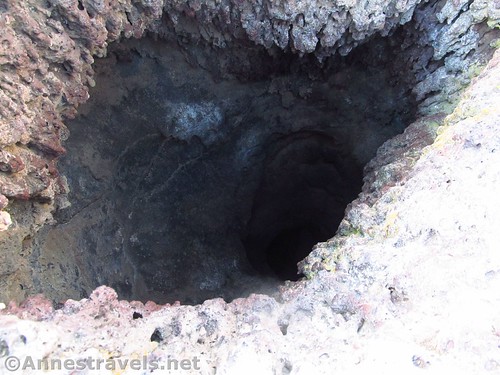
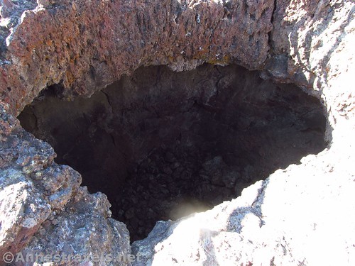
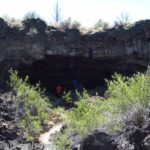
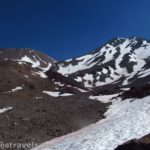
Once at the top of the hill, it’s not hard to follow the trail (left or right) to various overlooks down into the chimneys. The deepest is 50ft. deep.
Because the Fleener Chimneys are spatter cones (in other words, globs of lava were shot upward out of them), there are plenty of volcanic rocks around. Watch your step, as the lava makes for a very uneven surface off-trail. You can circle the chimneys before retracing your steps back down the hill to the parking area and picnic area.
The picnic area was made by the CCC’s in the 1930s using local rocks and wood from Oregon Caves National Monument (now there’s some trivia for you!)
Overall? It’s not worth traveling hundreds of mile out of your way for. But if you’re in the park and have a few extra minutes (and it’s not the middle of the day in summer; the heat is horrible), it’s well worth a stop.
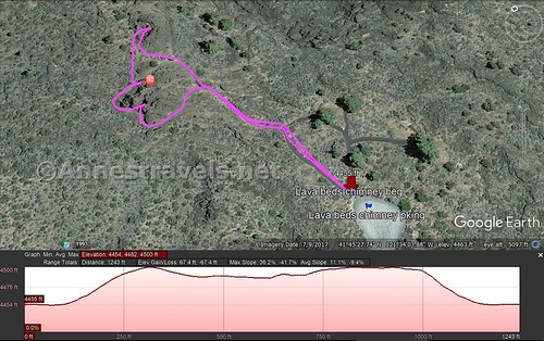
Round Trip Trail Length: 0.25 miles
Net Elevation Change: About 67ft.
Facilities: Picnic tables, primitive restroom
Fees: $15/vehicle, valid 7 days. National Parks and Federal Recreation Lands Passes (Annual, Senior, Access, Volunteer, Military, 4th Grade, etc.) and Lava Beds Annual Passes also accepted.
Trail Notes: The trail is short, but there is one steep section. Don’t try this on a hot summer day; the trail is very exposed. Do not, under any circumstances, throw anything into the chimney – if you want to know how deep it is, use a flashlight 🙂
Trail 
![]()
![]()
Road ![]()
Signs ![]()
Scenery ![]()
![]()
Would I go 100 miles out of my way for this? ![]()
![]()
![]()
Overall Rating: ![]()
![]()
Key GPS Coordinates for the Fleener Chimneys
Parking: 41.75718N / -121.56758W (41° 45’ 25.8474” / -121° 34’ 3.2880”) (4,452ft.)
Trail Beginning: 41.75727N / -121.56761W (41° 45’ 26.1714” / -121° 34’ 3.3960”) (4,453ft.) (0.0; ended 2.5)
The gpx file for the Fleener Chimneys Trail can be downloaded – please note that this and the GPS Coordinates are for reference only and should not be used as a sole resource when hiking this trail.
File size: 7.8 KB Downloaded 0 times
(Note: I do my best to ensure that all downloads, the webpage, etc. are virus-free and accurate; however, I cannot be held responsible for any damage that might result, including but not limited to loss of data, damages to hardware, harm to users, from use of files, information, etc. from this website. Thanks!)
Getting to the Fleener Chimneys
From the Lava Beds Visitor Center, drive north 3.8 miles. Turn left into the access road, marked for the Fleener Chimneys. Park at the end of the road.
If you’re coming from the north, the access road is 6.2 miles south of where the main road from Tulelake (Volcanic Legacy Scenic Byway) meets the other main park road west of Captain Jack’s Stronghold.
Zoom map out to browse nearby hikes & places of interest
This Week’s Featured Product!
Looking for more easy hikes in Northern California? Check out this book with over 100 trails in the northern part of the Sunshine State.
One response to “Spatter Cone Fascination at the Fleener Chimneys”
[…] Eating supper at the Fleener Chimneys. […]