
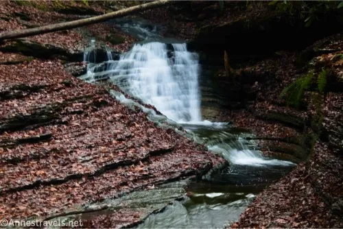
Tucked away in rural southwestern Virginia is a waterfall a place called the Devils Bathtub. I was a little disinterested in visiting, as I’d read the falls were really nice but the area is usually overrun and badly littered with trash. Well, I did visit, and I even kept my feet dry on the 10-ish stream crossings required to get up to the waterfall area. To my surprise, the trash wasn’t bad at all – I found one sock (apparently there are usually dozens of socks) and a few pieces of litter in a fire pit, but that was it. Considering the waterfall really was pretty on a late autumn afternoon, I’d call this hike a pretty good win!
Quick Stats
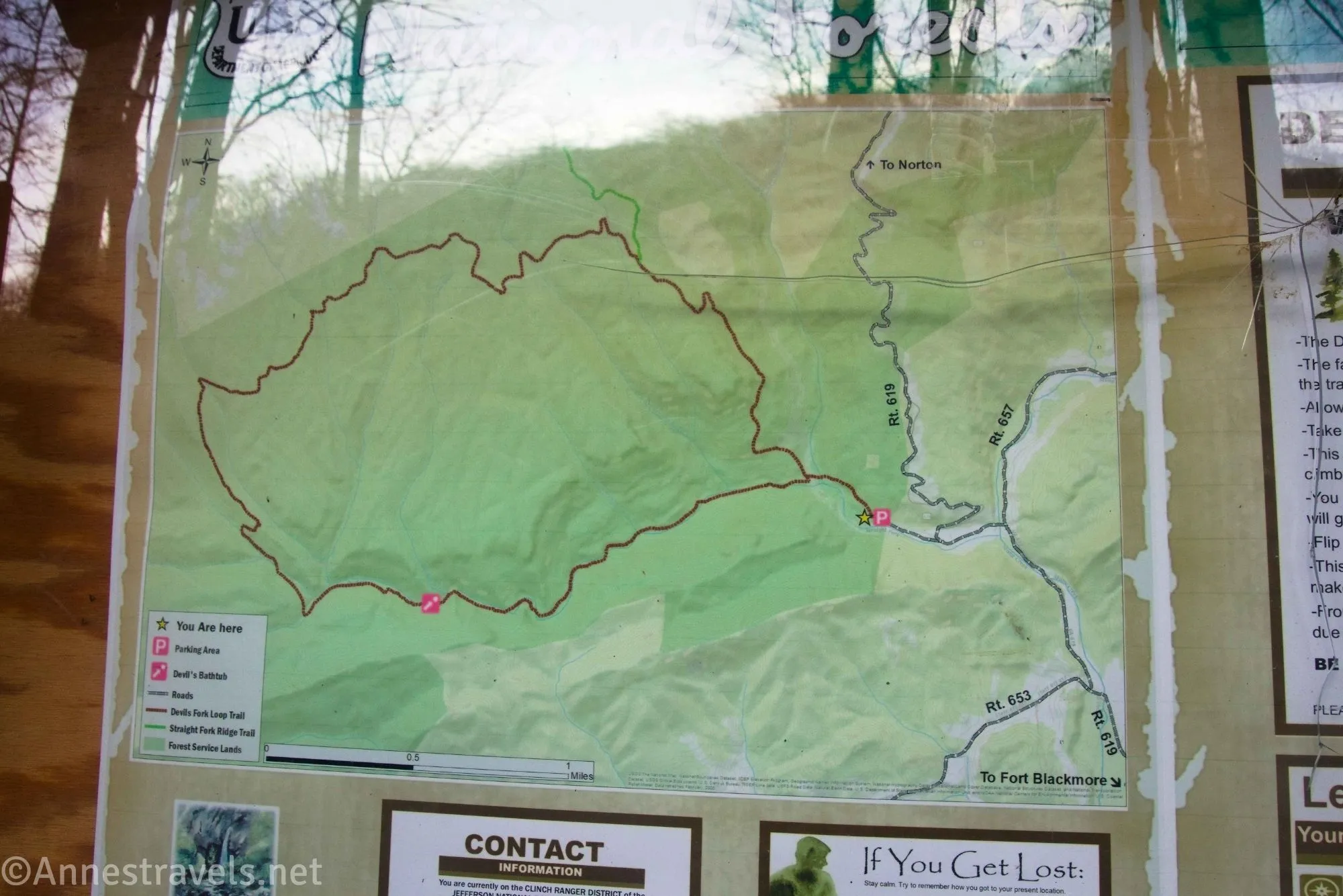
If you read AllTrails, you’d think the access road is 4×4 only (muddy with deep ruts), there’s very little parking, the stream crossings require good water shoes and a willingness to get wet, there is a lot of trash, you’ll see a lot of random socks, and most people who visit do so to use it as a swimming hole. Only some of this is true. The access road is gravel with a few potholes, and while I was happy for high clearance 2WD, a Camry made it up the road just fine. There is very little parking, and no parking is allowed along the access road or near where the access road leaves the main road – so be ready to go somewhere else if the small lot is full (late on a Wednesday in November, there were only two cars in the lot besides me, and you could easily have fit another half dozen or maybe squeeze a dozen into the gravel lot).
I did the stream crossings rock-hopping in hiking boots; my companion was wearing sneakers and rock-hopped with dry feet until the final crossing, when a rock slid and, well, his feet got wet. As I said above, the trash must have been picked up after the summer season, because litter was virtually non-existent. Even the socks had disappeared. It was far too cold to go swimming, but I expect it would be popular on a hot summer weekend.
My biggest problem – and what wasn’t mentioned on AllTrails – was that the trail has been rerouted several times. The old blazes often still exist, and while whoever keeps the trail open has done a good job of blocking off at least one end of the old trail, it can still get confusing, especially near the Falls area. In fact, I’m pretty sure I didn’t follow the trail correctly to the Bathtub, but it was getting dark, so I wasn’t exactly taking my jolly good ol’ time looking around for where the trail might go. Give yourself a little extra time to be sure to find the Bathtub instead of just see it from above!
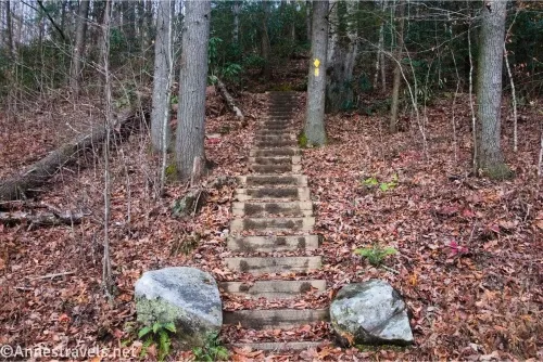
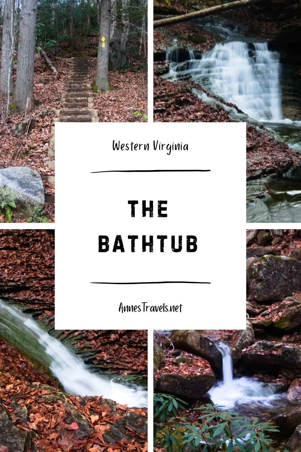
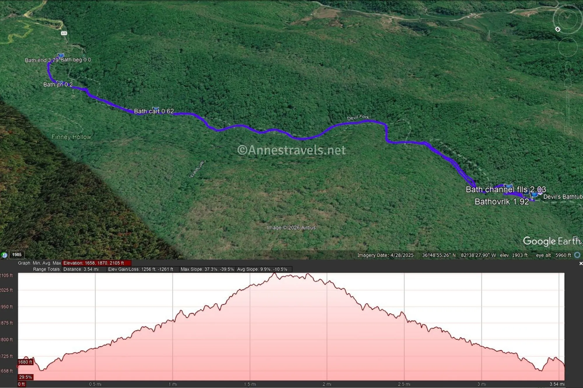
0.0 Bathtub Trailhead (1,636ft.). Climb up the stairs, then turn left up to the sign kiosk. Keep following the trail as it descends to the first creek crossing (one of the more difficult crossings IMO). Remember, the level of the stream will vary depending on the time of year and how recently it’s rained. I visited in November, but it had rained quite heavily the night before. Follow the wide path to the first (and only) trail junction. (36.8185920°, -082.6265740°)
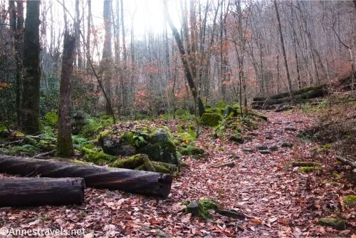
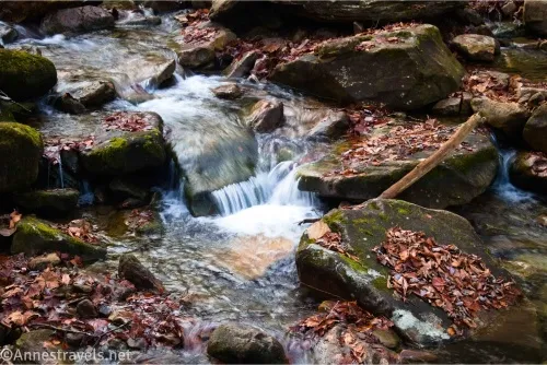
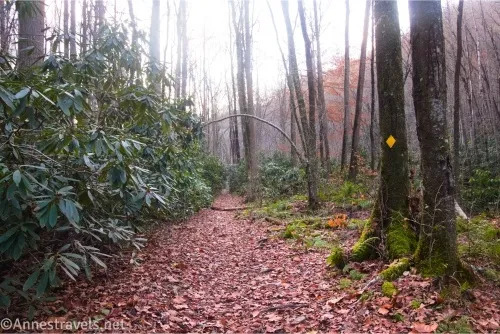
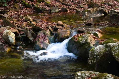
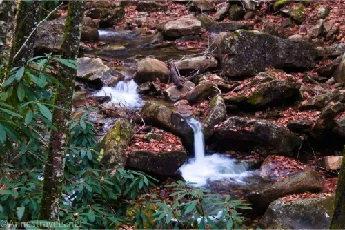
0.2 Trail Junction (1,619ft.). Turn left. At first, the trail is wide, but it quickly narrows at the creek. I counted a total of 8 stream crossings between the trail junction and the falls, but I hear there are actually 9, so apparently I forgot to count one. (Some people say there are 17 in this area, so I encourage you to count your own number.) Follow the yellow blazes on the trees. Much of the tread is an old mining road, but occasionally the trail has been rerouted, resulting in hills and more difficult hiking. (36.8196320°, -082.6292480°)
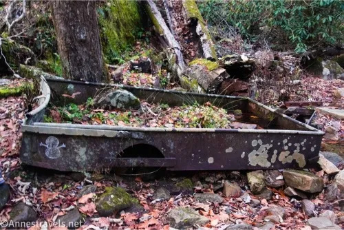
0.6 Mine wagon (1,698ft.). A sign explains the history of the mines in the area. Keep following the yellow blazes. (36.8180130°, -082.6353210°)
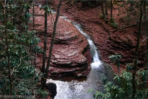
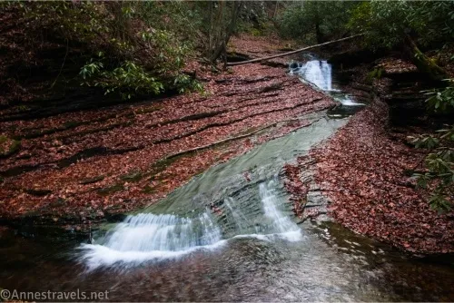
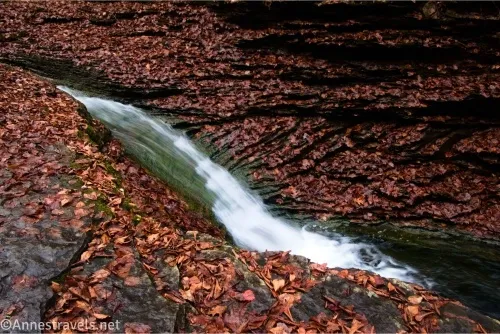
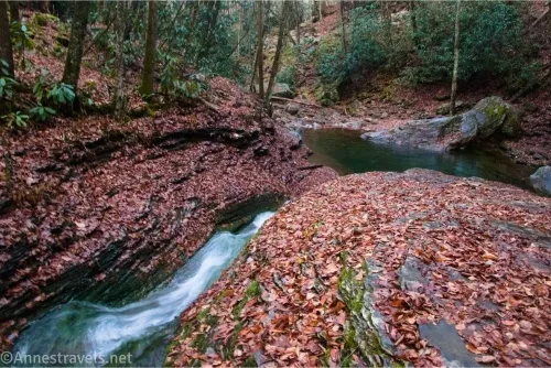
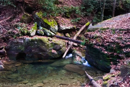
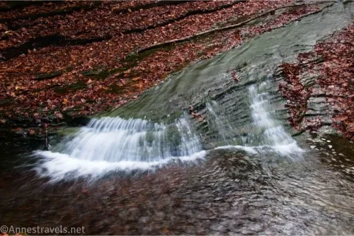
1.7 Lower Falls (2,013ft.). Turn right to walk down the rock shelf to see the waterfall and the pool below it. Then walk back up the shelf and continue upstream to the Bathtub Falls. (36.8133200°, -082.6497830°)
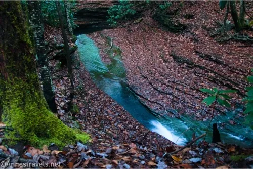
1.8 Bathtub Falls Overlook (2,016ft.). This is as close as I was able to get to the falls. I’ve read about a rope and creeping along a ledge (I think on the left side of the stream), but I couldn’t find it in the gathering dusk. Instead, I turned right and crossed the stream (following blazes, I might add), scrambled up the bank, found blazes going in both directions, turned left, and found myself above the Bathtub and Bathtub Falls. (36.8131730°, -082.6503420°)
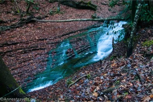
1.9 Bathtub from Above Overlook (2,030ft.). Be careful as there are no railings. After looking, retrace your steps to the trailhead – or take a dip in the creek first! (36.8131340°, -082.6506140°)
Round Trip Trail Length: I went a total of 3.8 miles
Elevation Gain: 1,256ft., supposedly, but I’m pretty sure that’s a gross overstatement (1,658ft. to 2,105ft.). AllTrails says 600ft., and that should be much closer to the truth.
Facilities: None; I saw a park with a pit toilet on our way in and was glad for it later
Fees: None
Trail Notes: Most people wear water shoes for this hike, but it’s too rugged for flipflops or other not-so-sturdy options. I rock hopped in hiking boots and was fine. Supposedly, there is a 7-mile loop that uses this trail, but I couldn’t figure out where it went from the Bathtub area, so be sure to use a map. The stream is a local swimming hole, so expect to see people in the water and in bathing attire on a warm day. Use care on the stream crossings, as I found the rocks slippery underfoot, even in hiking boots. There can be flash floods, so be wary of rising water. Remember to leave no trace – especially leave no trash (including socks)!
Trail 
![]()
![]()
![]()
Road ![]()
![]()
![]()
Signs ![]()
![]()
![]()
Scenery ![]()
![]()
![]()
![]()
Would I go 100 miles out of my way for this? ![]()
Overall Rating: ![]()
![]()
![]()
GPS Coordinates for the Devils Bathtub
TH: 36.8185920°, -082.6265740° (36°49.11552′, -082°37.59444′ / 36°49’06.9312″, -082°37’35.6664″) (1,636ft.) (0.0)
Junction: 36.8196320°, -082.6292480° (36°49.17792′, -082°37.75488′ / 36°49’10.6752″, -082°37’45.2928″) (1,619ft.) (0.2)
Cart/mine sign: 36.8180130°, -082.6353210° (36°49.08078′, -082°38.11926′ / 36°49’04.8468″, -082°38’07.1556″) (1,698ft.) (0.62)
Falls: 36.8131730°, -082.6503420° (36°48.79038′, -082°39.02052′ / 36°48’47.4228″, -082°39’01.2312″) (2,016ft.) (1.87)
Overlook: 36.8131340°, -082.6506140° (36°48.78804′, -082°39.03684′ / 36°48’47.2824″, -082°39’02.2104″) (2,030ft.) (1.92)
Channel Falls: 36.8133200°, -082.6497830° (36°48.79920′, -082°38.98698′ / 36°48’47.9520″, -082°38’59.2188″) (2,013ft.) (2.03)
End: 36.8185680°, -082.6266060° (36°49.11408′, -082°37.59636′ / 36°49’06.8448″, -082°37’35.7816″) (1,633ft.) (3.79)
The gpx file for the Devils Bathtub can be downloaded – please note that this and the GPS Coordinates are for reference only and should not be used as a sole resource when hiking this trail.
Download GPX File size: 75.6 KB Downloaded 189 times
(Note: I do my best to ensure that all downloads, the webpage, etc. are virus-free and accurate; however, I cannot be held responsible for any damage that might result, including but not limited to loss of data, damages to hardware, harm to users, from use of files, information, etc. from this website. Thanks!)
Getting to the Devils Bathtub
There is no good way to get to The Bathtub, and there is no easy way to describe how to get there. To make matters worse, cell signal out here is nonexistent (at least, no Verizon). Soooo… my best suggestion is to download offline maps and follow them to the trailhead coordinates (36.8185920°, -082.6265740°).
Take Exit 17 on I-81 in Abingdon. Turn north onto Cummins Street for 0l7 mmiles, then turn left onto W Main Street for 0.2 miles. Turn right onto Russell Road NW. After 1.0 miles, take a slight right onto US-19N/US-58 ALT W. Stay on this road for 12.3 miles, then take a left onto US-58 ALT W for another 12.3 miles. Turn left onto VA-65S for 10.9 miles, then take another left onto VA-65S for 8.2 miles. Turn right onto State Rte 619. After 4.4 miles, a slight right will take you onto Forest Service Begley for 0.3 miles to the trailhead.
Or from the west, take Exit 57B to merge onto I-26W toward Kingsport. After 8.7 miles, continue straight onto US-23N for another 2.6 miles. Keep left to stay on US-23N for another 4.4 miles, then take a slight right onto Kane Street. After 0.3 miles, turn right onto Jones Street; 0.3 miles later, turn right onto VA-71N for 1.0. Turn left onto VA-72 N and drive 10.9 miles. Turn left onto State Rte 619 for 4.4 miles, then take a slight right onto Forest Service Begley for 0.3 miles to the trailhead.
There are many no-parking signs in the area, especially along the road leading up to the access road. You may be able to find alternate parking farther away, but please respect local private property and any signs that may pop up.
Waterfall Hikes in Virginia
Explore the waterfalls of Virginia with this book, showcasing some of the best waterfall hikes across the state. This includes several hikes in southwestern Virginia. Buy your copy here.