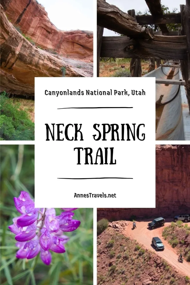

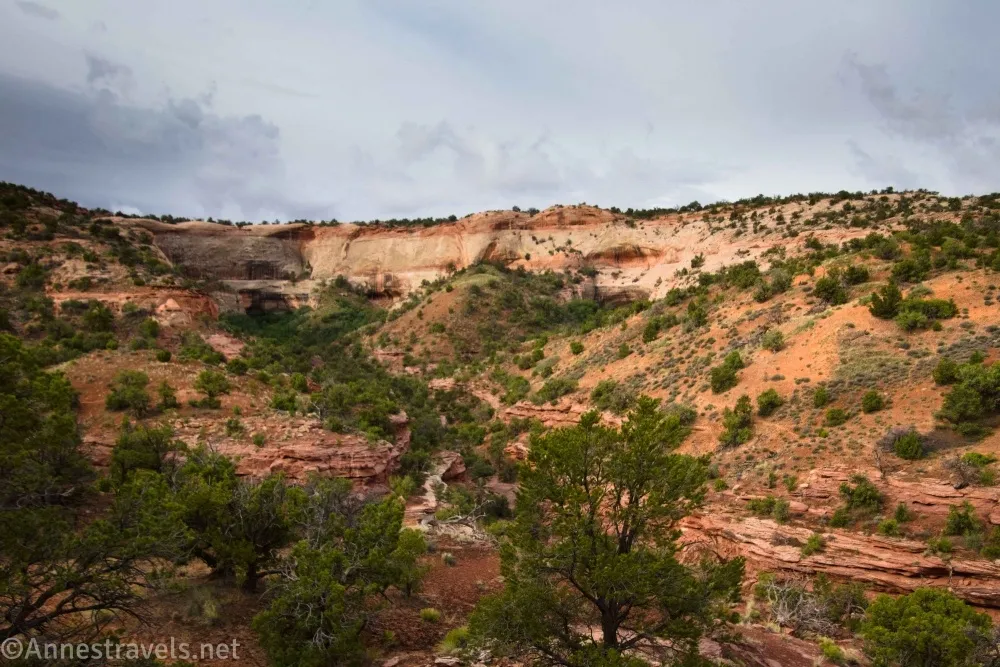
Neck Spring is the first hike you’ll encounter (along with the Shaffer Canyon Overlook) while driving into the Island in the Sky District of Canyonlands National Park. It’s also one of the few long trails on top of the mesa. As such, it holds an interesting position among trail choices while hiking in Canyonlands. Along the way, you get to see a few limited views of Lathrop Canyon, an arch, historic cattle troughs and other ruins, an alcove with a spring in it, and more.
Quick Stats
Now, to be honest, the Neck Spring Trail was not my favorite hike in the park. Much of the route is treed, and what views exist aren’t as spectacular as from other trails. If you need to minimize driving time, you love history, or you love seeing springs in the desert, this is a fantastic trail for you. Otherwise, keep driving to places like Aztec Butte (post coming soon!), White Rim Overlook, Lathrop Trail to the Overlook, Upheaval Dome (post coming soon!), or the Grand View Trail (hopefully a post coming soon!). Or take one of the trails down to the White Rim Road (Gooseberry is my favorite!)
My other issue with the trail was that I hiked it on a cloudy, gloomy morning. So neither my pictures nor my views were the best. Hopefully, if you do hike the trail, you’ll have better weather!
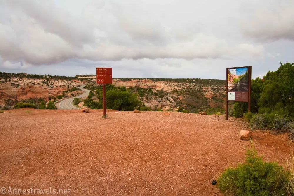
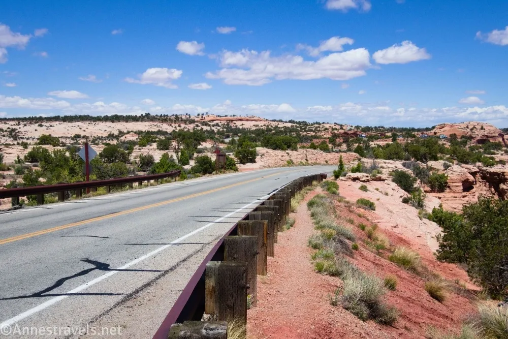
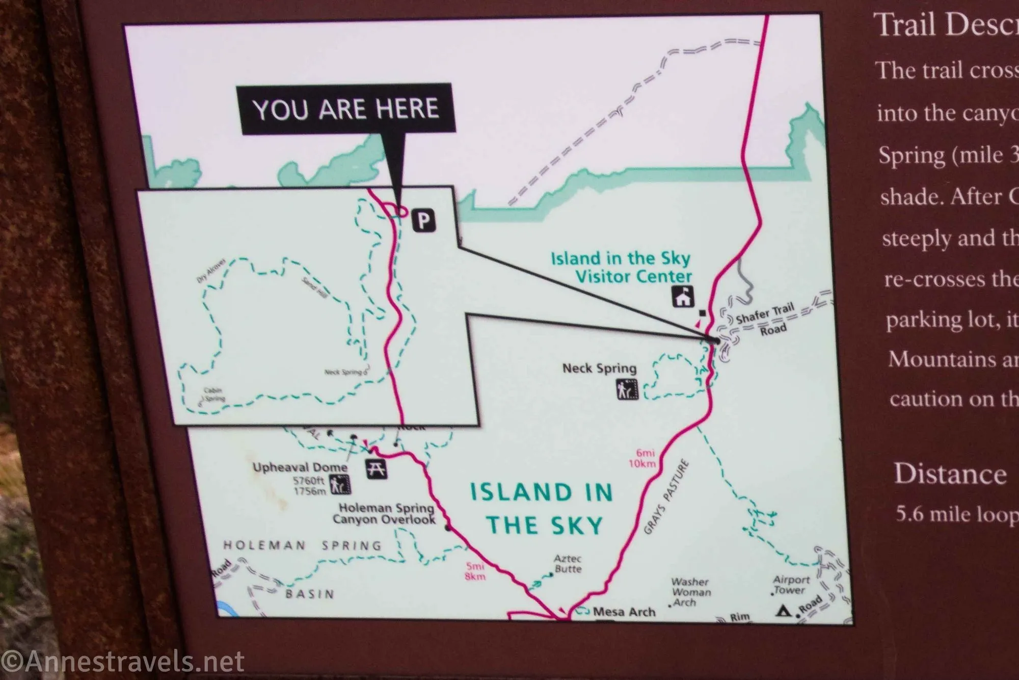
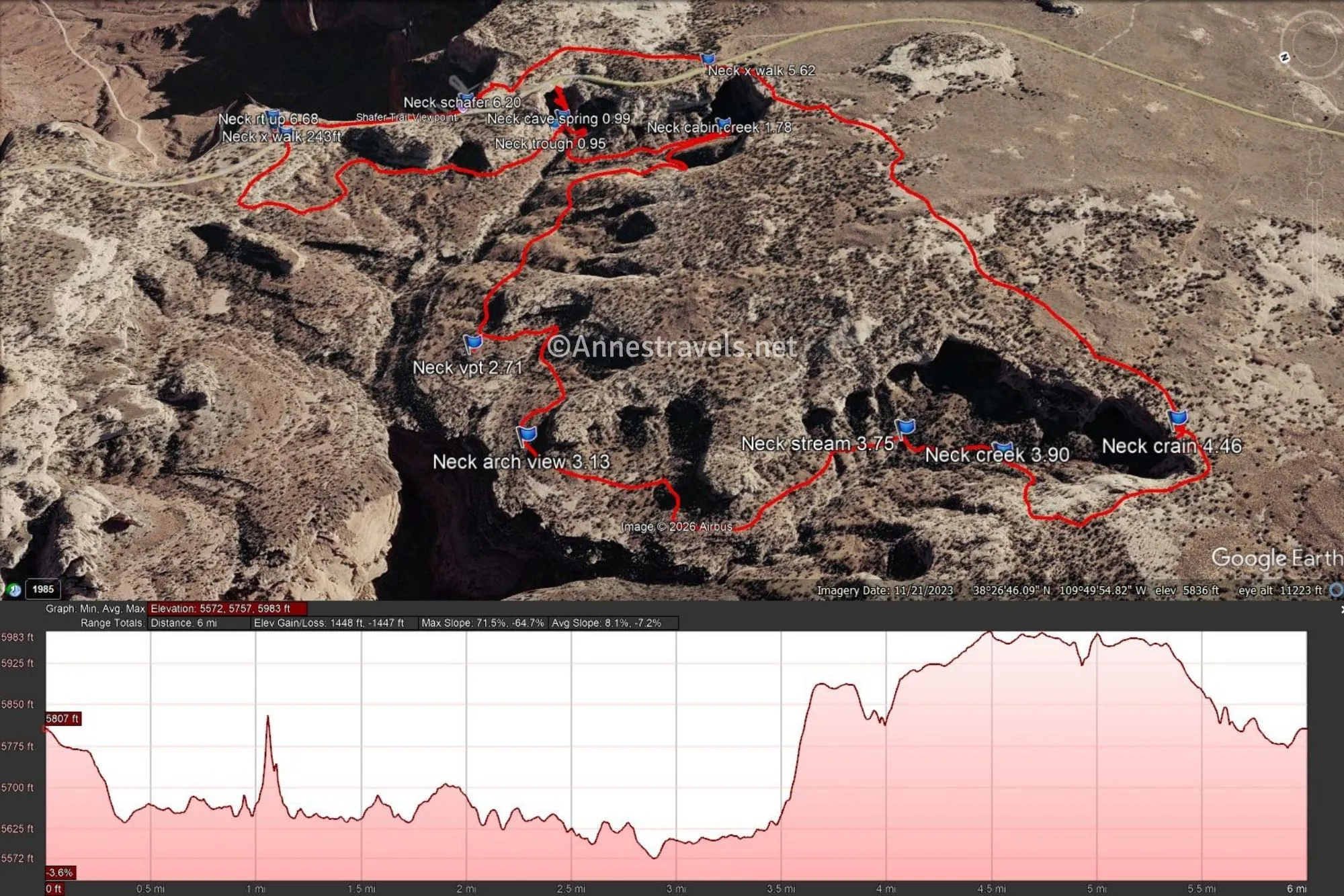
0.0 Neck Spring Trailhead at the Shafer Overlook Parking Area (5,808ft.). This is the same parking area as for the Shafer Canyon Overlook – the overlook trail heads in the opposite direction from the Neck Spring Trail – if you don’t cross the road almost immediately, you’re on the wrong trail. Follow the trail west as it crosses the road via a crosswalk and then turns north and west. Follow the cairns along the canyon rim for 0.25 miles and then descend a bench into the canyon. Views are limited during the descent but do exist. The trail rounds the head of a small canyon before heading south to Cave Spring. (38.4523333°, -109.8204833°)
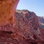
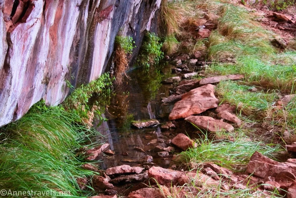
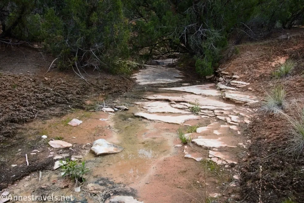
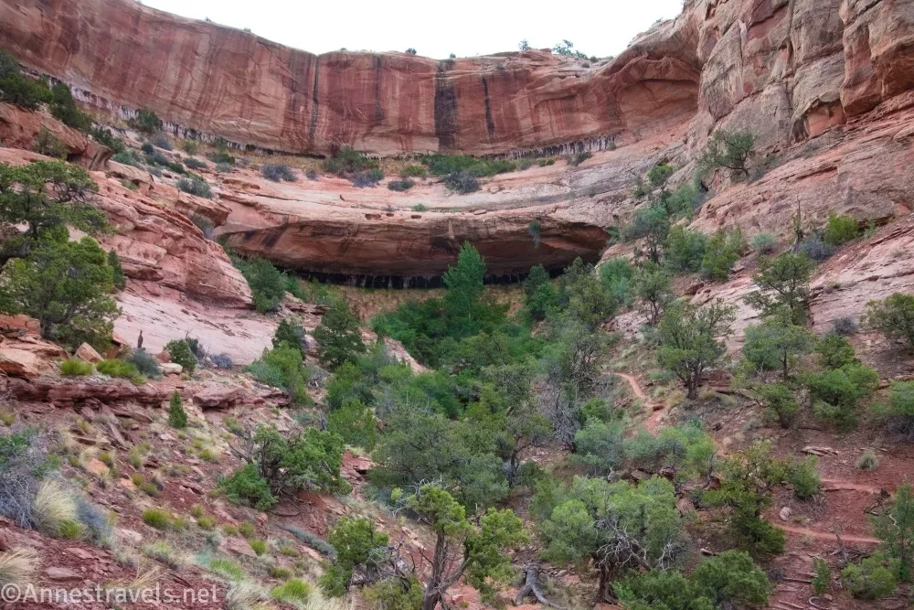
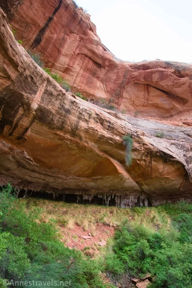
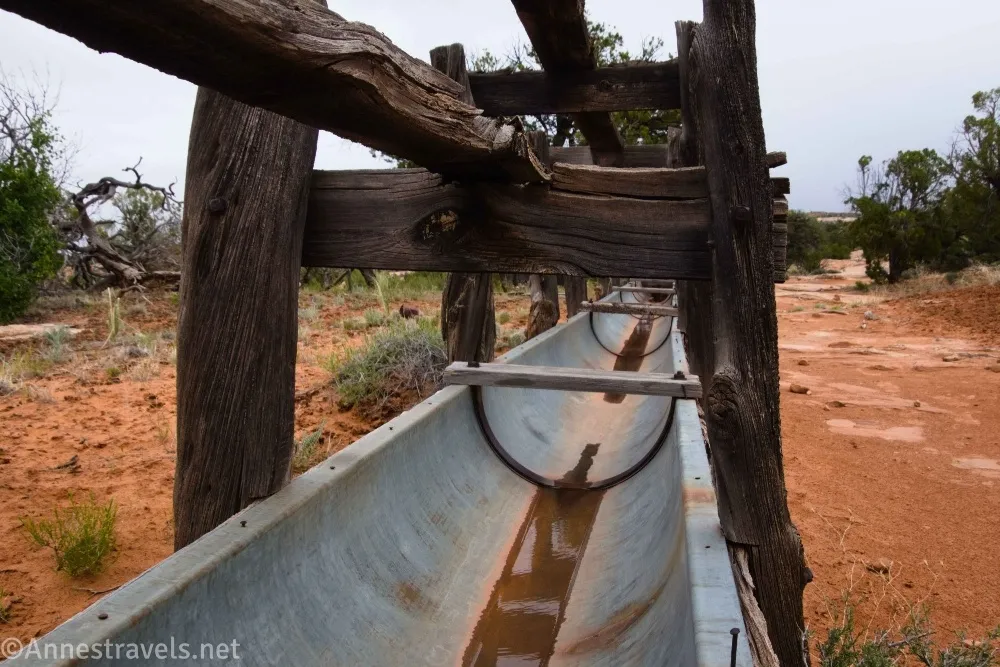
0.9 Watering Trough near the Cave Spring Outlet (5,668ft.). Cave Spring is located in the alcove at the head of the canyon. The trail passes below the seep, although social trails scramble upcanyon toward the spring itself. You can guess what I did. The social trails are narrow and brushy, but you can get up into the alcove without stepping on the black cryptobiotic soil. (38.4462800°, -109.8228930°)
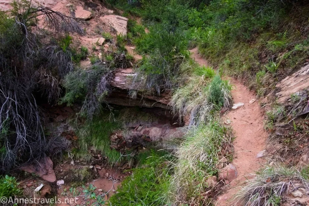
1.0 Alcove (5,691ft.). Enjoy the ferns and possible puddles of water from the seeps. You may find animal prints, as water is a precious commodity in the desert for animals as well as people. Retrace your steps down to the watering trough and the main trail. You can turn around here or turn left to complete the loop by continuing on the sometimes very sandy trail through drainages and sand hills. (38.44588862°, -109.82154381°)
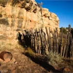
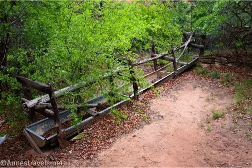
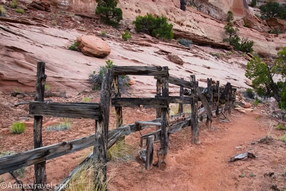
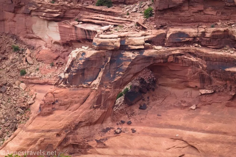
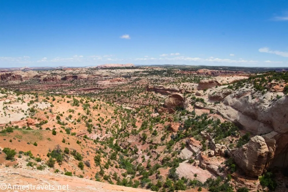
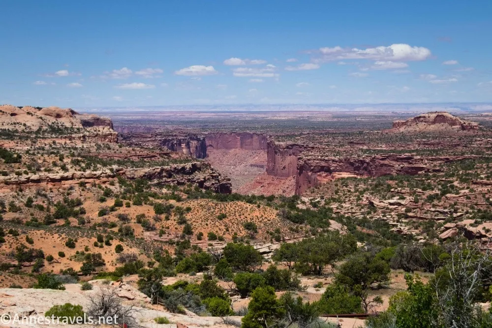
1.8 Cross the Neck Spring Outlet (5,672ft.). Social paths lead first to the remains of a watering trough near the outlet, reminders of cattle ranching in the 1930s. Cross over the outlet and continue along the sandy path. About mile 2.7 (approx. 38.4499850°, -109.8310290°), a short path on the right leads you to a viewpoint into Taylor Canyon. Keep your eyes open for a small arch within the canyon, especially around mile 3.1 (approx. 38.4497460°, -109.8343440°). The trail turns to the south again after this view. (38.4426450°, -109.8248470°)
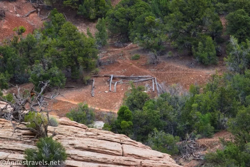
3.9 Cabin/Cabin Spring Outlet(5,610ft.). A few logs mark the remains of an old cabin. Sadly, I was so fixated on the Cabin Spring Outlet that I missed the remains (which are just uphill of the stream) and therefore don’t have any pictures. The trail now climbs steeply back to the canyon rim – follow the cairns. (38.4423880°, -109.8387920°)
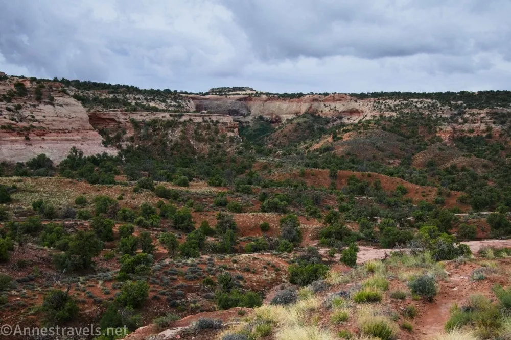
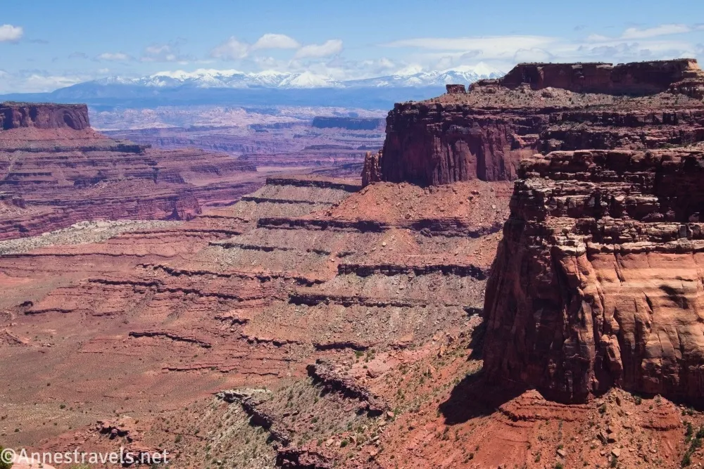
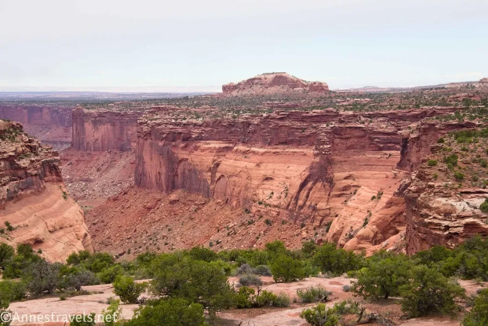
4.1 Canyon Rim (5,884ft.). The route turns left (south) to walk along the canyon rim. This was my favorite part of the hike, as the views are occasionally good down Lathrop Canyon. Keep your eyes open for another watering trough. (38.442473908°, -109.84135714°)
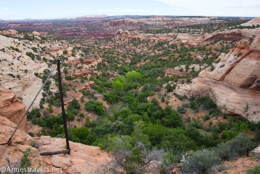
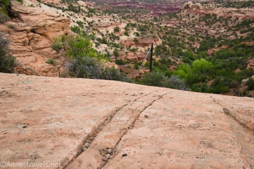
4.5 Old Crane (5,823ft.). An old crane system is visible, along with grooves worn in the slickrock from the cables. This was a neat find per me! Follow the slickrock and cairns back to the road, passing close to the top of the canyon that holds Cabin Spring. (38.4396000°, -109.8399120°)
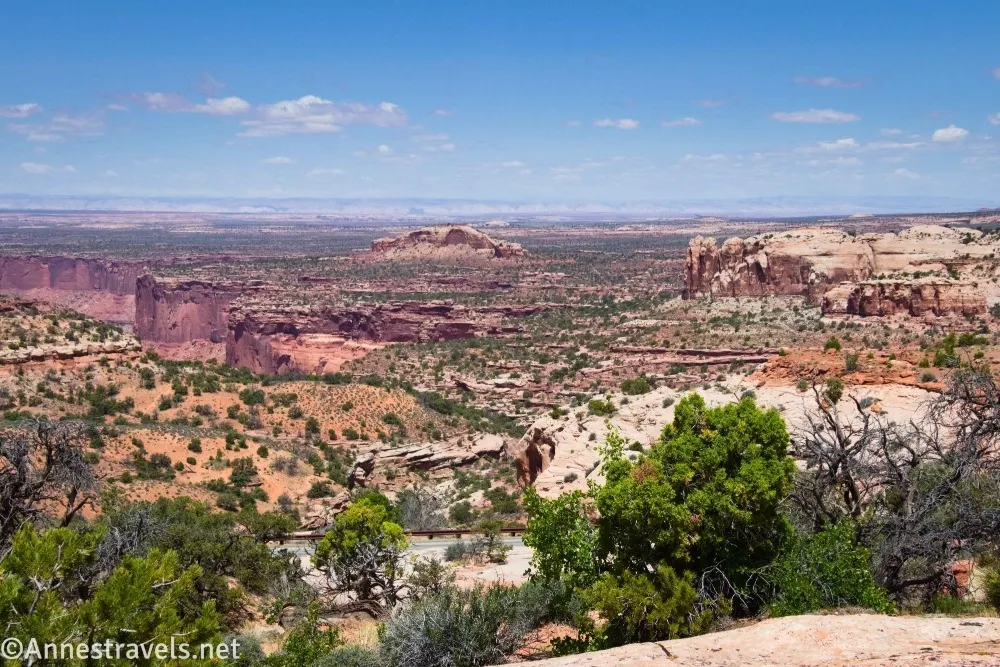
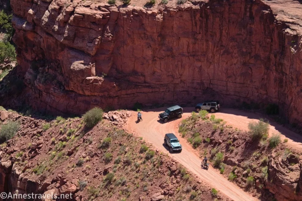
5.6 Cross road (5,956ft.). Cross the park road and continue following the cairns and trail past pretty views into Shaffer Canyon and to the La Sal Mountains. (38.4423500°, -109.8227940°)
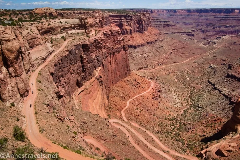
6.2 Shafer Trail Viewpoint (5,813ft.). Cross the pulloff for the viewpoint (take a quick look over the edge of the viewpoint while you’re at it!) and stay to the right of the guardrail to cross The Neck. (38.4479880°, -109.8211750°)
5.5 Pick up Trail (5,779ft.). At the end of the guardrail, follow the cairns to the right away from the road and back to the parking area. (38.451043°, -109.820693°)
6.7 Neck Spring Trailhead at the Shafer Overlook Parking Area (5,808ft.). (38.452347, -109.820367°)
While you’re at it, walk out to the Shafer Canyon Overlook – the views are amazing!
Round Trip Trail Length: I went 6.7 miles, which included scrambling up to Neck Spring and hanging out along the rim of Shafer Canyon for a while.
Elevation Gain: 1,348ft. (5,572ft. to 5,983ft.)

Facilities: None. Water, visitor services, and restrooms are located at the visitor center, 0.5 miles up the road.
Fees: $30/vehicle, valid 7 days. America the Beautiful National Parks & Federal Public Lands Passes are accepted.
Trail Notes: I’ve already given my opinion of the trail, which is that it’s pretty boring. But if you want a long trail without the elevation loss/gain of hiking down to the White Rim Road, you don’t have many other choices in Island in the Sky District. I did it to check another Canyonlands trail off my list (I seem to be on a semi-unintentional quest to hike every trail in the park). A few places require mild scrambling, but all of it is easy Class 2 at worst. More scrambling is required to get up into the alcove with Cave Spring.

Trail 
![]()
![]()
Road
Signs ![]()
![]()
Scenery ![]()
![]()
![]()
Would I go 100 miles out of my way for this? ![]()
![]()
![]()
![]()
Overall Rating: ![]()
![]()
Neck Spring Trail GPS Coordinates
TH: 38.4522910°, -109.8205440° (38°27.13746’, -109°49.23264’ / 38°27’08.2476”, -109°49’13.9584”) (5,807ft.) (0.0)
Crosswalk: 38.4521360°, -109.8210280° (38°27.12816’, -109°49.26168’ / 38°27’07.6896”, -109°49’15.7008”) (5,794ft.) (243ft.)
Watering Trough: 38.4462800°, -109.8228930° (38°26.77680’, -109°49.37358’ / 38°26’46.6080”, -109°49’22.4148”) (5,669ft.) (0.95)
Cave Spring: 38.4459710°, -109.8224850° (38°26.75826’, -109°49.34910’ / 38°26’45.4956”, -109°49’20.9460”) (5,646ft.) (0.99)
Creek (not Cabin Creek; it’s actually Neck Spring Outlet): 38.4426450°, -109.8248470° (38°26.55870’, -109°49.49082’ / 38°26’33.5220”, -109°49’29.4492”) (5,672ft.) (1.78)
Viewpoint: 38.4499850°, -109.8310290° (38°26.99910’, -109°49.86174’ / 38°26’59.9460”, -109°49’51.7044”) (5,641ft.) (2.71)
Arch view: 38.4497460°, -109.8343440° (38°26.98476’, -109°50.06064’ / 38°26’59.0856”, -109°50’03.6384”) (5,630ft.) (3.13)
Stream (Cabin Creek): 38.4423880°, -109.8387920° (38°26.54328’, -109°50.32752’ / 38°26’32.5968”, -109°50’19.6512”) (5,641ft.) (3.90)
Crane: 38.4396000°, -109.8399120° (38°26.37600’, -109°50.39472’ / 38°26’22.5600”, -109°50’23.6832”) (5,823ft.) (4.46)
Crosswalk: 38.4423500°, -109.8227940° (38°26.54100’, -109°49.36764’ / 38°26’32.4600”, -109°49’22.0584”) (5,957ft.) (5.62)
Shafer Trail Overlook: 38.4479880°, -109.8211750° (38°26.87928’, -109°49.27050’ / 38°26’52.7568”, -109°49’16.2300”) (5,783ft.) (6.20)
Route up to the trailhead: 38.4523030°, -109.8200160° (38°27.13818’, -109°49.20096’ / 38°27’08.2908”, -109°49’12.0576”) (5,808ft.) (6.68)
End: 38.4523130°, -109.8204330° (38°27.13878’, -109°49.22598’ / 38°27’08.3268”, -109°49’13.5588”) (5,808ft.) (6.71)
The gpx file for the Neck Spring Trail can be downloaded – please note that this and the GPS Coordinates are for reference only and should not be used as a sole resource when hiking this trail.
Download GPX File size: 86.6 KB Downloaded 48 times
(Note: I do my best to ensure that all downloads, the webpage, etc. are virus-free and accurate; however, I cannot be held responsible for any damage that might result, including but not limited to loss of data, damages to hardware, harm to users, from use of files, information, etc. from this website. Thanks!)
Getting to the Neck Spring Trailhead
From the Island in the Sky Visitor Center, drive south on the main park road for 0.5 miles. Turn left into the large parking area for the Shafer Canyon Viewpoint and the Neck Spring Trail.
Trail Maps
Browse Nearby Trails
My Favorite Book about Hiking Canyonlands
Delve into the history of the area, great maps, great write-ups, and trails both famous and infamous with this guide. It’s my favorite. Buy your copy here.