
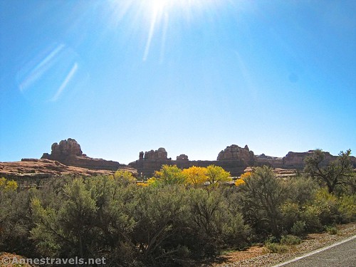
The Needles District of Canyonlands National Park is really only set up for hiking long distances. Chesler Park, Druid Arch, Wooden Shoe Canyon, Big Spring Canyon, and Peek-a-boo Trail all play this out fairly well. It’s also set up for serious 4×4 vehicles (Elephant Canyon, The Joint Road, Davis Canyon, Lavender Canyon, Horse Canyon, and the much easier Colorado River Overlook are all good examples). But for those who wish to hike only a short distance, there are a few viewpoints and trails to check out.
Quick Stats

I’ll try to describe these in a (generally) straight line, as though you were doing a driving tour of the Needles.
Roadside Ruin
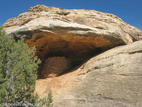
The first short trail is only 0.3 miles RT to a viewpoint of a granary high in an alcove above the trail. It’s not super impressive, though if you’ve never seen one before, it’s certainly a worthy specimen (some even say it’s one of the best-preserved granaries in the park).

From the trailhead, follow the path to a junction; turn right. After about 0.1 miles, turn right again on the spur that will take you to the overlook of the granary. Return to the main trail, turn right, and complete the hike back to the trailhead. A pamphlet guide with corresponding numbers is available along the route.

GPS Coordinates for Roadside Ruin
Trailhead: 38.1631610°, -109.7625680° (38°09.78966′, -109°45.75408′ / 38°09’47.3796″, -109°45’45.2448″) (0.0)
Trail junction: 38.1634670°, -109.7607560° (38°09.80802′, -109°45.64536′ / 38°09’48.4812″, -109°45’38.7216″) (0.1)
Granary Overlook: 38.1636330°, -109.7604140° (38°09.81798′, -109°45.62484′ / 38°09’49.0788″, -109°45’37.4904″) (0.15)
Cave Spring

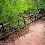
This hike is located off of the main road, down an unpaved road that passes by Salt Creek (which is 4×4 only; permit required). But getting to the Cave Spring Trailhead is suitable for most vehicles. The trail itself has great views, a small spring, rock art, and a historic cowboy camp along the way.

From the trailhead, take an almost immediate left to hike the route clockwise (best for the views). A short distance later, the historic cowboy camp can be seen under the overhanging rock alcove. Keep hiking for about 0.1 miles to Cave Spring, which also has rock art and was named for the alcove within which the spring resides.

Beyond this, the trail ascends two ladders and then follows cairns (small piles of rocks) across the top of the slickrock mesa with great views to the Needles, Six Shooter Peak, the La Sal Mountains, and the cliffs of Island in the Sky. The route eventually returns to the desert floor, looping back to the trailhead about mile 0.6. (If you’re tall, use care in this final section, as an overhang may be slightly too short for you to stand up comfortably.)

GPS Coordinates for the Cave Spring Trail
Trailhead: 38.1572240°, -109.7516690° (38°09.43344′, -109°45.10014′ / 38°09’26.0064″, -109°45’06.0084″) (0.0)
Cowboy Camp: 38.1569340°, -109.7522280° (38°09.41604′, -109°45.13368′ / 38°09’24.9624″, -109°45’08.0208″) (0.05)
Cave Spring: 38.1565490°, -109.7539050° (38°09.39294′, -109°45.23430′ / 38°09’23.5764″, -109°45’14.0580″) (0.15)
Wooden Shoe Arch Overlook
This is little more than a viewpoint, but the arch is worth seeing. It really looks like a wooden shoe, with the arch between the sole and the heel!

Wooden Shoe Arch Overlook: 38.1505594°, -109.7815283° (38°09.03356′, -109°46.89170′ / 38°09’02.0138″, -109°46’53.5020″)
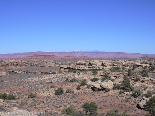
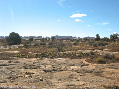
Pothole Point

This is another nature trail that is a 0.7 mile loop. It’s especially fascinating after a rain, when the “potholes” in the slickrock fill with water. You may also be able to see the life that swims in the potholes, including little minnows, frogs, and tadpole shrimp.

There are two trailheads from the same parking area for Pothole Point – both will take you on the same trail (it’s a loop), but I’ll start at the trailhead in the middle of the parking lot (as opposed to the southern (left) corner). The path loops across dirt and slickrock with views of the Needles and the potholes (technically ephemeral (fleeting) pools, but you don’t have to be that technical). Follow the cairns (small piles of rocks). The trail returns to the parking area at its south corner after 0.7 miles.
The NPS requests that you never stick fingers, feet, or anything else into the potholes, even when they’re dry. The oils, sunscreen, and other foreign materials can pollute the water or disturb the eggs in the dried mud – when the potholes fill again, the eggs will hatch, continuing the life cycle of the animals that call these potholes home.
GPS Coordinates for Pothole Point
Center-of-the-parking-lot Trailhead: 38.1703420°, -109.8064890° (38°10.22052′, -109°48.38934′ / 38°10’13.2312″, -109°48’23.3604″) (0.0)
South-corner Trailhead: 38.1702480°, -109.8065160° (38°10.21488′, -109°48.39096′ / 38°10’12.8928″, -109°48’23.4576″) (0.7)
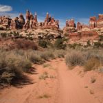
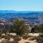
Slickrock Trail

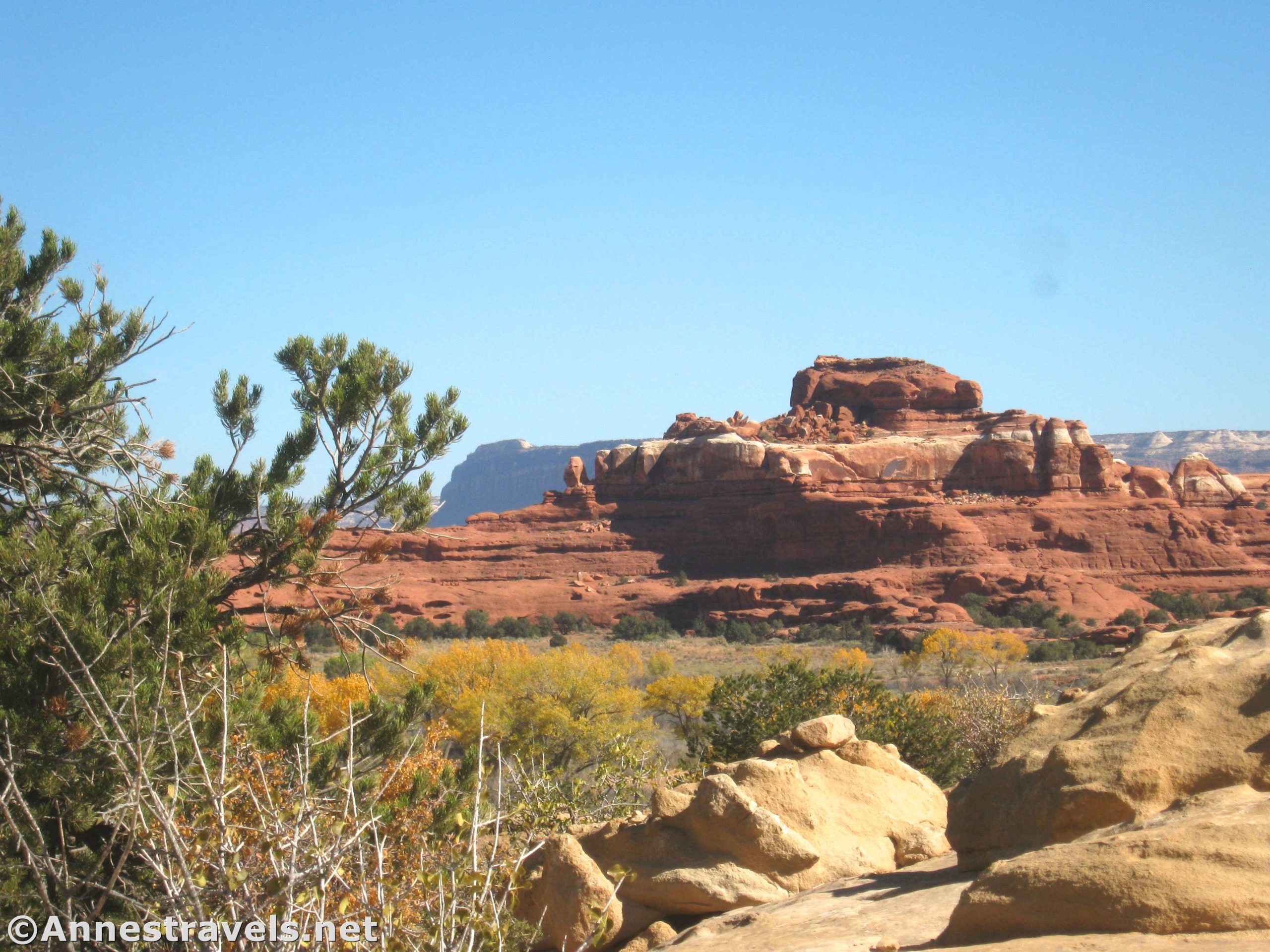
It’s hard to call a 2.9 mile loop trail an “overlook,” but I’ll include it here anyway. The trail visits multiple viewpoints with views of the Needles, the La Sal Mountains, the cliffs of Island in the Sky, Six Shooter Peak, a couple of canyons, and much more.

Most of the trail is on slickrock, so follow the cairns from the trailhead to a viewpoint on the right after about 0.3 miles. A quarter mile later, the trail splits (the remainder of the trail is a loop). I’ll turn right another 0.4 miles to a second viewpoint on the right overlooking Upper Little Spring Canyon. A third viewpoint is also on the right at mile 1.2. The most popular viewpoint can be found at mile 1.6, which allows you to look down on Big Spring Canyon. Some people choose to retrace their steps, while others complete the loop via a cliff-edge route (it is cairned) with good views of the Needles. Return to the trail junction that began the loop at mile 2.4 and the parking lot at mile 2.9.

GPS Coordinates for the Slickrock Trail
Trailhead: 38.1770220°, -109.8144920° (38°10.62132′, -109°48.86952′ / 38°10’37.2792″, -109°48’52.1712″) (0.0)
Spur to Viewpoint 1: 38.1770220°, -109.8144920° (38°10.62132′, -109°48.86952′ / 38°10’37.2792″, -109°48’52.1712″) (0.3)
Trail Junction for Lollipop Loop: 38.1820520°, -109.8138510° (38°10.92312′, -109°48.83106′ / 38°10’55.3872″, -109°48’49.8636″) (0.5)
Viewpoint 2: 38.1855170°, -109.8113430° (38°11.13102′, -109°48.68058′ / 38°11’07.8612″, -109°48’40.8348″) (0.9)
Spur to Viewpoint 3: 38.1873770°, -109.8136220° (38°11.24262′, -109°48.81732′ / 38°11’14.5572″, -109°48’49.0392″) (1.2)
Viewpoint 4: 38.1880500°, -109.8158840° (38°11.28300′, -109°48.95304′ / 38°11’16.9800″, -109°48’57.1824″) (1.6)
Big Spring Canyon Overlook

Finally, an honest-to-goodness overlook! It’s also the end of the Needles Road and overlooks Big Spring Canyon. While you can hike around (about 0.2 miles RT), most people simply look from the parking area. Views are also good of the cliffs that surround Island in the Sky.

GPS Coordinates for Big Spring Canyon Overlook
Trailhead: 38.1782180°, -109.8171960° (38°10.69308′, -109°49.03176′ / 38°10’41.5848″, -109°49’01.9056″)
Big Spring Canyon Overlook (about 0.1 miles from the trailhead): 38.1793600°, -109.8189300° (38°10.76160′, -109°49.13580′ / 38°10’45.6960″, -109°49’08.1480″)

And there you have the viewpoints and short trails in the Needles District of Canyonlands National Park! (Though if you really want another hike that doesn’t have to be long, check out Elephant Canyon…)
Note: I did not include the Colorado River Overlook or the Confluence Overlook in this guide. The first requires 4×4 and a long drive on a dirt road, while the other requires very technical 4×4 skills, a permit, and another long drive on several technical dirt roads.
Getting to the Needles District
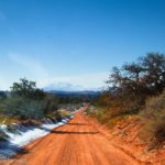
From Moab, Utah, drive south on US-191 for 39.6 miles; turn right onto UT-211W (signed for the Needles District and other sites – this turn is 14.4 miles north of Monticello via US-191). Drive for 34.1 miles to the entrance station for the Needles. Along the way, you’ll pass a lot of great scenery; I also highly recommend stopping at Newspaper Rock for another easy, interesting path/overlook.

Today’s Featured Product!
Expand your options for short and easy hikes in Canyonlands and beyond with this guide. It covers 50 trails throughout the Big 5 National Parks. Buy your copy here.