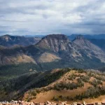
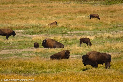
If I could only choose one trail to hike in northwestern Yellowstone, it would be the Lamar River Trail. I’m crazy about meadows and mountain views, but beyond that, we also saw more wildlife than on any other trail we’ve hiked in the park (the only contender would be the Fountain Flat Freight Road, which had a lot of bison – but I still think Lamar Valley beat it out for sheer numbers). Add to this that it’s not particularly strenuous, and yet you feel in the middle of nowhere. You can also extend it to be longer or shorter depending on your needs, interests, timeline, and desires.
Quick Stats
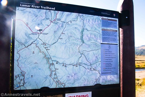
We didn’t get an early a start that morning, mostly because I’d had other plans for the day. But since that trail was unexpectedly closed, I quickly pivoted to head up into the Lamar Valley. At about 8am, I took the second to last spot at the official Lamar River Trailhead (the stock trailhead still had a few spots when we drove by – for all the cars, I only saw a dozen people at most on the trail).
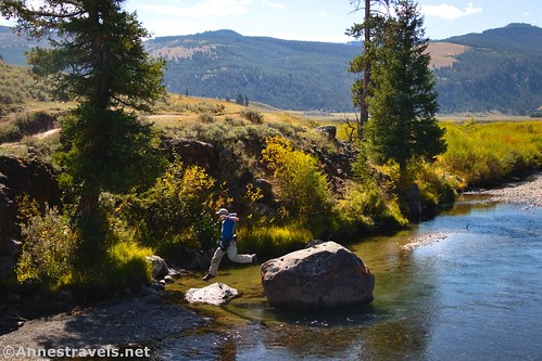
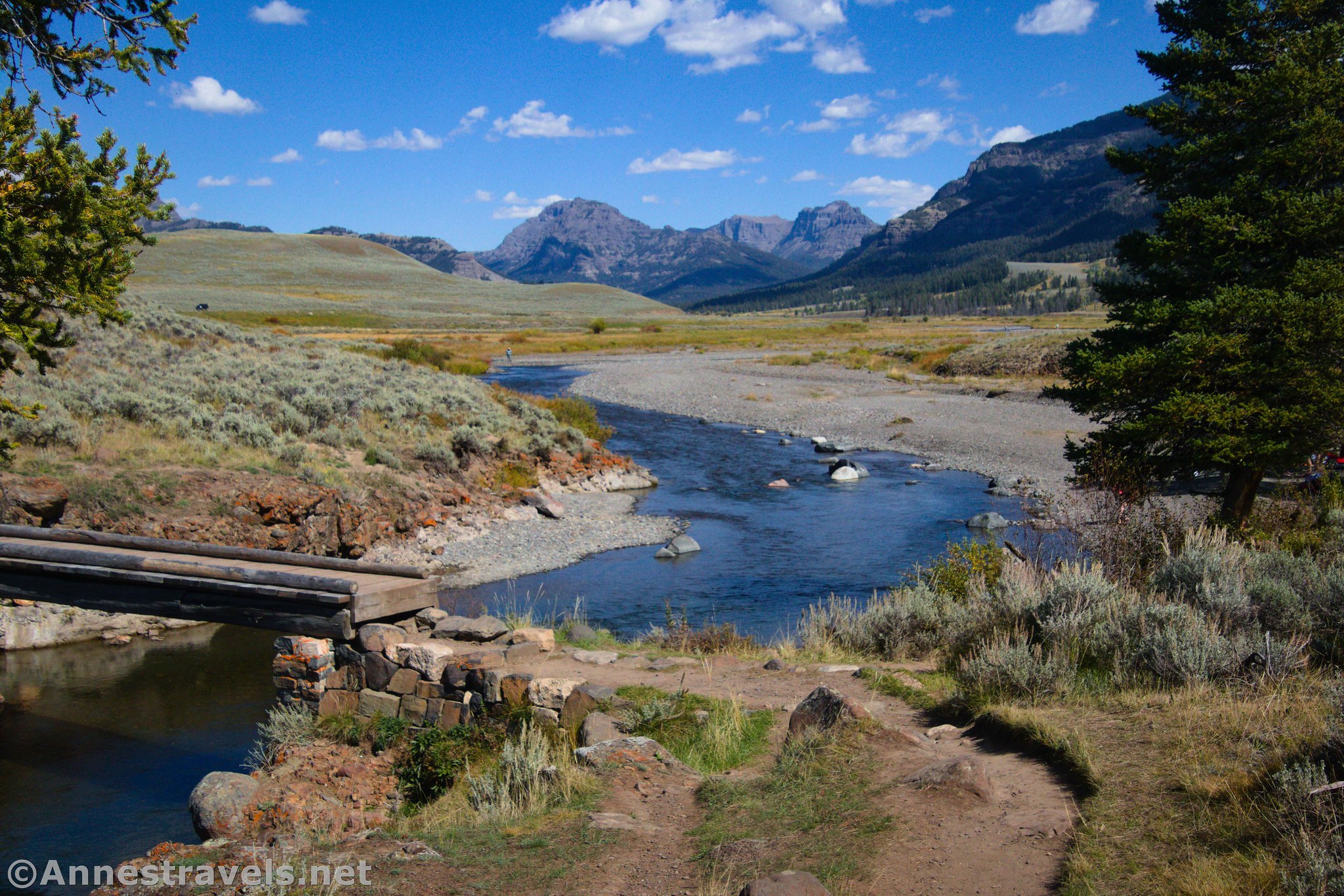
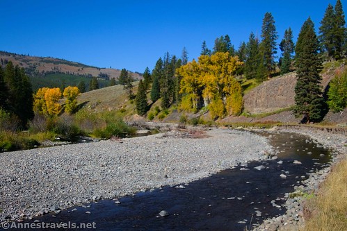
From the parking area, take the well-beaten path down to the bridge over Soda Butte Creek. The view from the bridge is one of the best on the entire trail – to the south (right), the river is blue with grasslands and low mountains; to the north, Abiathar and Barronette Peaks rise beyond the river. Gorgeous!
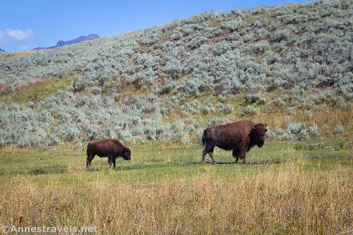
On the other side of the bridge, the trail turns right to head upstream. Quite a few bison were grazing on the flat beside the river. Thankfully, the trail rises above the creek (and finally ascends the bluff to the valley level), so it stayed far enough away from the grazing bison.
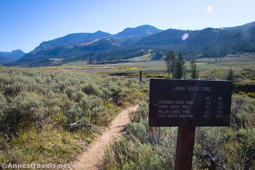
Once atop the bluff, the trail meanders through sagebrush to the junction with the Stock Trail (which goes off on the right to the Stock Trailhead). There’s no reason you couldn’t park at the Stock Trailhead and hike in that way – the views would still be great.

A quarter mile later, the trail to Specimen Ridge (and to Amethyst Mountain) strikes off on the right. Continue left on the Lamar River Trail.

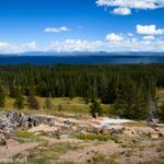
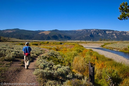
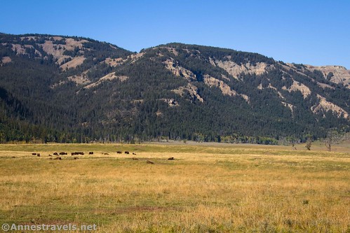
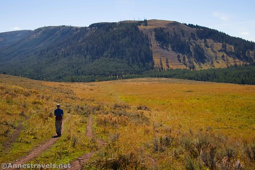
After the two junctions, the trail turns left to continue its ascent above the Lamar Valley. The views are gorgeous of the valley below and the peaks of the Mirror Plateau across the valley.

I had the advantage of hiking in September, so the grass had turned yellow. There’s just nothing (in my mind) like a yellow-grass-filled valley! We also saw bison grazing in the valley bottom.
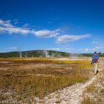
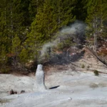
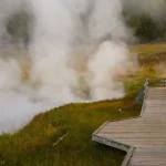
In this section, if you look closely, you can see a geothermal area that empties into the Lamar River. It’s not very impressive, but it has turned the hillside white.
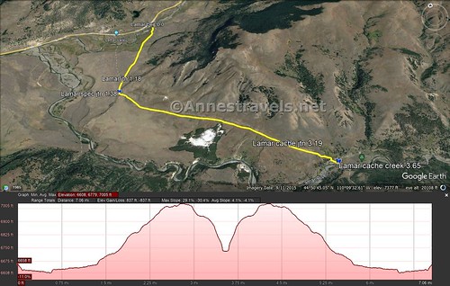
The trail rises up to a pass and then descends to the Cache Creek Trail Junction at mile 3.6. Take the right fork toward Miller Creek Trail and the Cold Creek Junction (I was glad we weren’t turning left – the trail looked like it was rarely used). The trail descends from there, losing elevation more quickly after entering the trees on its way down to Cache Creek.
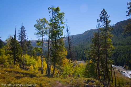
Finally, 3.8 (or so) from the parking area, the trail reaches Cache Creek. Two backcountry campsites are located near here; the first (3L1) is just upstream, while the second (3L2) is across the river. To continue on the Lamar River Trail, you would need to cross the creek here and then hike south. In fact, beyond this, you’d meet up with the Lamar River – so far, the Lamar River Trail has crossed two creeks and never touched the Lamar River, itself!
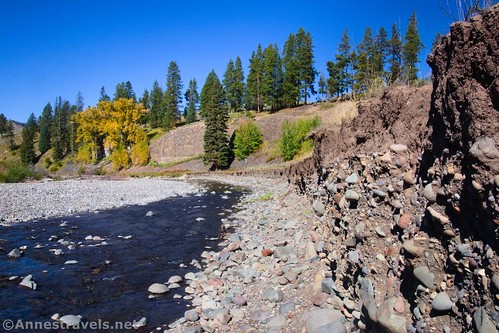
I had no special interest in crossing Cache Creek (not because it looked hard, but because I wasn’t just going to hop across), so we sat with our backs to a wall of dried mud along the riverbank and ate a snack before heading back to the parking area.

Hiking back, the most surprising thing to me was the views after the Specimen Ridge Trail. Abiathar Peak and Barronette Peak rise up out of the valley and are super spectacular!

Round Trip Trail Length: I went 7.2 miles
Elevation Gain: 837ft. (6,608ft. to 7,005ft.)
Facilities: Primitive restroom at the Stock Trailhead
Fees: $35/vehicle, valid 7 days. America the Beautiful National Parks & Federal Lands Passes and Yellowstone Annual Passes are accepted.
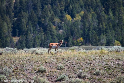
Trail Notes: The Lamar Valley is famous for its wildlife, including bison, wolves, bears, pronghorn, coyotes, wolverines, and much more. Be ready to navigate traffic along the side of the road, full parking lots, and plenty of huge camera lenses blocking the view (just kidding on the last one, but you get the idea). Early morning or late afternoon are your best bets for seeing wildlife, though I preferred the mid- to late-morning views of the mountains. The 7.2 miles felt much shorter to me (closer to 5 miles) because of the gentleness of the terrain and a (mostly good if not very wide) trail (the trail is usually just a dirt ribbon between the grass).

Trail 
![]()
![]()
Road ![]()
Signs
Scenery
Would I go 100 miles out of my way for this? ![]()
Overall Rating: ![]()

GPS Coordinates for the Lamar Valley Trail
TH: 44.8692110°, -110.1662300° (44°52.15266′, -110°09.97380′ / 44°52’09.1596″, -110°09’58.4280″) (6,647ft.) (0.0)
Stock Trail Junction: 44.8562900°, -110.1758320° (44°51.37740′, -110°10.54992′ / 44°51’22.6440″, -110°10’32.9952″) (6,644ft.) (1.18)

Specimen Ridge Trail: 44.8536510°, -110.1771840° (44°51.21906′, -110°10.63104′ / 44°51’13.1436″, -110°10’37.8624″) (6,679ft.) (1.38)
Cache Creek Junction: 44.8360630°, -110.1528960° (44°50.16378′, -110°09.17376′ / 44°50’09.8268″, -110°09’10.4256″) (6,951ft.) (3.65)
End at TH: 44.8692200°, -110.1661960° (44°52.15320′, -110°09.97176′ / 44°52’09.1920″, -110°09’58.3056″) (6,646ft.) (7.29)
The gpx file for the Lamar River Trail to Cache Creek can be downloaded – please note that this and the GPS Coordinates are for reference only and should not be used as a sole resource when hiking this trail.
Download GPX File size: 77.9 KB Downloaded 409 times

(Note: I do my best to ensure that all downloads, the webpage, etc. are virus-free and accurate; however, I cannot be held responsible for any damage that might result, including but not limited to loss of data, damages to hardware, harm to users, from use of files, information, etc. from this website. Thanks!)
Getting to the Lamar River Trailhead
From Tower Junction, drive north on US-212 toward Northeast Entrance and Cooke City. After 14.7 miles, the (more or less unmarked) trailhead will be on the right.

From the Northeastern Entrance to Yellowstone National Park, follow the main road 13.4 miles to the (more or less unmarked) trailhead on the left.
If the parking area is full, there may still be space at the Stock Trailhead, 0.4 miles east down the road (be careful to respect that area set aside for trailers). Take the Stock Trail to meet up with the regular Lamar River Trail.
Today’s Featured Product!
Go for an extremely varied and all-encompassing guide to Yellowstone with the quality of this FalconGuide. With 110 trails to choose from, organized by difficulty and region, it’s easy to plan a trip with it. Buy your copy here!