

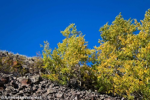
I decided to hike Sheepeater Cliff because it sounded different. So many hikes in Yellowstone are to geothermal features, with a few mountains and waterfalls thrown into the mix. Sheepeater Cliff seemed like it might be a break from the (non)monotony. As it turned out, I hiked it at a poor time of day, and it wasn’t quite as exciting as I’d imagined. But the cliff and “waterfall” (rapids?) were fun and interesting, and the fall colors were quite pretty. Plus, the trail is short with varied scenery; it is definitely different from the rest of Yellowstone!
Quick Stats
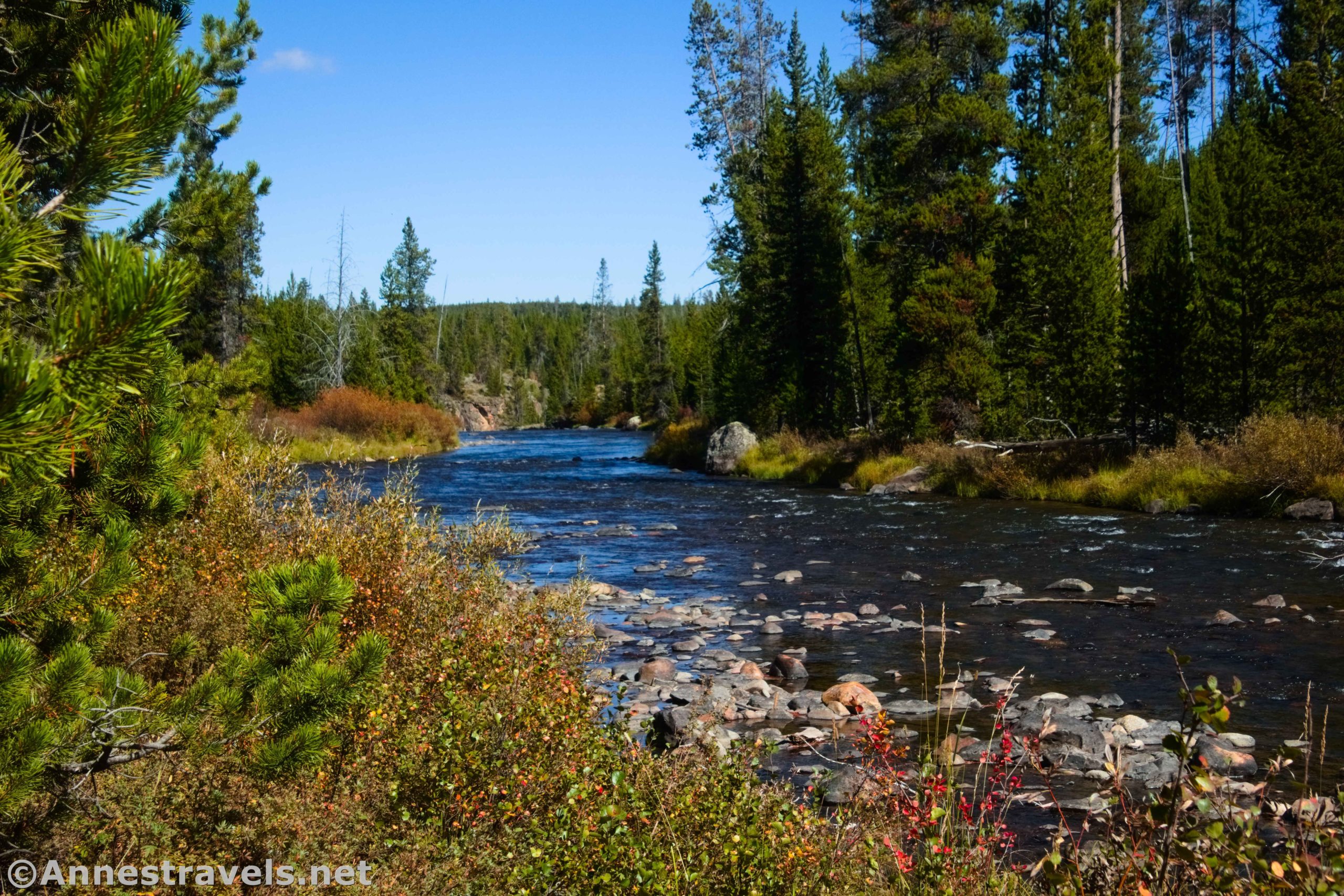
The path begins by the Sheepeater Cliff picnic area (you can see some of the cliff right here next to the parking area, but it gets better further on). Follow the trail that works its way downstream (be sure you get the right path – there are a few others in the area) on the bank beside the Gardner River. It’s somewhere between grown-in/brushy and quite worn. You can’t exactly lose the path!
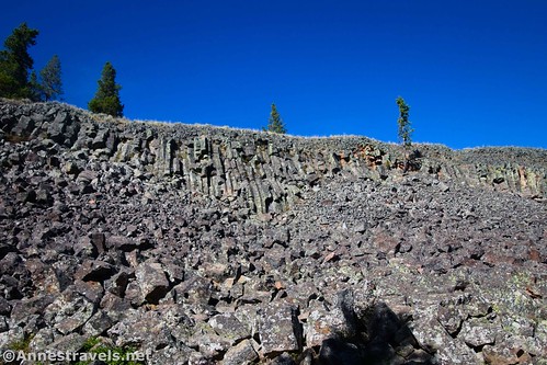
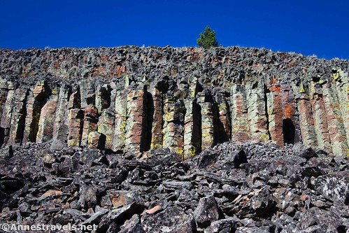
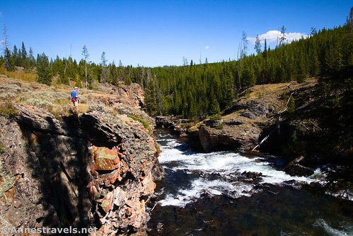
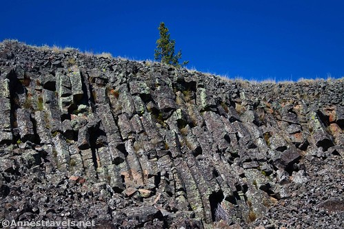
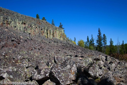
After 0.25 miles, you’ll come to Sheepeater Cliff. This is a volcanic area with basalt columns (think Devils Tower or Devils Postpile, only on a much smaller scale). It’s neat to see if not to look at for very long.

You could turn around here, but I recommend hiking along the bottom of the cliff to see the best views.
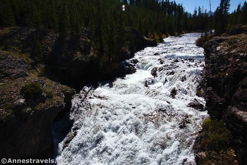
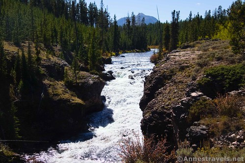
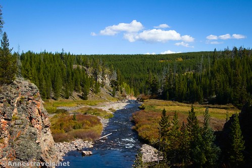
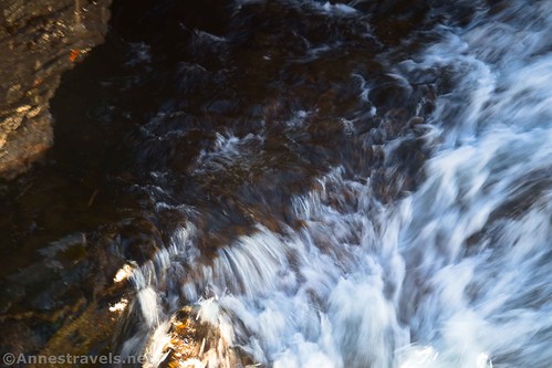
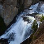
Beyond this, the trail is brushier as it continues to The Chute, which is about 0.2 miles beyond Sheepeater Cliff. You’re up on the bank of the river, high above the rushing water, which drops via a small waterfall into the miniature canyon.
Unfortunately, I couldn’t find a decent place to see the waterfall. But it was scenic, especially in the autumn. It would have been nicer in the morning, though.
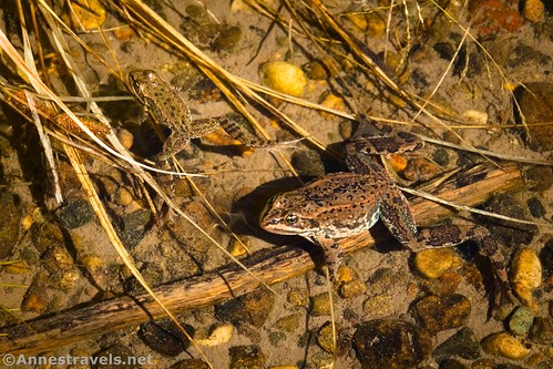
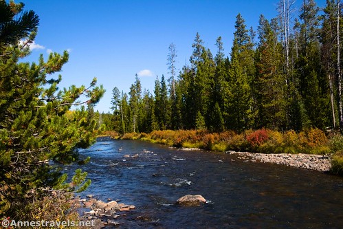
You really should turn around here. However, we thought we saw a waterfall further downstream. So a couple of us continued to follow the trail. When the trail continued to be high above the river, we found a social trail (there are many!) that took us steeply down to river level (about 0.4 miles beyond the Chute). Our first excitement was finding a frog.
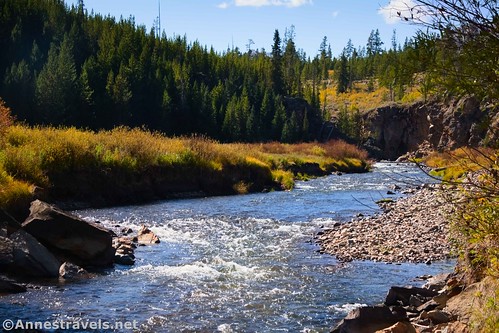
It turned out that the “waterfall” was just some rapids. It was quiet and peaceful and would have been a nice place to sit and enjoy the river for a while.

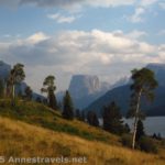
When you’ve explored as far and as long as you want, retrace your steps to your vehicle. In the morning, the views to the mountains of the Gallatin Range (northwestern part of Yellowstone) would be nice up the valley, though the views downstream are nicer in the afternoon.
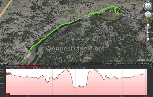
Round Trip Trail Length: 0.5 miles to Sheepeater Cliff; 1.0 mile to the Chute; I went almost 1.7 miles with all of my exploring
Elevation Gain: 376ft. (7,288ft. to 7,210ft.) – Note that if you don’t go beyond the Chute, it’s more like 120ft. elevation gain
Facilities: Primitive restrooms and picnic tables at the trailhead
Fees: $35/vehicle, valid 7 days. Yellowstone Annual and America the Beautiful National Parks & Federal Lands Passes are also accepted.
Trail Notes: I saw a lot of parents with young children on this path. I’m not really sure why; it’s fun for the kids to play in the river (closer to the picnic area), but the trail itself is brushy, rocky, and rooty – so it’s not the best for very young children (we’re talking toddlers). Please stay on the trail (assuming you can find it!) in the Sheepeater Cliff section. The term “Sheepeater” is a translation of the nickname of the tribe that lived and hunted in this area (apparently, sheep were a delicacy). You can explore quite a bit further along the river and the trail if you so desire.
Trail 
![]()
![]()
Road ![]()
Signs ![]()
![]()
![]()
Scenery ![]()
![]()
Would I go 100 miles out of my way for this? ![]()
![]()
![]()
Overall Rating: ![]()
![]()
GPS Coordinates for Sheepeater Cliff
TH: 44.8913520°, -110.7297440° (44°53.48112′, -110°43.78464′ / 44°53’28.8672″, -110°43’47.0784″) (7,271ft.) (0.0)
Sheepeater Cliff: 44.8938060°, -110.7273280° (44°53.62836′, -110°43.63968′ / 44°53’37.7016″, -110°43’38.3808″) (7,246ft.) (0.24)
The Chute: 44.8948830°, -110.7241140° (44°53.69298′, -110°43.44684′ / 44°53’41.5788″, -110°43’26.8104″) (7,238ft.) (0.47)
Turn Around: 44.8950380°, -110.7196190° (44°53.70228′, -110°43.17714′ / 44°53’42.1368″, -110°43’10.6284″) (7,222ft.) (0.88)
End at TH: 44.8913350°, -110.7297330° (44°53.48010′, -110°43.78398′ / 44°53’28.8060″, -110°43’47.0388″) (7,269ft.) (1.63)
The gpx file for Sheepeater Cliff can be downloaded – please note that this and the GPS Coordinates are for reference only and should not be used as a sole resource when hiking this trail.
Download GPX File size: 33.6 KB Downloaded 458 times
(Note: I do my best to ensure that all downloads, the webpage, etc. are virus-free and accurate; however, I cannot be held responsible for any damage that might result, including but not limited to loss of data, damages to hardware, harm to users, from use of files, information, etc. from this website. Thanks!)
Getting to Sheepeater Cliff Trailhead
From Mammoth, drive south on US-89 (toward Old Faithful, Madasin, Norris, etc.). After about 8 miles, turn left onto Sheepeater Cliff Road (it should be marked). The rough, pot-hole-ridden dirt/gravel road ends 0.3 miles later at the trailhead. I was grateful for high clearance, especially in the parking area, though I saw plenty of lower-clearance vehicles (including minivans).
From Norris Junction, head north on US-89 (toward Mammoth). After 13 miles, turn right onto Sheepeater Cliff Road (it should be marked). The rough, pot-hole-ridden dirt/gravel road ends 0.3 miles later at the trailhead. I was grateful for high clearance, especially in the parking area, though I saw plenty of lower-clearance vehicles (including minivans).
Today’s Featured Product!
Explore the easier hikes in Yellowstone National Park with this guide. That’s not to say that they’re all 0.1 mile nature trails – in fact, there are some real gems in here with spectacular scenery, lovely geothermal features, waterfalls, lakes, and more. Buy your copy here!


One response to “Sheepeater Cliff, the Chute, and Exploring!”
[…] Lemonade Lake was dry), Centennial Geyser (0.1 miles), Clearwater Spring (0.1 miles), and finally Sheepeater Cliff (1.6 miles). I hiked down to the cliff, then down to the “Chute” waterfall, then continued on […]