
Every once in a while, a hike that you thought would be nice turns out to be fantastic. That’s how you want it to be, and such was our hike on the Gooseberry Trail and then off-trail to an overlook of Monument Basin (which I’ll talk about in another post). It was a lovely day with fantastic views. If you’re looking for an adventure and a long hike in Island in the Sky, I highly recommend it!
Quick Stats
Note: Some of the links in this post are affiliate links. If you click one and purchase something, I may earn a small commission without an extra cost to you.

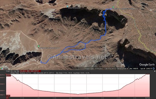
The Gooseberry Trail is known as the shortest path in the park from the rim of Island in the Sky down to the White Rim Road. In other words, you’re losing 1,500ft. in 2.5 miles, or about 600ft. every mile. That trail is crazy steep! But it also has fabulous views, especially in the afternoon (most of the photos looking out toward the La Sal Mountains are from my trek back up).

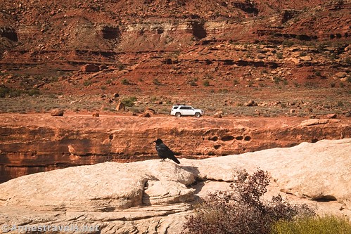
The trailhead is the same as for the White Rim Overlook, which I’d hiked about a year earlier. There are only about six parking spots, so I’d recommend arriving early and/or hiking during an off-time of year (November-February).
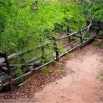
One good thing about the trailhead is that it’s also a picnic area. So you can enjoy breakfast with the convenience of a picnic table and a primitive restroom after you snag a parking space but before you start down the trail. I call that a win!
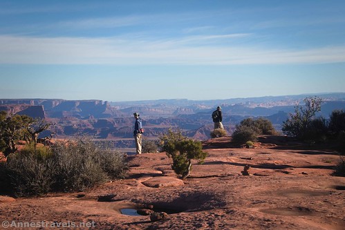
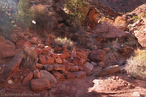
Head out across the slickrock, following the signs for White Rim Overlook and Gooseberry/White Rim. After 350 feet, a sign indicates that the White Rim Overlook turns right while the Gooseberry Trail to White Rim Road goes straight. Continue straight, following the cairns up and over a slickrock ledge.
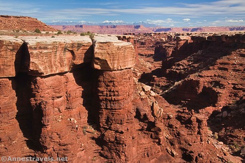
The trail begins its descent quite suddenly, about a tenth of a mile from the trailhead. It just sort of falls off the edge of the cliff. There is a path, but the first hundred feet or so are pretty rough. I think they’re trying to discourage people from hiking too far if they’re wearing flip-flops.

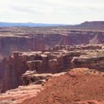
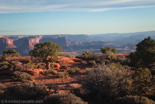
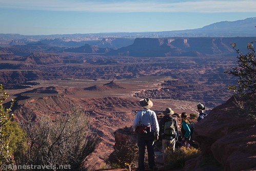
In the afternoon, the views along the descent are fabulous. In the morning, they’re only spectacular. However, morning views are incredible to the north across some small canyons and to the north and east of cliffs. These views get better as you go lower.

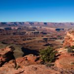
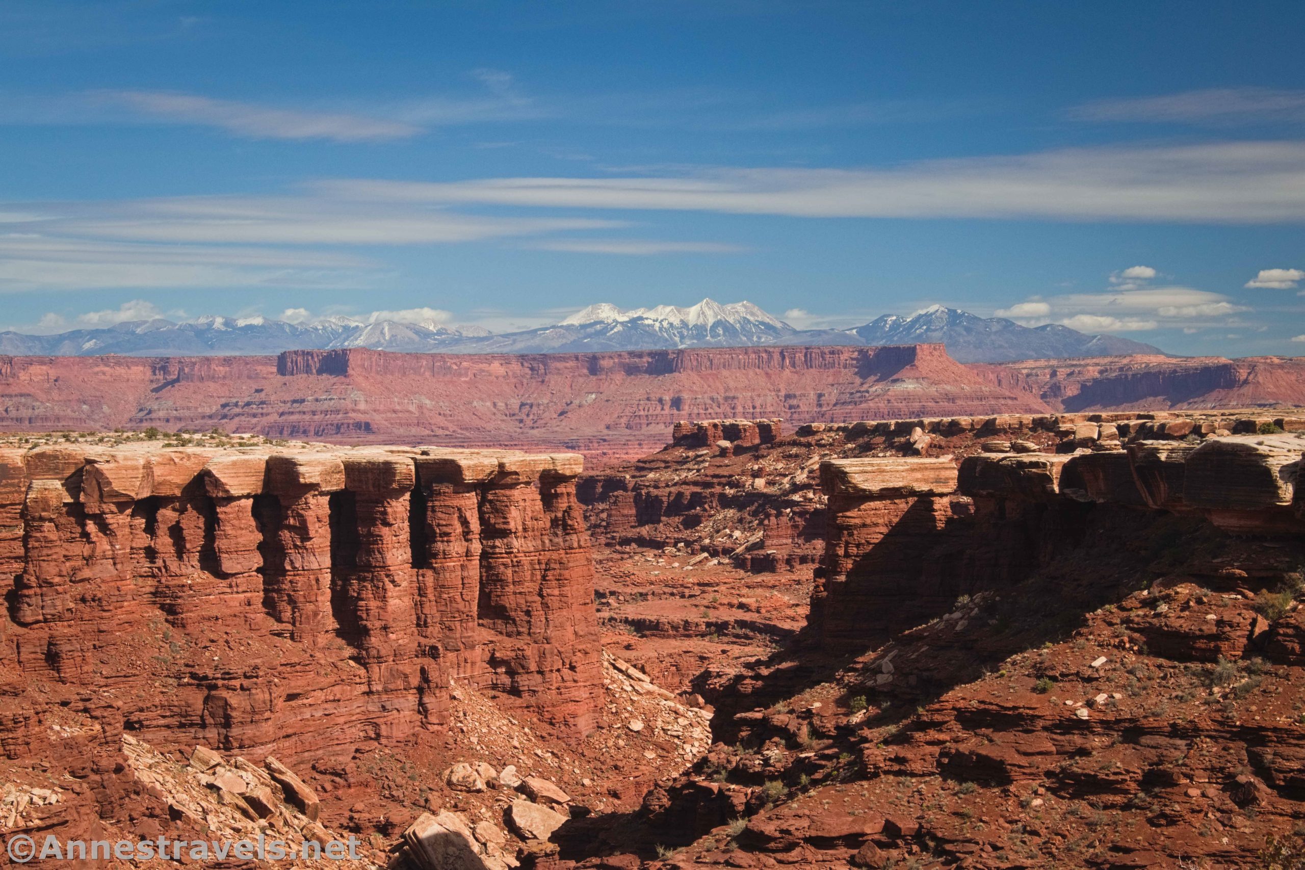
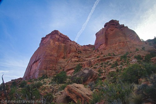
The views to the west, as I said, are better in the afternoon. You’re looking down on Gooseberry Canyon and across the Colorado River Valley to the La Sal Mountains. Wow!

The trail switchbacks quickly down the side of the cliff. I hear that the path was created by WPA workers in the 1930s to give access to a spring that was below the rim. The trail was also made in hopes that it would give local ranchers easier access to the White Rim. However, I’m not sure if livestock ever used the trail.

Be careful to follow the cairns; the trail is pretty obvious, but it’s also pretty rocky in places. I was very grateful for my hiking boots with their ankle support for this hike!

About 1.1 miles and 1,200ft. of elevation descent later, the trail drops you neatly into a wash. Helpful hikers have built numerous cairns here, probably while waiting for others in their group to catch up. But it’s a good thing: It would be relatively easy to walk right past the junction on the way back up.
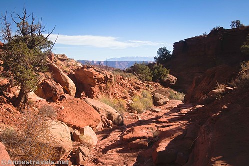
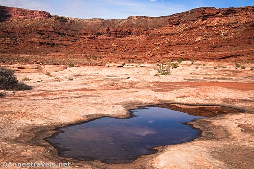
Turn right to walk down the wash. For the most part, it’s quite walkable, if a little sandy. You’ll come to a few small dryfalls but nothing that’s more than an easy Class 2 scramble.
The wash is also sometimes brushy. However, it’s a natural trail, so it makes sense for the National Park Service to use it as the route down toward the White Rim Road.

Views are more limited in the wash than they were on the way down the cliff face, but there are still occasional views to the La Sal Mountains. There are also some cliffs and other interesting features along the way.

Be sure to look back at the cliffs, as well. They’re quite impressive!

As you travel downstream, you’ll enter a larger wash about mile 1.4. I missed it entirely on the way down (maybe I was distracted by twisting my head around to see the views?), but on the way back up I accidentally missed the turn. So I headed up the wrong wash while everyone else went the right way.
I finally figured out my mistake (GPSes are good for something!) and hopped over the hill between the two washes. By then, everyone else had stopped to wait for me downstream of where I entered the correct wash. Let’s just say that we did find each other (without cell phones, since there’s not much in the way of signal down there), but it was more confusing than it should have been.

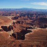
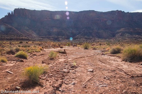
At 2.5 miles from the trailhead, the wash very suddenly ends at the White Rim Road. Actually, the wash doesn’t end here; it continues across the road and to the huge dryfall into the lower part of Gooseberry Canyon.

From here, I highly recommend walking right (south) about a tenth of a mile (or less) to where you can stand on the very edge of Gooseberry Canyon. (You could go left (north), but the views aren’t as good.) The views from here – especially in the afternoon – are outrageously awesome!
From here, you have a few options (besides just retracing your steps up to the top of Island in the Sky). If you have permits, you can camp at one of the two Gooseberry Campsites. (Snagging one of these sites can be difficult since they’re very popular with 4×4 vehicle drivers on the White Rim Road; check recreation.gov for availability.) You can also walk along the rim of the canyon for a while. I walked south along the White Rim Road and then took an overland route (with no trail and Class 3 scrambling) to an overlook of Monument Basin, but that’s a topic for another post!
Round Trip Length: 5.0 miles out & back
Elevation gain: 2,071ft. (6,275ft. to 4,682ft.)
Facilities: Picnic facilities and one primitive restroom at the trailhead. If you walk south on the White Rim Road, you’ll come to another primitive restroom near the second Gooseberry Campsite.
Fees: $30/vehicle, valid 7 days. Southeast Utah Parks Pass and America the Beautiful passes are also accepted.
Trail Notes: This trail is steep! It’s definitely not for the faint of heart. I found it easier (if a little longer, time-wise) to climb back up than to hurtle down. The afternoon has the best views. For an easier version of this hike, you get some of the same views from the White Rim Overlook.

Trail 
![]()
![]()
![]()
Road ![]()
Signs ![]()
Scenery
Would I go 100 miles out of my way for this?
Overall Rating: ![]()

GPS Coordinates for the Gooseberry Trail
TH: 38.322842,-109.849479 (38°19.37052′, -109°50.96874′ / 38°19’22.2312″, -109°50’58.1244″) (6,262ft.) (0.0)
White Rim Overlook Junction: 38.323031,-109.848374 (38°19.38186′, -109°50.90244′ / 38°19’22.9116″, -109°50’54.1464″) (6,255ft.) (340ft.)

Begin descent: 38.323210,-109.847540 (38°19.39260′, -109°50.85240′ / 38°19’23.5560″, -109°50’51.1440″) (6,260ft.) (0.13)
Wash: 38.328575,-109.846638 (38°19.71450′, -109°50.79828′ / 38°19’42.8700″, -109°50’47.8968″) (5,074ft.) (1.12)

Sign at White Rim Road: 38.335104,-109.829010 (38°20.10624′, -109°49.74060′ / 38°20’06.3744″, -109°49’44.4360″) (4,736ft.) (2.49)
End: 38.322847,-109.849497 (38°19.37082′, -109°50.96982′ / 38°19’22.2492″, -109°50’58.1892″) (6,262ft.) (8.74)
The gpx file for the Gooseberry Trail can be downloaded – please note that this and the GPS Coordinates are for reference only and should not be used as a sole resource when hiking this trail.
Download GPX File size: 83.4 KB Downloaded 490 times
(Note: I do my best to ensure that all downloads, the webpage, etc. are virus-free and accurate; however, I cannot be held responsible for any damage that might result, including but not limited to loss of data, damages to hardware, harm to users, from use of files, information, etc. from this website. Thanks!)
Getting to the Gooseberry Trailhead
From the Island in the Sky Visitor Center, drive south on the main road. Continue straight toward Grand View Overlook when the road to Green River Overlook, the Campground, Upheaval Dome, etc., goes off on the right. About 11.3 miles south of the visitor center, turn left, following the sign for the picnic area and restrooms. Halfway around the one-way loop, there will be a half a dozen or so parking spaces on the right next to the trailhead.
This Week’s Featured Product!
It’s not hard to highly recommend this book! Beyond just the famous hikes, the author has explored Canyonlands in depth and offers great history and directions for all three districts of the park. Buy your copy here!