
A perennial waterfall? In Death Valley? You’ve got to be kidding! But really – blazing hot summer, parched autumn, or during the (slightly less arid) winter/spring, Darwin Falls in the far west of Death Valley National Park is a beautiful waterfall – not just a trickle, but a real waterfall (though only 18ft. high, it’s still quite impressive). Most of the water is piped down to the Panamint Springs Resort, so no swimming is allowed, but the pipe begins downstream of the falls, so it always has water. Actually, there’s another small waterfall below the more famous one, so you get two waterfalls for the “cost” of one!
Quick Stats
Note: Some of the links in this post are affiliate links. If you click one and purchase something, I may earn a small commission without an extra cost to you.

Darwin Falls used to be an almost unknown attraction, but now the National Park Service sends visitors there. That, combined with the uniqueness of the hike and the fairly short length, has made it popular (though not in the ballpark of Badwater). Be ready to wait for a parking spot in busy seasons such as Spring Break.

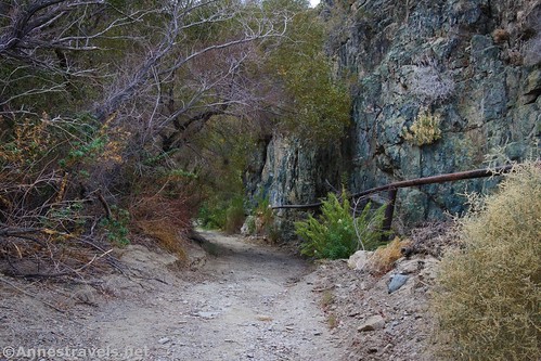
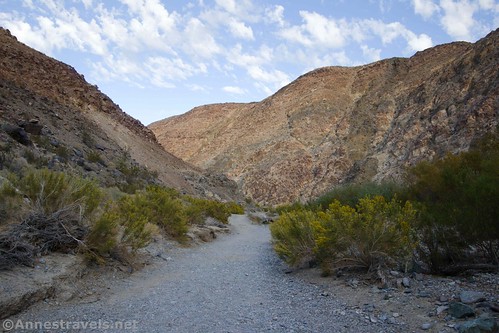
The trail begins by the gate. It goes downhill, crosses Darwin Wash, and then picks up as a not-too-sandy trail that heads generally up the wash. After a quarter mile, the trail crosses the Wilderness Boundary.
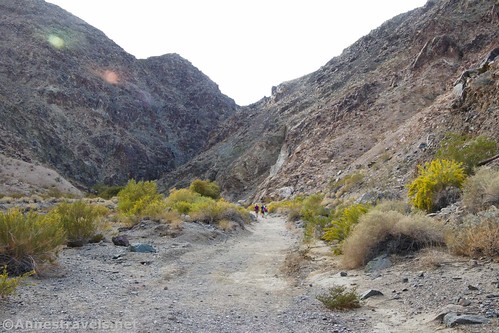
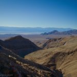
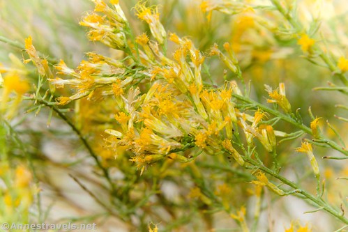
The views going up the canyon aren’t particularly interesting. In November, there were some pretty wildflowers – even though most of the water is piped out of the area, it’s still wet enough to let plenty of undergrowth and flowers grow.

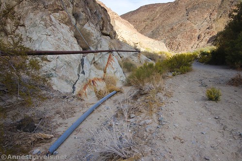
You’re following the pipeline most of the way up the canyon. It’s never really in the way, but it’s there, usually on the right (north). Some of the connections are leaky – I guess it doesn’t leak enough to matter to the Panamint Springs Resort, but it leaks enough to grow algae and plants!
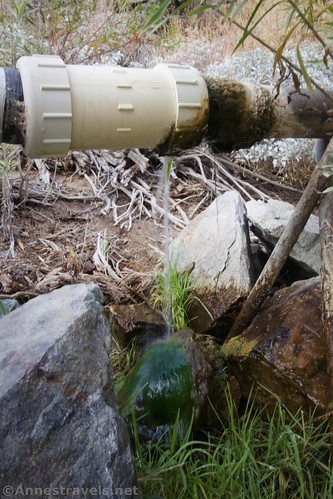
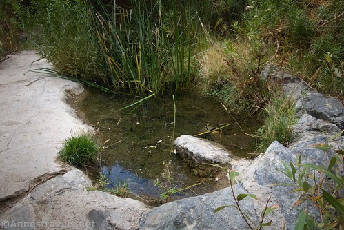
After about 0.75 miles, the trail begins to duck under trees and follow the canyon wall (trees? In Death Valley?!?) A short distance beyond this, there are a couple of pools of water – this is the beginning of the pipeline. Do not put anything into the pools, as this is the drinking water supply for the resort (I’m sure they must clean it, but still…!)
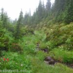
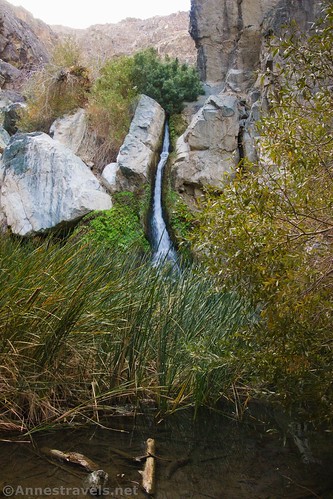
After the pools, the canyon becomes even lusher with grass and brush and the sound of flowing water. You’ll come to a small waterfall on the left – there are rocks here, and it seems that many people turn around (or at least hang around) here.

But to get to Darwin Falls, continue upcanyon on the now very narrow trail. The ground is sometimes soggy, but helpful hikers have put down brush and logs to help keep your shoes dry. The smell here is amazing – that water-in-the-desert fragrance that I’ve never before smelled in Death Valley.
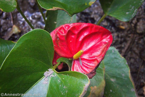
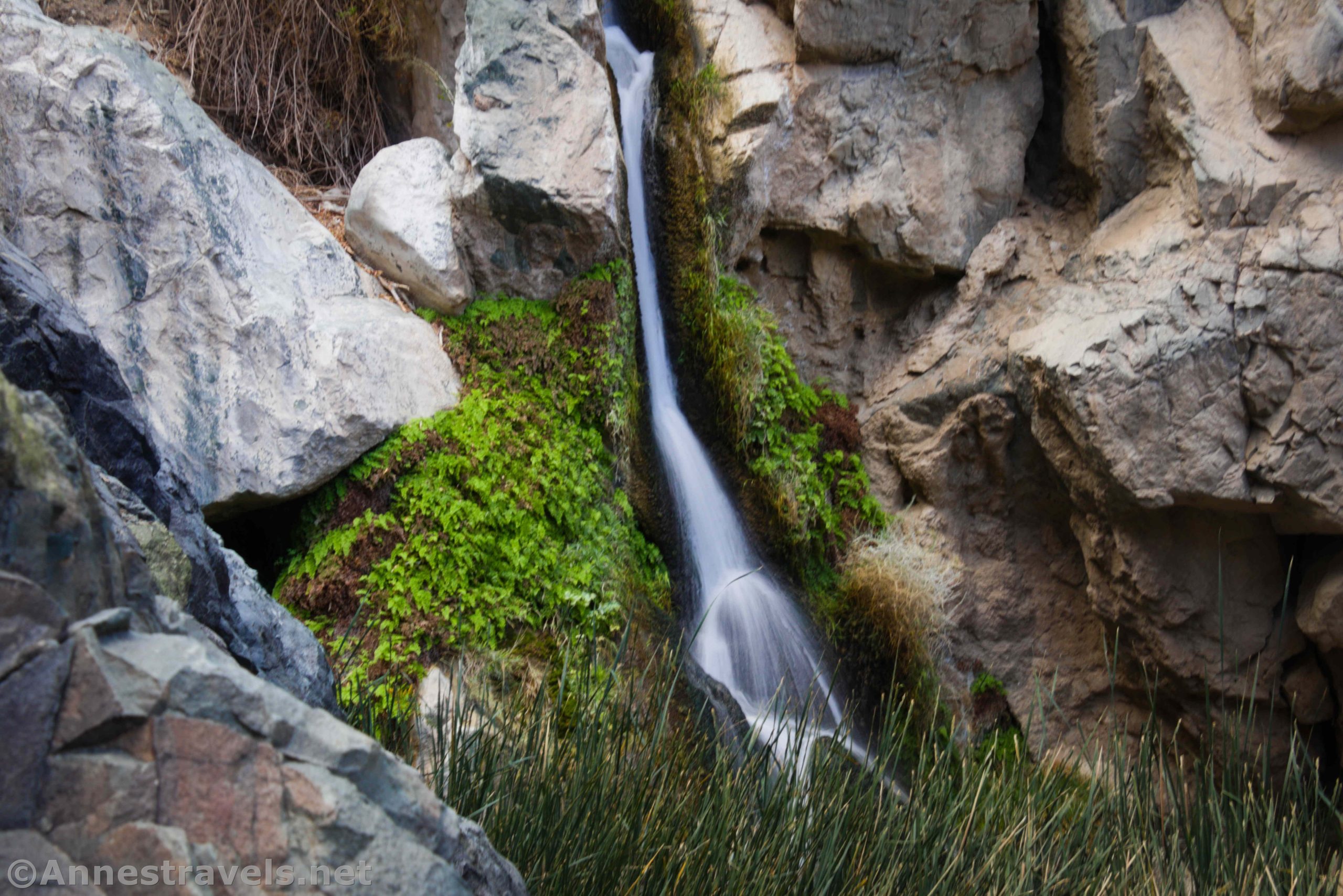
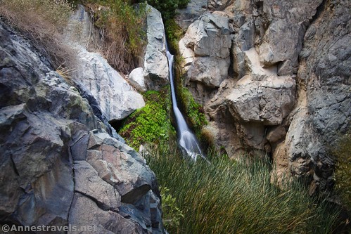
Then suddenly there’s a small clearing. The first thing I noticed was an anthurium (wow!), but then I saw the waterfall. It’s hard to get a good angle on it, but it’s very impressive.
The best way I found to be able to see the falls was to hug the wall to the right until your toes hit the pool. It’s a side-view, but at least you can see the entire falls!

The other good place to get a view from is to scramble up the rock wall to the left of the clearing. The bottom of Darwin Falls is obscured, but it’s a great vantage point – just watch your step, as the rocks are steep and slippery.
Darwin Falls was named for an army physician, Erasmus Darwin French, who came west during the Mexican American War in 1846. He prospected for silver in the area – the ghost town of Darwin is also named after the doctor.
Round Trip Trail Length: 2.2 miles out & back
Elevation Gain: 605ft. (2,475ft. to 2,831ft.)
Facilities: None
Fees: $30/vehicle, valid 7 days. America the Beautiful and Death Valley Annual Passes also accepted
Trail Notes: Don’t try to scramble up above the falls – there isn’t much to see and it’s pretty slippery from what I read. I did see some rock climbers coming back down (either from the falls or elsewhere in the canyon), but don’t try it unless you’re well prepared. The trail is fairly busy and the parking area fairly small – go early to get a parking space. The road to the trailhead has washboard but should be accessible by low clearance vehicles in good weather. The road beyond the parking area is 4×4 only. No swimming is allowed!

Trail 
![]()
![]()
Road ![]()
Signs ![]()
Scenery ![]()
![]()
![]()
Would I go 100 miles out of my way for this?
Overall Rating: 
![]()
GPS Coordinates for Darwin Falls
Darwin Falls TH: 36.3276167°, -117.5147500° (N36° 19.657′ W117° 30.885′ / 36°19’39.4200″, -117°30’53.1000″) (2,434ft.) (0.0)
Wilderness Boundary: 36.3245333°, -117.5150667° (N36° 19.472′ W117° 30.904′ / 36°19’28.3200″, -117°30’54.2400″) (2,494ft.) (0.24)

Darwin Falls: 36.3208000°, -117.5239000° (N36° 19.248′ W117° 31.434′ / 36°19’14.8800″, -117°31’26.0400″) (2,665ft.) (1.16)
End: 36.3276500°, -117.5147500° (N36° 19.659′ W117° 30.885′ / 36°19’39.5400″, -117°30’53.1000″) (2,634ft.) (2.16)

The gpx file for Darwin Falls can be downloaded – please note that this and the GPS Coordinates are for reference only and should not be used as a sole resource when hiking this trail.
Download GPX File size: 34.4 KB Downloaded 441 times
(Note: I do my best to ensure that all downloads, the webpage, etc. are virus-free and accurate; however, I cannot be held responsible for any damage that might result, including but not limited to loss of data, damages to hardware, harm to users, from use of files, information, etc. from this website. Thanks!)

Getting to Darwin Falls Trailhead
From Furnace Creek, drive north on CA-190W (toward Stovepipe Wells). Continue on CA-190 for 56.1 miles. After passing through Panamint Springs, turn left (0.9 miles after the resort) onto the Old Toll Road (signed for Darwin Falls). The dirt road is kept in good repair and should be accessible to low-clearance vehicles – take it slow, though, as there is a fair bit of washboard. After 2.4 miles, turn right into the parking area. The road beyond the parking area is 4×4 only.
From the west, take CA-190E up to Father Crowley Vista (worth a 5 minute stop). After 6.9 miles, turn right onto the Old Toll Road (signed for Darwin Falls). The dirt road is kept in good repair and should be accessible to low-clearance vehicles – take it slow, though, as there is a fair bit of washboard. After 2.4 miles, turn right into the parking area. The road beyond the parking area is 4×4 only.

This Week’s Featured Product!
Check out this book with more than 50 hikes in Death Valley – from sand dunes and salt flats to mountains and desert canyons.