I’ve always thought of Petrified Forest National Park as a place of overlooks and quick trails – no way to get down into the Painted Desert or other areas of the park for a nice, long hike with interesting or at least beautiful things to see. So I was very excited on my most recent visit to find several true hikes. Our first endeavor was to find Onyx Bridge. And since I made my fair share of mistakes trying to get there (the tail is nonexistent much of the time), I’ll tell you how to do it right – and see lots of petrified wood along the way!
Quick Stats
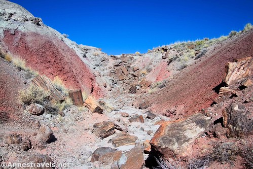
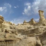
Onyx Bridge is a long petrified log that once stretched across what is now a wash. The bridge has sagged in the middle until it’s now in several pieces, but it’s still pretty interesting to see. It also has a nice setting with colorful badlands up the wash. Even better, I found dozens of pieces of petrified wood en route to the bridge and also in the general area!
The path begins at the Wilderness Trailhead just to the left of the Painted Desert Inn. (The Wilderness Route is a fantastic adventure in its own right, but for today, I’m just focusing on the Onyx Bridge.)
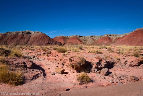
Head down the dirt path as it quickly descends between red badlands. Even here, there are pieces of petrified wood – please stay on the path in this section to protect the easily eroded badlands. At first, the trail is very easy to follow; as it winds toward the plain, it becomes vaguer. Stay to the right as you pass out of the hills, and hike on the path above an old wash.
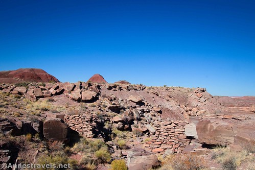
About 0.75 miles from the trailhead, pass the remains of an old stone dam on the left. It was actually a bridge, built by Herbert Lore as part of his road system in the Painted Desert in the early 1900s. Continue down the wash on what trail you can find, being careful near the old bridge to continue straight on the path as opposed to turning right with the wash. Once out on the plain, the trail becomes harder to locate, but I was still able to mostly follow it or a dry wash to the edge of Lithodendron Wash.
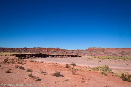
Lithodendron Wash is virtually impossible to miss. It’s very wide and is located between the plains and the badlands, about 1.25 miles from the trailhead. I hear that during monsoon season, there may be water in the wash. It was dry in mid-November, so I was able to easily scramble down into it. To get to Onyx Log, turn right up the wash – though if the wash is flowing with water, you’ll have to cross the wash and follow it upstream (be very careful if crossing the wash with water – wait a bit and make sure it’s not a flash flood before crossing).
As you’re hiking, you’ll see a squared-off red butte. This is a good landmark to head for; in fact, you can cut off a gooseneck in the wash by heading straight for it instead of walking in the wash, though the wash will get you there, too. Pass by the squared-off butte and walk to the next major wash on the left that flows into Lithodendron Wash (at the point where Lithodendron turns sharply to the right/east next to an “island” of greenery in Lithodendron Wash – note that this is the bend after a straight section after passing the squared-off butte). I should have stayed in the wash for all of this, but with the vague directions I was following, I ended up doing a lot of cross-country walking (which is what you might have to do if the wash is full of water).
When you locate the correct side-wash, turn left up it. About 2.2 miles from the trailhead (about a mile after meeting up with Lithodendron Wash), you’ll come to a point where the smaller wash splits; turn right. Turn left a short distance later at another split – the right fork would take you to an impassable dryfall (as well as Onyx Bridge, but the following directions a much safer way to access it). The left route goes up the side of the wash and then over to the right to bypass the dryfall. Onyx Bridge is a short distance up the wash above the dryfall.
While you can approach Onyx Bridge, I found the view to almost be better while climbing up the left side of the wash just above the bridge.
You can also explore the area, as there is quite a bit more petrified wood to be found. My GPS track reflects this… I wandered around on top of the nearby badlands on my route back instead of following the wash.
Retrace your steps to the trailhead… or head off on the Wilderness Route for even more adventures!
Round Trip Trail Length: If I’d done an out and back, I would have gone about 4.6 miles RT
Elevation Gain: 661ft. (5,835ft. to 5,456ft.)
Facilities: Restrooms and water at the trailhead
Fees: $25/vehicle, valid 7 days. America the Beautiful National Parks and Federal Lands Passes and Petrified Forest Annual Passes are also accepted.
Trail Notes: The lack of trails in this area makes it only suitable for those with good wayfinding skills. Be prepared to self-rescue, don’t enter washes with flash floods, bring plenty of food and water, and be aware of your surroundings so you can make it back to the trailhead. If you’re up for an adventure, I highly recommend exploring in the area around Onyx Bridge (just make sure you can get back to the trailhead!) A few NPS rules include: Stay on the trail until you get to the plain; do not create rock cairns, trail markers, structures, or trenches; travel on durable surfaces and washes as much as possible; and (of course!) leave everything you find, especially petrified wood!
Trail 


Road 


Signs 


Scenery 


Would I go 100 miles out of my way for this? 


Overall Rating: 


GPS Coordinates for the Onyx Bridge
TH: 35.0836960°, -109.7890040° (35°05.02176′, -109°47.34024′ / 35°05’01.3056″, -109°47’20.4144″) (5,831ft.) (0.0)
Bridge: 35.0916810°, -109.7907890° (35°05.50086′, -109°47.44734′ / 35°05’30.0516″, -109°47’26.8404″) (5,505ft.) (0.76)
Lithodendron Wash: 35.0982330°, -109.7911610° (35°05.89398′, -109°47.46966′ / 35°05’53.6388″, -109°47’28.1796″) (5,463ft.) (1.26)
Square butte: 35.1038110°, -109.7909850° (35°06.22866′, -109°47.45910′ / 35°06’13.7196″, -109°47’27.5460″) (5,482ft.) (1.93)
Onyx split: 35.1072420°, -109.7916470° (35°06.43452′, -109°47.49882′ / 35°06’26.0712″, -109°47’29.9292″) (5,511ft.) (2.21)
Onyx split: 35.1080330°, -109.7921570° (35°06.48198′, -109°47.52942′ / 35°06’28.9188″, -109°47’31.7652″) (5,526ft.) (2.28)
Onyx Bridge: 35.1086010°, -109.7921990° (35°06.51606′, -109°47.53194′ / 35°06’30.9636″, -109°47’31.9164″) (5,542ft.) (2.35)
Turnoff for Onyx Bridge in Lithodendron Wash: 35.1063330°, -109.7906640° (35°06.37998′, -109°47.43984′ / 35°06’22.7988″, -109°47’26.3904″) (5,496ft.) (2.87)
The gpx file for Onyx Bridge can be downloaded – please note that this and the GPS Coordinates are for reference only and should not be used as a sole resource when hiking this trail.
Download GPX File size: 54.8 KB Downloaded 120 times
(Note: I do my best to ensure that all downloads, the webpage, etc. are virus-free and accurate; however, I cannot be held responsible for any damage that might result, including but not limited to loss of data, damages to hardware, harm to users, from use of files, information, etc. from this website. Thanks!)
Getting to the Onyx Bridge Trailhead
From I-40, take Exit 311 for Petrified Forest National Park. At the end of the exit ramp, turn north, following signs for Petrified Forest. You’ll enter the park almost immediately. Drive 2.1 miles to turn right into the parking area marked for Kachina Point and the Painted Desert Inn.
From the southern part of Petrified Forest National Park, drive north on the park road. The left turn into the parking area for Kachina Point and the Painted Desert Inn (the trailhead) is 23.8 miles north of the southern visitor center (Rainbow Forest Museum / the parking lot through which the main road travels).

Today’s Featured Product!
Discover some of the best hikes in Arizona in so many parks across the state! There are 221 trails in this book, so buy your copy here!










Pingback: Sneak Peak: Petrified Forest, Southern Utah, and Death Valley! – Anne's Travels