
One of the most scenic dirt roads in Utah that I’ve had the pleasure of driving is the Waterhole Flat Road into the Maze District of Canyonlands (maps call it NP-633, the Flint Trail, and Canyonlands National Park Road among other things). It boasts spectacular cliffs, phenomenal rock formations, amazing views, and even a few options for hikes or other adventures. And while it’s mostly driven either with OHVs or as access to the famous (infamous?) Dollhouse Road, you don’t need to be quite that dedicated with a rugged 4×4 vehicle for this road.
Quick Stats
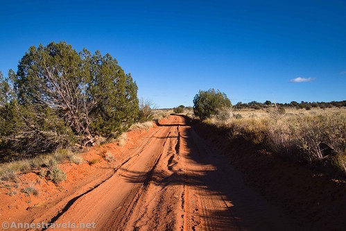
To do the entire road requires high clearance and 4×4 (believe me, I did it with 2WD and wouldn’t try that again), but the first 30 miles or so are usually fine for high clearance (you might even be able to get some of that distance with normal clearance, depending on how much you love your undercarriage). It’s well worth the visit if you happen to be near Hite, Utah (south of Hanksville along US-95).
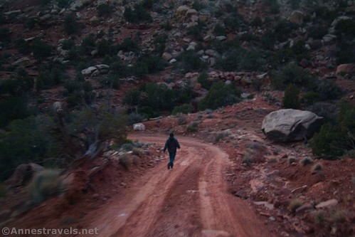
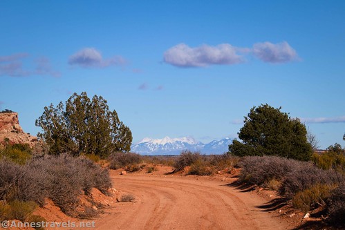
The beginning of the road is not marked, though it does boast the modernization of a real, honest-to-goodness stop sign. I usually end up driving past it – but if I get to the bridge over the Colorado River (or if you get to the crossing of the Dirty Devil River if you’re driving north on US-95), I know I’ve gone too far and it’s time to go back. (GPS coordinates are below.)
The road immediately swings south before turning east again and crossing a cattleguard. Less than half a mile from the pavement, pass a sign kiosk and a small parking area. Many OHV riders leave their vehicles/trailers here while enjoying the dirt roads in this area. Two things you’ll need to know: 1) OHVs are allowed only to the junction with the Dollhouse Road (from there, they’ll need to turn around or head up to Sunset Pass/Poison Spring Canyon – more on that later), and 2) while the sign says that you’ll need a permit to camp, you’ll only need one after entering the Orange Cliffs District of Glen Canyon National Recreation Area, about 27 miles down the road.
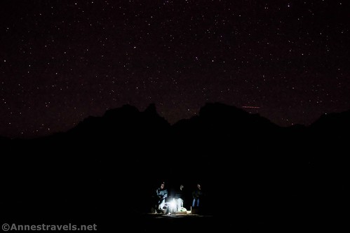
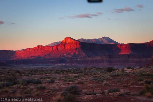
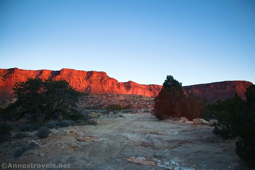
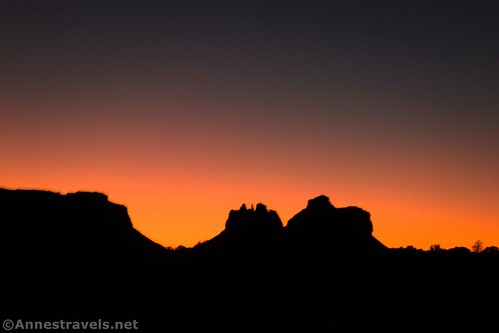
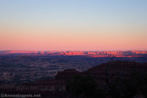
After the kiosk, the road rounds the end of a rib of rock formations and turns northeast. I always seem to drive onto the road in the dark (if you don’t know why, read the second to last sentence). But that also means that I get to enjoy sunrise over Hite – and that’s spectacular.
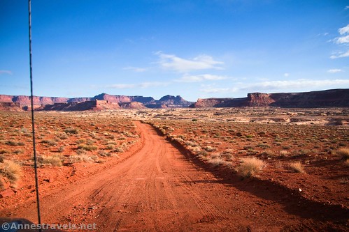
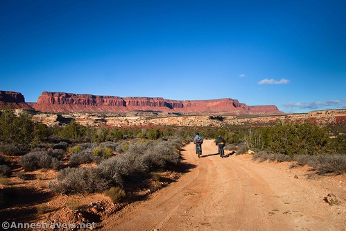
The Waterhole Flat Road (aka NP-633, aka the Flint Trail, aka the road to the Dollhouse Road, aka the Poison Spring Canyon Loop) heads northeast on a flat area between the long fin of slickrock and the Colorado River (and then Rock Canyon, which empties into the Colorado). After about 4.4 miles, a road to an old corral and ranching operation strikes off on the left. Continue straight for a short distance before the road turns right to cross the head of an offshoot of Rock Canyon. This crossing is typically not too bad, though you might need to take it slowly if you don’t have much ground clearance.
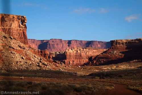
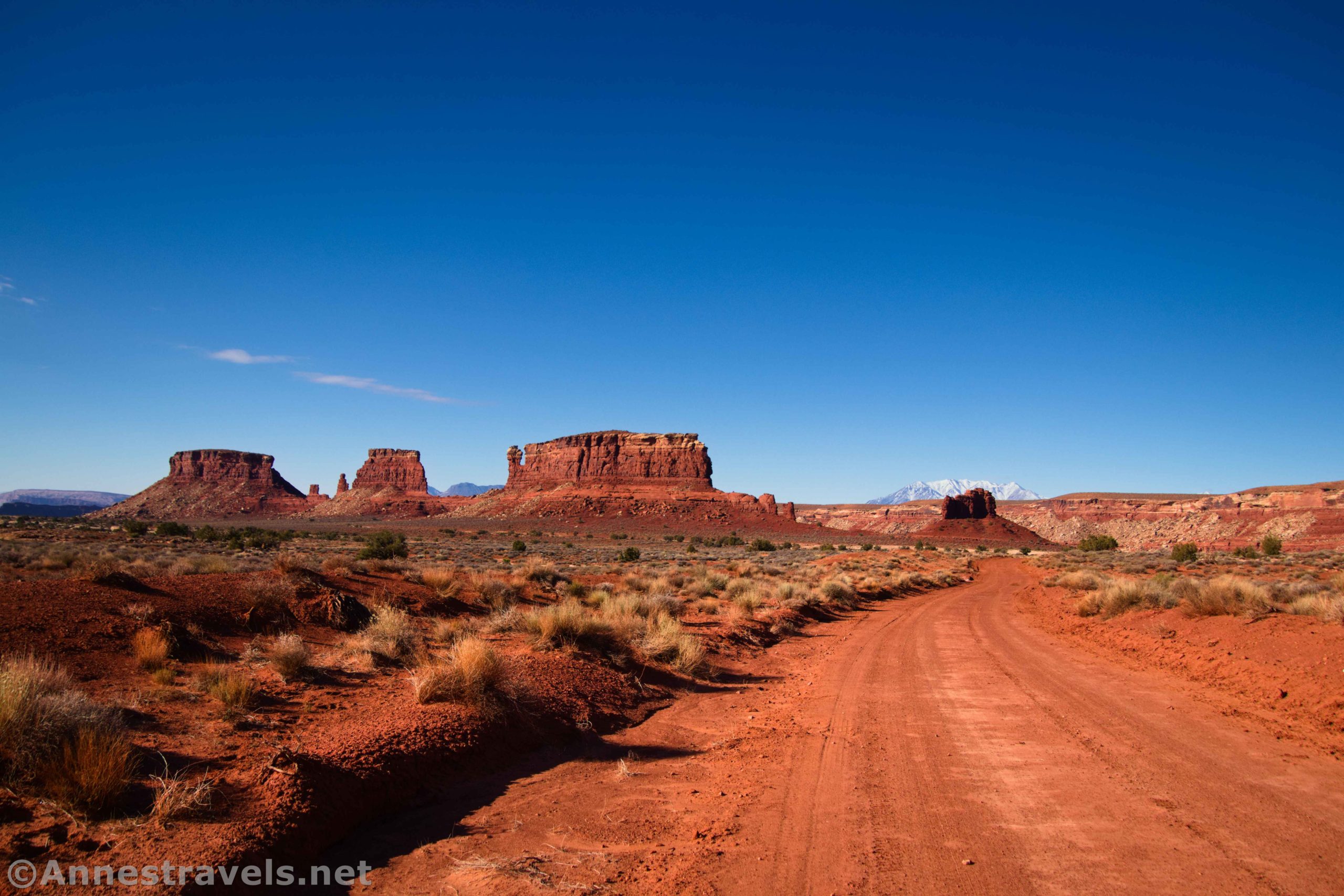
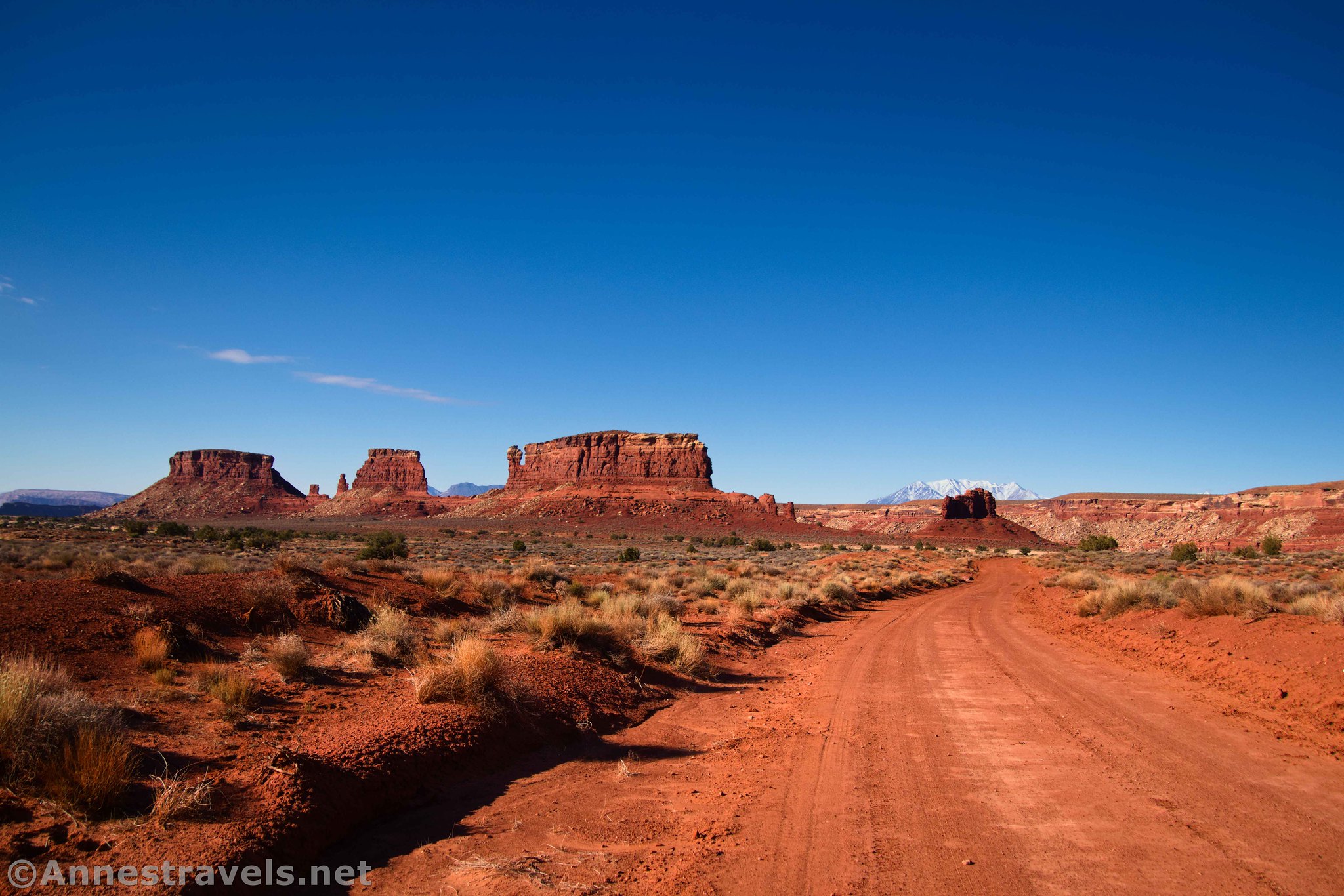
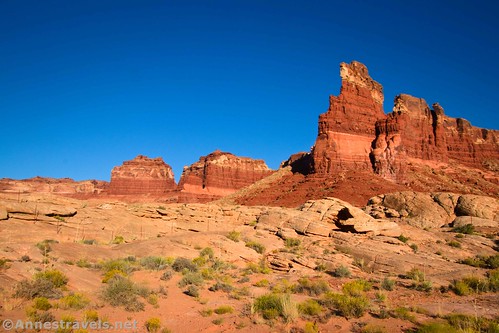
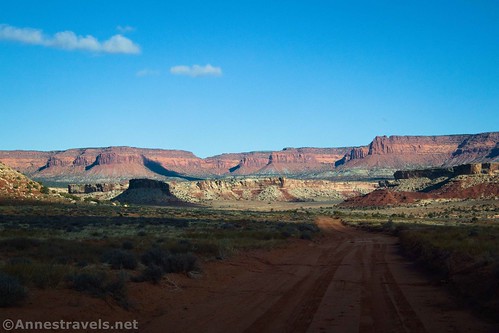
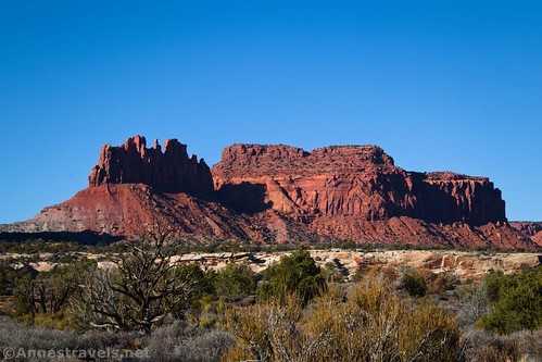
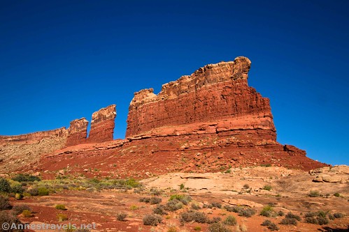
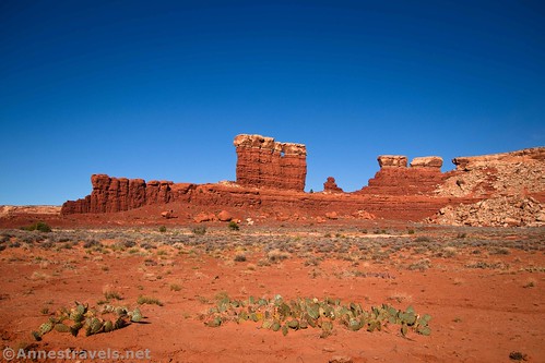
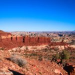
The road after this crossing rises to go around a truly cool rock formation. It’s just a narrow rock fin with several chunks missing between pieces of the fin, but it’s spectacular (this side is nicer in the afternoon). We decided to name it the Chocolate Bars. (A rip-off of the Chocolate Drops in the Maze District.)
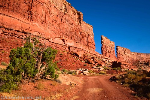
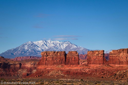
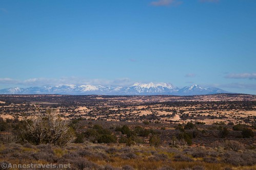
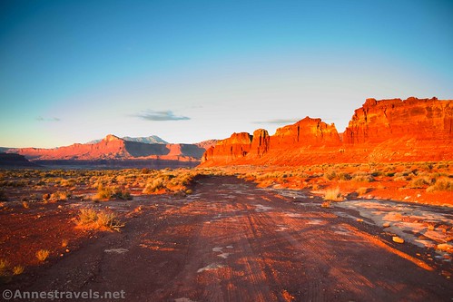
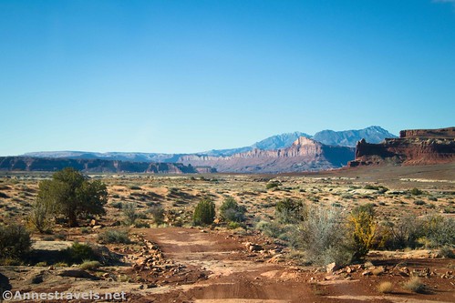
The road becomes rougher as it turns around the end of the Chocolate Bars, but in the morning, the views from the other side are crazy awesome! It just happened that Utah had received a snowfall shortly before my first visit, so the Henry Mountains were gorgeous, too.
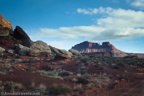
The road crosses the head of Rock Canyon about mile 7.6 (we parked near the water tank here to hike up Rock Canyon to the Sewing Machine – trip report coming soon!) From here, the road travels south with spectacular views back to the Chocolate Bars and the Henry Mountains before rounding the end of a mesa and leaving behind everything you’ve seen up to this point.
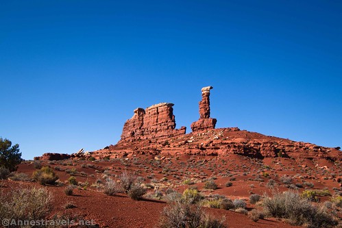
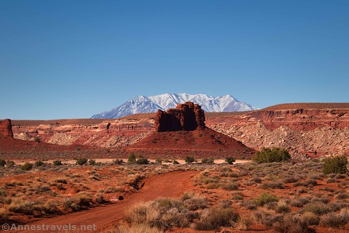
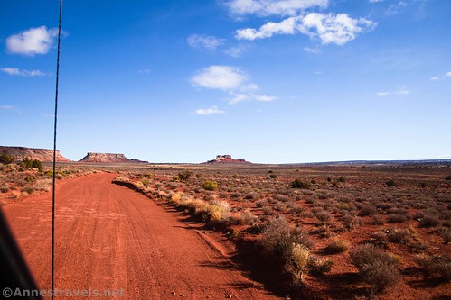
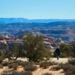
That’s ok – you’re entering another really cool area! The road (which has gone back to being mostly benign) passes between some crazy rock formations. There are simply so many fun spires and cliffs here!
About mile 17.2, the road crosses a saddle between two rock formations. Per me, this ends the most spectacular parts of the Waterhole Flat Road until you get up on the Black Rim, but it’s still worth driving. It descends gently, passing a sideroad on the right (east) about mile 18.6 and arriving at another more major junction (Y) at mile 19.5. A small brown sign (post, really) points right. The left road is the Cove Canyon Road. You want to turn right and cross Cove Canyon (we parked just after this and hiked down Cove Canyon – post coming soon).
The character of the scenery changes subtly but dramatically after crossing the wash that is Cove Canyon. There are still cliffs (the Orange Cliffs, specifically) on the left (west), but the shelf has more trees and other foliage. Views are good but not excellent for the next few miles. About mile 23.9, a sideroad goes off on the right – this is the turnoff for the Cataract Canyon Overlook, which we explored on our way back out a couple of days later (post coming soon!)
Another road strikes off on the left (west) a mile later, but the real excitement comes at mile 27.0, where you’re greeted by a cattle guard, a fence, and a very large information board informing you that you’re entering the Orange Cliffs District of Glen Canyon National Recreation Area (which is administered by the Maze District of Canyonlands National Park). Pets are not allowed beyond this point, even in a vehicle (though I doubt anyone would care as long as you followed the OHV rules as to where you drive and the pet stayed in the vehicle). OHVs are only allowed as far as the Dollhouse Road Junction (more on that in a minute). Camping is also only allowed in designated sites, which is why there are a couple of small sites just on this side of the fence.

Cross the cattleguard and continue through the treed plain with the Orange Cliffs on your left (west). Cross Clearwater Canyon wash at mile 28.5 (I hear you can hike down this canyon, too, but I didn’t on that visit). As the road rises up to Waterhole Flat, the trees diminish and the grasslands begin. You’ll know you’ve arrived at Waterhole Flat when the unmarked sideroad (a bit of a Y) strikes off to the right (east) at mile 29.2 – this leads to the Chaffin Cowboy Camp. (The Chaffin family ranched extensively in the Maze District and named many of the features in the area – post coming soon.)
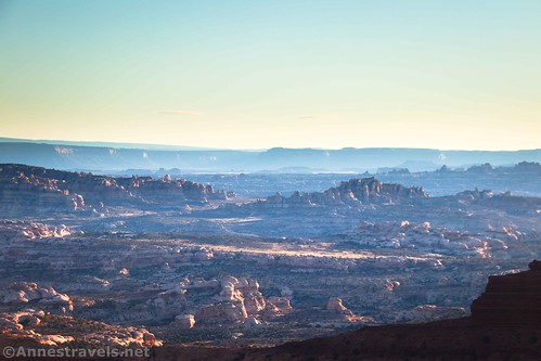
The views over Waterhole Flat are excellent, stretching from the Orange Cliffs to the Needles and the La Sal Mountains.
At mile 30.6, you’ll come to a well-marked 4-way junction. OHVs have only two choices: turn around or turn left up toward Sunset Pass. From there, they can descend into Poison Spring Canyon. When the Dirty Devil River is at low flow (think fall, but even then it can be too swift), the road continues up to reconnect to US-95. Turning right in a vehicle would take you down the Dollhouse Road (which becomes extremely rough after about 2 miles; serious 4×4 only but no OHVs). To complete the Waterhole Flat Road, continue straight (which is signed for Hans Flat R.S. 24 and Maze Overlook 21).
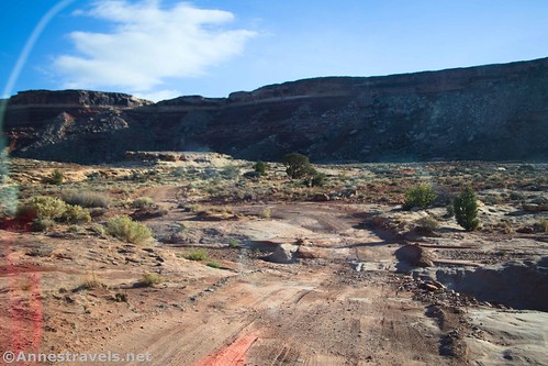
Waterhole Flat continues for another mile, where it crosses a small but obvious wash (a sideroad strikes off on the right, but you want to stay on the main road). After this, the road is significantly rougher, beginning a rough ascent up to the Black Rim about mile 33.0. I did make it up this section – and back down – with my 2WD, high clearance van. However, I doubt I’ll ever try it again. The ground is loose enough and the tread rocky enough to require 4×4. We probably wouldn’t have made it without a very good spotter.
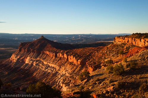
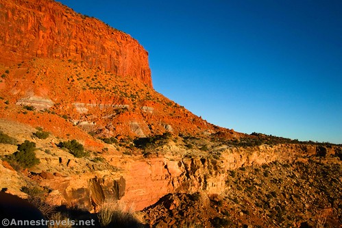
Once up on the Black Rim, the road mellows a little in terms of rough terrain (though it’s still rougher than down on Waterhole Flat). But you’re on the very edge of the cliff here, with no space to pass another vehicle in many places. A sharp cliff up to the Orange Cliffs on the left, and a crazy cliff drop on the right.
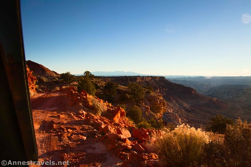
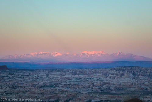
I was in the passenger seat, and while I don’t usually mind heights, this was pretty dizzying! The good news is that the views in this section are outstanding – you can see much of Canyonlands National Park (including Island in the Sky and the Needles), the La Sal Mountains, the Land of Standing Rocks, the Dollhouse Road (including the Mother and Child formation), and much more.
The Waterhole Flat Road ends (at least in my imagination!) at a 3-way junction at mile 37.4. Here, the Flint Trail turns left to ascend to Hans Flat, while the road that goes straight is officially the Millard Canyon Road. I went straight another mile to the Golden Stairs Campsite Road, turned right, and made it (albeit with rebuilding the road once or twice) to the overlook, 0.5 miles from the Millard Canyon Road. I wanted to hike the Golden Stairs Trail, and this brought me close enough that I didn’t need to use my bicycle to get to the trailhead. I call that a win!
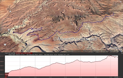
One-way Road Length: 37.4 miles from US-95 to the Flint Trail/Millard Canyon Road junction
Elevation Gain: 4,562ft. up, 2,520ft. down (3,975ft. to 6,219ft.)
Facilities: None
Fees: None
Road Notes: The road before the ascent to the Black Rim (33 miles into the road) I’d rate at 1.4-1.7 difficulty (high clearance is somewhere between a good idea and necessary; 4×4 is nice but not needed in dry weather). You’ll want 4×4 to ascend to the Black Rim or go beyond the end of the Waterhole Flat Road (I hear the Maze Overlook is great and I was sad that we didn’t have time/the vehicle to go that far down the Millard Canyon Road). Pretty much anything that includes Leave No Trace is allowed before the big signboard (mile 27.0) telling you that you’re entering the Orange Cliffs District (examples: Horseback riding, pets, OHVs (must stay on the road), dispersed camping, etc.) Regulations tighten considerably once inside of the area administered by the Maze District.
A Note on Road Names: I call this the Waterhole Flat Road. Some only consider the section of the road from US-95 to the Dollhouse Road to be the Waterhole Flat Road, thus orphaning the section between the Dollhouse Road and the Millard Canyon Road. Others refer to it as NP-633 and/or the Flint Trail. This isn’t a misnomer, as you could call all of the road from Hans Flat, down the Flint Trail, and then out to US-95 by the same name. So take it or leave it when it comes to road names; it’s not like the NPS has little green road signs up!
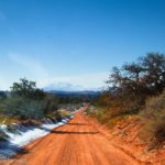
Road 
![]()
![]()
Signs ![]()
![]()
![]()
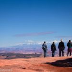
Scenery
Would I go 100 miles out of my way for this?
Overall Rating: ![]()
GPS Coordinates for the Waterhole Flat Road
US-95/Beginning of the Waterhole Flat Road: 37.9010890°, -110.3789140° (37°54.06534′, -110°22.73484′ / 37°54’03.9204″, -110°22’44.0904″) (3,975ft.) (0.0)
Road to corrals on the left: 37.9348650°, -110.3365210° (37°56.09190′, -110°20.19126′ / 37°56’05.5140″, -110°20’11.4756″) (4,518ft.) (4.4)
Sideroad on right: 37.952160, -110.248130 (5,243ft.) (18.6)
Cove Canyon Road Junction: 37.9636400°, -110.2478480° (37°57.81840′, -110°14.87088′ / 37°57’49.1040″, -110°14’52.2528″) (5,170ft.) (19.5)
Sideroad to Cataract Canyon Overlook: 37.9899620°, -110.1844970° (37°59.39772′, -110°11.06982′ / 37°59’23.8632″, -110°11’04.1892″) (5,703ft.) (23.9)
Sideroad on left: 38.0040110°, -110.1859380° (38°00.24066′, -110°11.15628′ / 38°00’14.4396″, -110°11’09.3768″) (5,555ft.) (24.9)
Cattle Guard/Orange Cliffs District Boundary: 38.0293820°, -110.1889460° (38°01.76292′, -110°11.33676′ / 38°01’45.7752″, -110°11’20.2056″) (5,462ft.) (27.0)
Clearwater Canyon Wash: 38.0449940°, -110.1664780° (38°02.69964′, -110°09.98868′ / 38°02’41.9784″, -110°09’59.3208″) (5,362ft.) (28.5)
Sideroad on the right: 38.0446600°, -110.1590480° (38°02.67960′, -110°09.54288′ / 38°02’40.7760″, -110°09’32.5728″) (5,445ft.) (29.2)
Dollhouse Road/Poison Spring Canyon Road Junction: 38.0585030°, -110.1413240° (38°03.51018′, -110°08.47944′ / 38°03’30.6108″, -110°08’28.7664″) (5,499ft.) (30.6)
Begin ascent up to the Black Rim: 38.0886890°, -110.1248290° (38°05.32134′, -110°07.48974′ / 38°05’19.2804″, -110°07’29.3844″) (5,798ft.) (33.0)
Flint Trail/Millard Canyon Road/Waterhole Flat Road Junction: 38.1274330°, -110.1059660° (38°07.64598′, -110°06.35796′ / 38°07’38.7588″, -110°06’21.4776″) (6,022ft.) (37.4)
The gpx file for the Waterhole Flat Road can be downloaded – please note that this and the GPS Coordinates are for reference only and should not be used as a sole resource when hiking this trail.
Download GPX File size: 357.1 KB Downloaded 510 times
(Note: I do my best to ensure that all downloads, the webpage, etc. are virus-free and accurate; however, I cannot be held responsible for any damage that might result, including but not limited to loss of data, damages to hardware, harm to users, from use of files, information, etc. from this website. Thanks!)
Getting to the Beginning of the Waterhole Flat Road
From Hanksville, Utah, head south on US-95S. After 46.5 miles, 1.2 miles after crossing the bridge over the Dirty Devil River Canyon, the Waterhole Flat Road is unmarked on the left. (If you cross the bridge over the Colorado River, turn around and retrace your wheels 1.0 mile back to the unmarked road on the right).
From Blanding, Utah, drive south on US-191S. After 3.9 miles, turn right onto US-95N for 74.9 miles. The unmarked Waterhole Flat Road will be on the right 1.0 mile after crossing the bridge over the Colorado River (2.1 miles north of the turnoff for Hite).
Today’s Featured Product!
Explore the Maze District (and the rest of Canyonlands) with this great guide. There’s so much history as well as hikes, jeep roads, and more. Buy your copy here!


One response to “Driving the Waterhole Flat Road into the Maze”
[…] two-day pass expired, so it was down to the Waterhole Flat Road (you knew I’d be back toward Canyonlands, right?) for a few miles. We hiked up an unnamed […]