One of the most beautiful (and adventurous!) hikes we took in the Maze District in Canyonlands was the scramble up Observation Rock. No trail leads to the summit; there’s not even a cairned route to its base. But the views from the top were well more than spectacular enough to make us glad we climbed it – you can see forever up there!
Quick Stats
(This post contains affiliate links – there is no extra cost to you, but I may receive a small commission if you click and link and buy something.)

Before you leave, make sure you have a good sense of direction, Class 4 scrambling skills (maybe sketchy Class 3, depending on your route), and the ability to self-rescue. The chances of anyone finding you out here if you are injured are very low. Not that many people come to the Maze District in the first place, and a tiny fraction of them would dream of ascending the monolith – let alone do it. If you have plenty of experience out in the Utah desert and more than a dose of common sense, I’ll tell you how I climbed Observation Rock.

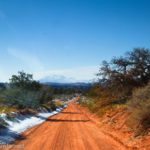
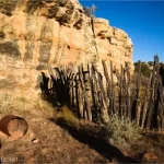
We started by parking near the beginning of the road to French Cabin, just off of NP-633 between Hans Flat and the Flint Trail. With 4×4 – which you’ll probably want to get here, anyway – you can drive all of the way to the French Cabin parking area, saving yourself 0.1 miles each way.

Once in the parking lot, you’ll be able to clearly see Observation Rock. With the cabin on your right, head over to the left to drop down out of the parking area, then turn right to head generally downhill and toward Observation Rock. You’ll be moving generally northeast throughout this section of the hike.
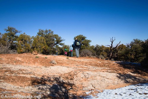
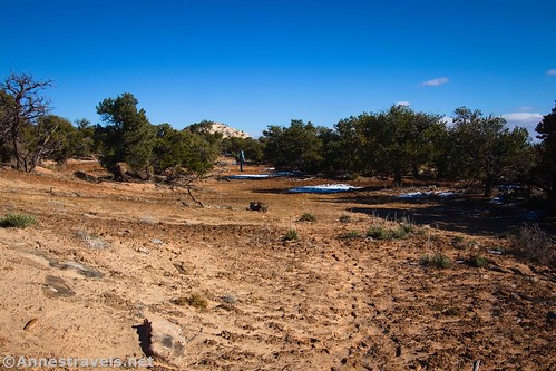
There was a fair bit of snow on the ground when I visited, so I tried to stick to snow patches and slickrock (and a few washes) to avoid stepping on the fragile soil. We were obviously not the first people to do this, but there also wasn’t any kind of a defined trail. The foliage is mostly juniper trees and other desert plants.

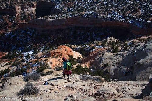
Our first real obstacle was a deep dip in the landscape between us and Observation Rock. By scrambling left up some slickrock and crossing it at its head (far left/north), it wasn’t bad at all.

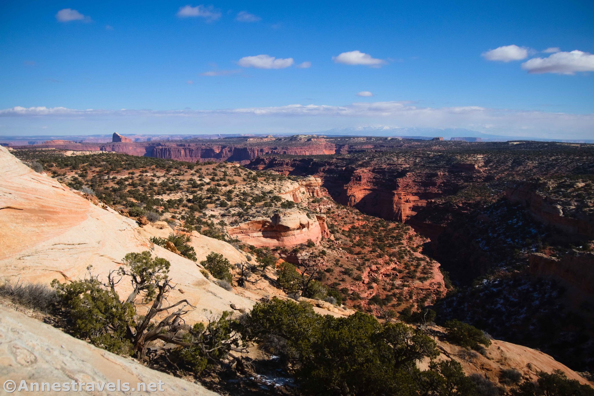
The other good thing about crossing at the head of the dip is that you get a fantastic view down into Millard Canyon about 0.8 miles from the beginning of the French Cabin Road. Amazing!
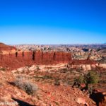
From here, we continued east to skirt the base of Observation Rock. The tread became more slickrock and less dirt, sometimes quite steep, as I rounded the southern face.

What I should have done at this point was to continue up and around the (not quite) eastern face and ascend the northeastern face of the rock – which is not quite as steep (the steepest sides are the west and north faces). Instead, I saw what looked like a good (or at least doable) route up the eastern face.

It was doable – as a steep, solid Class 3 scramble up the slickrock face. One move about halfway up was closer to Class 4 (just because of the lack of handholds/footholds). We did get the two less-scramble-happy members of my group up it with some boosting from behind and pulling from above. Thankfully, none of the group was terrified of heights.

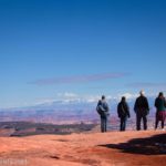
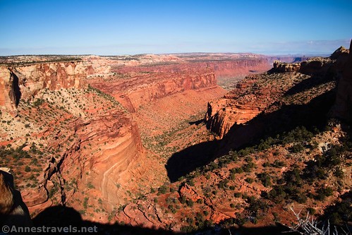
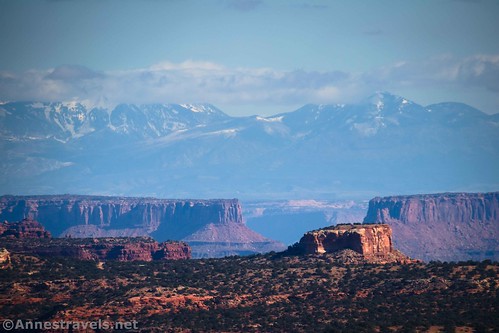
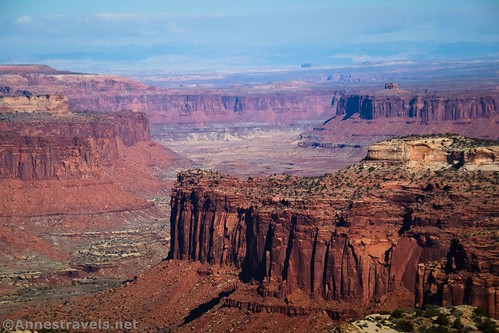
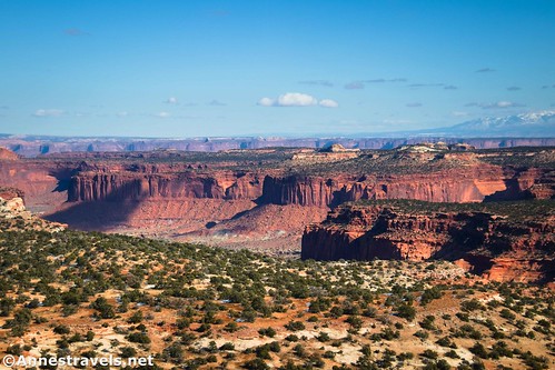
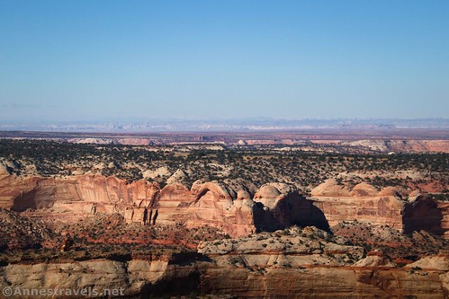
Almost 1.4 miles from the beginning of the French Cabin Road, the slickrock suddenly gives way to the flat top of Observation Rock. Talk about a relief! Views from here are quite good east and south across the Maze District, not to mention the Henry Mountains to the west.

Walk over to the north end of the flat area to get the best views. You can see most of Millard Canyon to the north, the La Sal Mountains and Cleopatra’s Chair to the northeast, Elaterite Butte, the Needles, and the Land of Standing Rocks to the southeast, and so much more!

Did I mention that the views are outright spectacular? Other features include the Sixshooter, Bagpipe Butte, Junction Butte, and Island in the Sky. I’m sure I’m missing some famous things – there’s so much to see!
We decided that, at least from this angle, the northeast face looked easier to descend. I’d say that it’s probably easier to ascend, too. While you still have some very steep slickrock slopes, at least it wasn’t bordering on Class 4 scrambling.

Take the route that looks best to you back around to the southern face of Observation Rock, back across the head of the valley, and finally back up to the French Cabin parking area.
And that’s a wrap! Observation Rock is definitely not for the faint of heart – all of us on this hike have many years of experience scrambling, desert way-finding, and assessing routes to decide if they’re doable (one member also has some experience rock climbing, though he hasn’t done it in years). So definitely think twice before attempting it… unless you really love an adventure!

Round Trip Trail Length: I went 2.9 miles, including walking the French Cabin Road (subtract 0.2 miles if you park at the cabin). However, it was not easy hiking and felt more like twice that.
Elevation Gain: 941ft. (6,371ft. to 6,633ft.)
Facilities: None
Fees: None
Trail Notes: I’ve already talked about how difficult the route is; just be sure you’re in shape for this before trying. Don’t attempt the hike in the summer, which can be blistering hot. Pets are not allowed in the Maze District, even in a vehicle. Interestingly, the trailhead and the top of Observation Rock are nearly identical in height – all of the elevation change happens on the way to and from the beginning of the road. Try to stick to already-trodden paths or slickrock to Leave No Trace.

Trail 
![]()
![]()
![]()
![]()
Road ![]()
![]()
![]()
![]()
Signs ![]()
![]()
![]()
Scenery
Would I go 100 miles out of my way for this?
Overall Rating: ![]()
![]()

GPS Coordinates for Observation Rock
French Cabin Road: 38.2376190°, -110.1510100° (38°14.25714′, -110°09.06060′ / 38°14’15.4284″, -110°09’03.6360″) (6,614ft.) (0.0)
Millard Canyon View: 38.2458420°, -110.1449200° (38°14.75052′, -110°08.69520′ / 38°14’45.0312″, -110°08’41.7120″) (6,431ft.) (0.83)
Top of Observation Rock: 38.2476710°, -110.1426390° (38°14.86026′, -110°08.55834′ / 38°14’51.6156″, -110°08’33.5004″) (6,705ft.) (1.37)
End: 38.2375820°, -110.1510510° (38°14.25492′, -110°09.06306′ / 38°14’15.2952″, -110°09’03.7836″) (6,615ft.) (2.89)
The gpx file for Observation Rock can be downloaded – please note that this and the GPS Coordinates are for reference only and should not be used as a sole resource when hiking this trail.
Download GPX File size: 74.7 KB Downloaded 509 times
(Note: I do my best to ensure that all downloads, the webpage, etc. are virus-free and accurate; however, I cannot be held responsible for any damage that might result, including but not limited to loss of data, damages to hardware, harm to users, from use of files, information, etc. from this website. Thanks!)
Getting to the Observation Rock Trailhead (French Cabin)
From the Hans Flat Ranger Station, drive NP-633 for 2.2 miles. A small sign on the right points to the sideroad on the left. Turn left onto this sideroad for 0.1 miles to a small parking area. I either did or could have traveled both of these roads in my 2WD van at the time I visited. However, I’d recommend 4×4 for a couple of hills shortly after leaving Hans Flat.

Today’s Featured Product!
It’s hard to get much better than this book when it comes to the Maze District. In fact, I haven’t run across a single guide that does a better job at describing the sheer number of adventure opportunities in the area, from jeep roads to explorations into the depths of the Maze. Buy your copy here!