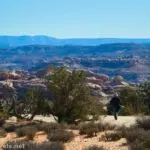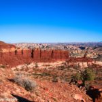

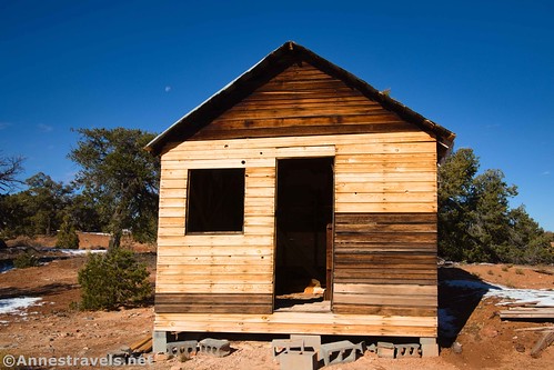
There isn’t a whole lot of hiking on top of the Orange Cliffs in the Maze District of Canyonlands National Park, but there are a few things to see (mostly overlooks, which are well worth seeing in their own right). An oft-visited attraction is French Cabin, built by an oil prospector in the 1920s. It’s not far off NP-633, so it’s worth a quick stop if you happen to be driving by.
Quick Stats
Note: Some of the links in this post are affiliate links. If you click one and purchase something, I may earn a small commission without an extra cost to you.
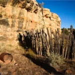
French Cabin wasn’t built by anyone French. I’d guess it received its title from nearby French Spring, which was named for Basque sheepherders in the 1880s. In the 1920s, a certain T.C. Conley wasn’t typically involved in prospecting; instead, he tended to promote others’ claims to investors. However, he traveled out to the Maze District to prospect some oil for himself, building the cabin a short distance above the spring. T.C. Conley used “wildcat” techniques – in other words, explosives – to drill several wells. While he found quite a few deposits of solidified oil (elaterite), he never struck it rich in the Maze.
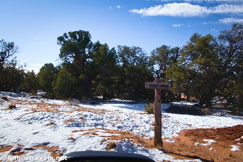
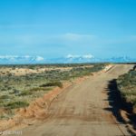
The cabin is located 0.1 miles down a sideroad off NP-633. I’d read that the road was probably 2WD friendly as long as we had high clearance, but we decided not to risk it. So we parked near the road entrance and walked in.
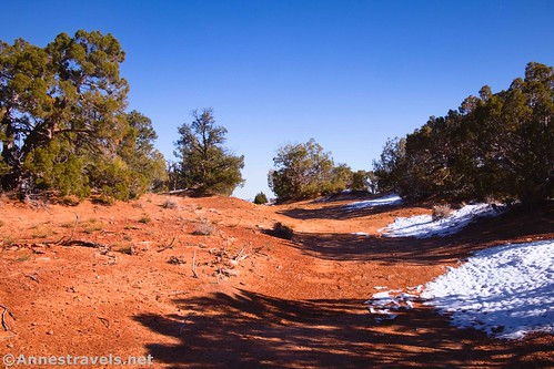
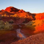
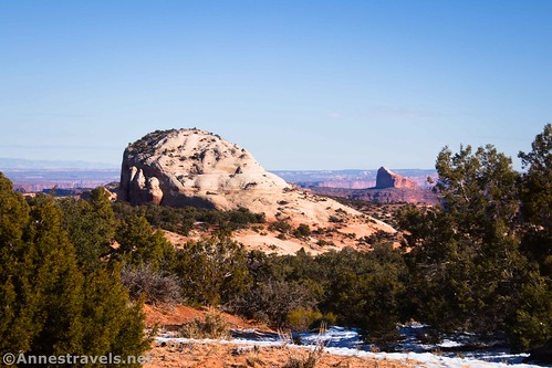
Once at the parking area, it’s likely the first thing you’ll see is an old boiler. This provided power for T.C. Conley’s oil drilling rig. Beyond this are excellent views to Observation Rock, Cleopatra’s Chair, and the La Sal Mountains.

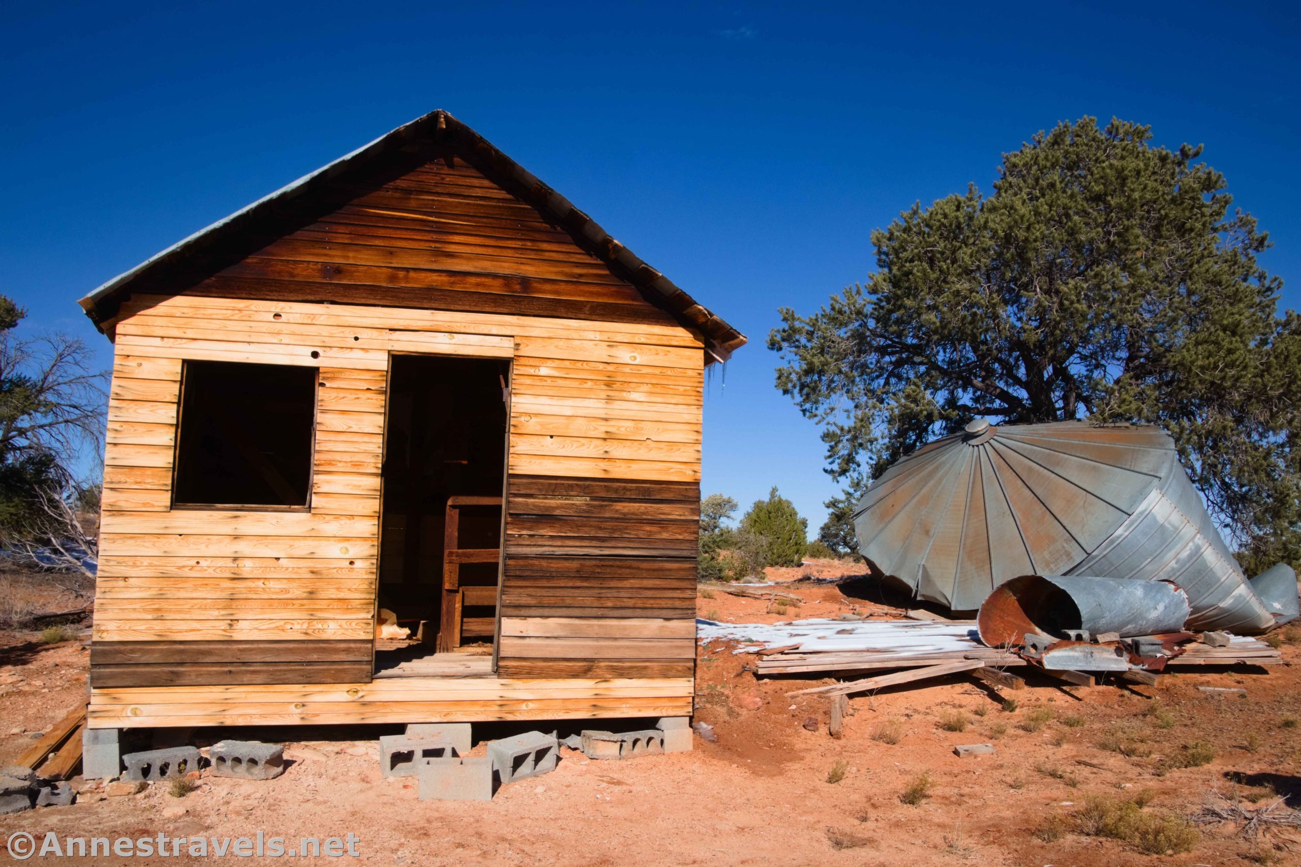
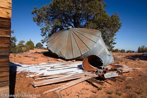
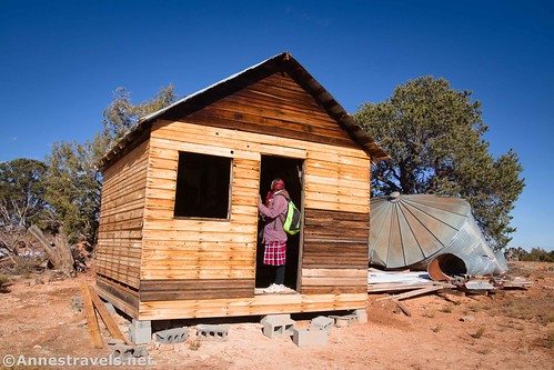
Turning right, the cabin and other associated historical junk are just on the other side of some trees. There are actually three separate structures (L-R as though looking from the parking area): A building half-buried in the ground; a round metal building (mostly fallen down at this point); and French Cabin.

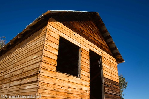
The cabin has been stabilized in recent years. I expect the new wood was fairly fresh in November 2022, and by now, it would be much harder to separate old from new. But at the time, it was pretty obvious.
Inside was a little bit torn up, but I could still make out what appeared to be either a bunkbed or some kind of cabinet.

That’s about all there is to see, so it’s not a 30-minutes-minimum kind of attraction. But it’s still a fun little stop not too far from Hans Flat!

Round Trip Trail Length: Varies. With quite a bit of walking around, and including walking the road, I hiked a total of 0.4 miles.
Elevation Gain: Minimal, though you will find yourself walking downhill to get to the cabin (my GPS read 38ft. (6,633ft. to 6,614ft.)
Facilities: None. Closest restrooms are at Hans Flat; closest water is in Goblin Valley State Park, more than 45 miles away.
Fees: None
Trail Notes: French Cabin is actually located in the Orange Cliffs District of Glen Canyon National Recreation Area. But since it’s managed by the Maze District of Canyonlands National Park, the rules are consistent with many national parks (one important variation: Pets are not permitted, even on roads or in vehicles). The cabin faces south, so photos are better in the late fall/winter than in the summer. Also, I visited in the morning, so you can see what lighting conditions are like at that time of day.
Trail 
![]()
![]()
Road ![]()
![]()
![]()
Signs ![]()
![]()
Scenery ![]()
![]()
Would I go 100 miles out of my way for this? ![]()
![]()
![]()
Overall Rating: 
![]()
![]()

GPS Coordinates for French Cabin
Beginning of French Cabin Road: 38.2374530°, -110.1512360° (38°14.24718′, -110°09.07416′ / 38°14’14.8308″, -110°09’04.4496″) (6,615ft.) (0.0)
Parking area: 38.2380440°, -110.1501440° (38°14.28264′, -110°09.00864′ / 38°14’16.9584″, -110°09’00.5184″) (6,611ft.) (456ft.)
French Cabin: 38.2377780°, -110.1501190° (38°14.26668′, -110°09.00714′ / 38°14’16.0008″, -110°09’00.4284″) (6,610ft.) (0.11)
Boiler: 38.2384420°, -110.1498250° (38°14.30652′, -110°08.98950′ / 38°14’18.3912″, -110°08’59.3700″) (6,609ft.) (0.26)
End: 38.2374500°, -110.1512330° (38°14.24700′, -110°09.07398′ / 38°14’14.8200″, -110°09’04.4388″) (6,615ft.) (0.42)
The gpx file for French Cabin can be downloaded – please note that this and the GPS Coordinates are for reference only and should not be used as a sole resource when hiking this trail.
Download GPX File size: 10.6 KB Downloaded 386 times
(Note: I do my best to ensure that all downloads, the webpage, etc. are virus-free and accurate; however, I cannot be held responsible for any damage that might result, including but not limited to loss of data, damages to hardware, harm to users, from use of files, information, etc. from this website. Thanks!)
Getting to French Cabin
From the Hans Flat Ranger Station, drive NP-633 for 2.2 miles. A small sign on the right points to the sideroad on the left. Turn left onto this sideroad for 0.1 miles to a small parking area. I either did or could have traveled both of these roads in my 2WD van at the time I visited. However, I’d recommend 4×4 for a couple of hills shortly after leaving Hans Flat.

Today’s Featured Product!
I’m a huge fan of this book on Canyonlands National Park. Besides an incredible breadth of jeep roads and trails, the author includes detailed directions and some fun history about the area. Buy your copy here.