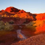
There are two roads that access the area generally called the Maze District of Canyonlands: The Hans Flat Road, from UT-24 to the Hans Flat Ranger Station, and the Waterhole Flat Road, from US-95 near Hite to… well, to the Dollhouse Road among other destinations. Both are generally good roads in dry weather, though either one may require high clearance or even 4×4 due to washouts or blowing sand. Both are also very scenic, though Waterhole Flat wins the scenery contest hands-down.
Quick Stats
Note: Some of the links in this post are affiliate links. If you click one and purchase something, I may earn a small commission without an extra cost to you.

In general, the Hans Flat Road is used to access the only ranger station in the Maze District (gotta pick up your camping permits somehow!) and the upper portion of the park – in other words, the area on top of the Orange Cliffs. From there, you can also drive to the famous (or infamous?) Flint Trail that connects the Hans Flat Road to the Waterhole Flat Road via a notoriously treacherous, steep, and winding route. (If it tells you anything, the Flint Trail has been ranked in difficulty as similar to the Elephant Hill Road over in the Needles District.)

In contrast, the Waterhole Flat Road is generally used to access the Poison Spring Canyon Road (popular with 4×4 ATVs and OHVs, but only accessible when the Dirty Devil River is low) and the Dollhouse Road (the most popular by far!), but it can also be used to get to the Maze Overlook (access to the Harvest Scene). I’m going to leave the Waterhole Flat Road for a post of its own, and today we’re going to look at what it’s like to drive the Hans Flat Road to the Hans Flat Ranger Station.
First though not foremost, don’t think of Hans as a German name. In fact, it was named for an Irishman, so the A in the middle is pretty American. In other words, it’s “Hands” without the D, not “Hons.” There is a display about Mr. Hans on the wall of the ranger station, but unfortunately, my camera didn’t take a proper photo of it, so I know very little about him besides that he herded cattle or sheep on the flat area around the grassland that bears his name.
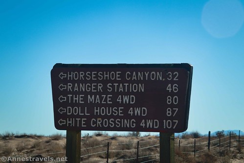
The Hans Flat Road begins along UT-24 just south of the turnoff for Goblin Valley State Park. Turn left (east) onto the road. A sign indicates that Horseshoe Canyon, Ranger Station, The Maze 4WD, Doll House 4WD, and Hite Crossing 4WD are all down this road.
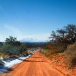
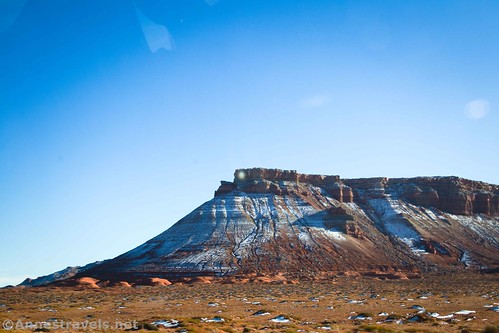
At first, the road is quite drivable. It’s said that most sedans can usually make it to the ranger station, provided that the road isn’t washed out and the sand hasn’t blown across the road. The road heads generally south and southeast to a ranch area, where the road takes a dramatic turn to the left to head directly for a butte that rises out of the surrounding desert. Actually, you’ll be passing just to the right (south) of the butte.

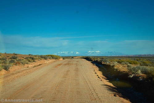
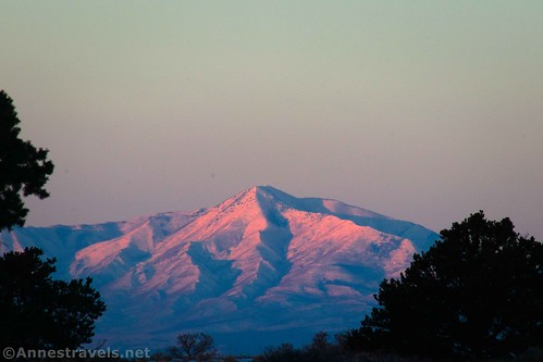
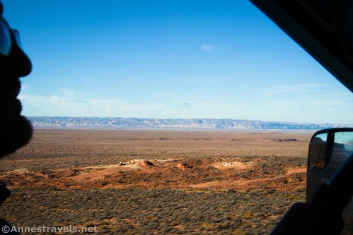
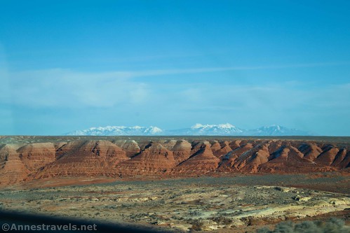
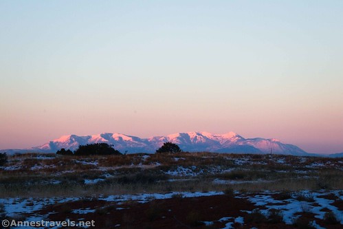
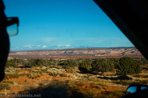
After passing the butte, you begin to get some great views of the La Sal Mountains. There’s also a sign that reads, “Flat Tops.” I’m assuming they mean the flat-topped buttes to the right (south). I believe you’re now on public land; before this, the area was owned by a local ranch.
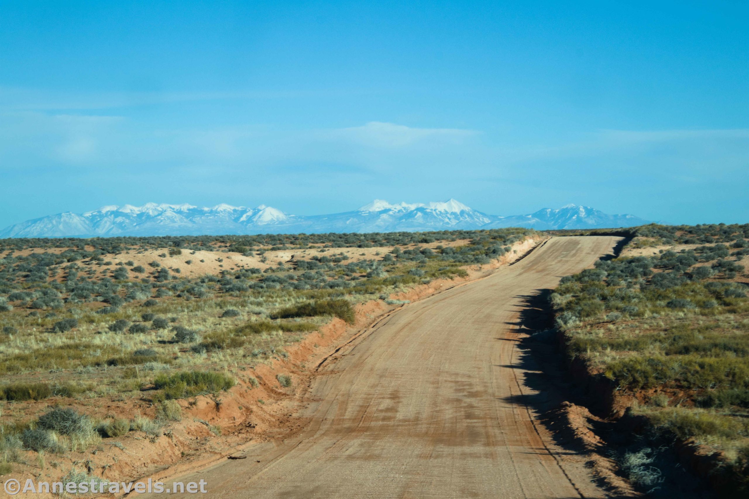
Signs along the road occasionally remind you that this is Bureau of Land Management land, and all vehicles must stay on designated routes. The road climbs up to the top of a mesa higher than the surrounding land. Views are fantastic from here back to the San Rafael Swell (to the west).
However, I was still obsessed with the snowy La Sal Mountains to the east.
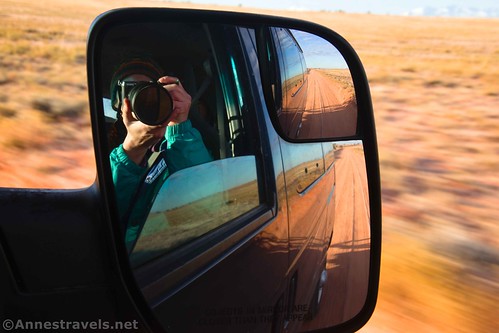
The road was generally very firm, but there were some pretty good ruts where people had driven after rain or snow. High clearance more than did the trick for us. There can also be quite a bit of washboard, so you’ll probably not get above 30mph most of the way.

A sign points left down a sideroad about mile 17.9 – signed for Sweetwater Reef. Continue straight. Actually, quite a few roads go off here and there, but it’s rarely difficult to figure out which one is Hans Flat Road.

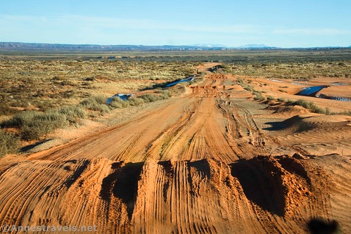
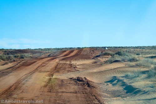
About mile 20.6, you’ll come to an area with orange sand dunes on both sides of the road. When the wind blows, the sand can drift across the road pretty badly.
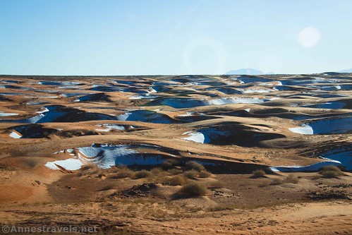
We were pretty worried since my van isn’t 4×4, and the sand had drifted in several spots. But thankfully, several people had broken through the drifts before us, so we followed their tire tracks and made it ok. If you can make it through this, you can likely make it to Hans Flat.
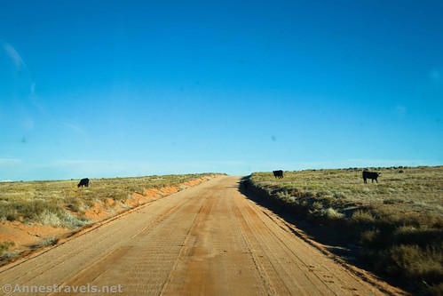
Keep an eye out for cows that graze along (or in?) the road!
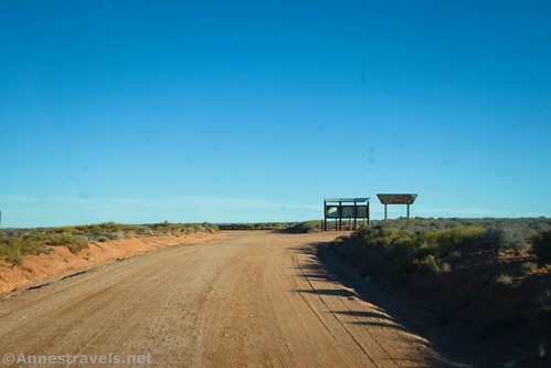
Arrive at the first major road junction about 3.4 miles beyond the sand dunes. The road makes a very definite Y, with main roads branching in both directions. There is also a signboard kiosk. Another sign tells you that Horseshoe Canyon and Green River are to the left in 7 miles and 54 miles, respectively. (Note: While this is a valid and viable way to get to Horseshoe Canyon, the rangers don’t recommend it since it typically requires at least high clearance, if not 4×4, while the road in from Green River is a bit more vehicle-friendly.) You want to turn right toward the Hans Flat Ranger Station.
The next major-ish junction is at mile 31.1 – a Y at the Ekker Ranch Road. Go left following the sign for Hans Flat Ranger Station 13. (Going right would take you into Robber’s Roost, but that’s a topic for another post. But suffice to say that I went down there for the night, so the rest of the photos are from driving into the Maze the next morning.)

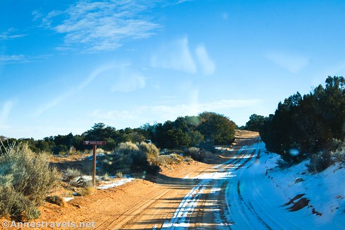
From here, the road travels through waving grasslands, though it suddenly becomes like a desert forest after mile 37.9. The mountains to the right (southwest) are the Henry Mountains.

You’ve been gradually going uphill ever since leaving UT-24, so we shouldn’t have been surprised to begin to see snow in the grasslands. In fact, we’d pretty well frozen the night before – I’d guess the temperatures were in the 20s or maybe even the teens. I didn’t pull out my thermometer until later in the trip. It was November, but it was also 20 degrees colder than average.
We’d also left some bananas in the windshield – they and our water bottles froze solid. We learned, wrapped ourself up warmer, and did pretty well at camping after that… though the bananas were pretty black once they thawed. They still tasted good, though.
Just when you think you’ve become totally lost in the trees, a sign indicates you’ve reached Hans Flat. But keep up the patience! It’s still a little way to the 15mph speed limit, then a sign welcoming you to Glen Canyon (Orange Cliffs District), and then suddenly, the road pops out of the trees at mile 45.0 and into the parking area for the Hans Flat Ranger Station. Yay!

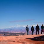
From here, you have choices. You can eat a snack (or a meal) at the picnic tables to the right of the ranger station. You can use the primitive restroom on the opposite side of the road of the ranger station. You can go into the ranger station to pick up maps/permits, talk to the rangers, get updated road conditions, and learn a little bit about the history of the area. (I found the rangers to be super helpful and informative – they really know their stuff!)
Or you can take one of the two roads that spur off of the parking area. The left road (beside the restroom) goes out onto High Spur (typically just called “Spur Road” by the rangers). Or you can take the road straight ahead (signed for the Flint Trail) to overlooks, the Flint Trail, and more adventures. But that’s a topic for another post!

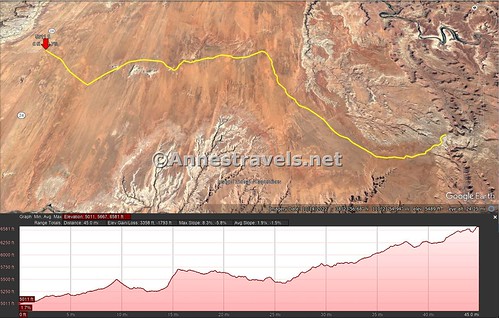
One-way Road Length: 45.0 miles from UT-24 to the Hans Flat Ranger Station
Elevation Gain: 3,350ft. up, 1,793ft. down (5,011ft. to 6,581ft.)
Facilities: Primitive restrooms, a picnic table, and visitor information at the Hans Flat Ranger Station. Note that there is no water anywhere along the road, including the ranger station. Fill up before you start!
Fees: None. The Maze District doesn’t charge an entrance fee; they make it up on camping fees.
Notes: Remember to take the road slowly. It’s a good enough road for low-clearance vehicles (most of the time!), but another vehicle can suddenly pop up over a hill and take you by surprise if you (or they) are going too fast (I nearly got run down – twice – by a Subaru careening down the road at probably 50 or 60 mph – in other words, way too fast). Pets are not allowed beyond the Hans Flat Ranger Station, even in a vehicle.

More Notes: Hans Flat can be somewhat busy on holiday weekends, especially in the spring and fall – anyone camping in the Maze must pick up their permit, in person, from Hans Flat during business hours (no off-hour permit pickups allowed). There are several campsites just outside of Hans Flat (the one we used (not Robber’s Roost) was close enough I would just walk down the road to the restroom), so you can always stay in one of those if you come too late to get your permit for the first night or if you weren’t able to snag a camping permit. I hear they leave maps of the local BLM sites in the information box outside the ranger station for just such emergencies. The Hans Flat Road is likely impassible when wet.
Road 
![]()
![]()
Signs ![]()
![]()
Scenery
Would I go 100 miles out of my way for this? ![]()
Overall Rating: ![]()

GPS Coordinates for Hans Flat Road
Hans Flat Road on UT-24: 38.6232995°, -110.5711082° (38°37.39797′, -110°34.26649′ / 38°37’23.8782″, -110°34’15.9895″) (5,011ft.) (0.0)
Gilson Butte Road Crossroads (go straight): 38.5882474°, -110.5563239° (38°35.29484′, -110°33.37943′ / 38°35’17.6906″, -110°33’22.7660″) (5,160ft.) (2.6)
Sweetwater Reef Road: 38.5003784°, -110.3805844° (38°30.02270′, -110°22.83506′ / 38°30’01.3623″, -110°22’50.1038″) (5,621ft.) (17.9)
Green River Junction (sign kiosk): 38.4725973°, -110.2804703° (38°28.35584′, -110°16.82822′ / 38°28’21.3503″, -110°16’49.6931″) (5,518ft.) (24.0)
Ekker Ranch Road Junction (to Robber’s Roost): 38.3775016°, -110.3052000° (38°22.65010′, -110°18.31200′ / 38°22’39.0058″, -110°18’18.7200″) (5,837ft.) (31.1)
Hans Flat Ranger Station: 38.2553495°, -110.1797751° (38°15.32097′, -110°10.78651′ / 38°15’19.2582″, -110°10’47.1904″) (6,581ft.)
The gpx file for Hans Flat Road can be downloaded – please note that this and the GPS Coordinates are for reference only and should not be used as a sole resource when hiking this trail.
Download GPX File size: 157.7 KB Downloaded 457 times
(Note: I do my best to ensure that all downloads, the webpage, etc. are virus-free and accurate; however, I cannot be held responsible for any damage that might result, including but not limited to loss of data, damages to hardware, harm to users, from use of files, information, etc. from this website. Thanks!)

Getting to the Hans Flat Road
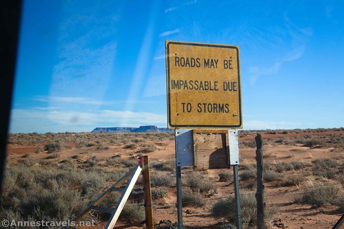
From I-70, take Exit 149 for Hansville and UT-24 and turn south on UT-24 toward Hanksville. The scenery is very interesting in a rugged sort of way. Badlands and grasslands eventually give way to views of the San Rafael Swell over on the right. Drive 24.2 miles to the turnoff, on the left. While the Hans Flat Road is not prominently signed, it does have a wooden signboard before the cattle guard that reads, “Horseshoe Canyon 32, Ranger Station 46, The Maze 4WD 80, Doll House 4WD 87, Hite Crossing 4WD 107.” (Everything past the ranger station is via the Flint Trail.) At the cattle guard, an ancient yellow sign says that the road may be impassible due to storms. They’re right on that one! The turnoff is 0.6 miles south of the turn for Goblin Valley State Park, which is well-signed if you want an easy landmark.
This Week’s Featured Product!
This is the best book I’ve found on the Maze District of Canyonlands. With maps, interesting descriptions/history, and a variety of trails and roads, it’s well worth checking out if you’re planning a trip to the Maze. Buy a copy here!