
I have four favorite overlooks in Canyon Rims Recreation Area south of Moab, Utah: Needles Overlook, Minor Overlook, Canyonlands Overlook, and Anticline Overlook. Each one is special and beautiful in its own way, but today I’d like to take a deep dive into exploring Minor Overlook, about 15 miles north of the pavement (aka road to the Needles Overlook) en route to Anticline Overlook. Minor Overlook is definitely not “less exciting” than the other viewpoints: it has great views to the La Sal Mountains, buttes, the Colorado River, and more!
Quick Stats
Note: Some of the links in this post are affiliate links. If you click one and purchase something, I may earn a small commission without an extra cost to you.

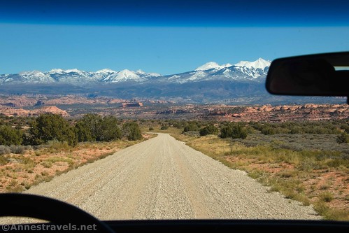
One of the great things about Minor Overlook is that it’s a good place to stop in both the morning and the afternoon. (Anticline Overlook is similar in this respect.) In the morning, views are better into the canyon and down over the Colorado River. In the afternoon, the La Sal Mountains are better to look at, but the canyon view is still nice enough to warrant a stop.

When you’re coming in the road to Minor Overlook, the road turns right and left to go around a large butte (more about the butte later). Turn right to follow the gravel road. It’s accessible to most vehicles in dry weather.

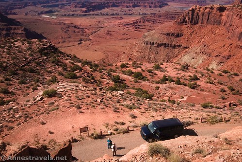
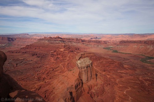
The entire far side of the butte is the overlook. A few signs explain the nearby geology and the layers in the rocks.

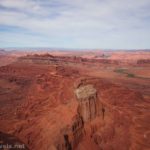
Enjoy the views down into the canyon, including a gooseneck of the Colorado River. You can just barely see one of the ponds at the Potash Plant, but it’s pretty easy to ignore if you don’t enjoy such things. I like the point more to the left – very cool!

And that’s that for Minor Overlook. Read the signs, enjoy the views, and leave.

Unless you’re my siblings and me when we were young…
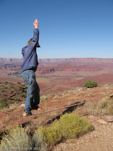
…because if you are anything like us, you’ll find some way to make a simple viewpoint into an epic adventure. Our first attempt at adding interest was to use the guardrail as a slackline. (In case you think it’s dangerous, it’s not anywhere close to as bad as it looks.) So of course we had to try it again on a more recent visit.
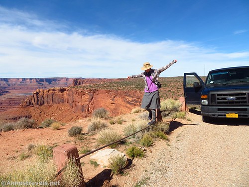
And then, we decided to scale the butte. There’s a fissure that gives access with a bit of easy Class 3 scrambling.

If you’re looking for the correct fissure, head toward the northern end of the butte on the viewpoint (western) side of the butte. It’s not all of the way to the northern end of the butte, but it’s much closer to the northern end than to the center. The area has two possible cracks that look possible to scramble; we used the more southerly of the two.

It’s not a stroll in the park scramble, but it’s not too bad. I got my mom up there once. Use common sense and don’t try it in flip flops and you should be fine.
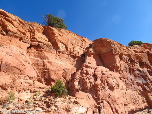
Once up the crack, try not to trample fragile soil and scramble (Class 2) your way up to the top of the butte. I headed right for a bit and then doubled back on a higher bench.
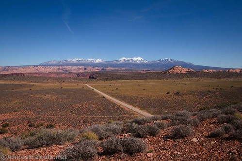
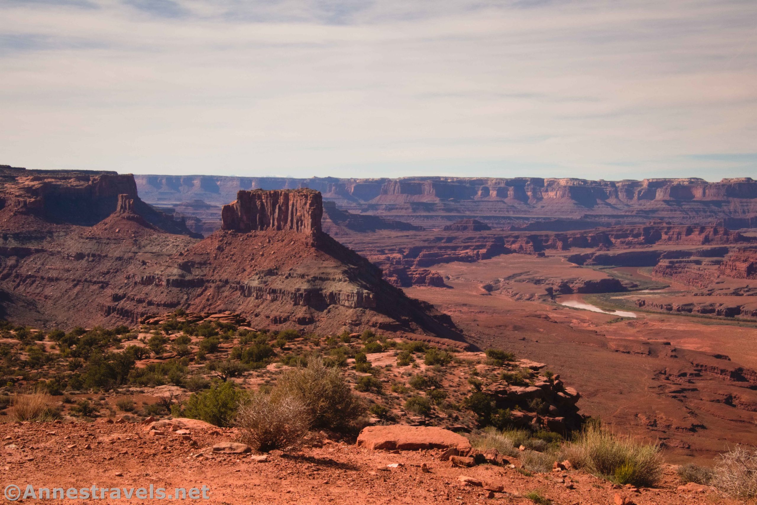
The views from on top of the butte are fantastic! To the east are the La Sal Mountains, which look better in the afternoon than in the morning.

To the west is the canyon of the Colorado River, and the views are even better up here than they are from the official overlook.
We enjoyed the view for a while before scrambling back down. It’s well worth the trek up if you have the time and don’t mind a bit of scrambling.

From here, you’ll probably want to continue up to Anticline Overlook, which has a short trail and lots of great views!
Round Trip Length: This is a viewpoint, not a trail per se. So you almost don’t have to get out of your vehicle. If you scramble up the butte, you’ll probably go about half a mile or a bit less all told.
Elevation gain: N/A unless you climb the butte, which is about 100ft. high
Facilities: None. There are picnic tables and primitive restrooms at Anticline Overlook.
Fees: None

Trail Notes: Don’t try scrambling up the fissure unless you’ve done some amount of scrambling before. Some of the rocks are a little loose underfoot. Also, look for a generally easy way up after the crack – you don’t have to scramble up the nearly sheer hillside; there are easier ways! The views of the La Sals are definitely better in the afternoon and the views of the canyon are generally better in the morning.

Trail 
![]()
![]()
![]()
![]()
Road ![]()
Signs ![]()
![]()
Scenery
Would I go 100 miles out of my way for this? ![]()
Overall Rating: 
![]()
GPS Coordinates for Minor Overlook
Minor Overlook: 38.439968,-109.622936 (38°26.39808′, -109°37.37616′ / 38°26’23.8848″, -109°37’22.5696″) (5,629ft.)
Top of Butte: 38.439455,-109.622153 (38°26.36730′, -109°37.32918′ / 38°26’22.0380″, -109°37’19.7508″) (5,705ft.)
The gpx file for my hike around Minor Overlook can be downloaded – please note that this and the GPS Coordinates are for reference only and should not be used as a sole resource when hiking this trail.
Download GPX File size: 6.6 KB Downloaded 507 times
(Note: I do my best to ensure that all downloads, the webpage, etc. are virus-free and accurate; however, I cannot be held responsible for any damage that might result, including but not limited to loss of data, damages to hardware, harm to users, from use of files, information, etc. from this website. Thanks!)

Getting to Minor Overlook
From US-191 south of Moab, Utah, turn west (right if coming from Moab, left if coming from Monticello) onto the road marked for Needles Overlook, Anticline Overlook, and Canyon Rims Recreation Area. Drive across the cattle guard and follow the paved road 15 miles. At this point, the road to the Needles Overlook goes off on the left and is paved. You want to go right onto the gravel road for another 14.7 miles (you’ll pass by the Hatch Point Campground along the way). Turn left on the gravel road that strikes west toward a butte, following the sign for Minor Overlook. The access road is about a half a mile long. Turn right at the junction to drive around the north side of the butte to the viewpoint on the western side.
The roads to Minor Overlook are paved or grave and should be accessible to most vehicles (not sure I’d take a super-low clearance sports car, but most others should be fine).

This Week’s Featured Product!
This guidebook takes you to some of the great trails near Moab. Some of them are inside Arches and Canyonlands National Parks, but many others are hidden in the canyons and valleys in the nearby hills. Buy your copy here.