

Early morning at Pueblo del Arroyo
Pueblo del Arroyo doesn’t get the attention it would get if it was a little further away from other well-preserved Chacoan great houses in Chaco Culture National Historical Park, like Pueblo Bonito. But that doesn’t mean it’s not worth a quick tour. Because of its location, the sunrise hits it earlier than many of the other ruins, so it’s a great sunrise spot – assuming it’s after 7am, which is when the park opens!
Quick Stats
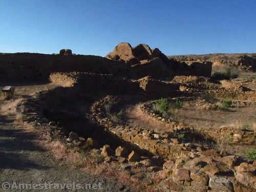
Curving walls inside the pueblo
We visited Pueblo del Arroyo very early one summer morning. In some ways it was an accident; we were on our way to hike the Pueblo Alto Loop, and while others in the group were making last-minute preparations for the hike, a few of us ran across the parking lot to walk around Pueblo del Arroyo. And then a few more followed, and before you knew it, most of us were wandering around the old stone walls in the early morning sunshine.

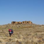
Approaching Pueblo del Arroyo
After about 300ft., you have the choice to enter the pueblo or to turn right and go around the western edge. Since the trail is a loop, it doesn’t really matter which way you go. I’m more interested in exploring a pueblo than wandering around the outside, so I turned left to enter the pueblo.

Shadows of hikers along the walls
There are several kivas and rooms; the trail isn’t as explore-able as Pueblo Bonito, nor is this structure as large, but it’s still interesting. We wandered through the structure, then around the southern side and back around the western side, following the packed gravel path.

Walking around the outside of the pueblo
The moon was setting behind the structures, which was fun.
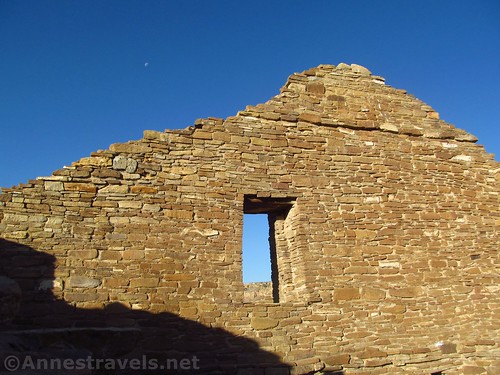
I’m not sure that you can see the moon, high up above and to the left o the window
But then we had to hurry back to the van to help the others finish packing up for our hike up to Pueblo Alto. Still, it was a great little side-trip, especially under the swiftly rising sun!

Looking out across the ruins of Pueblo del Arroyo
Round Trip Trail Length: 0.33 miles
Elevation Change: Just a little to get up and over a part of the wall
Facilities: A couple of picnic tables – restrooms are located back at the Pueblo Bonito parking area and about a quarter mile beyond the gate across from Kin Klesto.
Fees: $25/vehicle, valid 7 days. National Park & Federal Recreational Lands Passes are accepted.
Trail Notes: This isn’t a long hike. It’s more like an overlook with a little trail than a hike. Don’t touch, sit, or lean on walls or structures. Always obey the rope closures and “keep out” notices. The area is closed at sunset and on Thanksgiving, Christmas, and New Year’s Day.

Ruined walls
Trail 
![]()
Road ![]()
Signs ![]()
Scenery ![]()
![]()
Would I go 100 miles out of my way for this? ![]()
![]()
Overall Rating: 
![]()

A more intact part of the pueblo
GPS Coordinates for Pueblo del Arroyo
Trailhead: 36.0621000°, -107.9653333° (N36° 03.726′ W107° 57.920′ / 36°03’43.5600″, -107°57’55.2000″) (5,900ft.) (0.0) (end 0.33)
Go in or go around: 36.0613833°, -107.9657000° (N36° 03.683′ W107° 57.942′ / 36°03’40.9800″, -107°57’56.5200″) (5,917ft.) (315ft.)

A window through the wall – with a balancing rock on the cliff beyond!
The gpx file for Pueblo del Arroyo can be downloaded – please note that this and the GPS Coordinates are for reference only and should not be used as a sole resource when hiking this trail.
File size: 8.7 KB Downloaded 0 times
(Note: I do my best to ensure that all downloads, the webpage, etc. are virus-free and accurate; however, I cannot be held responsible for any damage that might result, including but not limited to loss of data, damages to hardware, harm to users, from use of files, information, etc. from this website. Thanks!)

One of the surviving curved walls
Getting to Pueblo del Arroyo
From I-40, take Exit 53 and turn north onto NM-371N. After 28.5 miles, turn right onto NM-57 and drive 13.3 miles. Turn left (following the sign for Chaco) to stay on NM-57 (the road is now dirt, suitable for low clearance vehicles except after storms which may make washes rough until graded) for another 19.2 miles. Once in the park, turn left on the one-way Chaco Canyon Loop Road about 4 miles to the parking area for Pueblo del Arroyo, etc.

Close up of the stonework
Alternatively, from the east (US-550) turn onto Road 7900 (signs point toward Chaco Culture National Historical Park) – the turn is on the south side of the road about 15 miles west of Counselor or 3 miles south of Nageezi. The road is now dirt, but passable to low clearance vehicles in dry weather. Continue to follow the main dirt road (signs mark any confusing junctions) for about 22 miles to the Chaco Culture Park visitor center. Continue straight a short distance, then continue straight onto the one-way Chaco Canyon Loop Road for about 4 miles to the parking area for Pueblo del Arroyo, etc.

Visual trail map and elevation profile for Pueblo del Arroyo
Zoom map out to browse nearby hikes & places of interest
This Week’s Featured Product!
Learn the history and hike the trails of Chaco Canyon with this informative guide.
More Related Posts:
 Some of the Best Ancient Civilization Ruins at Pueblo Bonito
 Pueblos, Lizards, and More on the Pueblo Alto Loop
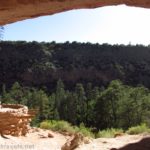
 Climbing Ladders into Caves on Bandelier’s Main Loop
 Climbing the Ladders to Alcove House
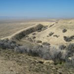 Walk Across a Real Earthquake Fault Line at Carrizo Plain!
 Day-hiking Coyote Gulch: Waterfalls, Arches, and Solitude