
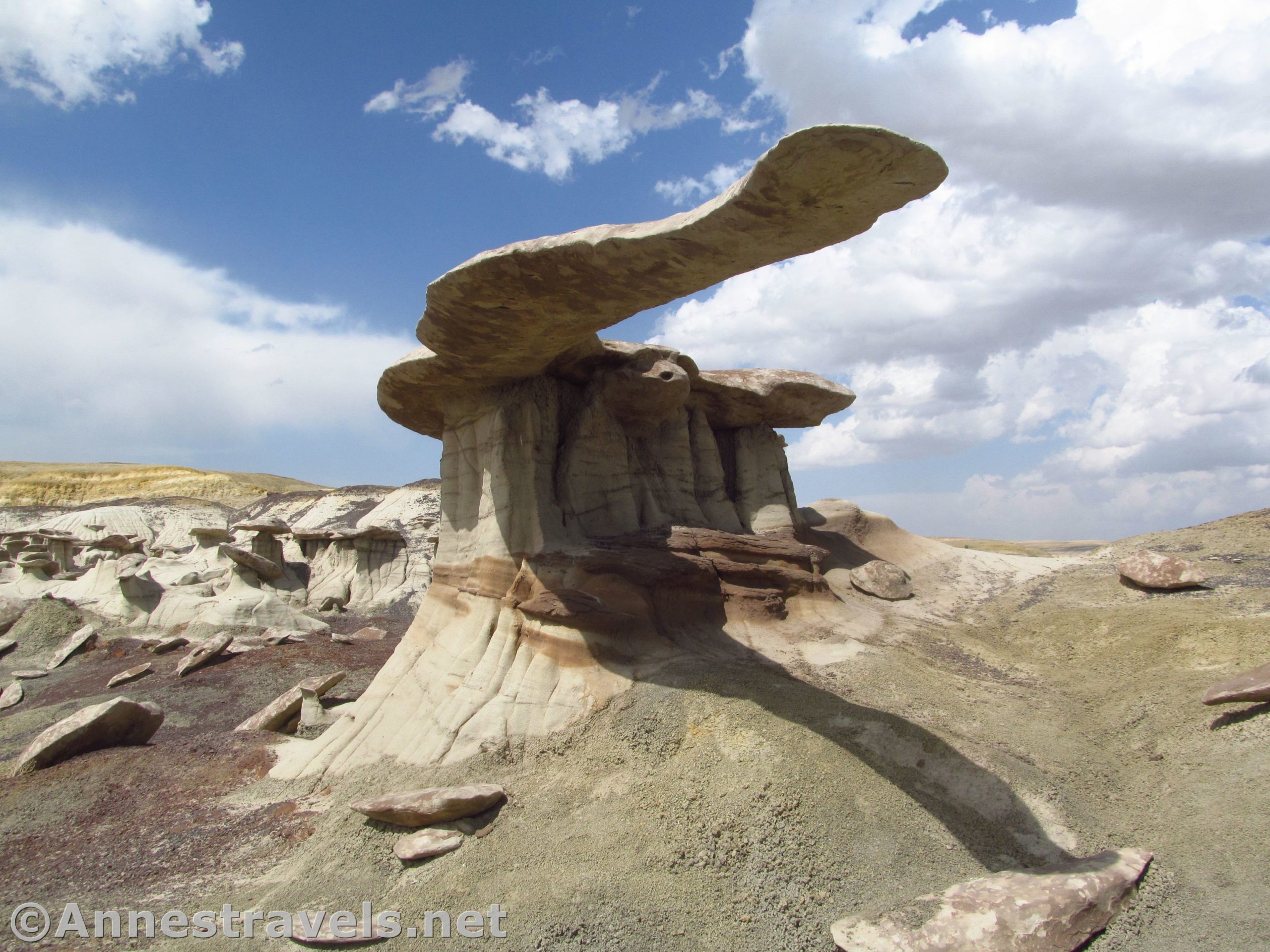
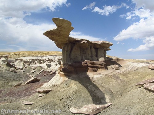
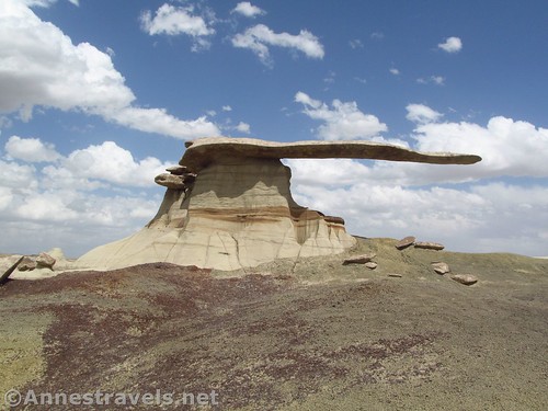
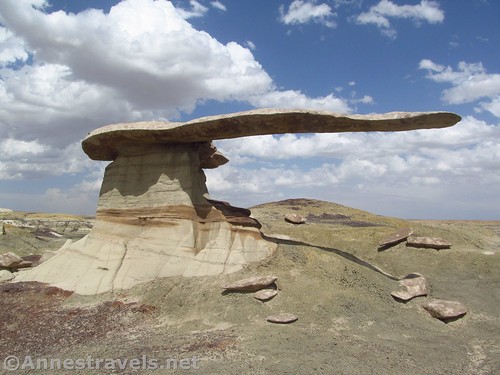
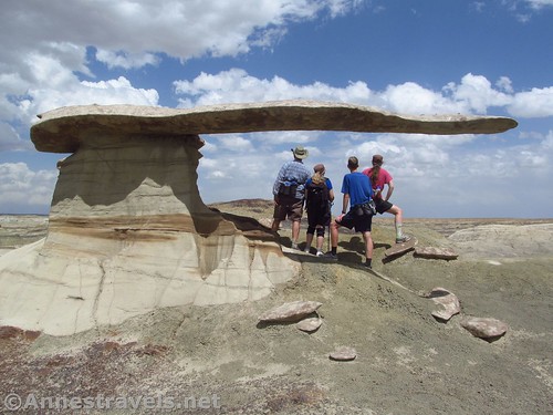
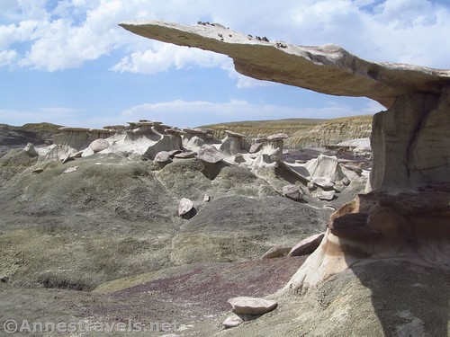
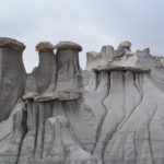
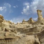
Deep in the badlands of northwestern New Mexico, there is a rock formation known as the “King of Wings”. It’s pretty remarkable, and it definitely defies gravity. On one end is a kind of hoodoo or pedestal. On the other end is… nothing. But between the pedestal and the nothing is a very long, very flat rock. You have to see it in real life to believe it!
Quick Stats
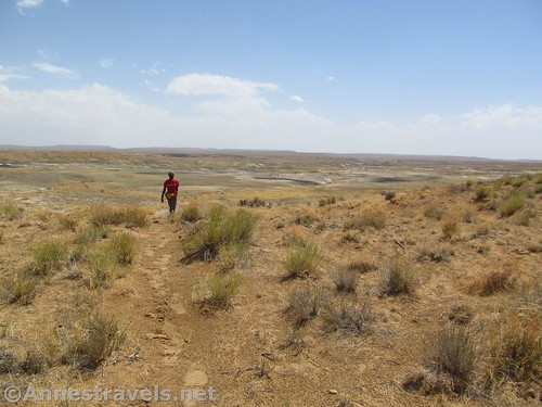
The problem with the King of Wings is that it’s not easy to find. There’s no trail, and by following the trail that was there, we headed in the wrong direction altogether. You pretty much need a GPS for this one though I suppose you might be able to follow directions there if you knew what you were looking for and didn’t mind wasting time looking for it.

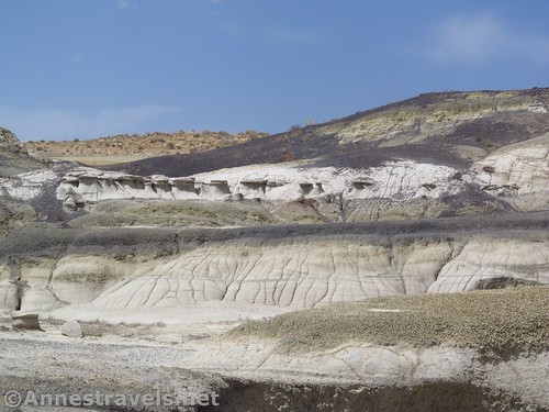
We set off around the pond(?), slipped through the fence, and followed a path that headed generally south and down toward the wash and the badlands. A summer storm had just blown through, and we’d hidden out in the van until the thunder and sprinkles stopped. The sun had returned, and the area wasn’t too wet… if it had really rained, we would have been driving out before the roads became slick and goopy… no 4×4 makes us extra cautious about things like that!
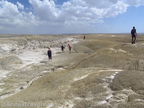
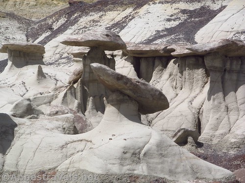
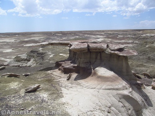
The path goes down into the badlands (pretty scenic to my Eastern eye). We would have kept right on following the trail down into the wash, but thankfully the friends of Frank Ruggles (former Official National Park Photographer) had scouted ahead and pointed us in the right direction. (He happened to be scouting out the area the same day we were – how cool is that!)
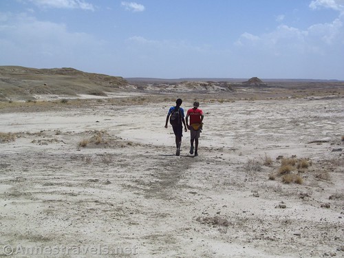
You don’t want to go all the way down to the wash. Instead, turn left and walk east-ish through the edge of the badlands. You’ll see the King of Wings eventually.

Yep, that’s as much as I’m going to tell you about how to get there. You’ll have to search for this one!
You can also come down through the badlands from the top – but since there is no trail, I can’t describe it. I met a German couple doing this with their GPS, and I used my GPS to go back that way.
The formation itself is very cool. It’s quite the thing to take your picture underneath the wing… just to show how huge it really is!
Important! Do not in any way alter the King of Wings or vandalize it or the area. This is free to explore because people are respectful… disrespectful behavior will result in no one being allowed near it. Do your part to preserve this incredible wonder!

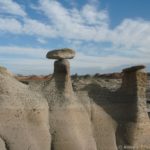
The surrounding area is nice enough. I found some petrified wood as well as a number of toadstools, and the badlands would be fun to explore.

We returned to the van for a total of 2.4 miles, most of it without trail… but it was worth it!

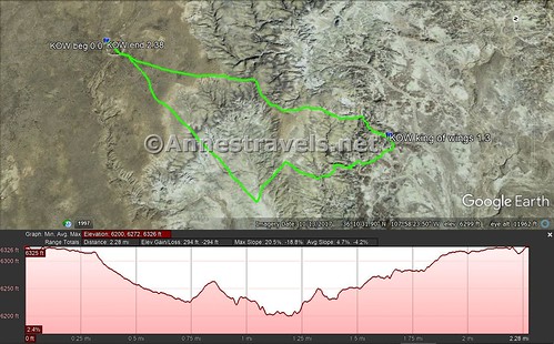
Round Trip Trail Length: My GPS came out at just less than 2.4 miles
Elevation Gain: 294ft. (6,200ft. to 6,326ft.)
Facilities: Absolutely none for miles
Fees: None
Trail Notes: You may be parking on private land; be sure to be extremely respectful. I’ve read horror stories about people driving to the parking area and meeting some of the not-so-friendly locals, but we saw no one other than the photographers we had already met earlier in the day. If it rains, you won’t be able to get out… and there are no services for close to a hundred miles in any direction, so plan accordingly. As I’ve said before, no vandalizing! You’re a guest here.
Trail 
![]()
![]()
![]()
![]()
Road ![]()
![]()
![]()
Signs ![]()
![]()
![]()
![]()
Scenery ![]()
Would I go 100 miles out of my way for this?
Overall Rating: 
![]()
![]()

GPS coordinates
Trailhead: 36.1838500°, -107.9717000° (N36° 11.031′ W107° 58.302′ / 36°11’01.8600″, -107°58’18.1200″) (6,307ft.) (0.0) (end 2.38)
King of Wings: 36.1711167°, -107.9726333° (N36° 10.267′ W107° 58.358′ / 36°10’16.0200″, -107°58’21.4800″) (6,225ft.) (1.3)

The gpx file for my trek to The King of Wings can be downloaded – please note that this and the GPS Coordinates are for reference only and should not be used as a sole resource when hiking this trail.
Download GPX File size: 45.7 KB Downloaded 552 times
(Note: I do my best to ensure that all downloads, the webpage, etc. are virus-free and accurate; however, I cannot be held responsible for any damage that might result, including but not limited to loss of data, damages to hardware, harm to users, from use of files, information, etc. from this website. Thanks!)
Getting to the King of Wings
From Farmington, NM, drive south on NM-371S. After 45 miles, turn left onto County Road 7650 – the road almost immediately turns to gravel (the turn is on the right 60 miles north of I-40). Drive 10.2 miles. Just after a cattle guard, turn right onto a very unofficial road (like, two tracks that head south). The unofficial road goes south, then takes a sharp turn to the east, then takes a sharp turn to the south/southeast. After 2.1 miles, the road more or less ends in a pile of dirt in a parking area with room for about 3-4 cars (if they don’t mind being close together). You’ll have to walk around the pile of dirt to access the “trail”. The unofficial technically keeps going, but I certainly wasn’t going to try it in my non-4×4 van.
From Nageezi, take Road 7820 (it’s marked “No Access to Chaco”) 0.4 miles; turn right onto Route 45A (it may be marked 7786). Drive 4.8 miles and turn right on County Road 7825. After 4.1 miles, keep straight (don’t turn) onto Road 7023 for another 6.4 miles. Just before a cattle guard, turn left onto a very unofficial road (like, two tracks that head south). The unofficial road goes south, then takes a sharp turn to the east, then takes a sharp turn to the south/southeast. After 2.1 miles, the road more or less ends in a pile of dirt in a parking area with room for about 3-4 cars (if they don’t mind being close together). You’ll have to walk around the pile of dirt to access the “trail”. The unofficial technically keeps going, but I certainly wasn’t going to try it in my non-4×4 van.
If coming from other areas of the Ah-Shi-Sle-Pah Wilderness, you may be able to come up Road 7870 to Road 7650; turn right for about 2.3 miles to the unofficial road, on right.
Note: The roads leading into the area are all dirt. A decent low-clearance vehicle could probably do the road from Farmington up to the unofficial road in good, dry weather. The unofficial road is – well – unofficial. You’ll need high clearance for sure, 4×4 is a good idea. I did it in my stock high clearance van in mostly dry weather and there were some pretty intense moments. You could possibly park out by the end of the road if you can find a safe place to do so – this will increase your hike by 4.2 miles RT.
Zoom map out to browse nearby hikes & places of interest
This Week’s Featured Product!
If you’re looking for more hiking ideas in northern New Mexico, this covers some of the most popular – and some of the most unknown. You’ll probably need to supplement the book with other data sources, but it’s a great place to get hiking ideas.


One response to “The Crazy King of Wings!”
[…] the afternoon, we hiked over to the King of Wings. All of these would have been nearly impossible to find without the GPS – even if the GPS did […]