
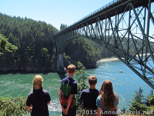
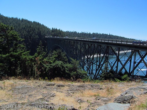
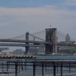
Looking at the Deception Pass Bridge from Pass Island
Ever since I saw my first picture of the Deception Pass Bridge in northwestern Washington, I wanted to see it in person. There was something so uniquely interesting about the graceful spans, and knowing some of my group members pretty well, I knew a bridge would be a very welcome addition to mountains and wildflowers (and maybe even a highlight of the trip!) But I also didn’t feel it was special enough to go a long way out of the way to see, and certainly not special enough to pay $10/day for visiting. (If I was making a day of it, sure, but just to see the bridge? Really???) So I was excited – no, thrilled – when I realized that to get between the Mt. Baker area and the Olympic Peninsula we’d have to drive right across the Deception Pass Bridge! Talking with other hikers about it, I also realized that (except for gas) we could do it 100% free… (Of course, you can park for free if you have a Discovery Pass, which I didn’t, so then it would be free no matter which side you parked on!)
Quick Stats
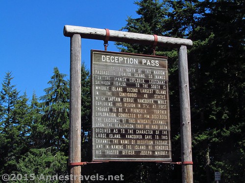
A sign about Deception Pass in the parking lot of the state park
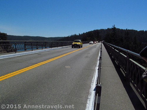
To visit the bridge (or for that matter, Deception Pass State Park) for free, you’ll need to park on the north side of the bridge. Since I was traveling from Mt. Baker, which is just about on the Canadian Border, that meant parking just before the bridge and then driving over it later. There are parking spaces specifically for doing this; unless it’s a busy day, there will likely be spaces open so you won’t have to park on the shoulder of the road (actually, that’s not allowed, so hope a space is open!) A sidewalk leads to the Deception Pass Bridge, so it’s more or less wheelchair accessible (I say more or less because the walkways are so narrow I’m not sure a wheelchair could fit some of the time…!) There is also a small parking area on Pass Island, if you’d rather park in the middle of the bridge. There is no toll, so you can drive across it about as many times as you want and only burn gas.
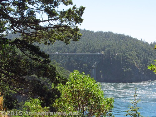
The bridge from near where we parked
We visited on a lovely sunny day. We arrived around midday and didn’t have too much trouble finding a parking place, even though the area was pretty busy. After parking and collecting water bottles and cameras, we walked over to the first span of the bridge.
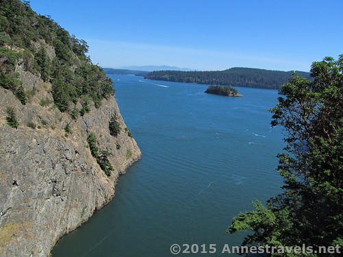
Steep cliffs over Canoe Pass
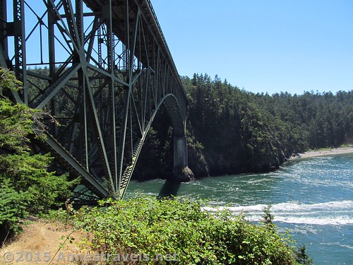
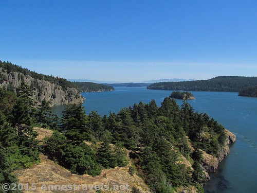
The Deception Pass Bridge actually has two spans crossing two different channels on either side of “Pass Island”. The northerly channel is “Canoe Pass” and the southerly, “Deception Pass”. Canoe Pass is shorter and smaller than Deception Pass.
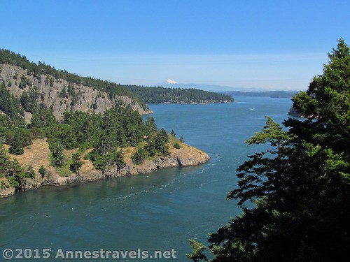
Deception Pass
The walkway is good, solid concrete with a hefty enough barrier to keep me feeling somewhat safe from falling over the edge. But the barrier between you and the traffic is another matter…no more than a wire between posts. And when the logging trucks rumble past, well, let’s just say it’s rather exciting!
Along the walkway. This picture is no exaggeration!
After the span across Canoe Pass, there is a set of stairs leading down to Pass Island (or under the highway and to the other side of the bridge – this is important because there is no underpass at the northern end of the bridge, so if you’re on the east side, you’ll have to cross back over via walking across the road. There’s enough traffic that I wouldn’t want to have to try it.) We passed up the opportunity to go down here, though we did it on the way back (and it’s definitely worth it!)
Part of the view from Pass Island
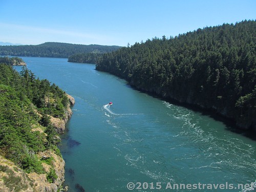
The views from both spans are breath taking (literally – you’re that high above the water!) You can see Mt. Baker clearly to the east, and the craggy cliffs and deep blue-green water made a spectacular sight. Boats also travel under the bridge, which keeps the looking interesting.
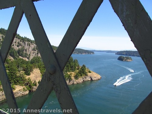
A boat approaches Deception Pass
At the far end of the bridge is Deception Pass State Park. To park here, you’d have to pay $10/day (if you don’t have a Discovery Pass). But since we’d parked on the other side, we cheerfully walked through the parking area, used the restrooms, and returned to the bridge. An underpass takes you over to the other side, and there are quite a number of trails you could take either up mountains or down to the shore. We didn’t have time for the trails, so maybe some other day.
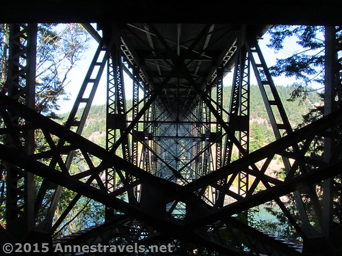
Underneath the Deception Pass Bridge. So cool!
We headed back across the bridge, but went down on Pass Island. The viewpoint is nice, but if you leave it to walk on some of the many social trails, the view of the span over Deception Pass becomes so much better. Too bad we were sort of short on time by this point – it would have been fun to explore Pass Island a bit more!
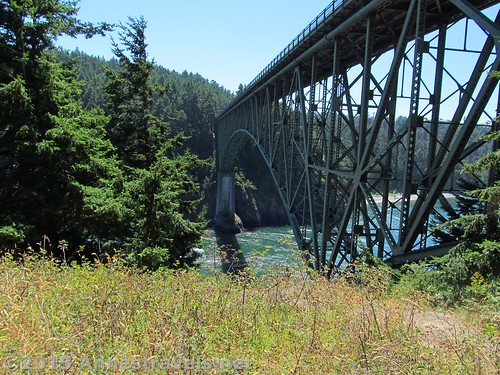
Deception Pass Bridge from the western part of Pass Island
Cross back over to go up the western stairs, then recross the span over Canoe Pass. I’m not sure I’d go hundreds of miles out of my way for this, but it certainly was fun to cross the bridges…and certainly worth stopping for if you’re in the area!
The bridge from the eastern side of Pass Island
Round Trip Length: We hiked about 1.5 miles
Net Elevation Change: Negligible. You’re around 160 ft. most of the way.
Facilities: Restrooms on the south end of the bridge
Fees: None on the north side of the bridge; $10/day or Discovery Pass on the south side of the bridge.
Trail 
Road
Signs
Scenery
Would I go 100 miles out of my way for this?
Overall Rating:
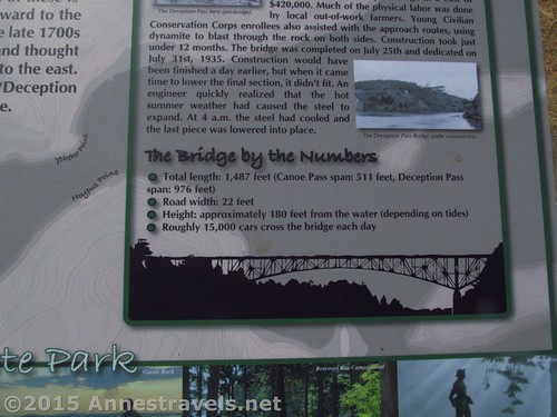
Statistics about the Deception Pass Bridge
Key GPS Coordinates for Deception Pass Bridge
Beginning of Parking Area: 48.41038N / -122.64822W (48° 24′ 37.368″ / -122° 38′ 53.5914″) (162ft.)
Bridge #1 (over Canoe Pass): 48.40857N / -122.64503W (48° 24′ 30.8514″ / -122° 38′ 42.108″) (183ft.)
Bridge #2 (over Deception Pass): 48.40623N / -122.64458W (48° 24′ 22.428″ / -122° 38′ 40.488″) (162ft.)
Island Overlook: 48.40766N / -122.64418W (48° 24′ 27.5754″ / -122° 38′ 39.048″) (164ft.)
Restrooms: 48.40436N / -122.64492W (48° 24′ 15.6954″ / -122° 38′ 41.7114″)
The gpx file for the Deception Pass Bridge can be downloaded – please note that this and the GPS Coordinates are for reference only and should not be used as a sole resource when hiking this trail.
Download GPX File size: 37.6 KB Downloaded 123 times
(Note: I do my best to ensure that all downloads, the webpage, etc. are virus-free and accurate; however, I cannot be held responsible for any damage that might result, including but not limited to loss of data, damages to hardware, harm to users, from use of files, information, etc. from this website. Thanks!)
Getting to the Deception Pass Bridge
Pass Island from the Deception Pass Bridge
From the North: Take I-5 to Burlington, WA; take Exit 230 and turn onto WA-20 W. After about 11.5 miles, turn left to stay on WA-20 W and drive another 5.8 miles. Park in the spaces provided along the side of the road.
Canoe Pass
From the South: From Oak Harbor, drive about 10 miles north on WA-20 E. Cross the bridge, then park in the spaces provided by the side of the road. Note: to get to Oak Harbor, you’ll have to take a ferry to the peninsula. Cool!
Zoom map out to browse nearby hikes & places of interest
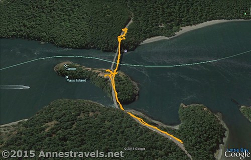
Visual map of my hike (walk, really) across the Deception Pass Bridges – North is down
This Week’s Featured Product!
Looking for more area hikes? This is one of my favorite series for trail info!


Pingback: Taking the Port Townsend Ferry - Fun Stuff - Anne's Travels