

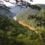
If you want a unique and personal perspective on the New River Gorge Bridge, you really need to take the Fayette Station Road from one side of New River Gorge to the other. This was the road – the only road – that everyone used to cross the gorge before the New River Gorge Bridge was built in 1977. Today, it’s a very scenic (if very steep) drive with several opportunities to get out and walk (three trails also have trailheads along the road – Kaymoor Trail, Fayetteville Trail, and Bridge Trail).
Quick Stats
The Fayette Station Road was built in 1909 under the name of Gentry Road. It gave access to up to 13 different mining towns between the late 1800s and the 1950s, including Fayette and South Fayette (the road still passes these old mining town sites at river level). Before 1977, anyone wishing to cross the gorge had to take the 45-minute trek along hairpin curves and steep grades. Today, if you’re in a hurry, you can take the New River Gorge Bridge – with a travel time of about 45 seconds.

If you want to drive the road, realize that the steep grades and sharp corners mean that RVs and large vehicles aren’t a good idea. Trailers are also discouraged due to low ground clearance while crossing the railroad tracks. Added to this, the bridge at the bottom can only accommodate vehicles under 12ft. tall. I did it in my Ford E-150 van and was just fine… though we went plenty slow on our way up the other side of the gorge!

Much of the road is one-way, so you’ll need to start at the New River Gorge Visitor Center. Turn right out of the visitor center and then take another sharp right a quarter mile later (signs point toward Fayette Station – follow these signs). At the stop sign a quarter mile later, take another very sharp right turn. Breathe a sign of relief; you’re done with intersections for a while.

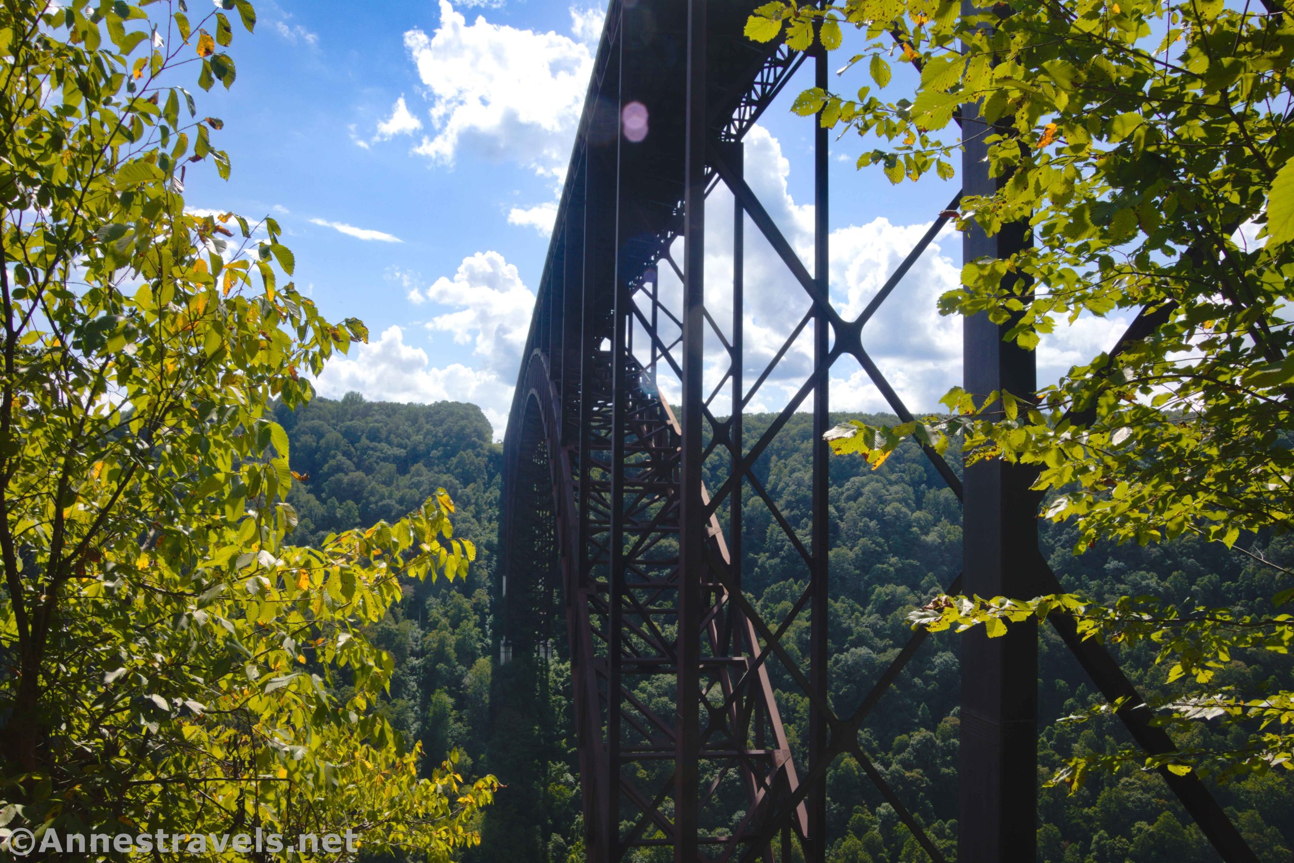
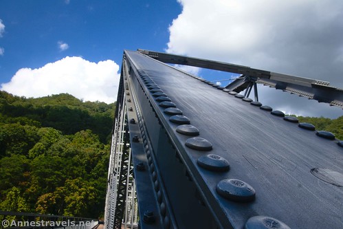
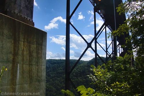
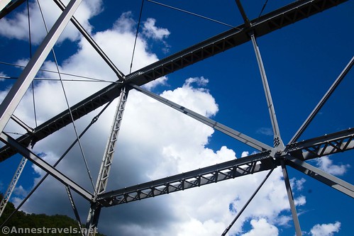
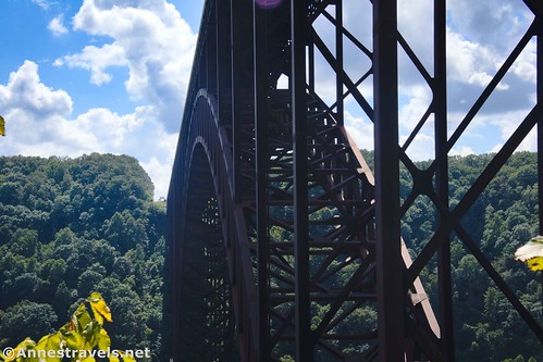
The road goes steeply downhill after this through the forest. It feels a bit like you’re on the edge of the cliff here, and you are! Pass a pulloff with information signs after 0.4 miles; you may wish to stop here and walk down under the New River Gorge Bridge (there is another pulloff after the bridge, so if you miss it, you’ll just have to walk back uphill… no big deal). It’s quite something to stand underneath the bridge!

After another 0.6 miles, you’ll come to Burma Road on a hairpin turn. If you’ve seen enough, you can go straight here and then turn right to get back to US-19. But to continue down to the bottom of the gorge, turn sharply left to continue descending. You’ll finally hit the bottom of the gorge about a mile later.

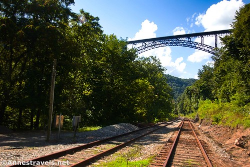
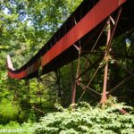
At long last, the road turns right to cross the railroad tracks. This railroad was built in 1873 by the Chesapeake & Ohio Railway, opening up the rugged West Virginian mountains to the rest of the US and allowing rich resources like coal and coke to find their way to market. Crossing the tracks, you’ll get your first good view of the side of New River Gorge Bridge. Do NOT stop in this section – I’ll tell you how to safely get good views in just a moment.
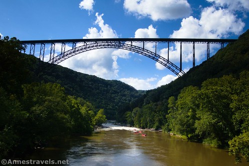
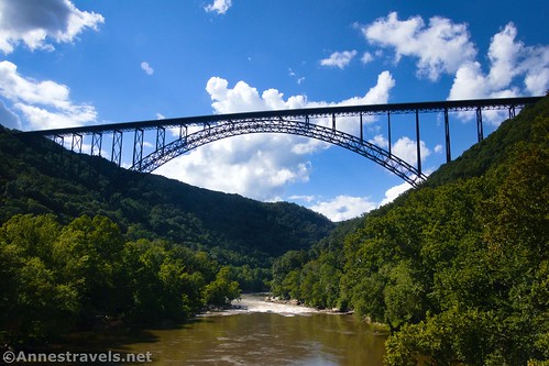
Almost immediately after crossing the tracks, the road crosses the New River via the Tunney Hunsaker Bridge (Fayette Station Bridge). A single-lane truss bridge that is 279ft. long, the bridge was built in 1889 by the Virginia Bridge and Iron Company of Roanoke, Virginia. It was named for Tunney Hunsaker, a boxer and the youngest chief of police in West Virginia when he served up in Fayetteville.

Tunney is best remembered as the first professional opponent of Muhammad Ali – Tunney would later say, “[Ali] was as fast as lightning… I tried every trick and knew to throw at him off balance but he was just too good.” Ali remembered the event quite differently; along the lines of, “Hunsaker’s style was far different from what I was used to. I was nervous; and Hunsaker’s pro style gave me trouble throughout the match.” The two remained friends for many years.

After the bridge, the road heads downstream before passing under a train bridge under a second set of railroad tracks. Just before the railroad bridge, turn right and then take another quick right into a parking area. Nearby, Wolf Creek cascades down rocks in a pretty falls that’s difficult to capture in a picture.

From here, you can walk back up the road to the Tunney Hunsaker Bridge. There are pedestrian walkways on either side of the bridge, so you can safely walk across it, pausing to take photos along the way.

I highly recommend this. It’s a great way to get views of the New River, New River Gorge, and New River Gorge Bridge (which, by the way, is the world’s longest single-span arch bridge outside of China (which has a whopping four such bridges that are longer)).
After enjoying the view, continue up the road by passing under the railroad track via the route under the railroad bridge. Pass by the Kaymoor Trailhead 1.2 miles beyond the bridge (it’s on the end of a switchback – the very steep trail with many stairs descends to the remains of an old mining town).

The road passes under the New River Gorge Bridge without fanfare 0.6 miles later and continues up another 2.2 miles to an intersection (with a light) at US-19 in Fayetteville. The morning after extremely heavy rain, a sweet little waterfall could be seen along the road in this section.

And from there, if you want to return to the visitor center, all you have to do is turn left to cross the New River Gorge Bridge, then make a right… and what took you 30-60 minutes will be bypassed in about 2 minutes!

One Way Road Length: 6.9 miles from the visitor center to the crossroad with US-19
Elevation Gain: 709ft. down, 928ft. up (912ft. to 1,719ft.)
Facilities: Restrooms and visitor services at the visitor center; river access near where you park at the bottom of the gorge; food, gas, and much more in Fayetteville at the end of the road
Fees: None

Road Notes: Don’t try this with an RV, a trailer, a large vehicle (bigger than a pickup truck), or any vehicle over 12ft. high. Be sure you have good breaks, and you might even want to use a lower gear on your vehicle while descending. The road is one-way from the visitor center to Fayetteville. Take your time and watch for pedestrians and cyclists.
Road 
![]()
Signs ![]()
Scenery ![]()
![]()
Would I go 100 miles out of my way for this? ![]()
![]()
Overall Rating: 
![]()
GPS Coordinates for Fayette Station Road
Turn right out of visitor center: 38.0717780°, -081.0749740° (38°04.30668′, -081°04.49844′ / 38°04’18.4008″, -081°04’29.9064″) (0.0)
Turn right: 38.0702410°, -081.0728150° (38°04.21446′, -081°04.36890′ / 38°04’12.8676″, -081°04’22.1340″) (0.2)
Turn right: 38.0683410°, -081.0733490° (38°04.10046′, -081°04.40094′ / 38°04’06.0276″, -081°04’24.0564″) (0.4)
New River Gorge Bridge: 38.0706190°, -081.0793150° (38°04.23714′, -081°04.75890′ / 38°04’14.2284″, -081°04’45.5340″) (0.8)
Burma Road (turn left): 38.0780630°, -081.0805800° (38°04.68378′, -081°04.83480′ / 38°04’41.0268″, -081°04’50.0880″) (1.4)

Tunney Husaker Bridge: 38.0648960°, -081.0770300° (38°03.89376′, -081°04.62180′ / 38°03’53.6256″, -081°04’37.3080″) (2.6)
Parking for walk to bridge: 38.0655990°, -081.0794010° (38°03.93594′, -081°04.76406′ / 38°03’56.1564″, -081°04’45.8436″) (2.8)
Kaymoore Trailhead: 38.0595340°, -081.0804920° (38°03.57204′, -081°04.82952′ / 38°03’34.3224″, -081°04’49.7712″) (3.8)
New River Gorge Bridge (again): 38.0673610°, -081.0856450° (38°04.04166′, -081°05.13870′ / 38°04’02.4996″, -081°05’08.3220″) (4.4)
US-19 in Fayetteville: 38.0609570°, -081.0985350° (38°03.65742′, -081°05.91210′ / 38°03’39.4452″, -081°05’54.7260″) (6.6)
The gpx file for Fayette Station Road can be downloaded – please note that this and the GPS Coordinates are for reference only and should not be used as a sole resource when hiking this trail.
Download GPX File size: 70.5 KB Downloaded 434 times
(Note: I do my best to ensure that all downloads, the webpage, etc. are virus-free and accurate; however, I cannot be held responsible for any damage that might result, including but not limited to loss of data, damages to hardware, harm to users, from use of files, information, etc. from this website. Thanks!)
Getting to Fayette Station Road
The route begins at the Canyon Rim Visitor Center, across the New River Gorge Bridge from Fayetteville.
For a map of the route, visit https://npmaps.com/wp-content/uploads/new-river-gorge-fayette-station-tour-map.pdf

Today’s Featured Product!
Go for the strolls and easy hikes in New River Gorge with this guide. It showcases some of the area’s best scenery and attractions along these easy routes. Buy your copy here!

More Related Posts:
 How to Visit the Deception Pass Bridge for Free
 Exploring the History of Nuttallburg
 Great Allegheny Passage: Salisbury Viaduct to the Mason-Dixon Line
 Genesee Riverway – Ontario Beach Park, Turning Point Park, & Maplewood Park
 French Cabin in the Maze District
 Canyon Rim Boardwalk Trail above New River Gorge