
I wrote in another post about ascending Little Wildhorse Canyon in Utah’s San Rafael Swell. It’s a great canyon experience, with dryfalls, sculpted walls, rock formations, and more to explore. Most people (myself included) opt to do the hike as a loop, descending via Bell Canyon. Besides all the benefits of a loop, the hike between the two canyons is quite scenic, and Bell is definitely easier than Little Wildhorse, so it’s a loop worth doing!
Quick Stats

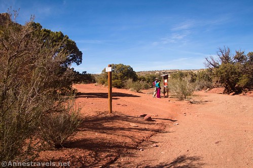
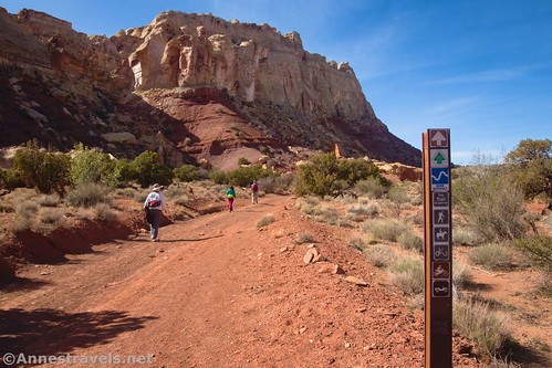
From where Little Wildhorse Wash crosses Behind the Reef Road, you want to turn left on the road. There is a sign kiosk here as well as a small sign pointing left toward Bell Canyon, so it’s easy to find.
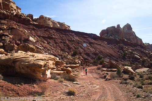
The road is definitely used, so be wary of vehicles. But at least when I visited on a weekday in early November, it wasn’t busy. (I’d imagine Spring Break would be worse.) One of the first things you’ll notice (even though it’s the other direction down the road) is an impressive formation known as Queen Hatshepsut, named for a famous queen of Egypt. (She was nicknamed “His Majesty, Herself” and is considered Egypt’s only successful female pharaoh (Cleopatra doesn’t count?).)

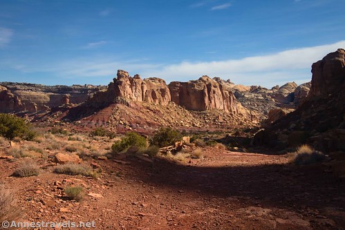
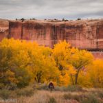
But back to walking in the correct direction down the road, the route starts out quite pleasantly, with cliffs ahead and Queen Hatshepsut behind. The views continue to be quite scenic as the road climbs to a high point and then steeply descends (one more reason not to do this hike in the opposite direction – the hike up the road would be pretty brutal, especially on a warm day). Views down into the upper reaches of Bell Canyon are especially nice.

The route finally drops down into Bell Canyon Wash about mile 7. A tenth of a mile later, the trail leaves the road when the road climbs out of the wash to continue its trek behind the San Rafael Reef.
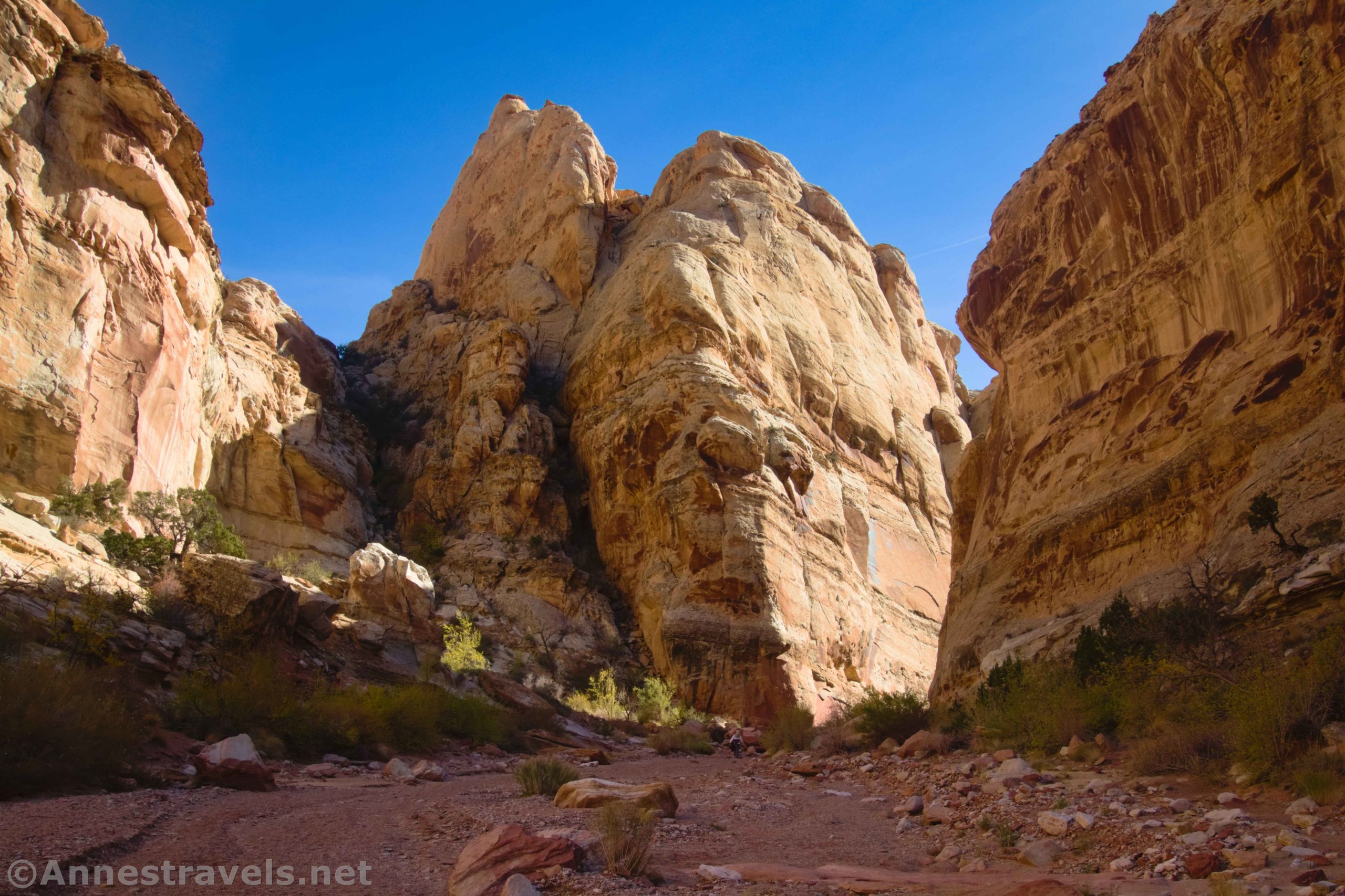
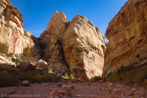
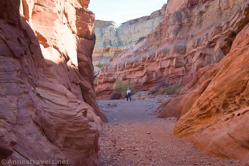
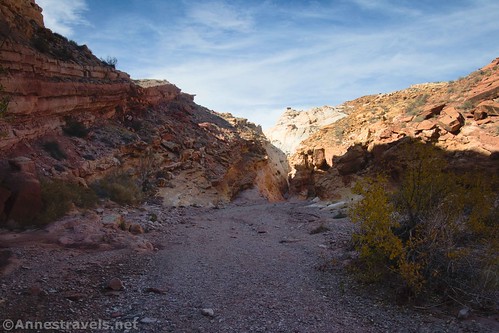
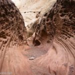
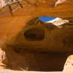
Almost immediately after this, you’ll enter the cool shadows of Bell Canyon. There are some nice rocks, cliffs, and sculptured walls; however, the route is never terribly narrow. There are a few small dryfalls to scramble, but nothing on the scale of Little Wildhorse Canyon.
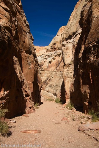
About mile 7.7, the route encounters a dryfall and then eventually enters narrows, which end about mile 9.3.

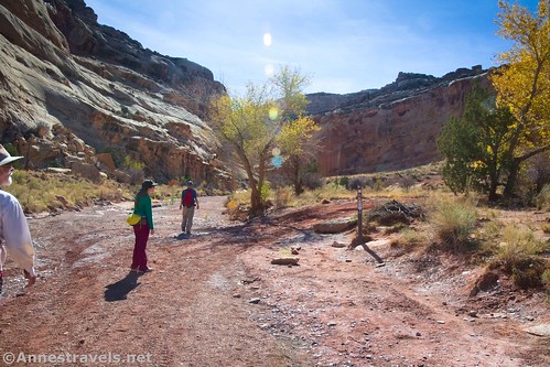
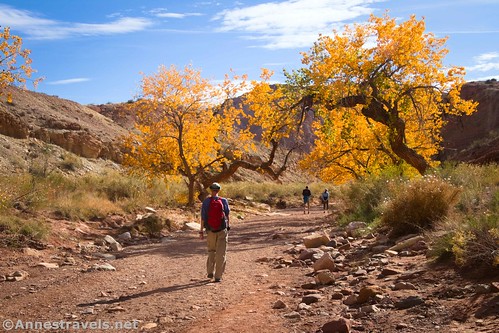
The canyon widens after this, and before I was expecting it – only about a tenth of a mile below the narrows – Bell Canyon suddenly empties into Little Wildhorse Canyon at the junction just above the dryfall bypass.
Continue downcanyon, over the bypass, and back to the parking lot for a great 10-mile hike!

Round Trip Trail Length: 10.0 miles as the loop with Little Wildhorse Canyon; if you wanted to do Bell Canyon as an out & back, it would be about 6 miles
Elevation Gain: 755ft. (4,955ft. to 5,674ft.) (Note that my GPX file thinks it’s quite a bit more elevation gain due to losing signal a few times in the narrow canyons.)
Facilities: Primitive restrooms at the Little Wildhorse Trailhead
Fees: None at this point. However, they seem to be instituting fees and shifting land ownership between federal/state in various places in the immediate area; I’m hopeful that this will stay free for the foreseeable future.
Trail Notes: There’s no question that Bell Canyon is not quite as scenic as Little Wildhorse Canyon. There’s also little doubt that both canyons are nicer hiking upcanyon than downcanyon! So I definitely recommend going up Little Wildhorse and down Bell, though if you prefer descending dryfalls, you should do the loop in the other direction. The rocks tend to radiate chill; this is great in the summer and not so awesome when it’s freezing outside! Remember to never, ever enter a slot canyon if there is rain in the forecast anywhere in the vicinity.
Trail 
![]()
![]()
![]()
Road ![]()
Signs ![]()
Scenery ![]()
Would I go 100 miles out of my way for this? ![]()
![]()
Overall Rating: 
![]()
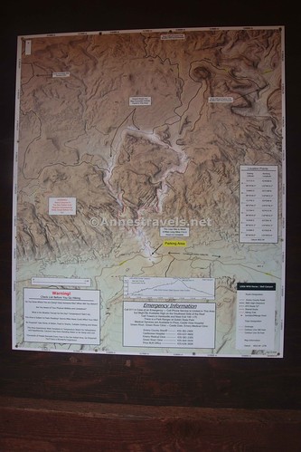
GPS Coordinates for Little Wildhorse Canyon
TH: 38.5830480°, -110.8028690° (38°34.98288′, -110°48.17214′ / 38°34’58.9728″, -110°48’10.3284″) (4,964ft.)
Enter wash: 38.5845580°, -110.8037910° (38°35.07348′, -110°48.22746′ / 38°35’04.4088″, -110°48’13.6476″) (4,964ft.) (0.12)
Puddle/scramble: 38.5886890°, -110.8058030° (38°35.32134′, -110°48.34818′ / 38°35’19.2804″, -110°48’20.8908″) (5,002ft.) (0.49)

Bell Canyon Junction: 38.5889430°, -110.8065730° (38°35.33658′, -110°48.39438′ / 38°35’20.1948″, -110°48’23.6628″) (5,044ft.) (0.62)
Narrows: 38.5929090°, -110.8071390° (38°35.57454′, -110°48.42834′ / 38°35’34.4724″, -110°48’25.7004″) (5,066ft.) (1.09)
Exit Narrows: 38.5942730°, -110.8074200° (38°35.65638′, -110°48.44520′ / 38°35’39.3828″, -110°48’26.7120″) (5,076ft.) (1.29)

Narrows: 38.5947110°, -110.8073040° (38°35.68266′, -110°48.43824′ / 38°35’40.9596″, -110°48’26.2944″) (5,075ft.) (1.36)
Exit Narrows: 38.5973760°, -110.8007060° (38°35.84256′, -110°48.04236′ / 38°35’50.5536″, -110°48’02.5416″) (5,287ft.) (2.51)
Narrows: 38.6028090°, -110.7986760° (38°36.16854′, -110°47.92056′ / 38°36’10.1124″, -110°47’55.2336″) (5,237ft.) (3.4)

Dryfall: 38.6060750°, -110.7957200° (38°36.36450′, -110°47.74320′ / 38°36’21.8700″, -110°47’44.5920″) (5,349ft.) (3.99)
Wash Junction: 38.6116050°, -110.7950340° (38°36.69630′, -110°47.70204′ / 38°36’41.7780″, -110°47’42.1224″) (5,431ft.) (4.87)
Behind the Reef Road: 38.6154130°, -110.8027650° (38°36.92478′, -110°48.16590′ / 38°36’55.4868″, -110°48’09.9540″) (5,503ft.) (5.48)

Bell Wash: 38.6063140°, -110.8170330° (38°36.37884′, -110°49.02198′ / 38°36’22.7304″, -110°49’01.3188″) (5,321ft.) (6.97)
Leave Road: 38.6059690°, -110.8171550° (38°36.35814′, -110°49.02930′ / 38°36’21.4884″, -110°49’01.7580″) (5,322ft.) (7.11)
1st Dryfall: 38.5995430°, -110.8152590° (38°35.97258′, -110°48.91554′ / 38°35’58.3548″, -110°48’54.9324″) (5,256ft.) (7.72)

End Narrows: 38.5886320°, -110.8081720° (38°35.31792′, -110°48.49032′ / 38°35’19.0752″, -110°48’29.4192″) (5,068ft.) (9.30)
Reurn to Little Wildhorse Canyon Junction: 38.5888910°, -110.8065650° (38°35.33346′, -110°48.39390′ / 38°35’20.0076″, -110°48’23.6340″) (5,051ft.) (9.44)
End: 38.5830640°, -110.8029000° (38°34.98384′, -110°48.17400′ / 38°34’59.0304″, -110°48’10.4400″) (4,964ft.) (10.04)
The gpx file for Little Wildhorse Canyon/Bell Canyon Loop can be downloaded – please note that this and the GPS Coordinates are for reference only and should not be used as a sole resource when hiking this trail.
Download GPX File size: 145.7 KB Downloaded 446 times
(Note: I do my best to ensure that all downloads, the webpage, etc. are virus-free and accurate; however, I cannot be held responsible for any damage that might result, including but not limited to loss of data, damages to hardware, harm to users, from use of files, information, etc. from this website. Thanks!)
Getting to Little Wildhorse Canyon Trailhead
From I-70, take Exit 149 west of Green River to UT-24. Head south on UT-24. After 24.1 miles, turn right onto Temple Mountain Road (signed for Goblin Valley State Park). About 5.2 miles later, turn left to continue on the paved road, following the sign for Goblin Valley State Park (there will probably be a sign near here welcoming you to Goblin Valley State Park at some point in the future – land shifts after my visit made this part of the road in the state park). Drive 6.1 miles and turn right onto Wild Horse Road for 5.4 miles (note that many blogs will tell you this is an unpaved road; as of November 2021, the road was freshly paved). Just after crossing the wash, turn right into the parking area for Little Wildhorse Canyon.
From Hanksville, UT, drive north on UT-24. After 19.6 miles, turn left onto Temple Mountain Road (there should be a sign for Goblin Valley State Park, but it may only show the other direction… there is a fair-sized gravel parking area at this junction). About 5.2 miles later, turn left to continue on the paved road, following the sign for Goblin Valley State Park (there will probably be a sign near here welcoming you to Goblin Valley State Park at some point in the future – land shifts after my visit made this part of the road in the state park). Drive 6.1 miles and turn right onto Wild Horse Road for 5.4 miles (note that many blogs will tell you this is an unpaved road; as of November 2021, the road was freshly paved). Just after crossing the wash, turn right into the parking area for Little Wildhorse Canyon.

Today’s Featured Product!
If you’re looking for an all-encompassing guide to the San Rafael Swell, this is a good one! Filled with destinations, history, photos, and much more, it’s a great guide. Buy your copy here!


2 responses to “Bell Canyon & Finishing the Little Wildhorse Canyon Loop”
[…] the entirety of Little Wildhorse Canyon (you don’t need to do the entire thing to see cool stuff) tack on Bell Canyon as a lollipop loop. I did this, too; just realize that Little Wildhorse is much more interesting and more difficult […]
[…] figured we might as well do the most famous of all of the slot canyons in the San Rafael Swell: The Little Wildhorse-Bell Canyon Loop. It was such fun, and I definitely recommend doing Little Wildhorse Canyon first… otherwise, […]