
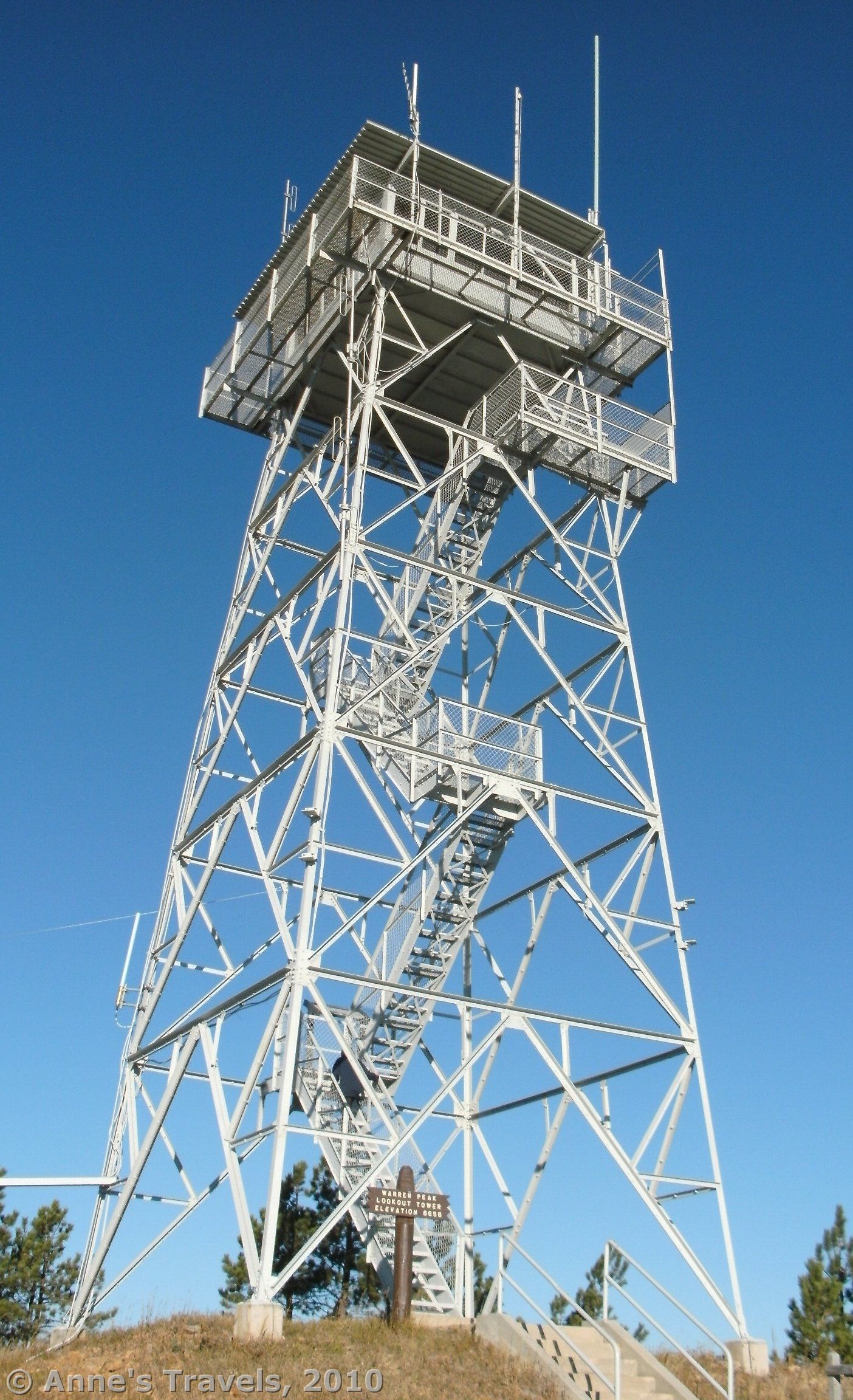

When researching Warren Peak in Wyoming, I read two different accounts, one that said the trail was 13 miles long, the other which said the trail was 6 miles long. Either they were talking about a different Warren Peak, or they didn’t know what they were talking about, because the Warren Peak in northeastern Wyoming you can drive to the top of. There was no hiking required; you could stay in your car and look at the view if you wanted to. However, I would highly recommend getting out of your car, at least long enough to climb up the fire tower. Those who do are rewarded with awesome views of the surrounding countryside (mostly national forest, so there’s a lot of wilderness) as well as a great look at Devil’s Tower, the Little Missouri Buttes, and even across the boarder into South Dakota.
(Affiliate links are present on this page.)

To get to Warren Peak, from the “town” of Sundance take I-90 west to exit 185 (the same as for Devil’s Tower). Then go northwest on Hwy 14 to a little road on your right called Warren Peak Road. It is also marked as Rd 838, although on my map its numbers are, at different points along the road, 208 and 100. Follow this paved road as it enters the national forest, and winds its way uphill through a forest. Eventually, you will come out of the trees and into an open section on the top of a hill. You should be able to see the fire tower on top of the peak from here. Not long after this is a brown sign that points the way up a dirt side road and reads “Warren Peak”. Take this short road to the top of the peak and the base of the fire tower.

You can also get to Warren Peak from the north and Hwy 24, but it is a maze of unpaved roads through the national forest. The numbers don’t line up with the numbers on my map, so I’m afraid I can’t be much help getting there from Hwy 24. However, if you have a good map, you could probably do it without much difficulty.

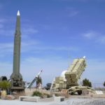
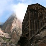
In the parking area is a primitive toilet and a sign that identifies the peaks you can see from there. The views from here are awesome, but to get even better views of the surrounding country, you will have to climb up the tower. You cannot get to the top deck (or at least we couldn’t the day we visited), but there are several other viewing platforms. A sign part way up tells about the world’s only nuclear radar station, located on the next hill, which operated during the 1960s. Apparently, there were a lot of missile silos in this area (such as the Minuteman Missile), so the US wanted to know immediately if the USSR was trying to get rid of our nukes. Unfortunately, the radar station is not open to the public.

The fire tower itself is medal, and steps lead up to the viewing platforms. Be careful on the stairs; they are uneven, and I (who am fairly surefooted) tripped several times while climbing. Also, this may not be for the faint of heart, as you can look right through the stairs to the ground below. This didn’t bother any of us, even though several of us don’t particularly like heights, but it’s worth noting. We did enjoy looking up at the others on the viewing platforms above us—they looked like they were walking on air!

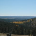
As I said before, the views from the top are awe-inspiring. They were especially nice when we were there on a morning in early October because the aspens were in color. However, at almost any time of the year, you can see Cement Ridge, among other peaks, to the southeast, more peaks (I’m sorry I don’t know the names) to the north, and to the west, Devil’s Tower and the Little Missouri Buttes. You can also look at the former site of the radar station, which is still government property.

After you descend the peak, you can continue along the paved road up to the old radar station. A plaque here explains about the nuclear power plant that was once on the site. You can’t enter the actual grounds, but if you go a little farther along the dirt road (at the bottom of the road that leads up to the old radar station), an ATV road goes off not long after the fence. I wouldn’t recommend this road for any vehicle except those like ATVs that are meant for rough roads, but you can walk it to the top of the hill for more great views of Devil’s Tower and the surrounding area. This was also especially nice when the aspen were in color.
Fees: None
Trail 
![]()
Road ![]()
Signs ![]()
Scenery
Overall Rating: 
This Week’s Featured Product!
With more than 50 hikes, this guide is a great place to start for planning hikes in the Black Hills.

3 responses to “Wyoming’s Black Hills Fire Tower: Warren Peak”
[…] We found several hikes/views (including the Red Beds Trail in Devil’s Tower National Monument, Warren Peak, Cement Ridge, Spearfish Canyon, and the Castle Trail in Badlands National Park), which saved the […]
[…] driving to California because the weather was so bad in New Mexico, and another time ending up in Wyoming and South Dakota because the weather wasn’t cooperating on Mt. Baker – another time we […]
[…] – it’s often an outcome of being in the area and on a whim stopping by (like the Flume Trail or Warren Peak, both in Wyoming). Other times we do go out of our way to see historical sites, especially if […]