
On a sunny December afternoon, a group member and I decided to take a hike. Being December, 1pm meant the sun was already low in the sky, but at least it was sunny! We ended up visiting Channing H. Philbrick Park (formerly Linear Park), a lovely little local hike along Irondequoit Creek. At times, there can be plenty of families walking and people fishing, but it was a little cold for that, so we saw almost no one. We also went waterfall-chasing, and did find it – though we searched much harder than necessary for the falls.
Quick Stats

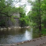
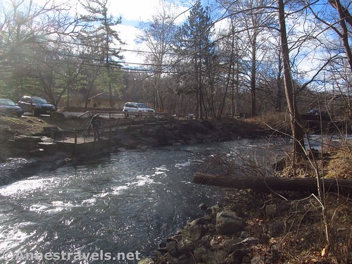
The parking area is down a side-road off of the very busy Rt. 441 (and yes, you can hear the traffic at times). There is space for a few cars to park on this side of the bridge (which is for pedestrians only). Views of the river from the parking area are pretty good.

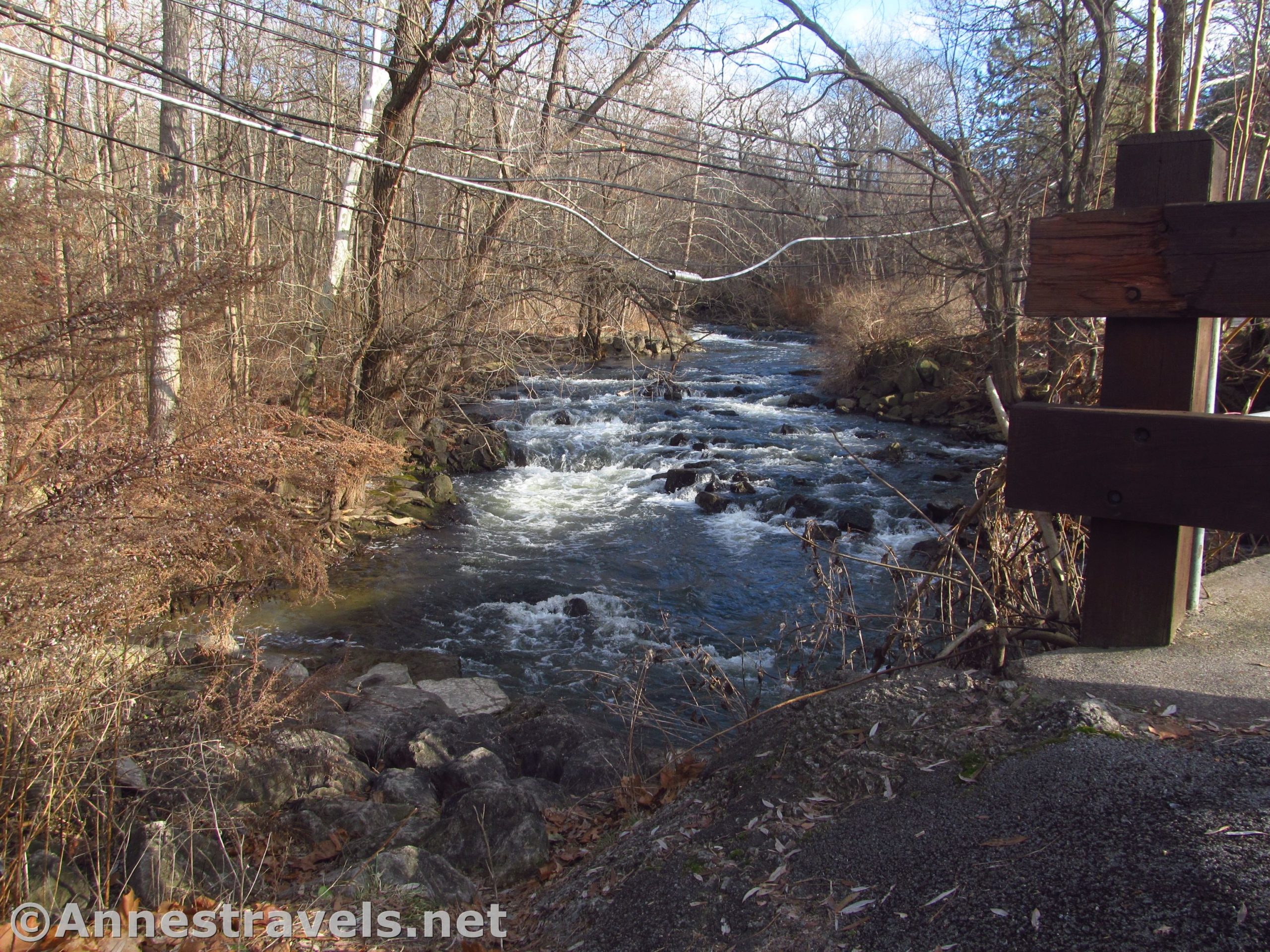
We started down the trail, enjoying the creek (no swimming allowed) and the sunshine – which is at a premium this time of year. There are a few concrete platforms for fishing as well as a few small waterfalls.
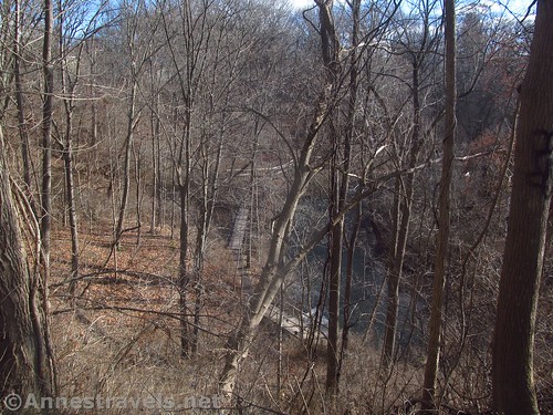
We hiked up to the Honey Creek Trail Junction and turned left up the trail. It’s steep enough, though the Overlook Trail might have been even steeper (we turned right on the Overlook Trail, marked in red). The overlook doesn’t have that great a view, but there are some views along the trail down to the creek.
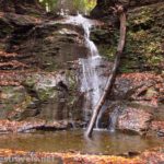
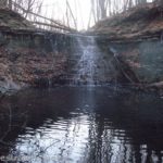
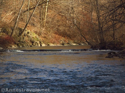
We reintersected the Honey Creek Trail and turned left. I’d heard that there was a waterfall nearby on Honey Creek, so instead of following the Honey Creek Trail, we struck off heading in the general direction of the coordinates. They led us through some people’s backyards (oops!) and finally down to a drainage that channels Honey Creek down to Irondequoit Creek. As it turns out, Honey Falls is right along the main trail; we came from the top which is much longer and harder.

So if you want to easily access the falls, as soon as you cross over a very small feeder creek (aka Honey Creek), turn left and walk up the social path. You’ll see the waterfall (mostly just over concrete; better after a lot of rain) shortly. If you end up in someone’s backyard, you’ve gone too far.

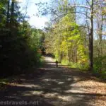
Since we were basically back to the main trail anyway, we scrambled the rest of the way down the social path and turned left on the main path. We passed the Honey Creek Trail Junction for a second time and continued along the trail along Irondequoit Creek.

The trail crosses several bridges and continues upstream about another 0.5 miles. Not as many people use this part of the trail – parts of it are not very close to the creek. But the Boy Scouts have put in some bridges to cross some of the muddier sections and the stream views at the end of the path are pretty good. So if you like a (mostly) peaceful walk in the forest, this isn’t too long or difficult.

We returned via the main trail and ended our hike about 2.1 miles. It’s not long, but if you’re just looking for a little stroll with some waterfalls and a creek, Philbrick Park is definitely a good one!

Round Trip Trail Length: About 1.6 miles on the main trail from the parking area to the end and back (seeing Honey Falls on the way)
Elevation gain: On the main trail – about 20ft though it feels less. If you go up the Honey Creek Trail, you’ll be climbing about 60ft.
Facilities: Possibly a port-a-potty at the trailhead. Playground and picnic tables nearby (across the creek).
Fees: None
Trail Notes: I hear the trail is pretty overrun on nice weekends. Unless you’re looking for a workout, I recommend just staying on the main path. There are other trails in the park if you want to check them out.

Trail 
![]()
![]()
Road ![]()
Signs ![]()
![]()
Scenery ![]()
![]()
![]()
Would I go 100 miles out of my way for this? ![]()
![]()
![]()
![]()
Overall Rating: 
![]()
![]()

Philbrick Park GPS Coordinates
Trailhead: 43.1274333°, -077.4847000° (N43° 07.646′ W77° 29.082′ / 43°07’38.7600″, -077°29’04.9200″) (321ft.) (0.0) (end 2.13)
Honey Creek Trail Junction: 43.1266333°, -077.4810000° (N43° 07.598′ W77° 28.860′ / 43°07’35.8800″, -077°28’51.6000″) (327ft.) (0.26)
Red Trail Junction: 43.1272500°, -077.4812333° (N43° 07.635′ W77° 28.874′ / 43°07’38.1000″, -077°28’52.4400″) (351ft.) (0.32)
Overlook: 43.1271167°, -077.4803167° (N43° 07.627′ W77° 28.819′ / 43°07’37.6200″, -077°28’49.1400″) (398ft.) (0.38)
Honey Creek Trail Junction: 43.1275167°, -077.4800500° (N43° 07.651′ W77° 28.803′ / 43°07’39.0600″, -077°28’48.1800″) (401ft.) (0.42)

We left the trail: 43.1276167°, -077.4809000° (N43° 07.657′ W77° 28.854′ / 43°07’39.4200″, -077°28’51.2400″) (397ft.) (0.47)
Honey Creek Falls: 43.1277500°, -077.4822833° (N43° 07.665′ W77° 28.937′ / 43°07’39.9000″, -077°28’56.2200″) (346ft.) (0.63)
Return to the main trail: 43.1274500°, -077.4826000° (N43° 07.647′ W77° 28.956′ / 43°07’38.8200″, -077°28’57.3600″) (329ft.) (0.71)
East end of main trail: 43.1224500°, -077.4778500° (N43° 07.347′ W77° 28.671′ / 43°07’20.8200″, -077°28’40.2600″) (343ft.) (1.35)
The gpx file for my hike in Philbrick Park can be downloaded – please note that this and the GPS Coordinates are for reference only and should not be used as a sole resource when hiking this trail.
File size: 38.4 KB Downloaded 0 times
(Note: I do my best to ensure that all downloads, the webpage, etc. are virus-free and accurate; however, I cannot be held responsible for any damage that might result, including but not limited to loss of data, damages to hardware, harm to users, from use of files, information, etc. from this website. Thanks!)

Getting to Philbrick Park
From I-49, take Exit 23 to Lindon Avenue / NY-441. Turn east (right if coming from Victor, left if coming from I-590 and Rochester) and drive 2.3 miles to turn right down the dead-end road to the parking area by the closed bridge.

You can also come down 441 from the east – the turn (left – very difficult to cross traffic most times of the day) is 0.5 miles from 5 Mile Line Road.

Zoom map out to browse nearby hikes & places of interest
This Week’s Featured Product!
If you’re looking for more local hikes, this book offers 20 great walks and hikes in the Rochester area.