I posted a few weeks back about biking the rails to trails Ontario Pathways between Goose Street and Phelps, NY. After we’d loaded up all the bikes in Phelps (not to mention chowed down on the delicious lunch one of our group members had packed for us), we drove down to Pan Yann to explore another biking / hiking trail, the Keuka Outlet Trail.
Quick Stats for the Keuka Outlet Trail
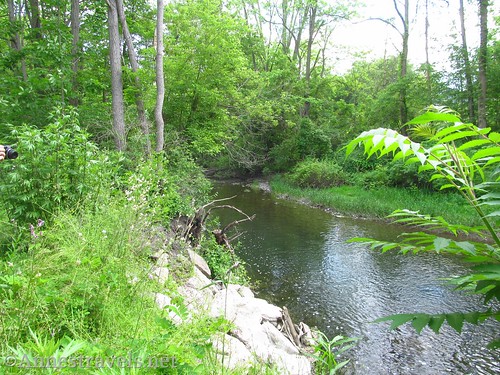
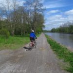
The trail has to be one of the most beautiful bike trails of all time. Not only does it follow a lovely little stream, but it passes by several outstanding waterfalls, a few meadows, forests, a train trestle or two, some old mill buildings, a historic land boundary, and generally is a pleasant, well-maintained ride – or walk – between Pan Yann and Dresden (New York, not Germany).
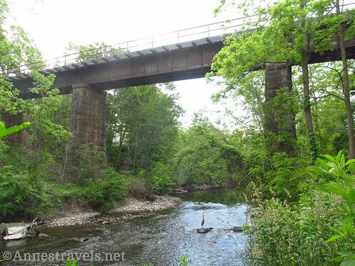
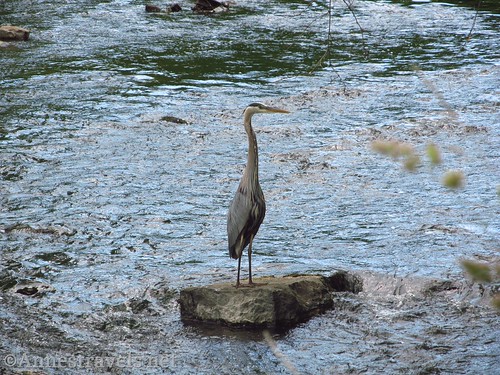
An old train trestle just east of Penn Yan. At one time, the tracks went north to Stanley Junction and south to Watkins Glen. Can you spot the Heron in the river?
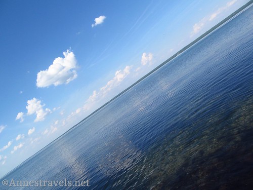
If you’re feeling like a few more views at the end of the trail, you can also bike or drive down to a tiny little park right on the shore of Seneca Lake, which is quite lovely!
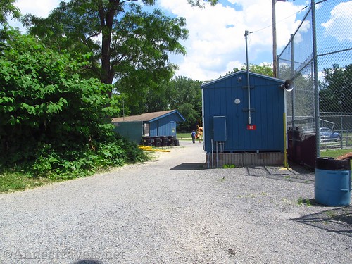
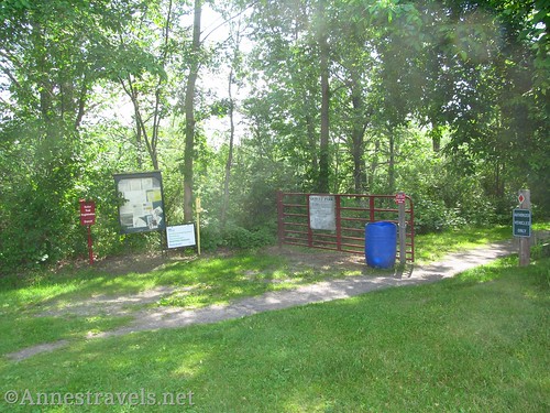
The trail begins near the buildings beside the baseball fields (sorry, no restrooms). It jogs along for a short time, then crosses another park – follow the signs. I’m afraid I got a bit confused in this area, and can’t really describe the trail, because we were weaving in and out and among and past a fairly large art festival! It was fun, and there were a lot of cool venders, but not really what I had in mind for the afternoon. The one really good thing was that there were port-a-pottis set up for the festival…
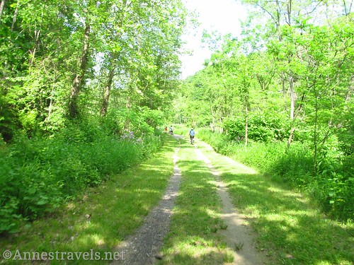
We finally passed the last of the vendors, and left the sounds of the crowds in the distance as we were able to mount our bikes (riding through all those people didn’t sound like a good idea) and continue down the gravel path through the woods. Passing under a train bridge, we spotted a great blue heron on the river.
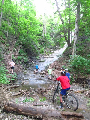
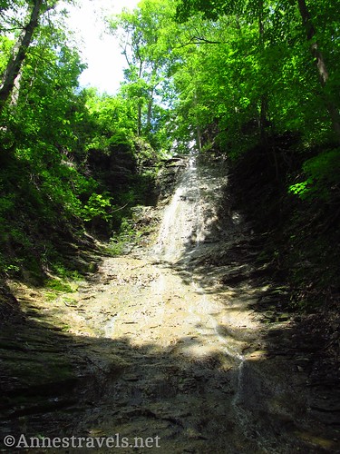
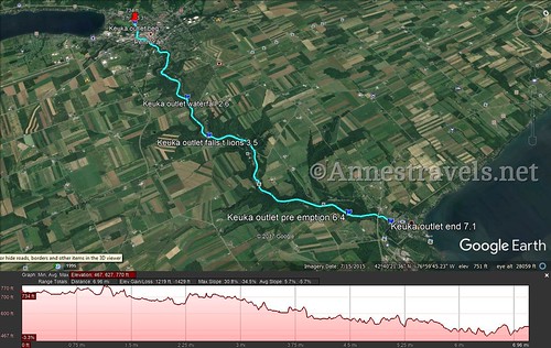
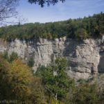
At mile 2.6, we could hear splashing to our left (the river is on the right), so we turned off the path. A beautiful waterfall tumbles down the slate ledges. You’ll probably have to climb the falls part way to get a good view. In June, the water wasn’t too high, and climbing was easy, though I suspect it could be more exciting after a heavy rain.
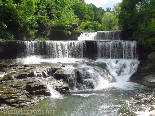
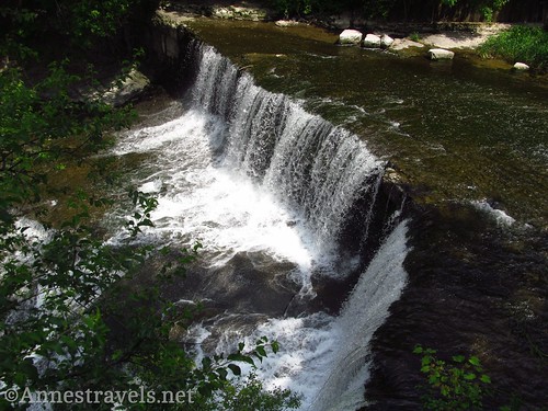
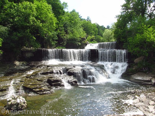
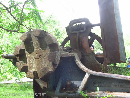
Continuing on our way, we passed the Lyons picnic shelter near mile 3.5. Here you really do need to take a break, not because of the shelter, but because nearby is a totally beautiful and outstanding waterfall. Mills once stood on both (?) sides of the river. Now all that’s left are a few gears and stone walls. I have read since that the waterfall is called “Cascade Mill Falls” or more often “Seneca Mills Falls”. Whatever the official name, they are beautiful!
View the falls from above, then go down the grassy slope to get a better view of the falls. Totally beautiful!
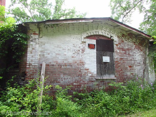
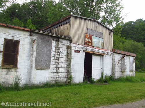
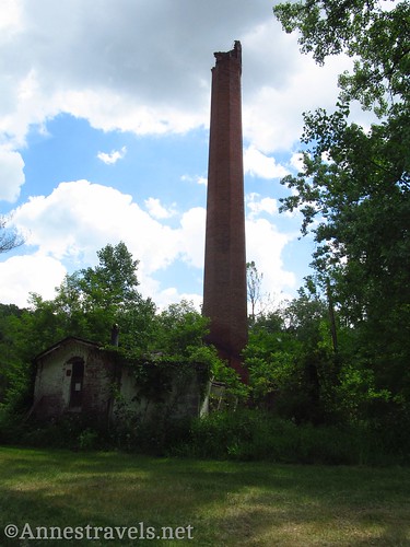
The trail reenters the woods for about 1.5 miles before passing by some old buildings, probably once part of a more modern-day mill. The place gave us the creeps, so we didn’t stay long. Apparently there is another waterfall here, but I didn’t check it out.
The next point of interest is about mile 6.4. A sign indicates the “Pre-emption Line” once marking the boundary between Massachusetts and New York. Inept assistants (or outright dishonesty) marked the line further west in 1788, but the line was corrected in 1792. The land between the two lines was then termed “The Gore”.
Now the trail passes through meadows and stands of trees as the ground rises around the river valley. Just before the end of the trail, the path rises steeply up to the town of Dresden.
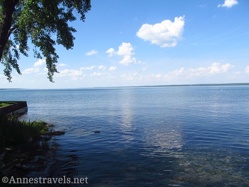
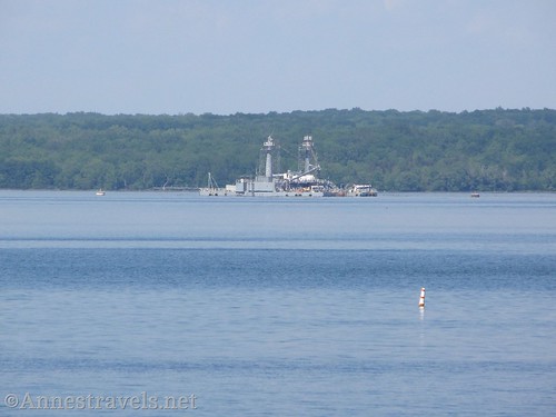
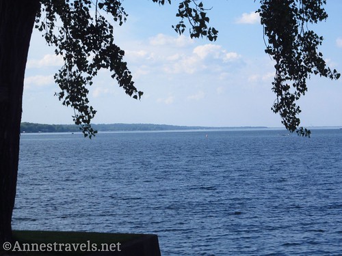
After loading up the bikes (a couple members of our party graciously drove the van for us, meeting us at the waterfalls for a nice hike before coming down to the end of the trail to pick us up), we drove down Seneca Street to Seneca Lake. A lovely little park allows you to see out over the lake to the barge that houses the Navy’s official testing site for all things nautical, not to mention just a really nice view over the lake in general!
Round Trip Trail Length: 7.1 mile shuttle from Pan Yann to Dresden. Add half mile to get down to the lake.
Net Elevation Change: 233ft. Most of the trail is a gentle downhill.
Fees: None
Facilities: None. We barely even saw port-a-pottis at any of the parking areas.
Trail Notes: There are multiple parking areas along the trail, so you can start in a variety of places to make your trail experience your own! Stay out of the old buildings and obey all signs. Don’t miss the waterfalls – they are what make the trail special.
Trail 


Road 


Signs 


Scenery 


Would I go 100 miles out of my way for this? 


Overall Rating: 


Key GPS Coordinates
Trail Beginning in Penn Yan: 42.6590639°N, -077.0628389°W (42°39’32.63″N, -77° 3’46.22″W / 42°39.54383′ N, -077°03.77033’W) (713ft.) (0.0)
Waterfall over the ledges: 42.6607694°N, -077.0207500°W (42°39’38.77″N, -77° 1’14.70″W / 42°39.64617′ N, -077°01.24500’W) (639ft.) (2.6)
Seneca Mills Falls: 42.6605472°N, -077.0043528°W (42°39’37.97″N, -77° 0’15.67″W / 42°39.63283′ N, -077°00.26117’W) (624ft.) (3.5)
Preemption line: 42.6754611°N, -076.9656944°W (42°40’31.66″N, -76°57’56.50″W / 42°40.52767’N, -076°57.94167’W) (480ft.) (6.4; Old Mill Site was at 5.1)
End in Dresden: 42.6809722°N, -076.9586806°W (42°40’51.50″N, -76°57’31.25″W / 42°40.85833’N, -076°57.52083’W) (519ft. (519ft.) (7.1)
The gpx file for the Keuka Outlet Trail can be downloaded – please note that this and the GPS Coordinates are for reference only and should not be used as a sole resource when hiking this trail.
Download GPX File size: 79.6 KB Downloaded 180 times
(Note: I do my best to ensure that all downloads, the webpage, etc. are virus-free and accurate; however, I cannot be held responsible for any damage that might result, including but not limited to loss of data, damages to hardware, harm to users, from use of files, information, etc. from this website. Thanks!)
Getting to the Keuka Outlet Trail
To get to the Pan Yann Trailhead:
From I-90, take Exit 42 toward Geneva and Lyons. Merge onto NY-14S (a right turn whether you’re coming from the east or west). After 1.3 miles turn right onto Cross Road and drive 1.8 miles. Turn left onto Pre Emption Road for 18.3 miles, then turn right onto NY-54W. After 1.7 miles, turn right onto Elm Street. The parking area will be on the left after 0.5 miles.
Or from I-86, take Exit 40 toward Savona and NY-226. Turn right on NY-226N (left if coming from the north) and drive 7.7 miles. Turn left onto Rabbit Road for 0.3 mile, then right on Telegraph Road for 0.6 miles. The road changes names several times, keep going straight: W Lake Road (1.6 miles), Westlake Road (2.1 miles), W Wanetka Lk Road (0.6 miles), W Waneta Lake Road (2.8 miles), and Keuka Hill Road (0.6 miles). (Really, is this WNY politics, or does Google just have this confused?!?) Turn left onto NY-230 W for 1.3 miles, then take a slight right onto NY-54 N for 12.4 miles. Turn left onto Liberty Street and after 0.3 miles turn left on Elm Street. The parking area will be on the left after 0.4 miles.
To get to the Dresden Trailhead:
From I-90, take Exit 42 toward Geneva and Lyons. Merge onto NY-14S (a right turn whether you’re coming from the east or west). After 5.9 miles, turn right onto Seneca Street for 0.2 miles, then turn left onto S Main Street for 1.8 miles. Continue on NY-14S for another 11.4 miles to the town of Dresden. Turn left on Main Street for 200ft., then right on Seneca Street for 0.2 miles to the parking area, on right.
From I-86, take Exit 52A toward Watkins Glen and NY-14N; merge onto NY-14N. (If you’re coming from I-86E, this will be Exit 52B – just be sure to go north on NY-14). Drive 37.4 miles on NY-14N to the town of Dresden. Turn right on Main Street for 200ft., then right on Seneca Street to the parking area, on right, after 0.2 miles.
Zoom map out to browse nearby hikes & places of interest
This Week’s Featured Product!
If waterfalls are your thing, check out this book with 200 of the waterfalls in Western New York, from hidden gems to well-known cascades.

