

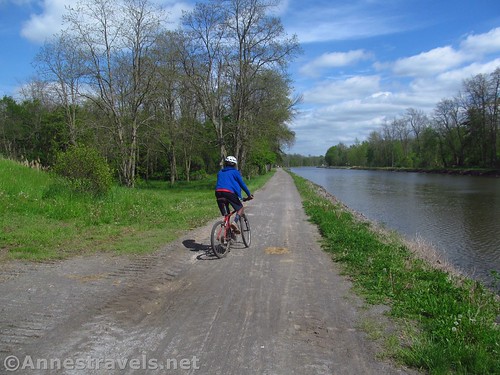
For Rochester locals, the Erie Canal Path is one of “the” places to go biking, running, and hiking. I even knew some kids who would hitch up their dog to a sled and go for a ride on the canal path in the winter (it was the highlight of that husky’s day to see the harness come out of the closet!) Every once in a while, I get to ride another portion of the Erie Canal Path on my bicycle – most recently, the section between Meridian Center Park in Brighton/Rochester and San Souci Park in Brockport.
Quick Stats
Note: Some of the links in this post are affiliate links. If you click one and purchase something, I may earn a small commission without an extra cost to you.
We parked near Meridian Center Park (actually, we parked in the office complex parking lot for reasons I won’t go into here – but suffice to say we had good reasons to be there). A path goes from the park or parking lot up to the canal path, which at this point is a good 10 or 20 feet above the parking lot level.
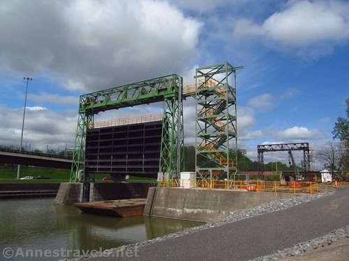
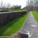
We turned right (west). We’d biked through this section once before after biking part of the Genesee Riverway, so it wasn’t new territory. The path goes along the canal and passes the guard locks that can be closed to keep the Genesee River from flooding the canal if the river gets too high. The guard locks are also closed in the winter when the canal is drained.
Directly after passing the guard locks, you’ll pass an old railway bridge on the left. This now carries the Lehigh Valley Trail over I-390 – post coming soon! Keep going straight on the canal path.

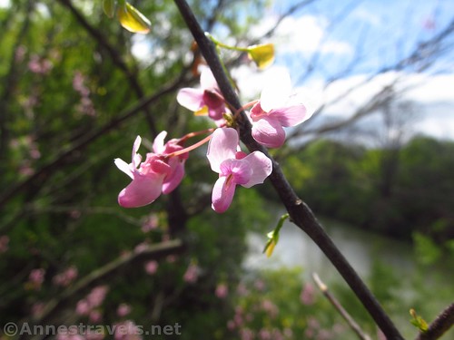
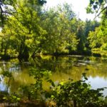
The next excitement is Genesee Valley Park. The park can have quite a few flowers and flowering trees in season. We were a little late for the flowering trees and a little early for the flowers since it had been a cool spring. Still, there were a few blooms around.
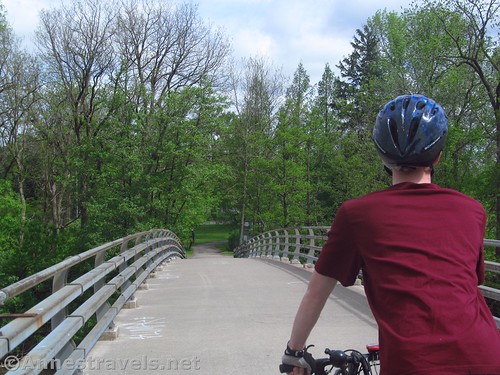
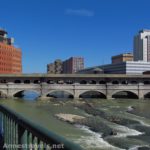
On the left, an old stone bridge crosses the canal. We biked up onto it just for the view, then we went back to the canal path and turned left to continue on the canal path, turned right on the Genesee Riverway, and turned left to cross the bridge over the Genesee River.
On the other side of the bridge, turn left to cross another stone bridge. It’s after this that things get a little bit tricky. You want the Canalway Trail (West) – the Riverway Trail goes south and the Greenway Trail (Genesee Valley Greenway – post coming soon!) also goes south from this junction. It is signed, but we ended up getting lost anyway under the I-390 bridges. There is a park under the bridges – some of the people there were normal enough looking; others seemed to be a bit seedy. At any rate, I was glad to get back onto the right trail and continue west.

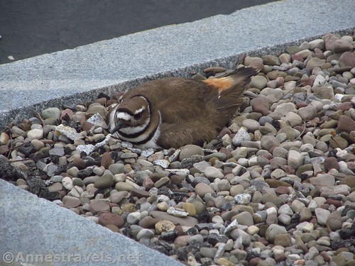
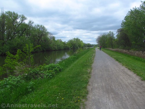
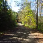
The next part of the Erie Canal Path was probably the worst part I’ve ever ridden on. The path itself had a good tread (much better than further west; more on that later). But the area itself wasn’t that nice. You’re going through not-quite-downtown Rochester, which in this case meant construction sites, rail yards, and low-income neighborhoods. It’s the only time I haven’t felt quite safe on the Erie Canal Path. Most of the people we met ignored our existence and went on fishing or biking or walking.
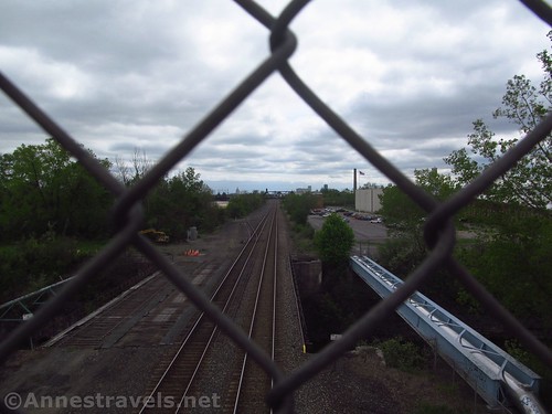
After crossing the CSX line via a bridge over what looks to be a rail yard, you’ll have to cross Buffalo Road, which is… exciting. There is a traffic light, but for a few minutes, we weren’t sure whether or not we’d make it across. The good news is that once you’re across that, the trail becomes more rural. Finally!
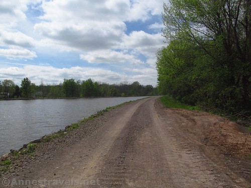
At 9.2 miles, cross under Long Pond Road, then take the exit (on the left) up off of the canal path and up to Long Pond Road. Turn left to cross over the bridge, then turn left again to take the entrance back down to the canal path on the opposite side of the canal. Turn right on the canal path – this will save you some gravel path and also save you from ending up in the middle of a neighborhood when the trail unexpectedly ends. After Henpeck Park at mile 11.25, the pavement ends and you’re riding on gravel (but it’s not too bad).

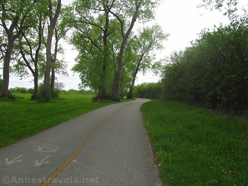
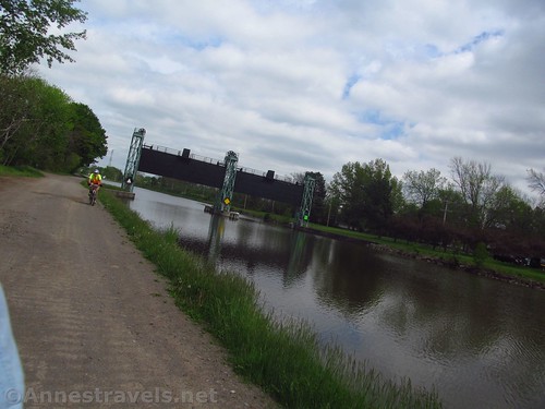
The scenery is pretty typical up to Gates and Spencerport about 15 miles from Meridian Center Park. Spencerport is a charming little town with a drawbridge over the canal. You’ll need to turn right for a short distance before you can cross the main road and get back on the Canal Path.

It was some time after this that we came to a portion of the path that was being renovated (it started maybe about mile 19 or mile 20.4). The problem with this is that so many big trucks had gone down the Canalway that the ride was exceedingly bumpy. Hopefully, this issue has been fixed since I rode it, but if not, realize that the bumpy path is not fun to ride on at all. The last 5 miles or so to San Souci Park were rough, but we made it!
There is a small pavilion, a boat launch, and a parking area at San Souci Park. I’d gather that it’s mostly used by fishermen wanting to launch or pull out their boats. Still, our shuttle ride was waiting for us, so it was a good ending point for us!
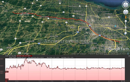
One-way Trail Distance: 25.75 miles point to point (you can make it shorter)
Elevation Gain: 812ft. (492ft. to 559ft.) Note: I find this unconvincing. There are a few ups and downs, but nowhere near as many as Google Earth seems to think!
Facilities: There are technically bathrooms and picnic tables in Meridian Center Park. A few other parks along the way have picnic tables and occasionally a port-a-potty.
Fees: None
Trail Notes: There are nicer sections of the Erie Canal Path to ride. However, for something different, this is a great section to ride as long as you skip the part between Genesee Valley Park and Buffalo Road.

Trail 
![]()
Road
Signs ![]()
Scenery ![]()
![]()
Would I go 100 miles out of my way for this? ![]()
![]()
Overall Rating: ![]()

GPS Coordinates for the Erie Canal Path between Meridian Center Park and San Souci Park
Meridian Center Park: 43.102873, -77.587147 (43°06.17238′, -077°35.22882′ / 43°06’10.3428″, -077°35’13.7292″) (493ft.) (0.0)
Guard gates: 43.116932, -77.632613 (43°07.01592′, -077°37.95678′ / 43°07’00.9552″, -077°37’57.4068″) (525ft.) (2.8)
Lehigh Valley Trail: 43.117762, -77.634303 (43°07.06572′, -077°38.05818′ / 43°07’03.9432″, -077°38’03.4908″) (530ft.) (2.9)
Bridge over the Genesee River: 43.122216, -77.639828 (43°07.33296′, -077°38.38968′ / 43°07’19.9776″, -077°38’23.3808″) (515ft.) (3.4)
Turn right for Canal Path: 43.121437, -77.644884 (43°07.28622′, -077°38.69304′ / 43°07’17.1732″, -077°38’41.5824″) (515ft.) (3.7)

Buffalo Road: 43.149900, -77.672077 (43°08.99400′, -077°40.32462′ / 43°08’59.6400″, -077°40’19.4772″) (541ft.) (6.25)
Long Pond Road: 43.182454, -77.701951 (43°10.94724′, -077°42.11706′ / 43°10’56.8344″, -077°42’07.0236″) (513ft.) (9.2)
Henpeck Park (parking): 43.187824, -77.730656 (43°11.26944′, -077°43.83936′ / 43°11’16.1664″, -077°43’50.3616″) (518ft.) (11.25)
Spencerport: 43.193638, -77.800165 (43°11.61828′, -077°48.00990′ / 43°11’37.0968″, -077°48’00.5940″) (515ft.) (15.0)
San Souci Park: 43.221764, -77.996656 (43°13.30584′, -077°59.79936′ / 43°13’18.3504″, -077°59’47.9616″) (513ft.) (25.75)

The gpx file for the Erie Canal Path can be downloaded – please note that this and the GPS Coordinates are for reference only and should not be used as a sole resource when hiking this trail.
Download GPX File size: 53.3 KB Downloaded 481 times
(Note: I do my best to ensure that all downloads, the webpage, etc. are virus-free and accurate; however, I cannot be held responsible for any damage that might result, including but not limited to loss of data, damages to hardware, harm to users, from use of files, information, etc. from this website. Thanks!)

Getting to Meridian Center Park
Take I-390 to I-590 (or from the east, take I-590) to Exit 1 – Winton Road. Take the exit and turn south onto Winton Road (note that it’s a very weird intersection – follow the signs). That’s right coming from I-390 and left coming from the east (I-590). After a quarter-mile, turn right onto Meridian Center Blvd – it will look like an office park and that is ok. Keep going straight past the office buildings to the end of the park road a half a mile later.
Getting to San Souci Park
From I-90, take Exit 48 toward NY-98N. Turn right (north) on NY-98N for 3.5 miles, then turn right onto NY-262E for 5.6 miles. Turn left onto Byron Road for 1.4 miles, left onto NY-237N for 9.6 miles, and a slight right onto Batavia Street for a tenth of a mile. Turn right onto NY-31E (State Street) for 1.7 miles; just after crossing the canal, turn left onto County Line Road. After a quarter-mile, turn left into San Souci Park.

From Meridian Center Park, go back out to Winton Road and turn left (north) and get on I-390S. Fairly quickly, merge onto I-390N toward the Airport. After 5.2 miles, use the left lane to continue on NY-390N (same road, maintained by the state). Directly after this, use the left lane to take Exit 20B to merge onto I-490W toward Buffalo. After 1.9 miles, take Exit 8 toward NY-531 W toward Spencerport and Brockport for 8.5 miles, at which point, the road changes names to NY-31W. After 5.5 miles, turn right on NY-31 W (Redman Road) for 1.5 miles and left on NY-31W for 1.3 miles. Just before crossing the canal, turn right onto County Line Road. After a quarter-mile, turn left into San Souci Park.
This Week’s Featured Product!
Check out this book – totally about the Erie Canal Path! With maps, information, lists of attractions, and so much more, it’s well worth getting if you’re planning trips along the Erie Canal.
More Related Posts:
 Genesee Riverway and Erie Canal Path: History via Bikes
 Genesee Riverway – Ontario Beach Park, Turning Point Park, & Maplewood Park
 Lock 60 Historic Site: Walk through an Erie Canal Lock Chamber
 Beautiful Keuka Outlet Trail!
 Genesee Valley Greenway – Oakland to Letchworth
 Genesee Valley Greenway-Lehigh Valley Trail Loop in Rochester!