

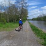
The Irondequoit Lakeside Multi-use Trail stretches from the mouth of Irondequoit Bay nearly all the way to the Genesee River. It’s paved the whole way, and parts actually offer views of the lake (other parts are residential sidewalks). There are also views of Irondequoit Bay, Seabreeze, and the forest and marshes of Durand Eastman Park. If you want a burger or a picnic, there are opportunities for both along the trail. There are also several places to park, and it’s fairly easy to connect to the Genesee Riverway Trail (also mostly paved) south toward Turning Point Park or north toward Ontario Beach Park. So there are a lot of options for this bike ride or hike!
Quick Stats
(Affiliate links are present on this page.)

I rode the Irondequoit Lakeside Trail twice – once from Ontario Beach Park nearly to the mouth of Irondequoit Bay and the other time from the top of the hill (it’s quite the hill!) near Seabreeze to Ontario Beach Park. Neither day had especially nice weather, though the winter sunset over Irondequoit Bay was nice. I’ll describe the trail as though you’ve parked near the mouth of Irondequoit Bay and are heading toward the Genesee River.

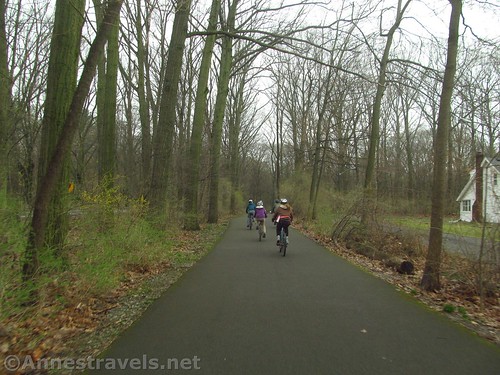
There are several parking areas for recreational use near the mouth of Irondequoit Bay. Pick up the path at any of these and begin your ride by climbing the big hill along the roadway. There is a pedestrian/bike path, so you won’t be on the road with traffic. At the first traffic circle, turn right to cross the road. Turn left on the sidewalk and head west on Durand Blvd. Cross Culver Road and immediately pick up the paved path as it enters Durand Eastman Park.

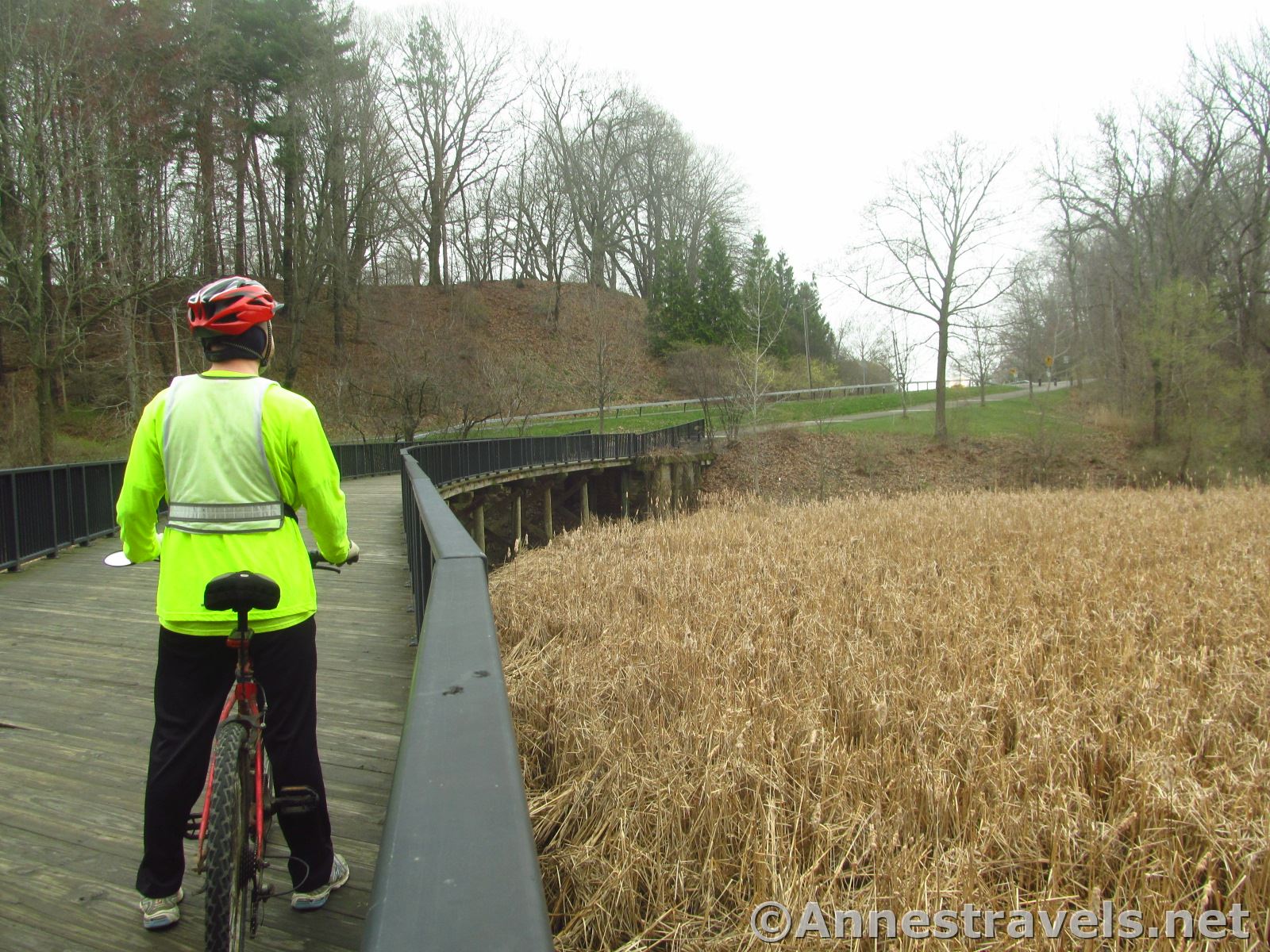
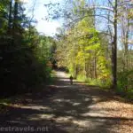
The trail from here passes through the woods and then descends a long hill (so much for all that elevation you just climbed!) It crosses a hefty bridge across a marsh, then climbs the other side along the road (but still as its own path) to enter the picnic area of Durand Eastman Park right on the shore of Lake Ontario about mile 2.5.
If you want to avoid all the hilly drama, you could park here (though I hear it’s extremely busy on summer weekends). Even just riding through, these are the best views of Lake Ontario you’ll get, and they’re quite nice. This (along with the forest and bridge in Durand Eastman Park) is my favorite part of the trail.

At the far end of the parking areas, the trail turns into a residential sidewalk. It’s still a nice ride, but be wary of traffic while crossing side-streets.
There is a light where the road Ts into St. Paul Blvd. Cross St. Paul and turn right but do not pass under the old train bridge (that was once part of the Hojack Line). Instead, turn left almost immediately on Pattonwood Drive.

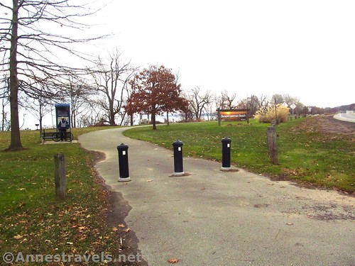
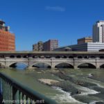
Continue down the sidewalk another 0.6 miles to the place where the sidewalk ends. This is the official end of the Irondequoit Lakeside Multi-use Trail. To pick up the Genesee Riverway or get to Turning Point Park or Ontario Beach Park, cross the drawbridge and turn on the trail (on right) that descends to the Riverway Trail.

Overall, this isn’t a trail that’s worth trekking across the country to see. However, it is a great way to spend a few hours on bikes. If you’re walking, just go for the eastern end of the trail through Durand Eastman Park.

Round Trip Distance: 9.5 miles out & back. Distance from Irondequoit Bay to the Genesee Riverway Trail is about 5 miles.
Elevation Gain: One way is 365ft., RT is more like 702ft.
Facilities: Picnic tables in Durand Eastman Park. There might also be restrooms or port-a-potties at Durand Eastman or down by Irondequoit Bay, depending on the season. There are restaurants at both ends of the trail.
Fees: None
Trail Notes: I’ve always found the area by Irondequoit Bay to be a little sketchy, though not as bad as the Webster side of the mouth of the Bay. Though I’ve never heard of an issue, I’d recommend riding this trail with a friend.

Trail 
Road ![]()
Signs ![]()
Scenery ![]()
![]()
Would I go 100 miles out of my way for this? ![]()
![]()
![]()
![]()
Overall Rating: 
![]()

GPS Coordinates for the Irondeqoit Lakeside Multi-use Trail
Parking area at Irondeqoit Bay: 43.2339667°, -077.5375667° (N43° 14.038′ W77° 32.254′ / 43°14’02.2800″, -077°32’15.2400″) (255ft.) (15.82)
Enter Durand Eastman Park: 43.2278167°, -077.5469833° (N43° 13.669′ W77° 32.819′ / 43°13’40.1400″, -077°32’49.1400″) (354ft.) (15.01)
Durand Eastman Park Picnic Area: 43.2366720°, -077.5575550° (43°14.20032′, -077°33.45330′ / 43°14’12.0192″, -077°33’27.1980″) (2.5)
End of Durand Eastman Park: 43.2423000°, -077.5773167° (N43° 14.538′ W77° 34.639′ / 43°14’32.2800″, -077°34’38.3400″) (265ft.) (12.7)
West end of trail: 43.2480833°, -077.6085333° (N43° 14.885′ W77° 36.512′ / 43°14’53.1000″, -077°36’30.7200″) (269ft.) (10.43)

The gpx file for the Irondequoit Lakeside Trail can be downloaded – please note that this and the GPS Coordinates are for reference only and should not be used as a sole resource when hiking or biking this trail. Also note that the file may direct you from the Genesee River to Irondequoit Bay – opposite to the directions in this post.
Download GPX File size: 42.3 KB Downloaded 503 times
(Note: I do my best to ensure that all downloads, the webpage, etc. are virus-free and accurate; however, I cannot be held responsible for any damage that might result, including but not limited to loss of data, damages to hardware, harm to users, from use of files, information, etc. from this website. Thanks!)

Getting to the Irondequoit Lakeside Multi-use Trail
To get to the Irondequoit Bay end of the trail, drive north on 590N. At the 104 interchange, continue straight toward Seabreeze. (From 104, take the Culver Road exit; turn north on Culver and then turn right on Ridge Road. Turn left onto 590N.) Keep going straight as the road turns into a labyrinth of traffic circles (who’s crazy idea was this!!!) until the road Ts into Culver Road (about 2.6 miles from the 104 interchange, though it feels a lot longer). Turn right onto Culver and park in one of the parking areas on the right.

Zoom map out to browse nearby hikes & places of interest
This Week’s Featured Product!
This is a great book for any Rochestarian who loves to bike! From family rides to full-day treks, there is a wide variety of rail trails and other bike rides in the area in and around Rochester, New York.
More Related Posts:
 Genesee Riverway – Ontario Beach Park, Turning Point Park, & Maplewood Park
 Rochester’s Secret Sidewalk
 Genesee Riverway and Erie Canal Path: History via Bikes
 Lock 60 Historic Site: Walk through an Erie Canal Lock Chamber
 Genesee Valley Greenway – Oakland to Letchworth
 Erie Canal: Meridian Center (Rochester) to San Souci Park (Brockport)