Every year I like to take a bike ride on a rails-to-trails or canal path in celebration of my birthday. It’s a nice time of year and everyone is ready to get out and enjoy the nice weather. Well, this year didn’t work so well – between the fact that it rained every single weekend, travel, graduations, parties, and the like (did I mention the weather?), we were booked pretty much to September. But we squeezed in not one trail, but two, in the middle of June – part of the Ontario Pathways between Canandaigua, NY and Phelps, and the very beautiful Keuka Outlet Trail between Penn Yan and Dresden. So this week I’ll talk about my trek along the Ontario Pathways, and another week we’ll get to explore the Keuka Outlet Trail.
Quick Stats for the Ontario Pathways
(Affiliate links are present on this page.)
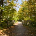
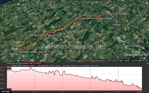
We started from Goose Street, because I really wanted to do the Keuka Outlet Trail, but knew if I did the entire of the Ontario Pathways my group would be ready to call it a day after just one trail. Starting at Goose Street would allow us a 12 mile trail before we loaded up the bikes and went down to Penn Yan.
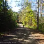
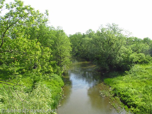
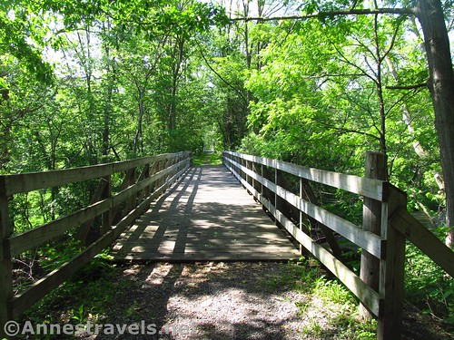
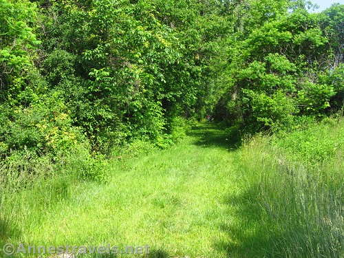
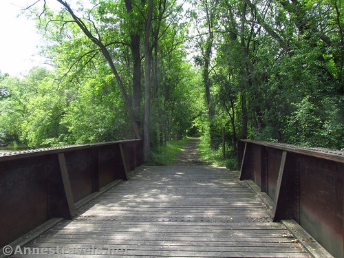
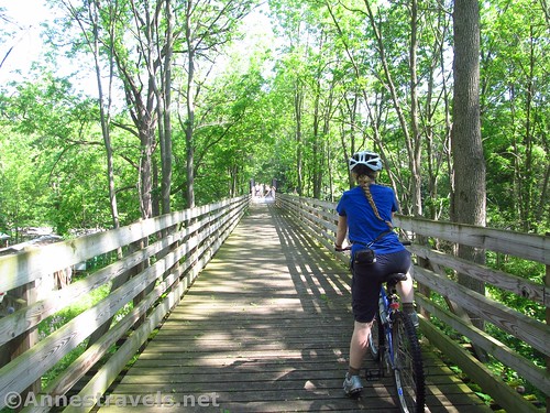
The trail started out pretty much flat through the forest with fields on either side of that. Besides a nice, high bridge that was once a trestle, the trail is pretty straightforward down to Stanley Junction at mile 2.0.
Stanley Junction was once a major train intersection, a place where trains were repaired and where crews could stay between train assignments. About 200 railroad employees lived full-time in Stanley in 1900, and a 24 hour restaurant served the employees. Today, there is little there except a parking area, a few houses, and a grain elevator or two.
The trail makes a sharp left turn here, basically turning back on itself. That is really what it looks like, though soon it turns north.
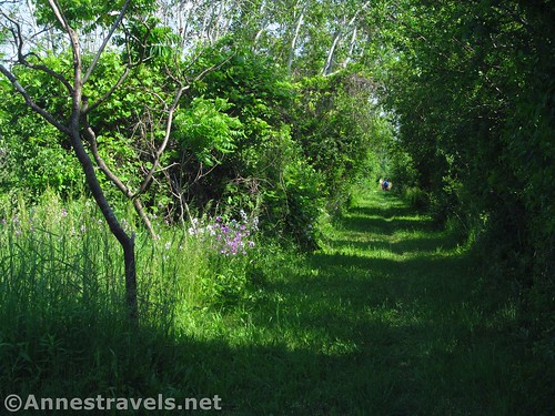
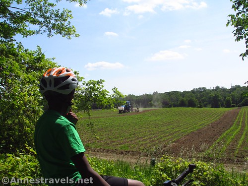
Keep going as the trail passes a junk heap and some garages / public works area (the junk heap, I’d guess, is the locals’ way of saying they don’t like the trail – just a guess). Then it keeps going through the forest, fields, etc. From the smell, I think some of those fields are fertilized the natural way – with what my great-grandfather called a “Honey Wagon”.
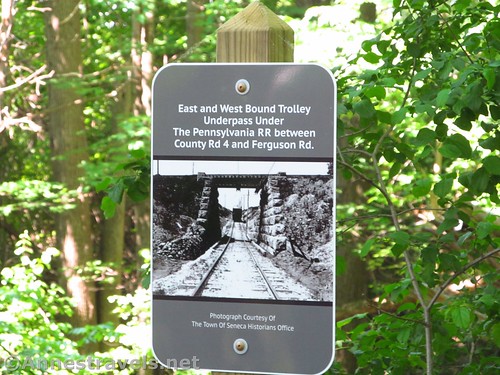
Before reaching Orleans, the trail will also pass the place where a trolley passed under the railroad. I would have loved to look around a little, but the bugs were so bad I barely stopped to take a picture of the sign.
You’ll know you’re in Orleans when you see the big wooden water tower. It’s a relic of the past, but it’s been fairly well-maintained (or restored). I think I once read a Hardy Boys book about a water tower like this one. We spent a good few minutes looking around at it.
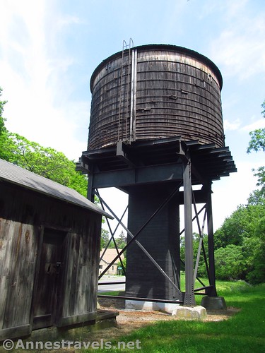
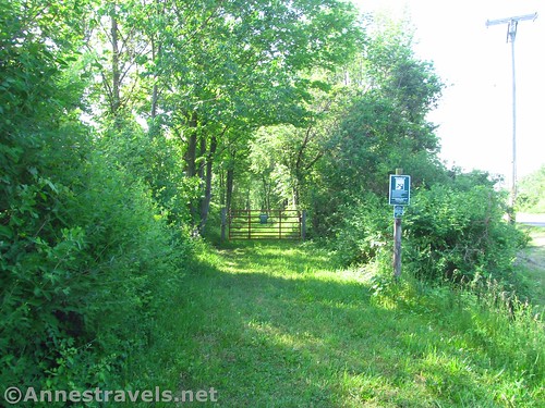
Here you’ll have to take to city streets for nearly a mile. The best I can guess, one property owner along the trail won’t give rights for the trail to go through their property. So for 0.1 mile of non-navigable land (the trail goes up to the property on both sides), go up the street past the water tower, turn right on the “highway”, and bike or walk uphill until the trail takes off again, on the right near Summer Beam Bookshop.
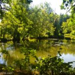
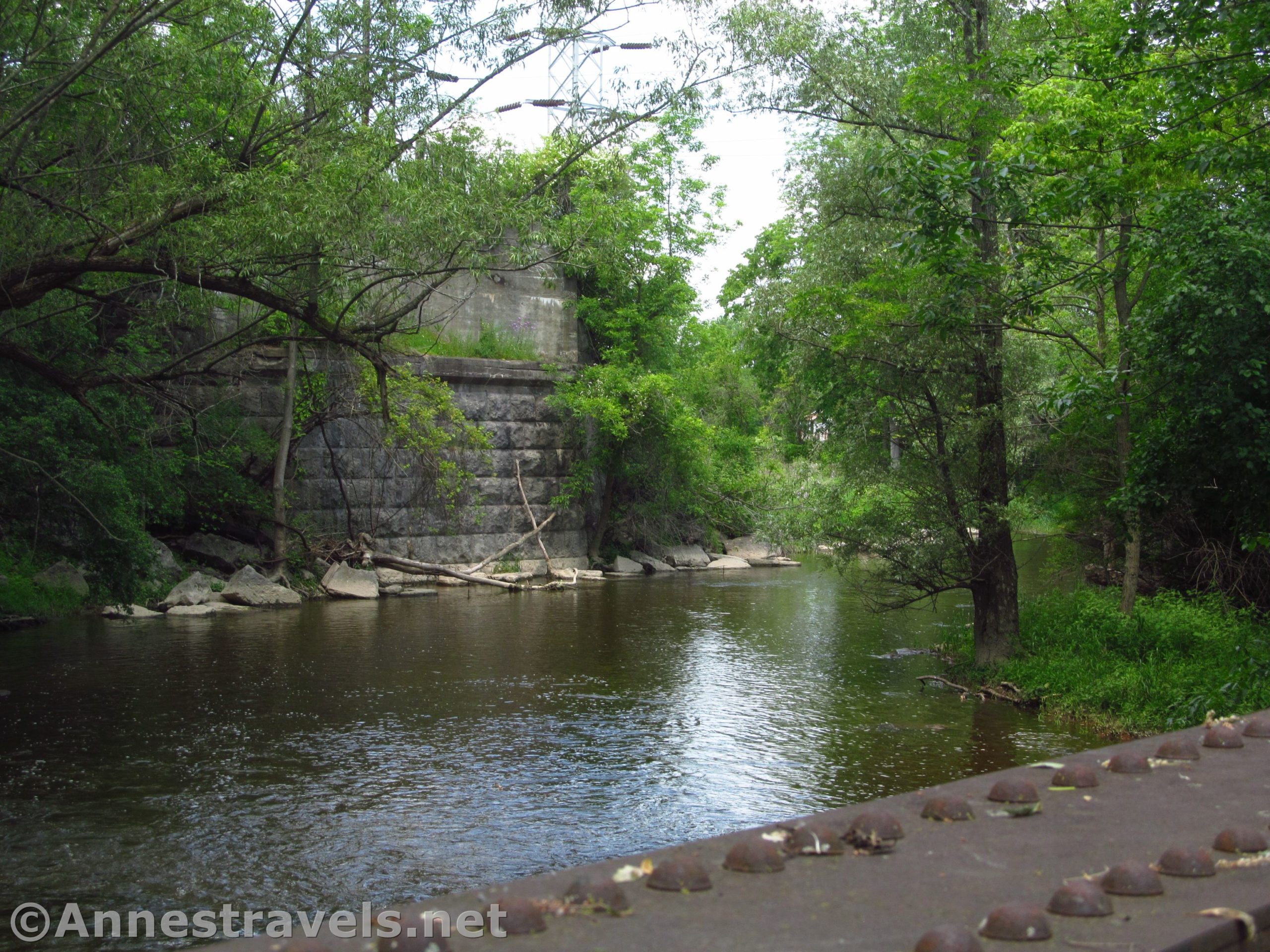
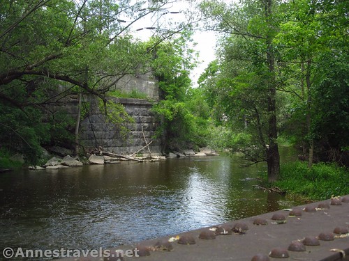
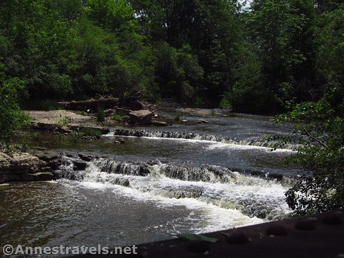
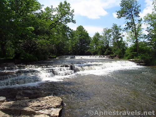
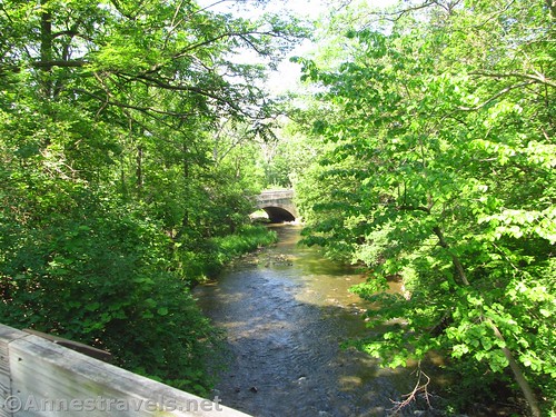
From here on out, the trail is easy to follow, but the next exciting thing may be the nicest part of the whole trail. About a mile from the end of the trail (about 11 miles from Goose Street) is a small old trestle. It’s pretty evident from nearby abutments that there was another trestle here at one time, as well as this one, and some small waterfalls tumble nearby. You then follow the river the rest of the way to the parking area in Phelps, 12.4 miles from Goose Street. Pretty nice ending, right?
A few random facts:
- The trail was once part of the Sodus Point & Southern Railroad.
- The train line was built in the 1860s and completed in 1873. The last shipment of coal was transported on the line in 1967.
- The railroad was constructed to carry coal from Pennsylvania to the Great Lakes and Canada – in the years surrounding 1911, five million tons of coal were transported on the SP&S each year.
- On the return trip, trains carried ice cut from Sodus Bay, grain from Seneca Castle, locally grown apples, cherries, potatoes, cabbages, onions, beets, and spinach, and products from the canneries in Newark.
- The last passenger train used the line in 1935.
Round Trip Trail Length: I did a shuttle from Goose Street to Phelps for a 12.4 mile ride. The entire trail (shuttle) is a little over 23 miles long
Net Elevation Change: 332ft. – you’re going downhill 99% of the trail
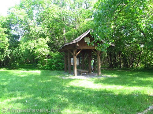
Facilities: You might find a port-a-potti at some trailheads
Fees: None
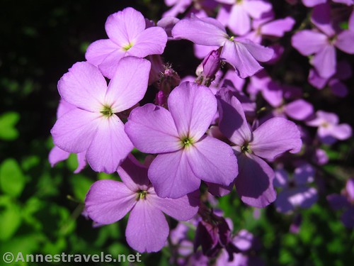
Trail Notes: Don’t miss the old water tower in Orleans or the waterfalls / bridge at the Phelps Junction end of the trail. Bring bug repellant if you’re going to be walking or riding slow (or if you want to explore). The smells along this trail range from wildflowers to the crops growing beside the trail to freshly turned earth to freshly fertilized or sprayed fields to… The trail is mostly dirt track or occasionally gravel. Watch out for tree roots – someone had spray painted them orange or white to come back later and remove them, but I’m not sure when they’ll finish.
Trail 
![]()
![]()
Road ![]()
Signs ![]()
Scenery ![]()
![]()
![]()
Would I go 100 miles out of my way for this? ![]()
![]()
![]()
Overall Rating: ![]()
![]()
Key GPS Coordinates for the Ontario Pathways
Goose Street Trail Crossing: 42.8456667°N, -077.1255139°W (42°50’44.40″N, -77° 7’31.85″W / 42°50.74000’N, -077°07.53083’W) (940ft.) (0.0)
Stanley Junction (big turn): 42.8251111°N, -077.1009278°W (42°49’30.40″N, -77° 6’3.34″W / 42°49.50667’N, -077°06.05567’W) (926ft.) (2.0)
Water tower: 42.9188972°N, -077.1131861°W (42°55’8.03″N, -77° 6’47.47″W / 42°55.13383’N, -077°06.79117’W) (747ft.) (8.9)
Regain Trail: 42.9308111°N, -077.1099389°W (42°55’50.92″N, -77° 6’35.78″W / 42°55.84867’N, -077°06.59633’W) (720ft.) (9.8)
Phelps Junction (trail end): 42.9612139°N, -077.0912917°W (42°57’40.37″N, -77° 5’28.65″W / 42°57.67283’N, -077°05.47750’W) (608ft.) (12.4)
The gpx file for the Ontario Pathways from Goose Street to Phelps Junction can be downloaded – please note that this and the GPS Coordinates are for reference only and should not be used as a sole resource when hiking this trail.
Download GPX File size: 94.9 KB Downloaded 448 times
(Note: I do my best to ensure that all downloads, the webpage, etc. are virus-free and accurate; however, I cannot be held responsible for any damage that might result, including but not limited to loss of data, damages to hardware, harm to users, from use of files, information, etc. from this website. Thanks!)
Getting to the Ontario Pathways
Note: there really isn’t any place to park except in Canandaigua, Stanley Junction, Orleans, and Phelps Junction. They even request you not to park at Goose Street, though that doesn’t stop trail crews, and I’m sure they could have cared less that we parked long enough to unload the bikes.
To get to the Goose Street access, from I-90, take Exit 43 toward Palmyra. At the bottom of the ramp, turn south (right). After 0.1 miles, turn left on the first cross street onto NY-96S. Drive 5.7 miles and then turn right on Bankert Road; continue straight 2.9 miles, when the road merges onto NY-488S for 0.7 miles (during this time, you’ll be on the road section of the trail). Turn left on County Road 20; after 4 miles, turn right on US-20W (are you confused yet?). Only 0.7 miles later, turn left onto Goose Street for 1.1 miles to where the trail crosses the road.
To get to the Phelps Junction Trailhead, take Exit 43 from I-90 toward Palmyra. At the bottom of the ramp, turn south (right). Stay on NY-96S 7.3 miles to the trailhead. Or take Exit 42 toward Lyons; at the bottom of the ramp turn right (south). Merge right onto the ramp for NY-96N; arrive at the trailhead 6 miles later, on left.
Zoom map out to browse nearby hikes & places of interest
This Week’s Featured Product!
Looking for even more rails-to-trails in New York? Check out this book, which lists all the ones I’ve ever heard of in my own local area, plus a whole lot more!