
On a chilly December day, a couple of us decided to check out Corbett’s Glen. I’d heard about it for some time, and I was excited to see the three waterfalls in person. As it turned out, there have been some recent changes to the structure of the trails near the falls. It’s still a great place for a picnic, a little photography, and to watch the trains along the track high above the park. You can also take a peaceful little trek through the rest of the park – the trail was nice, even in the early winter.
Quick Stats
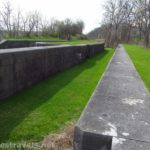
The parking area I used (the one closest to the falls) is along the road between two residential areas. Pay attention to the signs. I expect on a nice weekend, there isn’t half enough parking, and the residents are serious about obeying the parking rules. That said, it seems like a pretty safe neighborhood, and I didn’t worry too much about parking my van along the side of the road between the parking signs. There is more parking for Corbett’s Glen along Penfield Road (see directions).

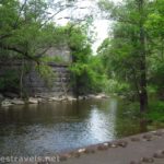
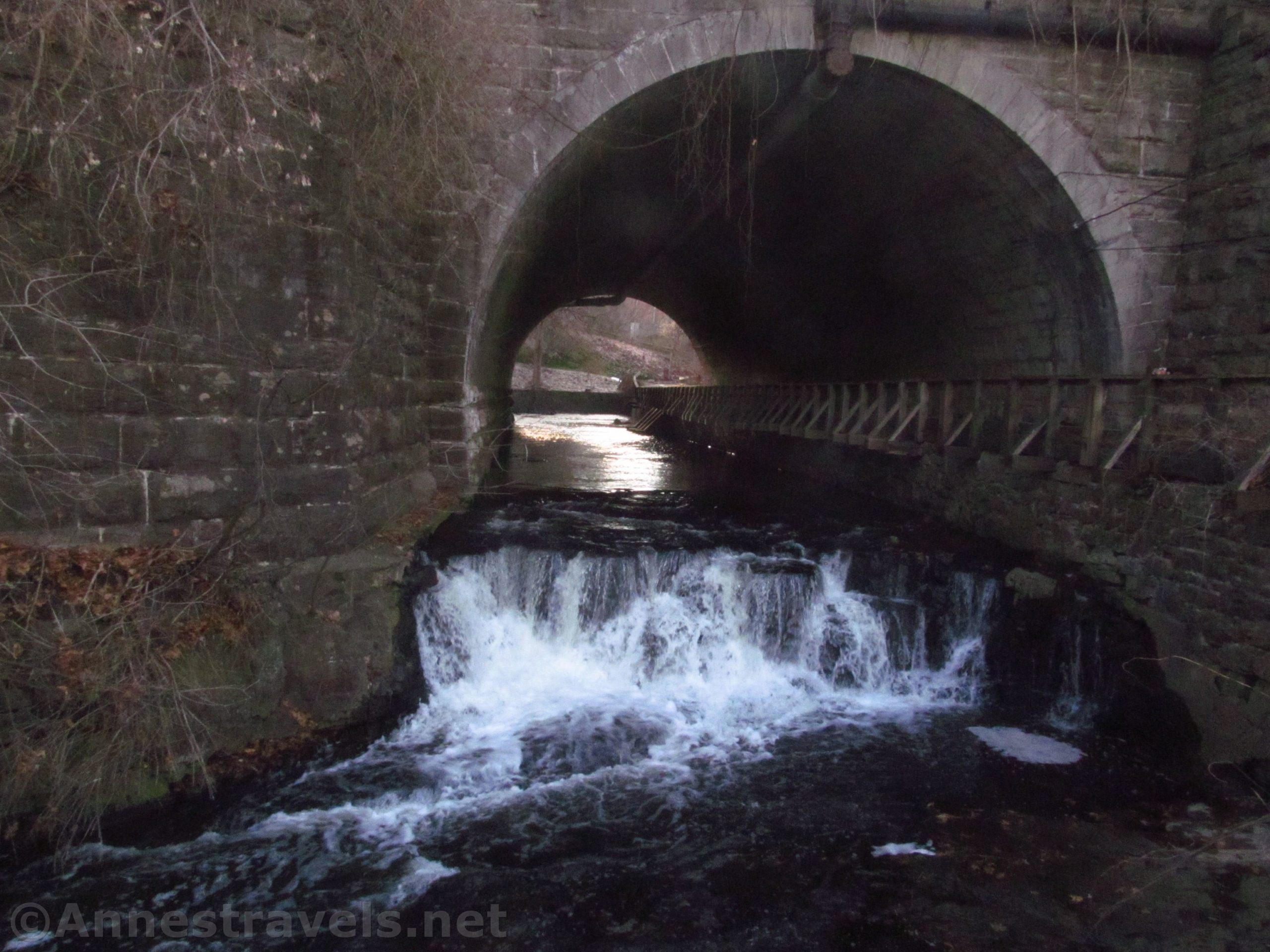
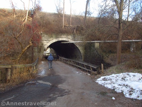
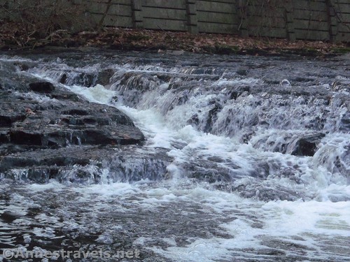
Walk down the road (truly downhill) past the houses and toward the railroad. Use the road through the tunnel to walk under the tracks (Allen Creek will be on your right). As soon as you get out of the tunnel, the first waterfall (Tunnel Cascade) is visible in the stream. It’s only about 4ft. high, but nestled right at the edge of the tunnel, it’s pretty picturesque.
My problem was that I was too late in the day (and season) for the sun to be shining on the falls, so all my pictures of the falls were a bit dark.

Walk right along the fence / stream to pass by the second falls (6ft.). The fence (put in place to protect the bank) means you can no longer see the falls. I ended up following a trail upstream from Postcard Falls to see the second falls, but I’m not sure that’s actually allowed.

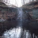
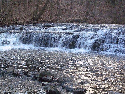
A quarter mile from the tunnel, an intentional break in the fence allows you to go down to stream level and see Postcard Falls (6ft.). It’s by far the most picturesque of the three falls. You could have some fun with photography here. I caught it just before golden hour on my way back, but the pictures were still pretty dark – you’d be better off here in the morning because the railroad blocks light from the west.

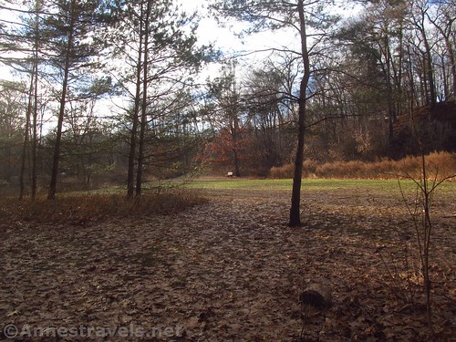
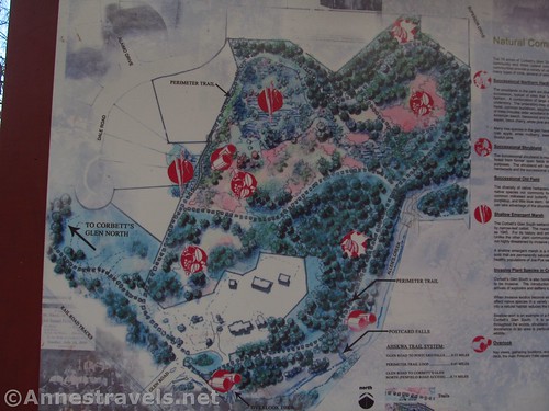
From here, you can turn around (no more waterfalls to discover) or you can continue on the trail. We continued, taking the loop trail (“Perimeter Trail”) 0.6 miles around to a marked trail junction with the Woodchip Trail. (Turning right on the Woodchip Trail, it’s about a mile up to a larger parking area off of Penfield Road (parking approx. 43.137404, -77.526580). Overall, the loop trail was nice, but it would probably be muddy in the spring. A grassy section at the far end would make a nice place for a picnic or to watch wildlife.
There is a boardwalk across a swampy section, probably installed by the boy scouts. Someone had hung a Christmas ball from one of the trees.

Turn left at the Woodchip Trail to finish the loop. We returned to the tunnel about 0.05 miles after the trail junction with the Woodchip Trail. We explored a little more around the falls before returning to our van.
Overall, you won’t spend hours here unless you’re just hanging out. But it’s a nice place for a little hike, and the waterfalls make it special.

Round Trip Trail Length: Just to Tunnel Cascade from the parking area is 0.3 miles RT. To Postcard Falls is 0.8 miles RT. Total loop is about 1.2 miles.
Elevation Change: About 58ft. if you count the parking, which is much higher than the waterfalls
Facilities: None
Fees: None
Trail Notes: This is a residential area; respect property rights. That said, despite the houses, you are allowed to be here. If you like old photographs, there’s quite the collection of historic photographs of Corbett’s Glen at the sign kiosk near Tunnel Cascade. Wading and swimming are prohibited, as are alcohol, hunting, and open fires.

Trail 
![]()
Road
Signs ![]()
![]()
Scenery ![]()
![]()
Would I go 100 miles out of my way for this? ![]()
![]()
![]()
Overall Rating: 
![]()

GPS Coordinates for Corbett’s Glen
Parking: 43.1286833°, -077.5219833° (N43° 07.721′ W77° 31.319′ / 43°07’43.2600″, -077°31’19.1400″) (382ft.)
Trailhead: 43.1294500°, -077.5214500° (N43° 07.767′ W77° 31.287′ / 43°07’46.0200″, -077°31’17.2200″) (351ft.) (0.0)
Postcard Falls: 43.1302000°, -077.5183667° (N43° 07.812′ W77° 31.102′ / 43°07’48.7200″, -077°31’06.1200″) (324ft.) (0.26)
Trail Junction; turn left: 43.1305667°, -077.5210167° (N43° 07.834′ W77° 31.261′ / 43°07’50.0400″, -077°31’15.6600″) (348ft.) (0.82)
Return to first falls / tunnel: 43.1300667°, -077.5204500° (N43° 07.804′ W77° 31.227′ / 43°07’48.2400″, -077°31’13.6200″) (347ft.) (0.87)
The gpx file for Corbett’s Glen can be downloaded – please note that this and the GPS Coordinates are for reference only and should not be used as a sole resource when hiking this trail.
File size: 26.9 KB Downloaded 0 times
(Note: I do my best to ensure that all downloads, the webpage, etc. are virus-free and accurate; however, I cannot be held responsible for any damage that might result, including but not limited to loss of data, damages to hardware, harm to users, from use of files, information, etc. from this website. Thanks!)
Getting to Cobett’s Glen
The place I parked is on a side street across Lindon Avenue from Lindon Oaks.
From I-490, take Exit 23 to Lindon Ave and Penfield. At the top of the ramp, turn east (left if coming from Rochester, right if coming from Victor). Take the first legal left (there’s a stoplight) onto Glen Road (it’s a dead end); take an immediate left downhill. Follow the signs to park along the edge of the road.
From the huge intersection at Rt. 441 (Penfield Road) and Rt. 250 (Fairport-Nine Mile Point Road) in Penfield, drive west on Rt. 441 (Penfield Road). Stay on Rt. 441 for 4.3 miles; turn right onto Glen Road (it’s a dead end); take an immediate left downhill. Follow the signs to park along the edge of the road.
You can also park off of Penfield Road (Rt. 269) (parking area is across from Forest Hill Road, not quite a half mile east of I-490). The trail in is longer, but there’s also more space to park.

Zoom map out to browse nearby hikes & places of interest
This Week’s Featured Product!
This book suggests several shorter trails in the Rochester, New York area. Many of the trails can be expanded for a longer hike.