
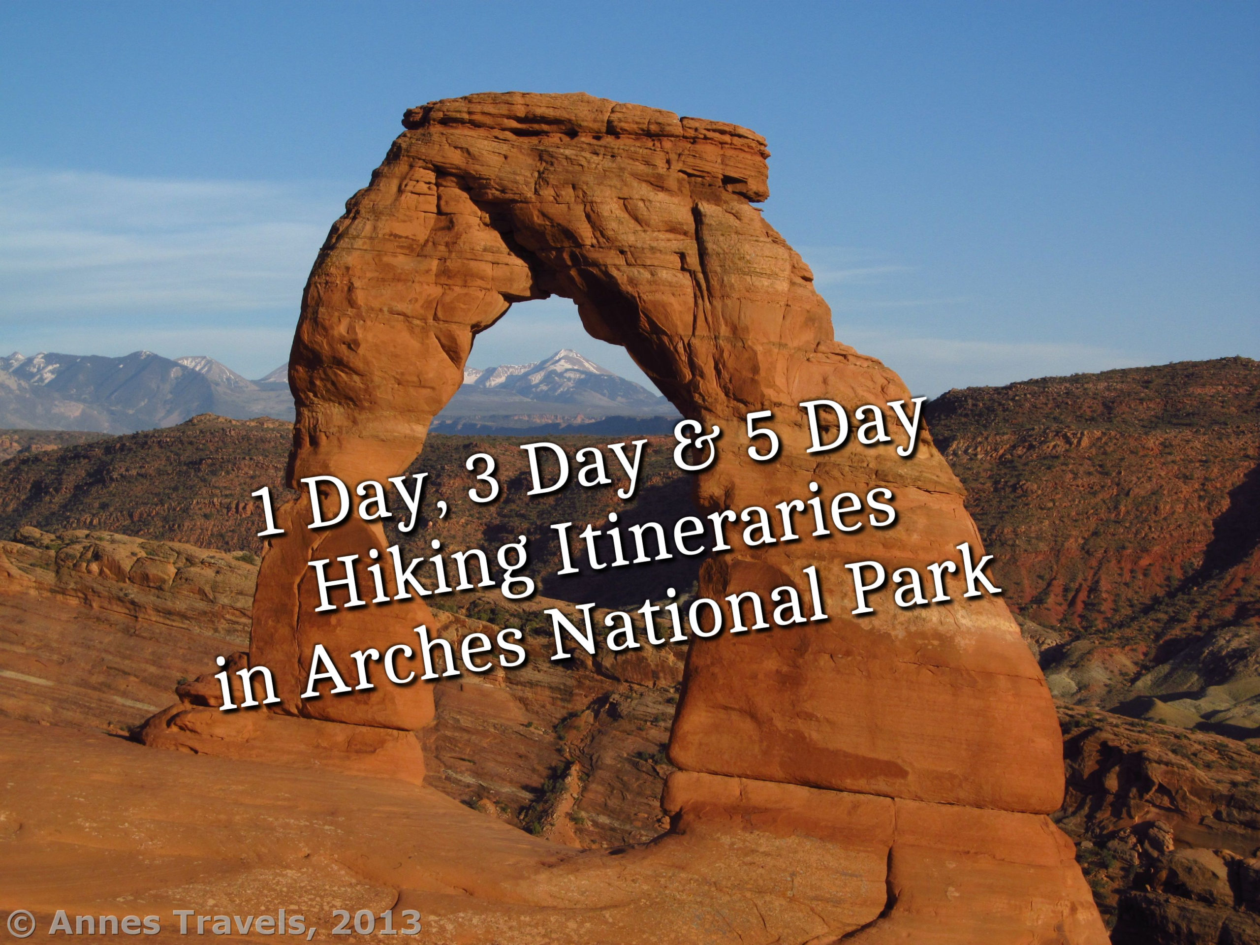

Arches National Park may have the most fantastic scenery concentrated into the smallest space of any national park in the United States. The park is less than 120 square miles, and almost every hike in the park is along one 18-mile scenic drive. But along that one scenic drive is one jaw-dropping view after another of rock formations, stunning vistas of the La Sal Mountains, and (of course!) more arches than can be counted. (Even the National Park Service isn’t certain how many arches are in Arches National Park, though they estimate it’s about 2,000.)

Because of the natural beauty, Arches should be high on your list of any trip to southern Utah. Below I’ve outlined what I’d consider must-do hikes for one day, three day, or five day trips to the park – for less-experienced and more adventurous hikers.
One Day in Arches National Park
If you only have one day in Arches National Park, then you’ll want to pack in as much of the iconic sights as possible.

Morning – Windows Loop & Turret Arch (1.0 mile loop with spurs) and Double Arch (0.5 miles out & back. (1a on the map)

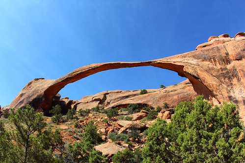
Afternoon – Devils Garden Trail to Landscape Arch (1.15 miles out & back; 1b on the map) and Delicate Arch (3.2 miles out & back; 1c on the map) in time for sunset.
Total Hiking Miles: 5.85
Don’t want to hike that much? Hike to the North & South Windows and Delicate Arch for an approximately 3.75 mile day.
Feeling Adventurous? Do the 5.85 miles described above, only continue beyond Landscape Arch on the Devils Garden Trail. Hiking the entire Devils Garden Trail will boost you up to 12.0 miles.
Three Days in Arches National Park
With three days in the park, you have more options for exploration beyond just the absolute must-see arches. If you want to hike to the Fiery Furnace, be sure to snag your permits the exact second that they become available 1 week before your intended hike date.

Day 1
Morning – Stop at the Visitor Center to try and snag permits to the Fiery Furnace tomorrow. (Don’t worry if they’re sold out; there are other options for hiking. You can also purchase permits ahead of time at Recreation.gov). Permits for the Fiery Furnace are only available online at Recreation.gov 1 week in advance If you are going to hike this on Day 2, you’ll need to stop by the visitor center today to take the orientation video. Then hike the Windows Loop & Turret Arch (1.0 mile loop with spurs; 1a on the map), Double Arch (0.5 miles out & back; 1a on the map), and the Balanced Rock (0.3 mile loop; 1b on the map).

Afternoon or evening – Delicate Arch (3.2 miles out & back; 1c on the map) in time for sunset

Total miles for Day 1: 5.0 miles
Don’t want to hike that much? Hike to the North & South Windows and Delicate Arch for an approximately 3.75 mile day.
Feeling Adventurous? Drive out to the 2.8 mile out & back trail to Tower Arch. Be sure to be back before dark, as the road is rough.
Day 2
Morning – Stop at the Visitor Center to check in for your Fiery Furnace tour. Hike up to the Upper Delicate Arch Viewpoint (0.6 miles out & back; 2a on the map). Then take on Sand Dune Arch/Broken Arch/Tapestry Arch (3.0 mile loops; 2b on the map). You can also hike to Skyline Arch (0.4 miles out & back; 2c on the map) if you want. If you plan to take the Fiery Furnace Tour, adjust the order of the hikes here based on the time of the tour.

Afternoon – Hike to either the Fiery Furnace (2.0 miles; 2d on the map; advance permits required) or Park Avenue (2.0 miles out & back; 2e on the map). Even if you can’t do the Fiery Furnace, I highly recommend a late afternoon or evening stroll to the Fiery Furnace Overlook.

Total Miles for Day 2: 6.0 miles
Don’t want to hike that much? Hike only to the Upper Delicate Arch Viewpoint, Sand Dune Arch, and either the Fiery Furnace or Park Avenue for a 3.0 mile day.
Feeling Adventurous? Park in the unmarked pulloff just north of the Courthouse Wash. Travel east (downstream toward Moab) down the wash as far as time and adventurousness hold out. The wash often has a little water in it; a few waist-deep potholes add to the fun in warm weather.
Day 3
Hike the Devils Garden Trail, a 7.3 mile loop through sandstone fins, arches, and fantastic views (3 on the map).

Total Miles for Day 3: 7.3 miles
Don’t want to hike that much? Hike only as far toward Double O Arch as you wish.
Feeling Adventurous? If you have 4×4, drive out to Eye-of-the-Whale Arch for a short hike to the oddly shaped arch.
Five Days in Arches National Park
Five days will allow you to discover almost everything the park has to offer.

Days 1, 2, and 3
See Days 1, 2, and 3 in the Three Day Itinerary above.

Day 4
Drive to the unmarked pulloff just north of where the scenic drive crosses Courthouse Wash (4 on the map). Hike downstream (southeast toward Moab) as much of Lower Courthouse Wash as you desire. Down to the highway and back is 11.5 miles.
Total Miles for Day 4: Varies; up to 11.5 miles

Day 5
Morning – If you have 4×4, drive out to Eye-of-the-Whale Arch (0.5 miles out & back; 5a on the map). Otherwise (or in addition to), drive out to Eagle Park (5b on the map) in the national park’s far northwestern corner. Explore as time and energy permit in the nearly trail-less wilderness.
Afternoon – on the way back to the main park road, visit Tower Arch (2.8 miles out & back; 5c on the map)

Total Miles for Day 5: At least 3.3 miles; varies depending on how much of Eagle Park you decide to explore.
Where to Stay
There is a small campground in Arches National Park. Lodging is available in nearby Moab. Other camping opportunities can be found along Highway 128 northeast of Moab along the Colorado River and south on Highway 279 along the Colorado River and near famous climbing routes.

Things to Consider
Arches National Park charges a $30/vehicle ($25/motorcycle) entry fee, valid 7 days. National Park Passes and Southeast Utah Parks Passes are accepted.
Because the park is so small, the trails tend to be congested. Parking can also be an issue. Leave yourself extra time to find a parking spot, especially at popular trailheads like The Windows, Delicate Arch, and Devils Garden.
Be sure to bring plenty of water and food on hikes and to drink whether or not you’re thirsty. Dehydration is no joke in the desert!
Water is available at the Visitor Center near the park entrance and at the Devils Garden Campground. Check the park map for restrooms and picnicking access.

Views of the La Sal Mountains are better in the afternoon.
I recommend camping outside of the park. The sites northeast along Highway 128 are most convenient, though the sites south along Highway 279 may be quieter.
Moab offers all the typical services, from gas and groceries to quality hotels and restaurants. Still, I overheard a conversation between two travelers: “No McDonald’s, no bus service, no movie theater – Moab is kinda primitive.”
The Arches Scenic Drive is very slow to drive, especially when congested with traffic. It can take 30 minutes to drive from the entrance station to The Windows, and 45 minutes from the entrance station to Devils Garden – a distance of only 18 miles.
Landscape Arch is the longest arch in the park, with a span of 306ft. The southern span of Double Arch is the tallest arch with a vertical opening of 112ft.
What are your favorite hikes in Arches National Park?
This Week’s Featured Product!
With tons of details and tons of trail, this book is a must for hikers in Arches and Canyonlands National Parks.
2 responses to “1 Day, 3 Day, and 5 Day Hiking Itineraries in Arches National Park”
This article is a keeper. I have always wanted to visit Arches
It’s an amazing park; I hope you enjoy it when you have the chance to visit!