

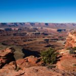
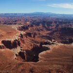
There are several premier trails that take hikers from the mesa of Island in the Sky to the White Rim Road. I’m sure they’re all very nice, but out of them all I chose to hike the Lathrop Trail… and I’m so glad I did! The scenery was absolutely spectacular (despite occasional cloud cover) and there’s quite a bit of beautiful trail before the path descends precipitously down a side canyon toward the White Rim Road. Due to time constraints, I was only able to hike about 3.5 miles down the 5.9 mile trail, but the part I did was fantastic and I can highly recommend the entire trail!
Quick Stats

From the trailhead, the path strikes out eastward across a grassy plain. There are occasional views over the edge of the mesa, far away. It’s a peaceful, magical place, like the Flat Tops of Colorado or grassy meadows of New Jersey (only dryer).

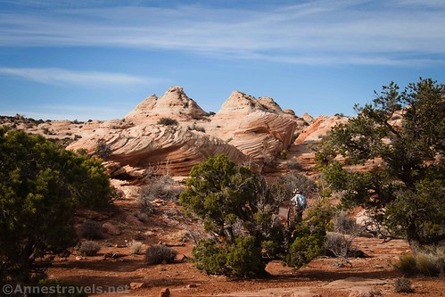
After about 1.5 miles, the trail transitions from dirt to slickrock. This is where the real fun begins. Besides the need to follow cairns, the white slickrock is swirled with orange. It’s beautiful! (For more information about this part of the hike, see my post on the Lathrop Point Overlook.)
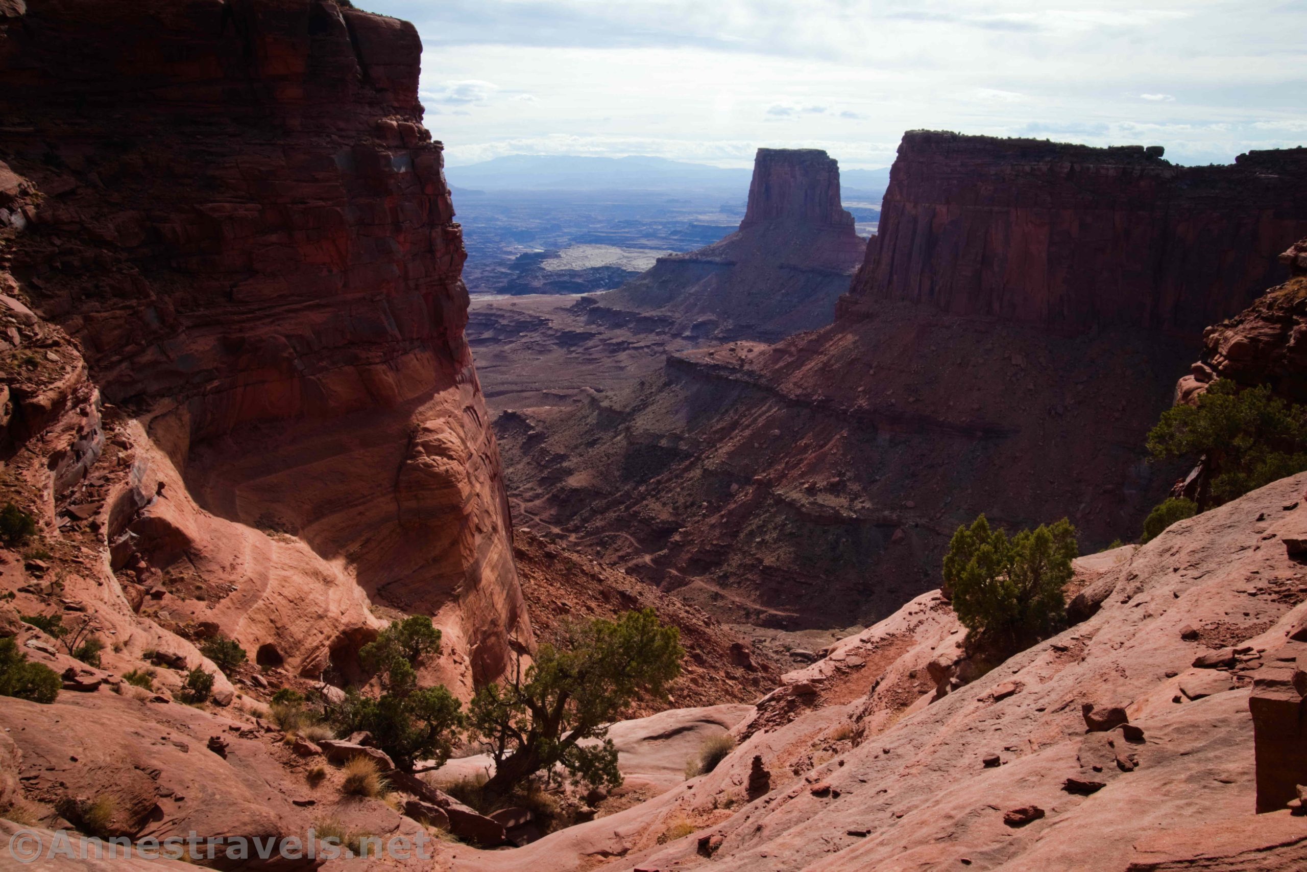
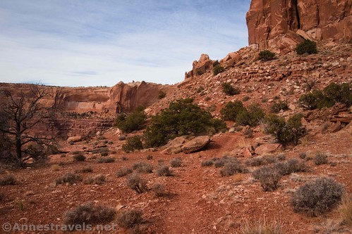
The trail descends off of the slickrock and onto a red-dirt bench. Be sure to look back at the swirled slickrock – it’s beautiful from this angle, too. You can also begin to see over the edge of the mesa and into the canyons below. It’s worth the hike just to see this!

At mile 2.0, the trail turns to descend steeply off of the red bench to a white-ish yellow rock shelf. Just before dropping over the edge, you can turn right to follow the social trail out to Lathrop Point Overlooks (I recommend doing this in the afternoon, as the views are better after the sun sinks toward the west).

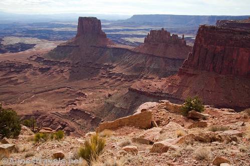
But to continue on the Lathrop Trail, descend to the white/yellow rock shelf. Near where the trail flattens on the shelf, there is an excellent view down the part of Lathrop Canyon that you’re currently in.

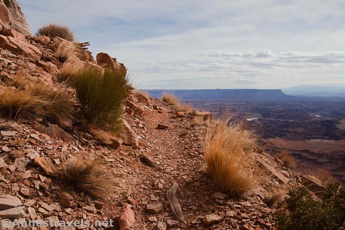
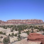
Follow the cairns as they lead you along the shelf, then down onto a lower shelf. This runs along the cliff face around the end of the butte (which is Lathrop Point) and along the cliff face in the canyon that you’ll be descending to the White Rim Road. Views in this section are good of Airport Tower.
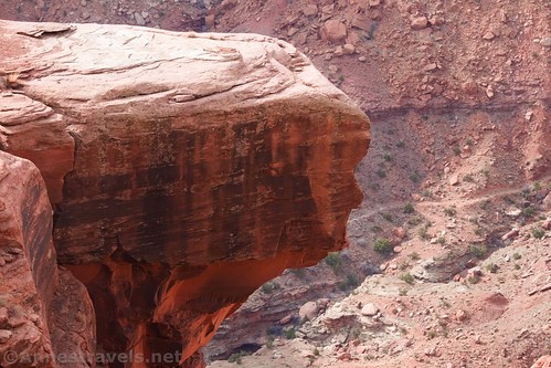
There aren’t any guardrails along the trail, and sometimes it feels like you’re walking on a shelf with a cliff up on the right and a cliff down on the left. But even if you’re afraid of heights, it’s not too bad. Certainly it’s nowhere near as bad as the Highline Trail in Glacier National Park. Two of my group members hate heights, and neither one had any issues.

The trail is a little bit more difficult to find after rounding Lathrop Point, but I didn’t find it too difficult if I kept my wits about me. You’re hiking through a tumble of rocks (some of which have some interesting shapes), so watch your footing and keep your eyes open for cairns.
The path winds over to the wash-end of the canyon, and then it begins to descend in many short switchbacks at an alarming rate. We went a short distance down the switchbacks, but then we decided we’d had enough. We knew we didn’t have time to reach the White Rim Road, so losing a lot of elevation just to regain it didn’t seem like a fantastic idea.

If you were to descend all of the way down to the White Rim Road, the switchbacks descend about 1,000ft. in just under a mile. Mines and mining roads dot the landscape (don’t go in or near; the tallas may be radioactive) at the bottom of the switchbacks. At about mile 5.25, the trail crosses a wash, goes over a small hill, and then turns down the wash. The wash ends at the White Rim Road about mile 5.9. At the White Rim Road, you can walk a short distance south and pick up the Lathrop Canyon Road that will take you down to the Colorado River; however, that is outside the scope of a day hike.

Overall, the Lathrop Trail is an incredibly scenic trail! The views are of buttes, canyons, the White Rim Road, and even the Colorado River, both from the rim of the mesa, halfway down, and down at the White Rim Road. Even hiking down to where the trail enters the tumbles of rocks (about 3 miles one way) is well worth it for the views… and going all the way to the bottom is even better!

Round Trip Trail Length: I went about 7 miles; the round trip to the White Rim Road and back is about 11.8 miles.
Elevation Gain: It’s 700ft. vertical loss to where I turned around; that’s probably more like 1,232ft. elevation loss overall. Total elevation gain for the entire trail is about 4,156ft.
Facilities: None
Fees: $30/vehicle, valid 7 days. Southeast Utah Parks Passes and America the Beautiful Passes also accepted.
Trail Notes: The first part of the trail isn’t steep, nor is the last section of trail. It’s just that one section of switchbacks that makes you wonder about your sanity. There are no guardrails, so watch your step.

Trail 
![]()
![]()
Road ![]()
Signs
Scenery
Would I go 100 miles out of my way for this?
Overall Rating: 

GPS Coordinates for the Lathrop Point Overlook
Lathrop Trailhead: 38.4337333°, -109.8270000° (N38° 26.024′ W109° 49.620′ / 38°26’01.4400″, -109°49’37.2000″) (6,976ft.) (0.0)
Slickrock: 38.4163667°, -109.8163333° (N38° 24.982′ W109° 48.980′ / 38°24’58.9200″, -109°48’58.8000″) (6,069ft.) (1.47)
Overlook Junction: 38.4128833°, -109.8095167° (N38° 24.773′ W109° 48.571′ / 38°24’46.3800″, -109°48’34.2600″) (5,962ft.) (1.98)
Subtract 0.3 from now on if you’re not going to the Overlook.

Viewpoint 3: 38.4125833°, -109.8068333° (N38° 24.755′ W109° 48.410′ / 38°24’45.3000″, -109°48’24.6000″) (5,876ft.) (2.64)
Return to Trail: 38.4129000°, -109.8095333° (N38° 24.774′ W109° 48.572’/ 38°24’46.4400″, -109°48’34.3200″) (5,964ft.) (2.36)
Turn around point: 38.4131167°, -109.8129667° (N38° 24.787′ W109° 48.778′ / 38°24’47.2200″, -109°48’46.6800″) (5,652ft.) (3.85)
End: 38.4337333°, -109.8270000° (N38° 26.024′ W109° 49.620′ / 38°26’01.4400″, -109°49’37.2000″) (5,981ft.) (8.18)
The gpx file for Lathrop Trail down to 3.5 miles can be downloaded – please note that this and the GPS Coordinates are for reference only and should not be used as a sole resource when hiking this trail.
Download GPX File size: 80.4 KB Downloaded 404 times
The gpx file for the entire Lathrop Trail can also be downloaded – I did this online, so it definitely should not be used as absolute fact.
Download GPX File size: 63.4 KB Downloaded 414 times
(Note: I do my best to ensure that all downloads, the webpage, etc. are virus-free and accurate; however, I cannot be held responsible for any damage that might result, including but not limited to loss of data, damages to hardware, harm to users, from use of files, information, etc. from this website. Thanks!)
Getting to the Lathrop Trailhead
From the Island in the Sky Visitor Center, head south exactly 2 miles to the trailhead, on left. It’s really just a small pulloff with a post-and-rail fence with a break in the fence for the trailhead (and a small sign denoting the name and mileage of the trail). Note that there is only space for about 4-6 vehicles in the pulloff. If there is no space to park, you may be able to park 1.2 miles north at the Schaffer Road Overlook.

This Week’s Featured Product!
Canyonlands has a fantastic number of hikes, and this book allows you to browse many of them. Check out the Falcon Guide below.


4 responses to “Lathrop Trail: Rim to White Rim Road”
What a great hike and such beautiful pictures!
Thanks so much!
[…] last hike of the trip was to take the Lathrop Trail down toward the White Rim Road. None of us really wanted to hike all the way back up all of […]
[…] last hike I did on my most recent trip was the Lathrop Trail in Canyonlands National Park, […]