
If you’re looking for hiking near Rochester, New York, and you don’t feel like driving down to the Finger Lakes, one of the best places to hike is Webster Park. Its 550 acres encompass hardwood forests, swamps, pinewoods, fields, streams, and dozens of official and social trails. This week, I’d like to detail a “Grand Tour” of Webster Park – basically encompassing some of the best of what Webster Park has to offer. (I should know something about that – I’ve only been hiking there since before I could walk!)

This post is the Grand Tour Hike that circles Webster Park. For the Easy loop hike showcasing the fishing pier, Mill Creek, and nearby grassy meadows, click here. For the Moderate Loop through a pinewood and along a quiet stream, click here.
Note: About a year and a half after I posted this, I discovered that someone has put up official signs marking out this loop (generally) as the “Grand Tour.” So most of the trail junctions now have signs!

The Best “Grand Tour” Loop Hike in Webster Park
Quick Stats
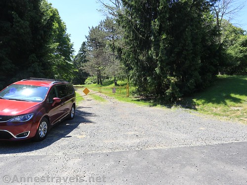
Start at the parking area just east of the road to the campground. It’s a peaceful parking area with space for about 20 cars. You do not need to drive down the campground road to get to it – which is a good thing since the road to the campground is gated when the campground and Boy Scout cabins aren’t in use.

Start by walking right, parallel to Lake Road, to cross the Campground Road. (Actually, if it’s not the dry of summer, you might want to walk on Lake Road to the Campground Road – there are plenty of wet areas in that field!) As you cross the Campground Road, look for a hole in the trees not far from Lake Road – this is the trail you want to take.
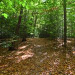
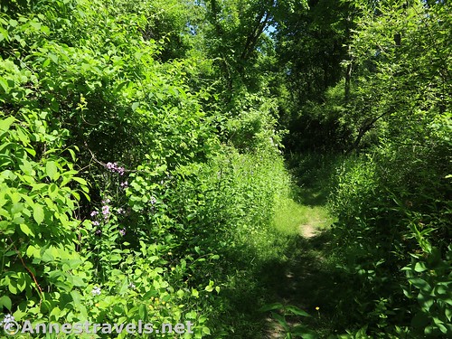
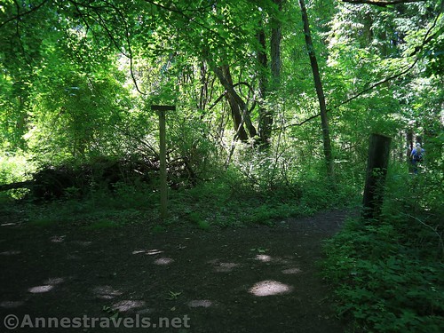
The path winds its way parallel to Lake Road, then turns down into a gully and climbs up the other side. From here it wanders through a pine forest – don’t take any of the side trails on the left.

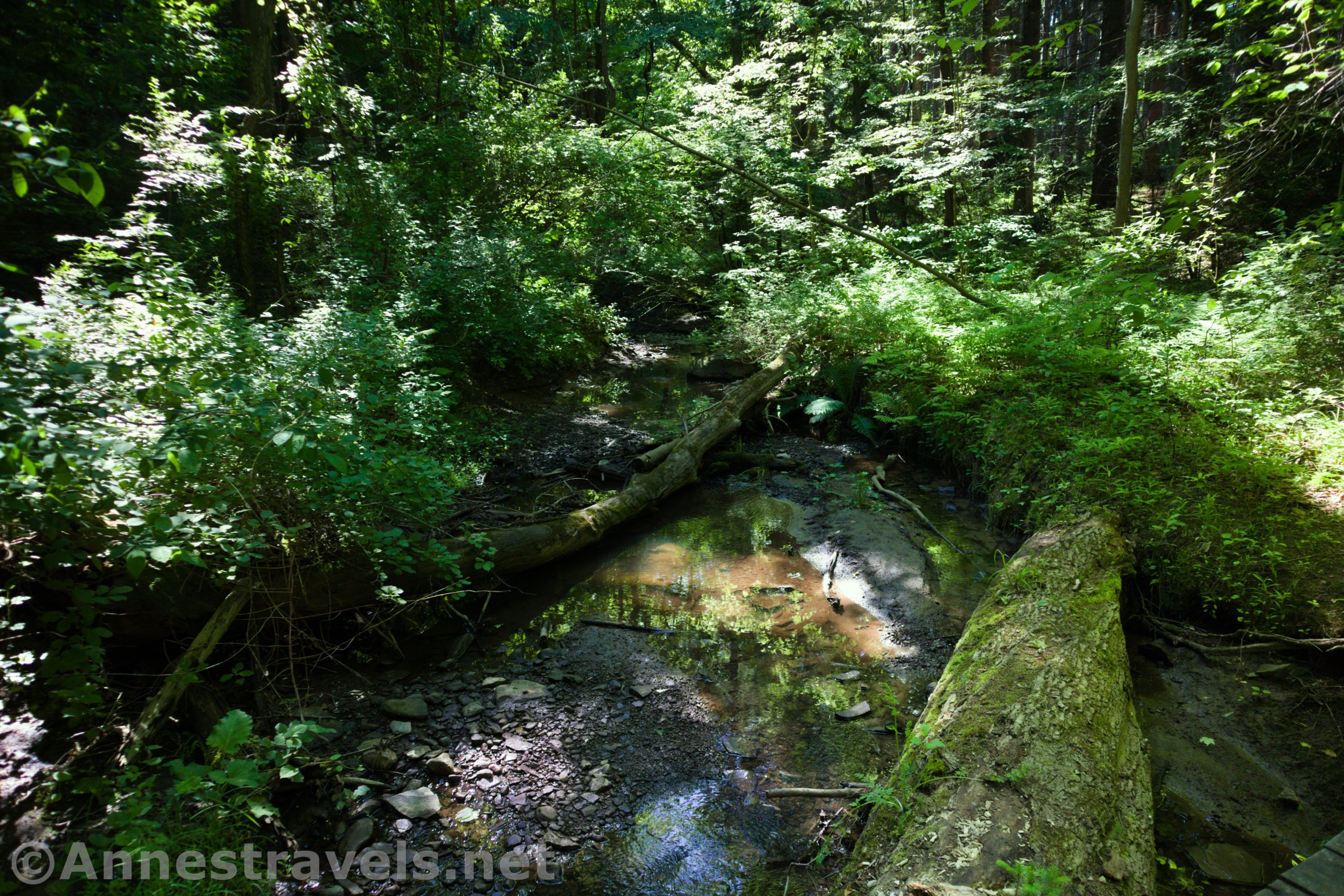
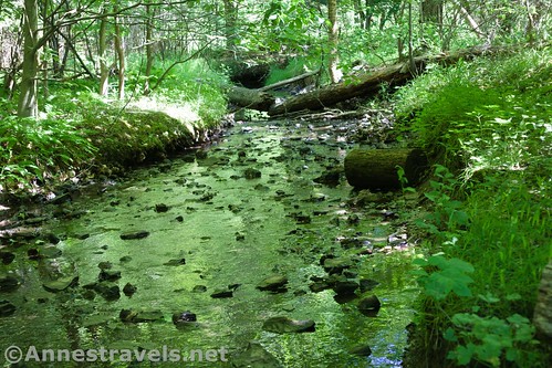
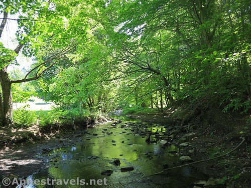
At last the trail comes to a bridge over West Creek. Cross the bridge and continue straight up the trail on the other side. Note: The official trail signs take you left at this junction along West Creek. It’s the more scenic of the two trails, and since they take you out to the same place, it’s fine to follow the signs.

The trail skirts the edge of the pinewood, passing trails to people’s houses on the right. It finally descends to a gravely sluice (sometimes with standing water in very wet weather) and turns to the left. Turn left with the trail (you don’t have a whole lot of choice) and continue to where a trail enters from the left (this is the trail you’d be coming down if you follow the Grand Tour signs). Turn right (or, if you’re following the signs, continue straight/left).

A short time later, the trail splits at a major junction. Turning left takes you over the bridge. (If you want to cut your hike short, turn left here, cross the bridge, and ascend the wide path up to the gravel road. Turn left and stay straight on the road – it will take you back to Lake Road near your vehicle). But you want to turn right and stay on this side of West Creek.

Very shortly after the major junction, the trail will split a second time. It doesn’t matter which trail you take; both will take you to the same place.

After the trails re-merge, the path enters a beech forest. This is likely one of the oldest plots of forest in the park (many parts of the park were fields when the Boy Scouts owned the property before it was turned into a county park – these fields have since grown into pine forests). It’s a beautiful place to hike in the autumn, when the trees turn brilliantly yellow. At a well-marked junction, a path turns right toward Whiting Road. You want to continue straight on the “West Trail” following the sign for the “Midnight Trail”.

The trail descends to a gully, rises on the other side, and then turns to descend to West Creek once again. Cross the bridge and follow the path up to the road. Turn right on the gravel road (uphill), following the sign for the Midnight Trail.
At the top of the hill is a Boy Scout cabin. You want to turn right (toward the pump) and follow the sign for the Midnight Trail into the woods.

At 1.4 miles from the trailhead, you’ll come to the turnoff (on right) for the Midnight Trail. Continue left; shortly afterward a trail will go off on left. Continue right (more like straight) down to a bridge to cross over a swampy creek. The trail rises to a T; turn right. Note: If you’re doing this trail in the opposite direction, realize that the sign here is incorrect. The arrow points to go over toward the cabin and down the road – this is not correct. You want to go downhill to the bridge. If you’re following the directions counter-clockwise (the way I describe them here), the sign is correct that you should turn right.

From here, the trail passes through a mixed forest and finally circles another cabin. After circling the cabin, the trail splits. You want to go left (I’m not entirely sure where the right trail goes – it’s new to me!)

Now you can relax for a bit from trail junctions! It’s a peaceful trot through pinewoods, slightly open areas, and mixed forest. You will pass a trail junction on the left (stay right following the sign for Holt Road and Lake Road)…

…and another trail junction on the right (stay left following the sign for Holt Road and Lake Road).

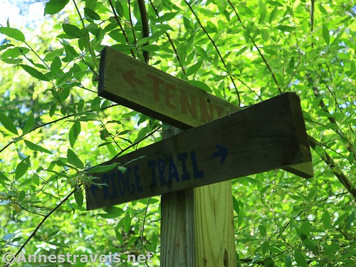
Eventually you’ll come to a trail junction where a trail turns right down the hill. A sign half-lost in the brush points toward the Tennis Courts to the right. Turn right to descend (ignore the trail that goes off on left before you get to the bottom of the hill and the trail on right before crossing the creek) to the creek and cross over.
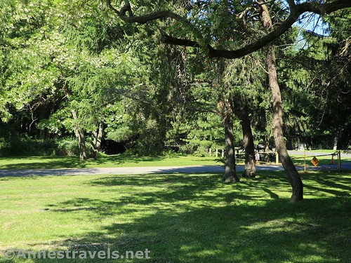
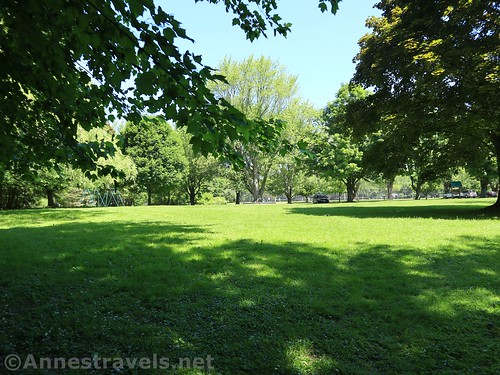
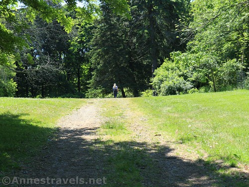
Continue up the hill and eventually ignore the trail on right (it goes out to Holt Road). Keep going straight out onto a grassy place about mile 2.8 – there’s a pavilion on the right and a swingset on the left.
Keep walking straight – you’ll eventually come to a small road. Follow the road clockwise as it circles the tennis courts. You want to get not quite halfway around the loop; a trail goes off on the left. It’s a large trail, but it’s not necessarily extremely obvious. This junction is marked with a Grand Tour sign and a sign for the Orchard Trail. As of 12/31/2021, it appears that the signmakers ran out of signs at this point – it is the final sign on the loop. But you can continue to follow my directions below to complete the loop. As of 4/17/2022, a sign directs you to walk to Lake Road, turn west, and return to the parking area. That’s not very helpful (where is Lake Road, and which way is West?). Besides, there are trails you can take – detailed below.
The trail descends to cross the bridge over Mill Creek. Cross the bridge into the field.

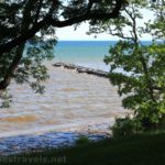
From here you have a couple of options. You can turn right to pick up the Easy Loop as it heads east to the sledding hill (I recommend this – pick up this loop again in the “Lake Parking Lot”). If you want a slightly shorter (only slightly) loop, continue straight across the field heading toward the road bridge that crosses over Mill Creek. That’s what I’ll do in this guide. A small walkway passes under the road bridge (it’s Lake Road) and then turn left to cross the metal grate bridge over Mill Creek. You’re now in the Lake Parking Lot. From here, you can walk out on the pier by walking down the parking lot to the lakeshore and turning right to cross back over Mill Creek and take the sidewalk out to the pier. While I highly recommend it if you didn’t take the “Easy Loop” option, I’m not including it in the mileage of this hike.

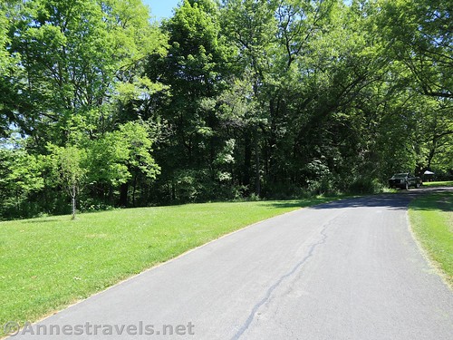
To continue on the loop, head west toward the entrance road to the parking area. Walk up the entrance road and turn right on Lake Road. Almost immediately you’ll see a sign for Ridge Hill (as in the shelter). Cross (carefully!) Lake Road and turn left up the gravel road to the gate (just before you get to the Ridge Hill sign) about mile 3.3.
Cross the gate and continue straight up the old road. You’ll pass the shelter and enter the woods.

Keep walking on this trail as it passes by an old dump area (mostly for branches now) and then becomes narrower. About a half a mile beyond the gate, you’ll come to a sign pointing toward Wolf Cabin. Turn right, following the sign.
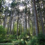
The path plunges into a pine forest. Keep going straight as the trail becomes slightly vaguer as it descends a hill. Turn right on the path just before you hit East Creek. It will take you along the creek to a crossing via logs. Immediately after crossing East Creek, turn right on the path that heads generally north and then east. The path winds its way up to the top of the hill, passes by a sign for a campsite trail (stay right), passes another trail (stay right again), and descends to cross a bridge. Continue up the other side to a four-way trail junction. Straight ahead would take you out in the field, but you want to turn right.

The path will take you shortly back to your vehicle about mile 4.25. Congrats – you’ve hike around much of the perimeter of Webster Park!

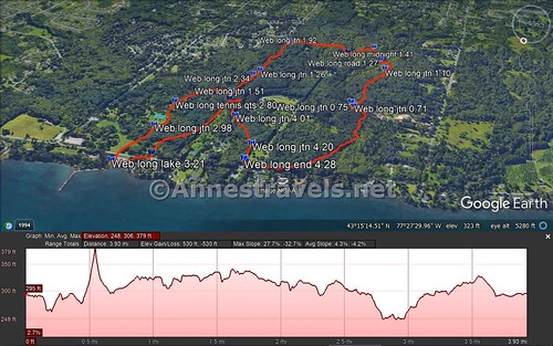
Round trip trail length: About 4.25 miles; it can be extended a little to go out to the fishing pier
Elevation Gain: About 350ft. (248ft. to 379ft.)
Dogs: Leashed
Facilities: There may be port-a-potties at some of the parking areas. A playground can be accessed if you turn right after crossing Mill Creek for the first time and keep walking beyond the pavilion. There are benches along some of the trails and also near the fishing pier. The campground is also nearby.
Fees: None
Trail Notes: There are a ton of trails you could possibly explore along this route. If you want to do the “Grand Tour” proper, turn right after crossing Mill Creek for the first time. Follow Mill Creek beyond the pavilion and the playground to the road, then turn left up the road. Turn right just before Lake Road into the parking area (there’s a new playground next to the parking area). Follow the gravel parking area/road back along the edge of the trees to pick up an out-and-back path above Mill Creek. Retrace your steps to continue with the loop.

Trail 
![]()
![]()
Road
Signs ![]()
![]()
Scenery ![]()
![]()
![]()
Would I go 100 miles out of my way for this? ![]()
![]()
![]()
Overall Rating: ![]()
![]()

GPS Coordinates for the Webster Park Grand Tour
Trailhead: 43.2579167°, -077.4586667° (N43° 15.475′ W77° 27.520′ / 43°15’28.5000″, -077°27’31.2000″) 368ft. (0.0)
Trail Junction: 43.2516667°, -077.4629000° (N43° 15.100′ W77° 27.774′ / 43°15’06.0000″, -077°27’46.4400″) 359ft. (0.71)
Trail Junction near bridge: 43.2513667°, -077.4625833° (N43° 15.082′ W77° 27.755′ / 43°15’04.9200″, -077°27’45.3000″) 362ft. (0.75)
Trail Junction(Whiting Road trail sign): 43.2473833°, -077.4636333° (N43° 14.843′ W77° 27.818′ / 43°14’50.5800″, -077°27’49.0800″) 418ft. (1.10)
Gravel Road: 43.2460667°,-077.4628500° (N43° 14.764′ W77° 27.771′ / 43°14’45.8400″, -077°27’46.2600″) 410ft. (1.27)
Midnight Trail Junction: 43.2446833°, -077.4617833° (N43° 14.681′ W77° 27.707′ / 43°14’40.8600″, -077°27’42.4200″) 440ft. (1.41)
Trail Junction: 43.2530667°, -077.4540000° (N43° 15.184′ W77° 27.240′ / 43°15’11.0400″, -077°27’14.4000″) 393ft. (1.51)
Trail Junction: 43.2460167°, -077.4599667° (N43° 14.761′ W77° 27.598′ / 43°14’45.6600″, -077°27’35.8800″) 433ft. (1.57)
Trail Junction (after circling cabin): 43.2460833°, -077.4545000° (N43° 14.765′ W77° 27.270′ / 43°14’45.9000″, -077°27’16.2000″) 419ft. (1.92)

Trail Junction: 43.2502500°, -077.4545000° (N43° 15.015′ W77° 27.270′ / 43°15’00.9000″, -077°27’16.2000″) 414ft. (2.26)
Trail Junction: 43.2508333°, -077.4542500° (N43° 15.050′ W77° 27.255′ / 43°15’03.0000″, -077°27’15.3000″) 394ft. (2.34)
Tennis Courts: 43.2551500°, -077.4509500° (N43° 15.309′ W77° 27.057′ / 43°15’18.5400″, -077°27’03.4200″) 376ft. (2.80)
Trail Junction (turn off tennis court road): 43.2573667°, -077.4513833° (N43° 15.442′ W77° 27.083′ / 43°15’26.5200″, -077°27’04.9800″) 365ft. (2.98)
“The Lake Parking Lot”: 43.2603000°, -077.4511500° (N43° 15.618′ W77° 27.069′ / 43°15’37.0800″, -077°27’04.1400″) 307ft. (3.21)
Gate near the Ridge Hill Shelter: 43.2592000°, -077.4530333° (N43° 15.552′ W77° 27.182′ / 43°15’33.1200″, -077°27’10.9200″) 326ft. (3.36)
Trail Junction (turn toward Wolf Cabin): 43.2537333°, -077.4543667° (N43° 15.224′ W77° 27.262′ / 43°15’13.4400″, -077°27’15.7200″) 355ft. (3.82)
Trail Junction (just after crossing East Creek): 43.2549833°, -077.4557667° (N43° 15.299′ W77° 27.346′ / 43°15’17.9400″, -077°27’20.7600″) 336ft. (4.01)
Trail Junction (near the field): 43.2566667°, -077.4582500° (N43° 15.400′ W77° 27.495′ / 43°15’24.0000″, -077°27’29.7000″) 342ft. (4.20)
End: 43.2578167°, -077.4585333° (N43° 15.469′ W77° 27.512′ / 43°15’28.1400″, -077°27’30.7200″) 336ft. (4.28)
The gpx file for the “Grand Tour” through Webster Park can be downloaded – please note that this and the GPS Coordinates are for reference only and should not be used as a sole resource when hiking this trail.
Download GPX File size: 61.8 KB Downloaded 543 times
(Note: I do my best to ensure that all downloads, the webpage, etc. are virus-free and accurate; however, I cannot be held responsible for any damage that might result, including but not limited to loss of data, damages to hardware, harm to users, from use of files, information, etc. from this website. Thanks!)
Getting to Webster Park
If you’re familiar with Webster Park, you want to park in the small gravel parking area near the entrance to the Campground Road, across from the Kanatota Lodge.

From Rochester, take I-490 to NY-590N. Use the middle lane to get onto NY-590N. After 4.5 miles, take Exit 10B onto NY-104E toward Webster. You’ll fairly quickly cross the Irondequoit Bay Bridge. After 5 miles, immediately after crossing under the bridge for 5 Mile Line Road, take the exit for Holt Road onto the exit ramp. At the end of the ramp, turn left onto Holt Road. Continue about 3 miles to the (nearly) end of the road; turn left onto Lake Road. After 0.6 miles, turn left into the parking area – the parking area is across the road from the Kanatota Lodge.
From Wayne County, either take NY-104W to Holt Road or you can drive west on Lake Road to the parking area.
This Week’s Featured Product!
If hiking and waterfalls are your thing, this is the perfect book for you! With 200 waterfalls in central and western New York state, complete with maps, trail descriptions, and more, this book is sure to be an explorer’s guide.