

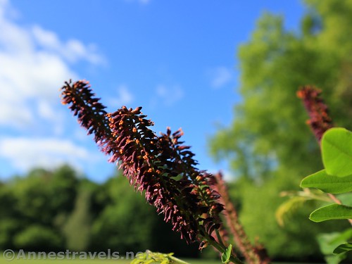
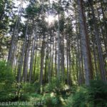
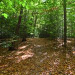
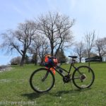
Webster Park is a local hiker’s paradise. Miles of trails crisscross the hardwood forests, pine forests, streams, and occasional meadows in its 550 acres. It’s big enough to lose yourself, as plenty of my friends have told me. (Hint: If you ever get lost, head north – you’ll hit Lake Road and/or Lake Ontario before too long.) Since I’ve hiked it extensively since I was “knee-high to a grasshopper” up through adulthood, I thought I’d share some of my “best” loop hikes in Webster Park. This is the easiest loop, but it’s also one of the most scenic because it showcases Lake Ontario.

This is the Easy loop hike – it showcases the fishing pier, Mill Creek, and nearby grassy meadows. For the Masy loop hike through a pine forest, click here. For the “Webster Park Grand Tour”, click here.

Best Easy Loop Hike in Webster Park
Quick Stats
Note: Though this is an “easy” loop, it does have two significant slopes – one up the sledding hill and one down to lake level. Furthermore, much of the “trail” is a grassy meadow. If you need a truly “easy” hike, take the route backward to the fishing pier and omit the rest of the loop.

From the parking lot, walk toward the southeast corner of the parking area (toward the road bridge over Mill Creek). A sign will point toward the “Beeches Shelter”; turn left to follow the sign and cross over Mill Creek via the metal bridge.
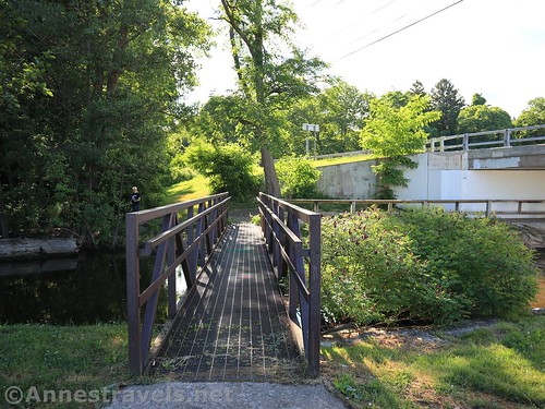
Cross the metal bridge by the road bridge, turn right, cross under the road bridge.
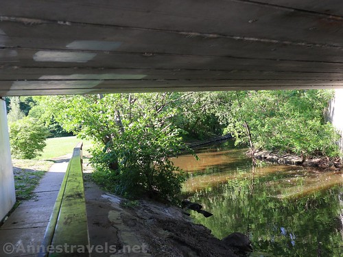
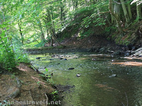
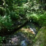
Continue through the field by the stream, staying sort of near Mill Creek.

You’ll pass a picnic shelter and then a bridge. Don’t cross the bridge (unless you want an extra bit of a walk – then cross the bridge, climb the hill, turn onto the road, go around the loop of the road around the tennis courts, go back down the hill, cross the bridge and continue right up the stream as for the loop I’m describing here). When you reach a second picnic shelter, turn left to walk up the hill. (This is a local favorite for sledding; I’ve seen children from two to teens using it, not to mention parents, grandparents, 20-somethings, etc. It’s likely the hill has been used for sledding for about 200 years.)

Continue straight and a little right (sort of toward the lodge) to come out in the parking lot.

Cross the parking lot and cross Lake Road (be careful; it can be busy) into an open field with a picnic shelter and a swingset.

Walk toward the lake. During the war of 1812, locals would gather here to watch the British gunboats sail by. When you get to the bluff above the lake, turn left. An old road leads down to lake level.

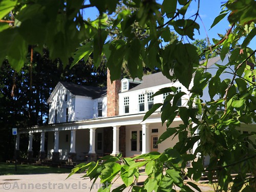
If you’d continued along the top of the bluff, you’d come to the White House Lodge. This was built by the second settler in Webster – a certain Charles Whiting. His widow, Pheobe, had a house down on the corner of Lake Road and what is now Whiting Road (the street was named after her). Her house burned down a very long time ago, but his house remains as a rentable lodge. It’s frequently in use for weddings and other events. It’s even a polling place in November.
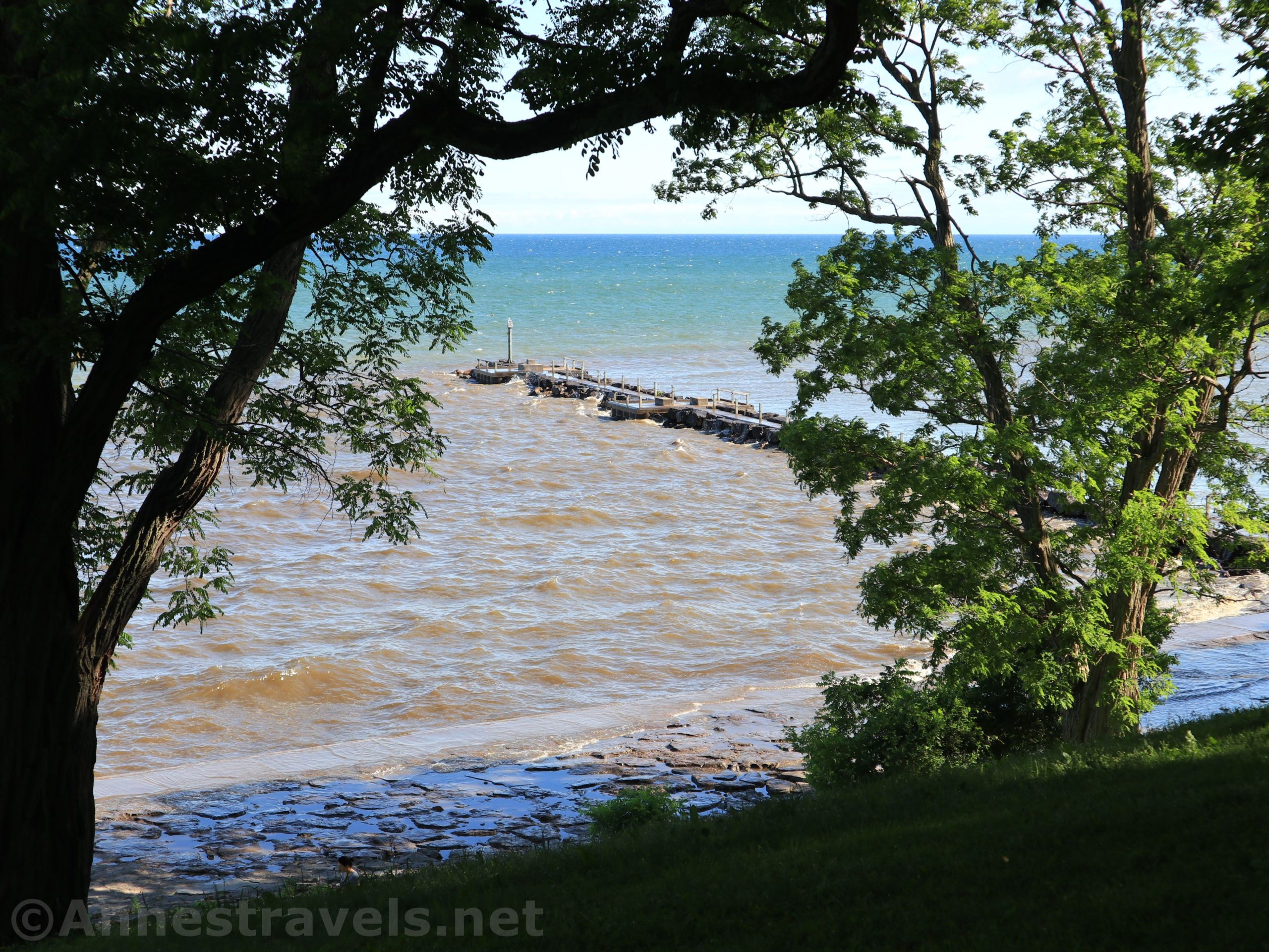
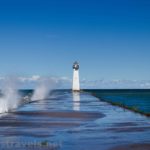
Once on lake level, turn right to walk out onto the fishing pier and enjoy the view. The wind and waves were crazy they day I was taking photos – usually there are quite a few people fishing on the pier, but it was too wet for that!


There is a lighthouse at the end of the pier.

Return to the mainland and follow the sidewalk to the right along the lake. My GPS track takes the path that is slightly inland from the sidewalk along the lake. Usually, I’d take the sidewalk, but the waves were so crazy that day that I was afraid I’d get wet!

At the end of the sidewalk, cross the bridge and return to the parking area.

Round Trip Trail Length: About 1 mile
Elevation Gain: 500ft. (244ft. to 297ft.)
Facilities: Occasionally a port-a-potty somewhere along the loop; bench near the pier; swings in one field; playground near the sledding hill
Fees: None
Trail 
![]()
Road
Signs ![]()
![]()
![]()
Scenery ![]()
Would I go 100 miles out of my way for this? ![]()
![]()
Overall Rating: 
![]()

GPS Coordinates for the Easy Loop in Webster Park
Trailhead: 43.2598667°, -077.4510333° (N43° 15.592′ W77° 27.062′ / 43°15’35.5200″, -077°27’03.7200″) 298ft. (0.0)
Bridge over Mill Creek: 43.2585500°, -077.4513000° (N43° 15.513′ W77° 27.078′ / 43°15’30.7800″, -077°27’04.6800″) 239ft. (0.15)
Pavilion – turn up sledding hill: 43.2577333°, -077.4485000° (N43° 15.464′ W77° 26.910′ / 43°15’27.8400″, -077°26’54.6000″) 238ft. (0.36)
Cross Lake Road: 43.2602500°, -077.4476500° (N43° 15.615′ W77° 26.859′ / 43°15’36.9000″, -077°26’51.5400″) 274ft. (0.57)
Beginning of Pier: 43.2613333°, -077.4496333° (N43° 15.680′ W77° 26.978′ / 43°15’40.8000″, -077°26’58.6800″) 232ft. (0.74)
End of Pier: 43.2625167°, -077.4500000° (N43° 15.751′ W77° 27.000′ / 43°15’45.0600″, -077°27’00.0000″) 238ft. (0.85)
End: 43.2603167°, -077.4511167° (N43° 15.619′ W77° 27.067′ / 43°15’37.1400″, -077°27’04.0200″) 234ft. (1.07)
The gpx file for the Best Easy Loop through Webster Park can be downloaded – please note that this and the GPS Coordinates are for reference only and should not be used as a sole resource when hiking this trail.
Download GPX File size: 19.0 KB Downloaded 533 times
(Note: I do my best to ensure that all downloads, the webpage, etc. are virus-free and accurate; however, I cannot be held responsible for any damage that might result, including but not limited to loss of data, damages to hardware, harm to users, from use of files, information, etc. from this website. Thanks!)
Getting to Webster Park
If you’re familiar with Webster Park, you want to park in the “Lake Parking Lot” (it’s signed for the Beeches Shelter). If the gate is closed, you can park east up Lake Road at the paved lot on the corner of Holt Road and Lake Road. Start your route by crossing Lake Road into the field with the pavilions and swingset.

From Rochester, take I-490 to NY-590N. Use the middle lane to get onto NY-590N. After 4.5 miles, take Exit 10B onto NY-104E toward Webster. You’ll fairly quickly cross the Irondequoit Bay Bridge. After 5 miles, immediately after crossing under the bridge for 5 Mile Line Road, take the exit for Holt Road onto the exit ramp. At the end of the ramp, turn left onto Holt Road. Continue about 3 miles to the (nearly) end of the road; turn left onto Lake Road. Drive down the hill. Shortly after crossing the bridge at the bottom of the hill, turn right into the driveway that will take them down to the large parking lot – the driveway is marked for The Beeches shelter.

From Wayne County, either take NY-104W to Holt Road or you can drive west on Lake Road to the parking area.

This Week’s Featured Product!
Looking for even more hikes in the Rochester, New York, area? Check out this book with 20 easy (or easier) hikes in Monroe County.
2 responses to “The Best Hikes in Webster Park – Short, Easy Loop”
[…] the Moderate Loop Hike – it is a peaceful hike through a pine forest along a creek. For the Easy loop hike showcasing the fishing pier, Mill Creek, and nearby grassy meadows, click here. For the […]
[…] post is the Grand Tour Hike that circles Webster Park. For the Easy loop hike showcasing the fishing pier, Mill Creek, and nearby grassy meadows, click here. For the […]