

You might remember that last year I wrote about kayaking Irondequoit Creek from Ellison Park to Irondequoit Bay, and then about kayaking Irondequoit Bay from La Salle Landing (the mouth of Irondequoit Creek) to the mouth of Irondequoit Bay. Our shuttle ride was still at least a couple of hours out, so we decided that, instead of turning right (east) toward the kayak pullout along Lake Road (soon to be an official kayak launch at Sandbar Park), we’d paddle out into Lake Ontario and see if we could get down to Mill Creek and the “Lake Parking Lot” in Webster Park. It worked pretty well, so in this post, I’ll detail how to paddle between the Sandbar Park launch in Irondequoit Bay to Webster Park!
Quick Stats

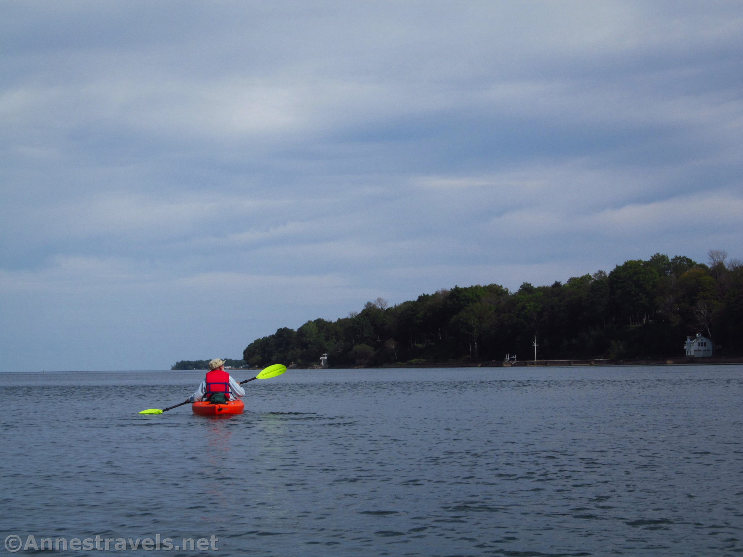
As I said, we didn’t actually start from the launch, since we were already near the mouth of Irondequoit Bay. And since we had two or so hours to kill, we decided to go out and see what Lake Ontario was like. I’ve paddled enough times on Lake Ontario to know that 1) You don’t want to paddle into a strong headwind, and 2) If the wind is coming from the south (it was that day), you can have very quiet water along the shelter of the north-facing cliffs.

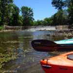
We passed through the narrow opening at the mouth of the bay that has a bridge over it November 1 to April 1 every year. Then we paddled out between the two rock jetties, making way for a few pleasure crafts – they have to move slowly through here, so there isn’t too much danger unless it’s super crowded.

The jetty on the right (east) belongs to Webster, while the jetty on the left (west) belongs to Irondequoit. The Irondequoit (longer) jetty has a slowly-rusting lighthouse at the end of it. The area is a favorite for fishermen and walkers and cyclists on both jetties.

Once beyond the shorter Webster jetty, we turned right (east). People were enjoying the beach (I don’t think it’s public) behind the houses. As you continue further east, you’ll pass Sandbar Park.
Unfortunately, at this point, “The Sandbar” of Webster doesn’t have a great reputation. Per local rumors, the neighbors are grouchy, the crime rate is high, the homes are dumpy, and the marinas draw snobby people who think they’re rich. Besides, no one is going to forget the internationally-covered arson/murder incident that happened there a number of years ago. (If it tells you anything, all of my friends and family from across the US were calling to make sure I was ok.) The town of Webster is trying hard to rebrand Sandbar Park by making improvements to the park – I expect this will help. At this point, while I don’t go biking down there alone, I’ve never had any issues while launching kayaks or cycling with other group members.

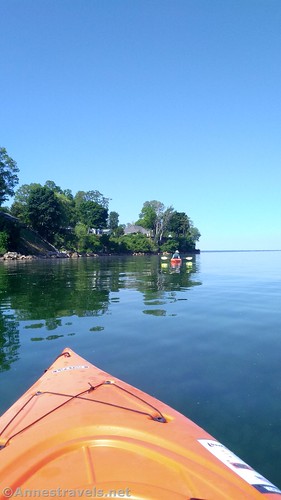
After passing the Sandbar, the cliffs rise into high bluffs above the lake. Houses peek out from under deciduous trees, and occasional docks or jetties poke out into the lake. You’ll pass several old communities; it’s like a trip back in time to see the pleasure homes of the rich from 50+ years ago. Be sure to look back (west) at Rochester, too.

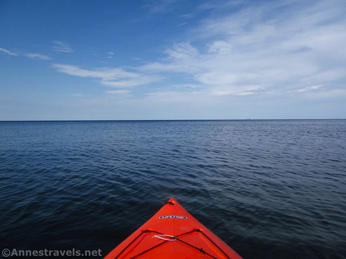
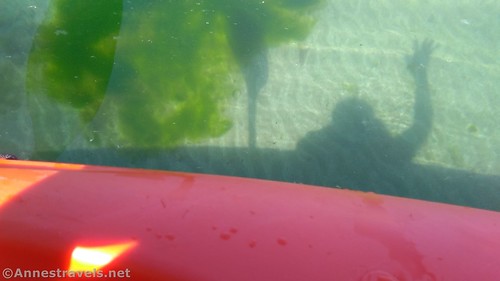
The lake in this area isn’t terribly deep (it’s probably deeper than it looks). On a calm morning, with the wind from the south (and therefore blocked by the cliffs), you can look down through the fairly-clear water to fish, occasional junk, and the really cool ripples and puzzle-like slabs of rock. It’s definitely special on a calm morning.

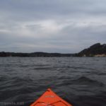
But we were on a not-quite-calm afternoon. There was enough wind to keep us cool and ripple the water, but its direction wasn’t easterly enough to be considered a headwind. That’s just about perfect!

It took us about 2.5 hours to paddle (steadily if not hurriedly) from the mouth of Irondequoit Bay to the fishing pier in Webster Park. When we got close, I called up our shuttle ride to tell them we’d changed plans. They were happy for a drive down to Webster Park instead of the Sandbar!

As you approach the pier in Webster Park (very similar to the Irondequoit jetty at the mouth of Irondequoit Bay), you’ll see a large rock beach and parking lot on the right, a smaller rock jetty, and then a paved sidewalk heading along the mainland and over to the fishing pier with its small lighthouse. Between the smaller rock pier and the concrete sidewalk is the mouth of Mill Creek. The easiest place to launch and pull out kayaks is just up Mill Creek.
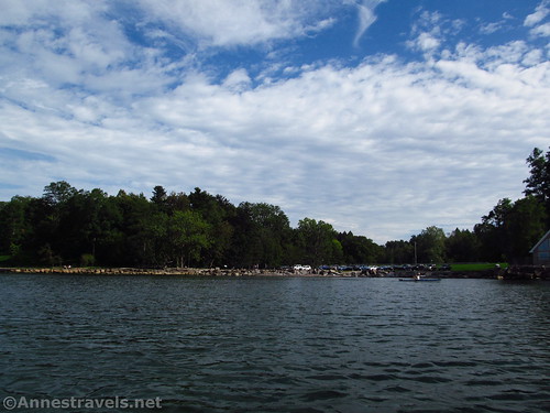
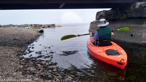
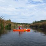
We paddled in (much to the enjoyment of the families and their small children playing nearby) and under the bridge. This is only possible in wet weather; a gravel bar blocks the way between the river mouth and the lake during dry weather and you’ll have to find another way to easily climb out of your kayak (maybe onto the gravel bar?) But if you can get to the bridge, pass underneath it with deeper water and then pull up on the gravelly area on the right (west) side of the creek, just below the parking area, which is only covered when the creek is at flood stage. The beach-ish gravel-ish area makes a good landing and launch.
From here, it was a simple matter of pulling the kayaks up the grassy bank and then portaging them across the parking area to our waiting shuttle. It was a good day to be thankful for people who didn’t mind picking us up – wet and sunscreen and kayaks and all!
Total Distance (one way shuttle): 4.7 miles from the mouth of Irondequoit Bay to Webster Park/Mill Creek (add about a mile if coming from the kayak launch in Sandbar Park).
Elevation change: Negligible. You’re mostly on Lake Ontario.
Facilities: They’re currently building a canoe/kayak launch, restrooms, and more at Sandbar Park. At the “Lake Parking Lot” in Webster Park, you might find a port-a-potti.
Fees: None
Paddle notes: This is a good trip for a calm day, or when the wind is from the west or south. A north breeze can make it difficult to land and an easterly headwind is brutal. The Lake Parking Lot is occasionally closed, usually during winter weather. If it’s closed, carry the kayaks toward the pier, then take the old road up to the top of the bluffs and across the field to the parking area on the corner of Lake Road and Holt Road. It’s a long trek, so I recommend this route only in summer when the regular parking lot is usually open. Note that, as of spring 2023, they’re still building Sandbar Park, so the park itself is closed for another year or so.
Water Trail 
![]()
Road ![]()
Signs ![]()
![]()
![]()
Scenery ![]()
![]()
Would I go 100 miles out of my way for this? ![]()
![]()
Overall Rating: ![]()
![]()
GPS Coordinates for Irondequoit Bay to Webster Park via Lake Ontario
Approximate site of canoe/kayak launch in Sandbar Park: 43.2368116°, -077.5223415° (43°14.20870′, -077°31.34049′ / 43°14’12.5219″, -077°31’20.4293″) (about a mile from the mouth of Irondequoit Bay)
Mouth of Irondequoit Bay: 43.237247, -77.533345 (43°14.23482′, -077°32.00070′ / 43°14’14.0892″, -077°32’00.0420″) (244ft.) (9.07)
Mouth of Mill Creek: 43.260860, -77.451174 (43°15.65160′, -077°27.07044′ / 43°15’39.0960″, -077°27’04.2264″) (245ft.) (13.69)
Webster Park Lake Ontario Parking Lot: 43.260132, -77.451268 (43°15.60792′, -077°27.07608′ / 43°15’36.4752″, -077°27’04.5648″) (250ft.) (13.79)
The gpx file for Sandbar Park to Webster Park can be downloaded – please note that this and the GPS Coordinates are for reference only and should not be used as a sole resource when hiking this trail.
Download GPX File size: 24.5 KB Downloaded 398 times
(Note: I do my best to ensure that all downloads, the webpage, etc. are virus-free and accurate; however, I cannot be held responsible for any damage that might result, including but not limited to loss of data, damages to hardware, harm to users, from use of files, information, etc. from this website. Thanks!)

Getting to Sandbar Park & Webster Park
Sandbar Park/Mouth of Irondequoit Bay:
Take the exit to Bay Road (this is just after crossing the Bay Bridge if coming from the west (Rochester) or 1.9 miles west of Five Mile Line Road). Turn north (right) on Bay Road. After 1.9 miles, turn left at the T onto Lake Road. There should be a parking area on the left after a half a mile; the kayak launch is nearby. Launch your craft, turn right (west) and head out toward the main part of Irondequoit Bay. At the end of the docks, turn right through the narrow channel out into Lake Ontario as described above.
Webster Park:
From Rochester, take I-490 to NY-590N. Use the middle lane to get onto NY-590N. After 4.5 miles, take Exit 10B onto NY-104E toward Webster. You’ll fairly quickly cross the Irondequoit Bay Bridge. After 5 miles, immediately after crossing under the bridge for 5 Mile Line Road, take the exit for Holt Road onto the exit ramp. At the end of the ramp, turn left onto Holt Road. Continue about 3 miles to the (nearly) end of the road; turn left onto Lake Road. Drive down the hill. Shortly after crossing the bridge at the bottom of the hill, turn right into the driveway that will take them down to the large parking lot – the driveway is marked for The Beeches shelter.
This Week’s Featured Product
If you’re looking for paddling opportunities in western New York State, this is a favorite book. It covers 45 different areas to take a canoe or kayak and includes detailed descriptions, mileages, and more for lakes, rivers, creeks, and scenic waterways. Buy your copy here!

More Related Posts:
 Paddle Irondequoit Bay
 Paddling Irondequoit Creek – Ellison Park to Irondequoit Bay
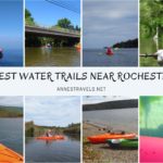 The Best Kayaking/Canoe Adventures & Water Trails near Rochester, New York
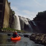 Kayaking the Genesee River to Lower Falls!
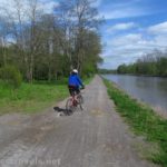 Erie Canal: Meridian Center (Rochester) to San Souci Park (Brockport)
 Kayaking Honeoye Creek: Rush to the Genesee River