

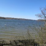
Irondequoit Bay is a bit of a fixture on the northeast side of Rochester, New York. It’s a favorite with marinas, pleasure-seekers, and amusement park-seekers (due to Seabreeze right up the hill). It’s also famous because of the so-called “Bay Bridge” – whether you live in terror of crossing it or do it every day out of necessity. (I don’t mind driving across it except when I’m in the outside lane in a high-profile vehicle on a windy day…) Irondequoit Bay is also a fun place to go kayaking. Last fall, I had the opportunity to kayak all of the way from the southern end (La Salle’s Landing at the mouth of Irondequoit Creek) and the north end (the mouth of Irondequoit Bay). We planned from there to exit via the unofficial kayak launch in Sandbar Park.
Quick Stats
Note: Some of the links in this post are affiliate links. If you click one and purchase something, I may earn a small commission without an extra cost to you.

Note that right now there’s an ongoing project to make Sandbar Park into a great place for recreation, including an official kayak launch, dock, picnic areas, playground, etc. So anything I say about Sandbar Park at this point is either what I read online or what I found before the project began. The park should reopen 2023-2025.

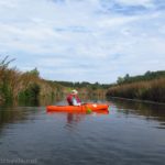
We’d just come down Irondequoit Creek, having been dropped off at Ellison Park by another group member, so after a quick snack, we headed out from the boat ramp in La Salle’s Landing Park into Irondequoit Bay. There are quite a number of water birds that hang out in this area – and I’m talking about more than just sea gulls and Canada geese (though you’ll see those too).

Someone keeps the main channel between Irondequoit Creek and Irondequoit Bay dredged. Otherwise, it would be full of reeds, seaweed, and scum. As it was, the water was somewhat low, so we worked our way out toward the clear water without poling through silt too much.
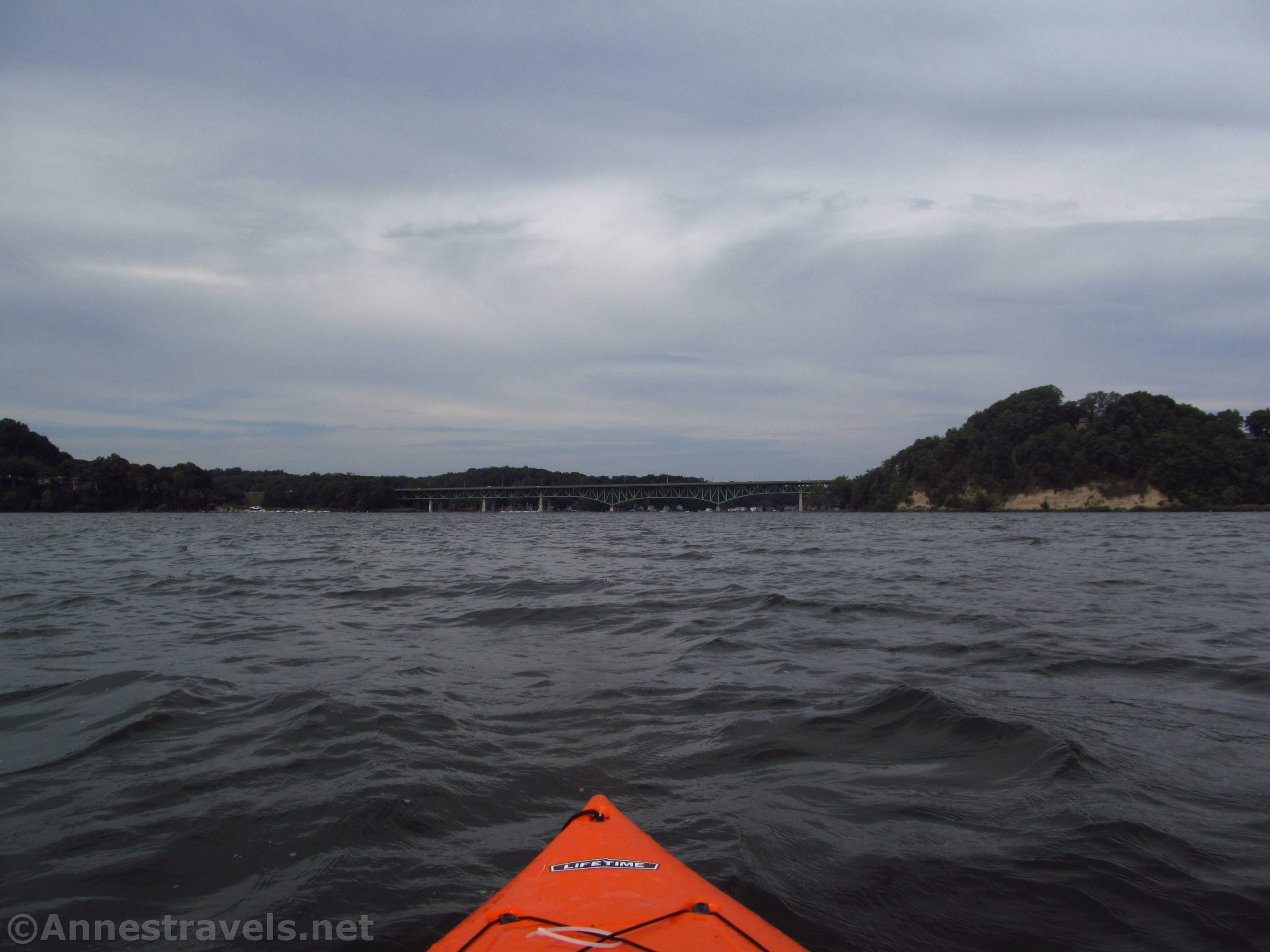
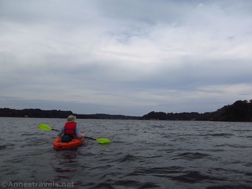
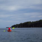
About this point, we realized that we had an incredible advantage. There was a gale blowing from the south; I had to do very little besides keep the bow of my kayak pointed in the right direction and I was being blown straight down Irondequoit Bay.
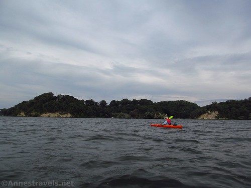
That’s fun, but I’m really glad we didn’t have to beat back against such a strong wind! Also, the wind made the bay much choppier than I’m used to.

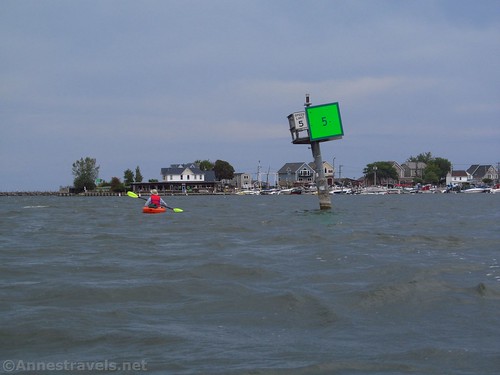
We stopped briefly at the dock by the new lodge in Abraham Lincoln Park to look for restrooms (all closed). That took us over to the east side of the bay. From there, we continued north, heading for the Bay Bridge, which is about 3.1 miles north of La Salle’s Landing.

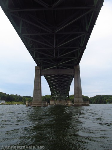
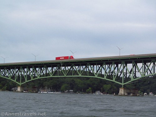
I had never expected the Bay Bridge to look quite the way it does. Somehow, driving across it, I couldn’t imagine a continuous truss bridge (it seemed more like an arch bridge in my mind’s eye). It’s actually fairly impressive as you kayak up to it.
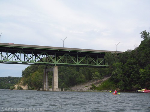
We paused beneath the bridge to eat lunch. The wind had died down a little, but we held onto the concrete pillars and ate our sandwiches, applesauce, and homemade peanut butter cookies.
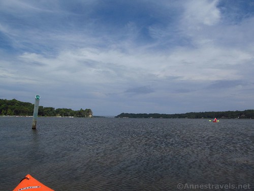
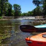
From there, we headed toward the mouth of Irondequoit Bay. I’ve kayaked this section a few times before – it usually takes me about 2 hours to kayak from Sandbar Park (tucked back about 0.6 miles into a side-bay off of Irondequoit Bay) to the Bay Bridge and back. The Bay Bridge to the mouth of Irondequoit Bay is about 2.1 miles.

On this particular day, we had planned to be picked up at Sandbar Park, but we’d come down Irondequoit Bay quite a lot faster than we’d expected. So our timings weren’t going to work with our pickup person. Instead of paddling all of the way to Sandbar Park, we decided to paddle out into Lake Ontario and see what the weather was like out there. It seemed better than sitting around for a couple of hours waiting to be picked up. But that adventure is better told in its own post, so I won’t detail it here other than to say that we ended up clear down at Webster Park before the day was out!

Trip Length: Irondequoit Bay is about 5 miles long. If you have a shuttle vehicle, you can go between La Salle’s Landing and Sandbar Park for a 5.6 mile shuttle paddle.
Elevation gain: Negligible
Facilities: None. I hear there will be restrooms at Sandbar Park; restaurants are nearby both ends of the bay.
Fees: None
Paddle notes: Irondequoit Bay gets very, very busy with boats on weekends in the summer, especially holidays like Labor Day and Memorial Day. I don’t recommend kayaking during busy times, since while there is a speed limit strictly enforced, it doesn’t mean people are paying attention to smaller crafts like kayaks and canoes. The bay is large enough that wind does affect it – from a glass-like lake to a choppy terror. Choose your weather wisely. It’s altogether possible to do this as an out and back. I’m looking forward to the new Sandbar Park in hopes of better facilities!
Water Trail 
![]()
Road ![]()
Signs ![]()
![]()
![]()
![]()
Scenery ![]()
![]()
Would I go 100 miles out of my way for this? ![]()
![]()
Overall Rating: ![]()
![]()
GPS Coordinates for Kayaking Irondequoit Bay
La Salle’s Landing Park Ramp: 43.176665, -77.525730 (43°10.59990′, -077°31.54380′ / 43°10’35.9940″, -077°31’32.6280″) (245ft.) (3.85)
Irondequoit Bay Bridge: 43.212249, -77.532014 (43°12.73494′, -077°31.92084′ / 43°12’44.0964″, -077°31’55.2504″) (244ft.) (6.95)
Mouth of Irondequoit Bay: 43.237247, -77.533345 (43°14.23482′, -077°32.00070′ / 43°14’14.0892″, -077°32’00.0420″) (244ft.) (9.07)
Old kayak launch near Sandbar Park: 43.238038, -77.520496 (43°14.28228′, -077°31.22976′ / 43°14’16.9368″, -077°31’13.7856″) (247ft.) (no mileage)
Approximate parking area at Sandbar Park: 43.2372754°, -077.5221930° (43°14.23653′, -077°31.33158′ / 43°14’14.1915″, -077°31’19.8946″)

The gpx file for Irondequoit Bay can be downloaded – please note that this and the GPS Coordinates are for reference only and should not be used as a sole resource when hiking this trail.
Download GPX File size: 32.6 KB Downloaded 400 times
(Note: I do my best to ensure that all downloads, the webpage, etc. are virus-free and accurate; however, I cannot be held responsible for any damage that might result, including but not limited to loss of data, damages to hardware, harm to users, from use of files, information, etc. from this website. Thanks!)

Getting to Irondequoit Bay
To get to La Salle’s Landing, from NY-590, take Exit 8 toward Empire Blvd. Turn east at the bottom of the exit ramp (left if coming from NY-590S (Webster, Irondequoit) and right if coming from NY-590N (the can of worms, Rochester, Victory, etc.). At the bottom of the hill, about 0.8 miles later, cross over the bridge over Irondequoit Creek. Take an immediate left into the small parking area with the sign indicating La Salle’s Landing Park.

To get to Sandbar Park, take Bay Road north until it T’s into Lake Road. Turn left and drive 0.4 miles to a parking area on the left. Note that from November 1 to April 1, you can cross over the outlet of Irondequoit Bay to access the parking area from the west. To do so, take NY-590N to where it T’s into Culver Road. Turn right. After about 0.9 miles, turn right into the parking area.

This Week’s Featured Product!
This is one of the best books I’ve found for paddle trail ideas in western New York. There are many quiet ponds and streams/creeks to choose from. Buy your copy here!

More Related Posts:
 Paddling Irondequoit Creek – Ellison Park to Irondequoit Bay
 Paddling Lake Ontario: Sandbar Park to Webster Park
 The Best Kayaking/Canoe Adventures & Water Trails near Rochester, New York
 Kayaking the Genesee River to Lower Falls!
 Great Local Park for Hiking – Abraham Lincoln Park
 Kayaking Honeoye Creek: Rush to the Genesee River