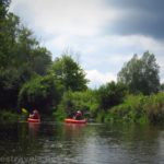

Last fall, I had the opportunity to kayak down Irondequoit Creek. It was fun, not too hard (as creeks in the Rochester area go), and we got to see quite a bit of flora and fauna along the way. It’s also fairly peaceful, though you’re rarely out of hearing of traffic on nearby roads and highways. We did the paddle as a shuttle trip between Ellison Park and Irondequoit Bay (LaSalles Landing Park), but there’s no reason you couldn’t do an out and back.
Quick Stats
Note: Some of the links in this post are affiliate links. If you click one and purchase something, I may earn a small commission without an extra cost to you.
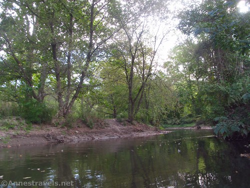
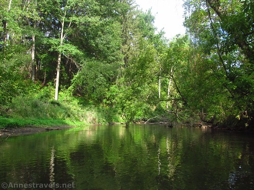
There’s no official kayak or canoe launch in Ellison Park. We scrambled down to the creek near the Old Meadow Shelter. It wasn’t ideal, and the banks were pretty muddy, but there wasn’t much in the way of brush and you can get to the creek here – which is unusual; much of Irondequoit Creek in Ellison Park has very steep brush-covered banks.

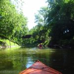
We launched just upstream of the bridge and began our float downstream. You’re passing through the park for a good distance, so you’ll see glimpses of picnic pavilions and trails through the brush along the river. There are a few snags to navigate, but it’s generally clear enough and deep enough for pretty easy paddling. I know a couple who did it in a 17ft. Grumman canoe, so it should be fine for both kayaks and canoes.

Pass under Browncroft Blvd about mile 1.4. After this, the sound of cars diminishes as you head into the swamp with Tyron Park on the left (west) and Lucien Morin Park on the right (east).
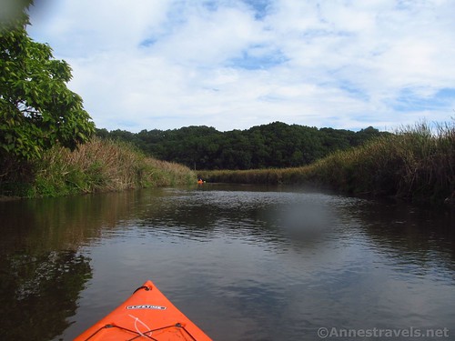
About a mile downstream from Browncroft Blvd, you’ll come to a place where two arms of Irondequoit Creek reconnect. As both arms flow through Ellison Park, you technically could have come down either arm; however, we came down the western channel which is deeper in Ellison Park. (The canoe trip came down the other channel, so that is passable, too.) The channel you just came down is marked by a sign telling that there is a 5ft. width limit ahead. It looks a bit out of place in the middle of a swamp, but I guess that’s what adventures are made of!

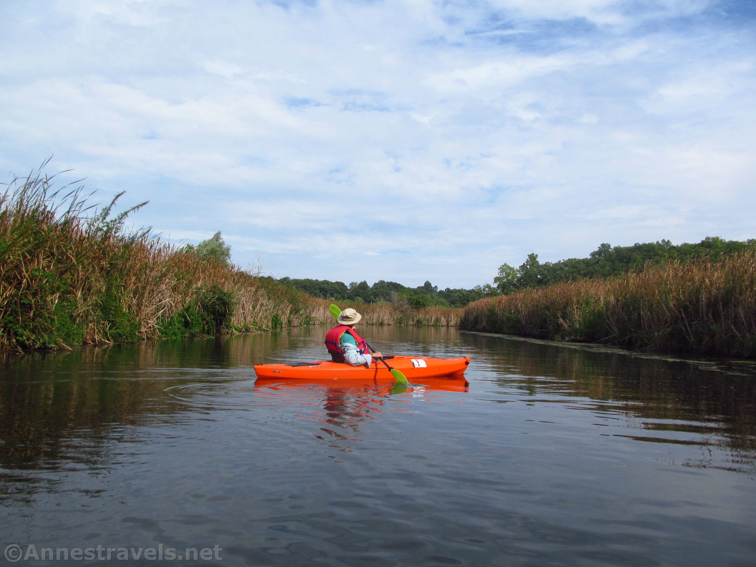
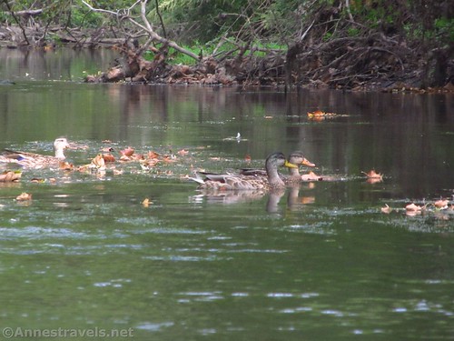
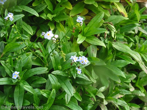
Continue left (downstream/north) into the swamp proper. We saw quite a few wildflowers and ducks after this. Go in the early morning and paddle quietly to see waterfowl and possibly other creatures that live near water.
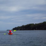
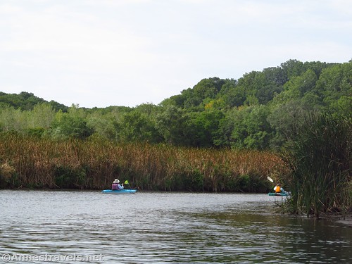
After twisting and turning amongst the reeds for quite a while in a fairly wide channel, you’ll come to Empire Blvd about mile 3.75. There are kayak rental companies here, so you may see more people out in watercraft. We met an entire school class out on the water trying dutifully to paddle their way upstream – in reality, it was hilarity and chaos, but most of the kids were having a great time!
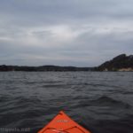
We continued another tenth of a mile out to the mouth of Irondequoit Creek and pulled up at the boat ramp in La Salle’s Landing Park. There weren’t restrooms, but we sat on the concrete wall and ate a snack. We also continued out into Irondequoit Bay, but that’s a topic for another post!

Trip Length: 3.85 mile shuttle or you can do it as an out & back of whatever length you choose
Elevation Gain: So little it’s hardly worth mentioning. There is a current, but it’s not strong.
Facilities: Restrooms and picnic facilities in Ellison Park; restaurants and kayak rental companies near La Salle’s Landing Park.
Fees: None

Trail Notes: Don’t forget bug spray. If you’re doing this in the opposite direction, be sure to take the middle channel (right and then left) after passing under Empire Blvd – it’s not quite so hard to know which way to go if you’re coming downstream. There is a current, but it’s not strong unless there has been quite a bit of rain recently.
Trail 
![]()
![]()
Road ![]()
Signs ![]()
![]()
![]()
![]()
Scenery ![]()
![]()
Would I go 100 miles out of my way for this? ![]()
![]()
Overall Rating: ![]()
![]()

GPS Coordinates for Irondequoit Creek
Launching Place near Old Meadow Shelter: 43.149169,-77.513990 (43°08.95014′, -077°30.83940′ / 43°08’57.0084″, -077°30’50.3640″) (249ft.) (0.0)
Browncroft Blvd: 43.157371,-77.527246 (43°09.44226′, -077°31.63476′ / 43°09’26.5356″, -077°31’38.0856″) (246ft.) (1.44)
Creek Junction: 43.166308,-77.532005 (43°09.97848′, -077°31.92030′ / 43°09’58.7088″, -077°31’55.2180″) (245ft.) (2.47)
Empire Blvd: 43.176153,-77.526572 (43°10.56918′, -077°31.59432′ / 43°10’34.1508″, -077°31’35.6592″) (245ft.) (3.75)
La Salle’s Landing Park Ramp: 43.176665, -77.525730 (43°10.59990′, -077°31.54380′ / 43°10’35.9940″, -077°31’32.6280″) (245ft.) (3.85)
The gpx file for paddling Irondequoit Creek can be downloaded – please note that this and the GPS Coordinates are for reference only and should not be used as a sole resource when hiking this trail.
Download GPX File size: 50.8 KB Downloaded 446 times
(Note: I do my best to ensure that all downloads, the webpage, etc. are virus-free and accurate; however, I cannot be held responsible for any damage that might result, including but not limited to loss of data, damages to hardware, harm to users, from use of files, information, etc. from this website. Thanks!)

Getting to Irondequoit Creek
To get to Ellison Park, from NY-590, take Exit 6 toward Blossom Road. Turn east at the bottom of the exit ramp (left if coming from NY-590S (Webster, Irondequoit) and right if coming from NY-590N (the can of worms, Rochester, Victory, etc.). After 1.3 miles, turn left into Ellison Park just after passing the parking area for the Dog Park and just before the road crosses Irondequoit Creek. (The park road crosses Blossom Road at this point – you want to turn left (north), although there are possibly places to put in if you go into the southern section of the park.)

Drive north until you cross Irondequoit Creek; this is where you want to put in, but sadly there’s no parking here. To park, you can continue on the road and then turn right to a small parking area or else you can go back down the park road to a rather large parking area. Either way, you’ll be carrying your craft 200-300 feet to the water.

To get to La Salle’s Landing, from NY-590, take Exit 8 toward Empire Blvd. Turn east at the bottom of the exit ramp (left if coming from NY-590S (Webster, Irondequoit) and right if coming from NY-590N (the can of worms, Rochester, Victory, etc.). At the bottom of the hill, about 0.8 miles later, cross over the bridge over Irondequoit Creek. Take an immediate left into the small parking area with the sign indicating La Salle’s Landing Park.