

A couple of weeks ago, we did a very long kayak trip –Black Creek all the way from Churchville to the Genesee River. The section between Churchville and Black Creek Park was quite nice; open water and pretty easy paddling (though you might need to drag your kayak or canoe over the shallows in low water). Below Black Creek Park was another story. I estimated that we climbed over 30-50 log jams, from freshly-downed trees to jams that had two or three years’ growth (at least) in the jam. Overall, though, it was a great adventure – though 19 miles was a bit longer than I was expecting!
Quick Stats
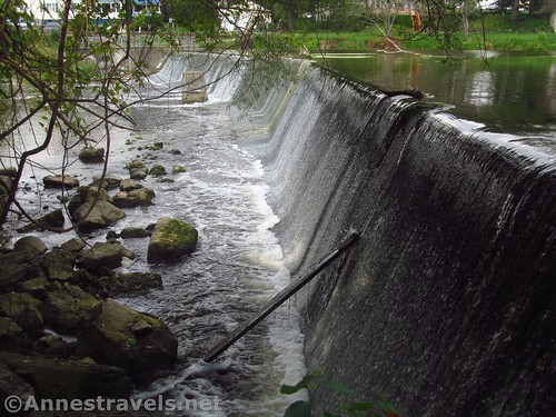
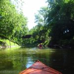
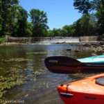
We didn’t get a terribly early start, and with driving and launching, we didn’t get on Black Creek until about 11am. We parked in the fishing parking area near the bridge, carried the kayaks down under the bridge, and then launched from one of the several launch spots (or maybe they’re used by fishermen) along the bank. It wasn’t too steep, which was nice. Be sure to look back at the Churchville Dam – it’s pretty when there’s water flowing over it.
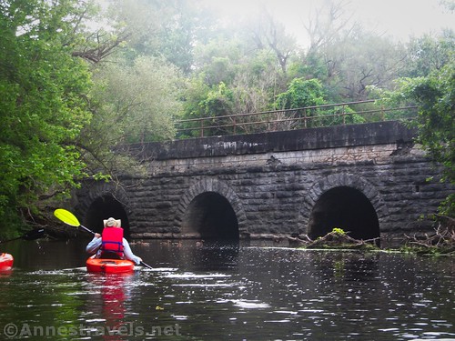
Only a tenth of a mile from where we launched, we paddled past an old rail bridge abutment, built in 1907. Buildings are being built where the rail line (West Shore Railroad) used to go, though west from here on the old rail line is the West Shore Trail.

A tenth of a mile beyond the bridge abutment, a CSX line crosses Black Creek. You’ll paddle under the old bridge and then immediately under the new bridge. The old bridge is definitely the more scenic of the two.
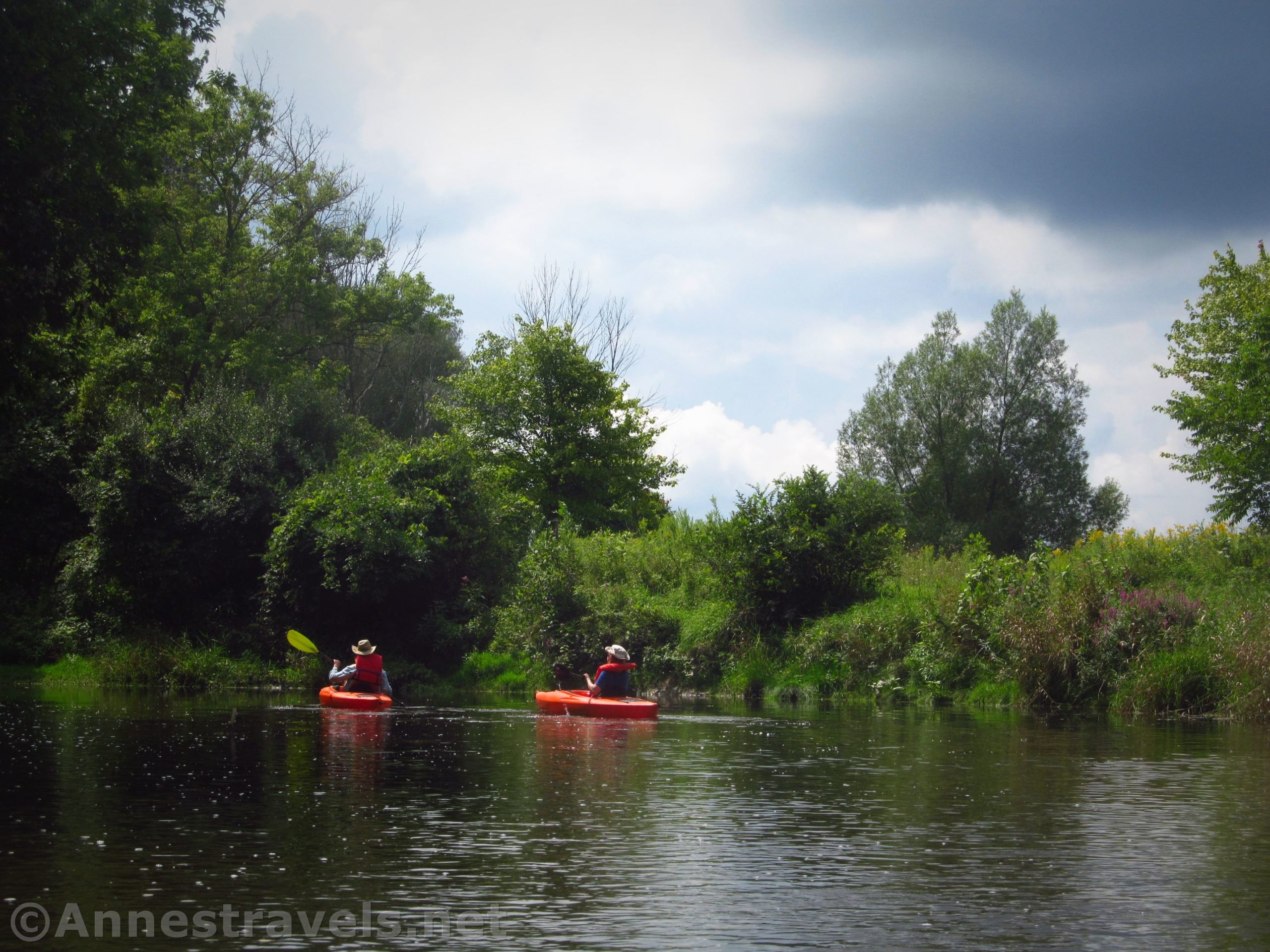
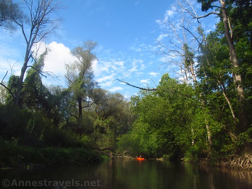
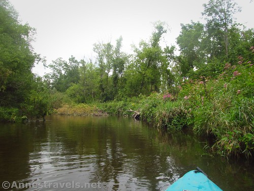
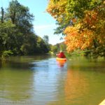
After the rail bridge, things settle down for a bit. It’s mostly just paddling downstream between the trees (and occasional neighborhoods – nearly all of the houses along Black Creek seem to be in great shape and with friendly occupants) with occasional rills. In low water, you may need to climb out and pull your craft through in places. We were mostly ok, but we’d had some rain the day before and you could see that the water had been higher not that long before.

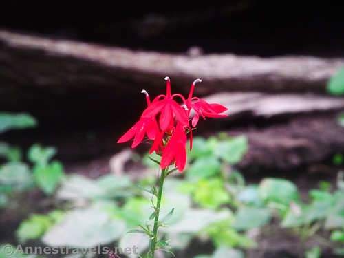
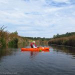
Pass under I-490 at mile 1.0 from Churchville. The next mile or so is along the highway, which wasn’t the best ambiance. Still, I found quite a bit of wildlife in this area. Actually, Black Creek has quite a bit of wildlife – I saw mallard ducks, Canadian geese, great blue herons, little blue herons, kingfishers, several white-tailed deer, a fish or two, and plenty of mosquitos. Actually, the mosquitos weren’t so bad up here; they became quite a bit worse downstream later in the day.
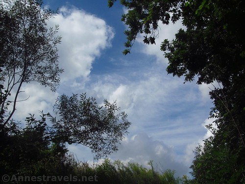
As we paddled downstream, the sky became darker, and then it began to rain (despite no rain in the forecast for that day). We pulled over under some trees, ate lunch, and by the time we’d finished the rain had stopped. In fact, the sun came out for at least part of the afternoon. That worked ok by me!

Cross under bridges at miles 2.2 (Burnt Mill Road), 4.2 (Attridge Road), 5.25 (a private, disintegrating bridge), and 7.0 (NY-33A). At some point in this section, I discovered a sulfur spring. It smelled strongly (actually, we smelled sulfur in several areas along the creek), but what gave it away was that the stream was white from the minerals. It reminded me of some of the areas of Yellowstone – only on a much smaller scale.

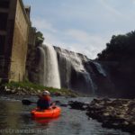
Right after NY-33A, Black Creek goes over a major rill where a dam used to cross the river. In somewhat high water, I was able to shoot the rapids going downstream. Something tells me that I couldn’t have paddled up this, and in lower water, you’d probably have to climb out of your craft. Right after the dam, another bridge (Stuart Road) is popular with fishermen.

If you’re looking for a nice kayak ride, and you happen to have a shuttle vehicle, I recommend parking said shuttle vehicle at Black Creek Park, 7.8 miles from Churchville. There is a boat launch here (and probably water and restrooms in season). We sailed right past, not realizing what was coming. Besides, our shuttle vehicle was near the Genesee, so pulling out at Black Creek Park wouldn’t have done us much good.

Paddle under the Union Street Bridge at about mile 8.2. After this is when the real excitement begins. I’ve heard that the DEC (NY Department of Environmental Conservation) comes through every spring and clears the fallen logs from Black Creek west (and possibly a short distance east) of Black Creek Park. However, east of Black Creek Park looks as though it hasn’t been cleared in five or more years. There are between 30 and 50 log jams in the next 9 mile stretch of water.

Some of the log jams can be navigated around. Others must be portaged. If you’re forced to portage, some of them you can just climb onto the log, drag your craft over the log(s), climb back into your boat, and keep right on going. By the end of the night, we had those types of logs down to a 30-second-per-person science. Others are easier to drag the craft on land around the blockage. The problems with the land routes are that 1) sometimes the log jams are next to peoples’ back yards, and 2) if the banks are in the woods, then it’s likely there is a fair amount of poison ivy and/or stinging nettle growing nearby. On one portage, I tramped through knee-deep poison ivy, so very grateful that I’d decided to wear pants, socks, and shoes that day instead of my flipflops.
So that part of the trip wasn’t much fun. It was an adventure to keep running across log jams, and we got some good laughs out of our predicaments (like when the log I stepped on sank to the bottom of the creek and I ended up in water up to my knees!) If we’d had more daylight, that would also have been more fun. But we knew we were racing against darkness and, as one of my companions said, “We could make time if we would just stop running into log jams!”
Pass under Stottle Road and 9.7 miles, Scottsville-Chili Road (NY-386) at 11.6 miles, and Archer Road (NY-252) at 15.1 miles. Then – oh joy, oh bliss – we finally came to the Rochester & Southern Rail Bridge at mile 17.25. One of my companions and I had paddled up to and shortly beyond this bridge a couple of years ago, so we knew that the paddling should be clear sailing from there down to the Genesee River. No impassable log jams. No shallow rills. Just peaceful paddling with a few possible places to make a wrong turn up a side-channel of Black Creek.

It was almost completely dark by this point (no more photos, sadly), but we could still see well enough to not take any of the wrong turns (hint: if there’s duckweed or excessive seaweed, it’s probably the wrong way to go). We passed under the Genesee Valley Greenway Bridge (quite impressive in the daylight!) at 18.75 miles, and despite the high water, we could still get under the archways (yay!)
It’s less than a half a mile from the Genesee Valley Greenway Bridge to the dock near the Genesee River (just west of the Scottsville Road Bridge, which is just west of the Genesee River). I’ve never seen such a good dock for launching kayaks; you can just put your kayak on the rollers and push yourself into the water. So easy! Getting out of the water is almost as easy – ram the bow up onto the rollers and use the railings to pull yourself up. It’s so much easier (and dryer) than a muddy riverbank or a traditional dock.

There were a couple of people fishing at some of the nearby docks, despite the fact that it was 9:20pm. (Given that we spent 15-20 minutes eating lunch, that put us at about 19 miles in 10 hours.) Two of us drove back up to Churchville to pick up the van while the third person drained the kayaks (they were pretty wet!) and set things up for an easy departure once I got back.

So all that to say that Black Creek can be pretty much any level of adventure you want! From a fairly easy paddle (start at the Genesee River and paddle up to the Rochester & Southern Bridge and back) to a moderate paddle (paddle between Churchville and Black Creek Park) or a true wilderness experience (the full 19.2 miles between Churchville and the Genesee River)… take your pick! (And don’t forget that you can also go west from Churchville above the dam!)

Paddle Length: 19.2 mile shuttle per my first GPS track – the second one (after the first one mysteriously vanished) turned out at 18.9 miles.
Elevation change: 43ft. (555ft. to 512ft.)
Facilities: None except stores in Churchville; the launch near the Genesee River had a port-a-potty. Black Creek Park probably has picnicking and restroom facilities.
Fees: None
Paddle Notes: Bring bug spray. Toward mid-afternoon – or maybe just when we got into a swampier area – the mosquitoes became fierce. Wear good shoes you don’t mind getting wet and pants if you plan to be portaging – the banks are not nice. The river after Black Creek Park becomes increasingly deeper (probably chest-deep by the Rochester & Southern Rail Bridge) so just getting out of the craft is more difficult.

Trail 
![]()
![]()
Road ![]()
Signs ![]()
![]()
![]()
![]()
Scenery ![]()
![]()
Would I go 100 miles out of my way for this? ![]()
![]()
Overall Rating: ![]()
![]()

GPS Coordinates for Black Creek: Churchville to the Genesee River
Launch near Churchville: 43.103875, -77.882678 (43°06.23250′, -077°52.96068′ / 43°06’13.9500″, -077°52’57.6408″) (551ft.) (0.0)
Old Rail Bridge Abutment: 43.101925, -77.883276 (43°06.11550′, -077°52.99656′ / 43°06’06.9300″, -077°52’59.7936″) (555ft.) (0.1)
Old and New CSX Rail Bridge: 43.100995, -77.882415 (43°06.05970′, -077°52.94490′ / 43°06’03.5820″, -077°52’56.6940″) (552ft.) (0.2)
I-490 Bridges: 43.094904, -77.880524 (43°05.69424′, -077°52.83144′ / 43°05’41.6544″, -077°52’49.8864″) (550ft.) (1.0)

Brunt Mill Road Bridge: 43.093239, -77.865059 (43°05.59434′, -077°51.90354′ / 43°05’35.6604″, -077°51’54.2124″) (546ft.) (2.2)
Attridge Road Bridge: 43.089891, -77.844800 (43°05.39346′, -077°50.68800′ / 43°05’23.6076″, -077°50’41.2800″) (544ft.) (4.2)
Bridge (Chili Avenu Extention is nearby): 43.087927, -77.830727 (43°05.27562′, -077°49.84362′ / 43°05’16.5372″, -077°49’50.6172″) (538ft.) (5.25)
NY-33A Bridge: 43.084407, -77.815363 (43°05.06442′, -077°48.92178′ / 43°05’03.8652″, -077°48’55.3068″) (537ft.) (7.0)

Old Dam Site: 43.084469, -77.813708 (43°05.06814′, -077°48.82248′ / 43°05’04.0884″, -077°48’49.3488″) (538ft.) (7.1)
Black Creek Park Launch: 43.087968, -77.801557 (43°05.27808′, -077°48.09342′ / 43°05’16.6848″, -077°48’05.6052″) (531ft.) (7.8)
Union Street Bridge: 43.090303, -77.796783 (43°05.41818′, -077°47.80698′ / 43°05’25.0908″, -077°47’48.4188″) (529ft.) (8.2)
Stottle Road Bridge: 43.089282, -77.780395 (43°05.35692′, -077°46.82370′ / 43°05’21.4152″, -077°46’49.4220″) (527ft.) (9.7)
Scottsville-Chili Road (NY-386): 43.088136, -77.759283 (43°05.28816′, -077°45.55698′ / 43°05’17.2896″, -077°45’33.4188″) (523ft.) (11.6)
Archer Road (NY-252): 43.091670, -77.730479 (43°05.50020′, -077°43.82874′ / 43°05’30.0120″, -077°43’49.7244″) (513ft.) (15.1)
Rochester & Southern Rail Bridge: 43.093885, -77.705540 (43°05.63310′, -077°42.33240′ / 43°05’37.9860″, -077°42’19.9440″) (512ft.) (17.25)
Genesee Valley Greenway Bridge: 43.097704, -77.687443 (43°05.86224′, -077°41.24658′ / 43°05’51.7344″, -077°41’14.7948″) (512ft.) (18.75)
Black Creek Boat Launch (near the Genesee River): 43.094739, -77.681330 (43°05.68434′, -077°40.87980′ / 43°05’41.0604″, -077°40’52.7880″) (514ft.) (19.2)
The gpx file for Black Creek between Churchville and the Genesee River can be downloaded – please note that this and the GPS Coordinates are for reference only and should not be used as a sole resource when hiking this trail.
Download GPX File size: 110.3 KB Downloaded 516 times
(Note: I do my best to ensure that all downloads, the webpage, etc. are virus-free and accurate; however, I cannot be held responsible for any damage that might result, including but not limited to loss of data, damages to hardware, harm to users, from use of files, information, etc. from this website. Thanks!)
Getting to the Churchville Launch
From I-490, take Exit 3 toward Churchville. At the top of the exit ramp, turn north toward Churchville (right if you’re coming from Rochester, left if you’re coming from Buffalo). After 0.75 miles, turn right onto E Buffalo Street. Almost immediately turn left into a small parking area just before the bridge. There is more parking across the bridge (a small, gravel lot on the left); there may also be another social trail down to the river from the public parking on S Main Street.
Getting to the Black Creek Boat Launch (near the Genesee River)
From I-390, take Exit 17 onto Scottsville Road (this is one exit east from the Airport). Take a right onto Scottsville Road to drive south 3.3 miles. Turn right onto Ballantyne Road (Rt-252; it would be Jefferson Road if you turned left) for 0.1 miles. Turn right onto Black Creek Road. At the end of the street, turn right. Go to the end of the street and turn left. You should be in the parking area for the Black Creek Boat Launch.

From I-490, take Exit 4 toward North Chili and West Chili (for all you non-natives, it’s pronounced “Chie-lie”). At the end of the exit ramp, turn south to the first intersection. Turn left on NY-33A E for 1.7 miles, then turn right onto NY-252E for 4.4 miles. Shortly before the stoplight, turn left onto Black Creek Road. At the end of the street, turn right. Go to the end of the street and turn left. You should be in the parking area for the Black Creek Boat Launch.
From I-90, take Exit 46 for I-390N toward Rochester. After only 0.9 miles, keep right, following signs for NY-253W and NY-15W. Just 0.5 miles later, turn left onto 253W for 0.6 miles; the road becomes Lehigh Station Road. Continue 1.9 miles; turn right onto E River Road for 2.5 miles. Turn left onto Jefferson Road to cross the Genesee River; after 0.3 miles, turn right onto Black Creek Road. At the end of the street, turn right. Go to the end of the street and turn left. You should be in the parking area for the Black Creek Boat Launch.

This Week’s Featured Product!
One of my favorite books about kayaking in the Rochester area! It features a few ponds as well as creeks and rivers to explore.
More Related Posts:
 Kayaking Honeoye Creek: Genesee River to I-390
 Kayaking the Genesee River to Lower Falls!
 Kayaking Black Creek: Churchville to 6.2 Miles
 Paddling Irondequoit Creek – Ellison Park to Irondequoit Bay
 The Best Kayaking/Canoe Adventures & Water Trails near Rochester, New York
 Kayaking Honeoye Creek: Rush to the Genesee River