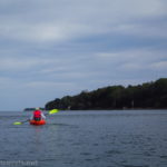

I’m always looking for new places to kayak near Rochester, New York. My oft-kayaking companion had heard about Black Creek for some time (like, when he first moved to the area close to 40 years ago), and so he and I had done the 5-mile section of Black Creek down near its mouth at the Genesee River. Last fall we decided to do a different section of Black Creek: from Churchville Dam up as far as we could go.
Quick Stats

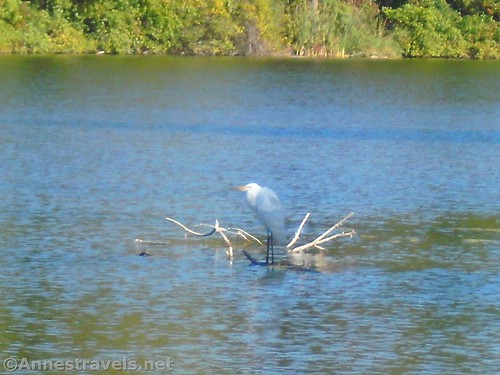
We ended up going all the way up to about a mile from West Sweden Road. At that point, we would have had to do a tricky portage, which given our time constraints didn’t seem like a good idea. But it’s a great paddle, with the possibility of seeing quite a bit of wildlife. Besides some great blue herons, we saw 30+ painted turtles and (to my shock!) a bald eagle sitting in a tree over the swamp! I didn’t have time to get out my camera (more’s the pity – he was well close enough for a photo), but it gave me an appreciation for just how huge bald eagles are.
We started out early one morning in late September. The area was in a drought, but the dam (which barely had any water going over it) keeps this section of Black Creek a fairly constant water level. We saw our first great blue heron from the parking lot.
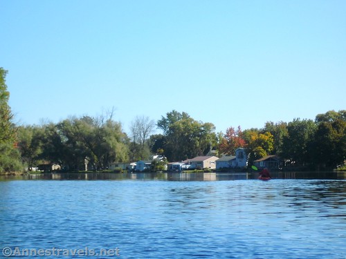
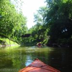
Social trails lead down to the creek, so we used those to launch our kayaks. It wasn’t the easiest launch I’ve ever done, but certainly not the hardest, either. We paddled upstream in the still water. It’s sometimes a little bit shallow (possibly because of the drought) but as long as you stay to the main channel a rowboat would be fine. After 0.8 miles, pass under North Main Street/CR-268.

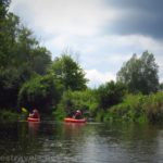
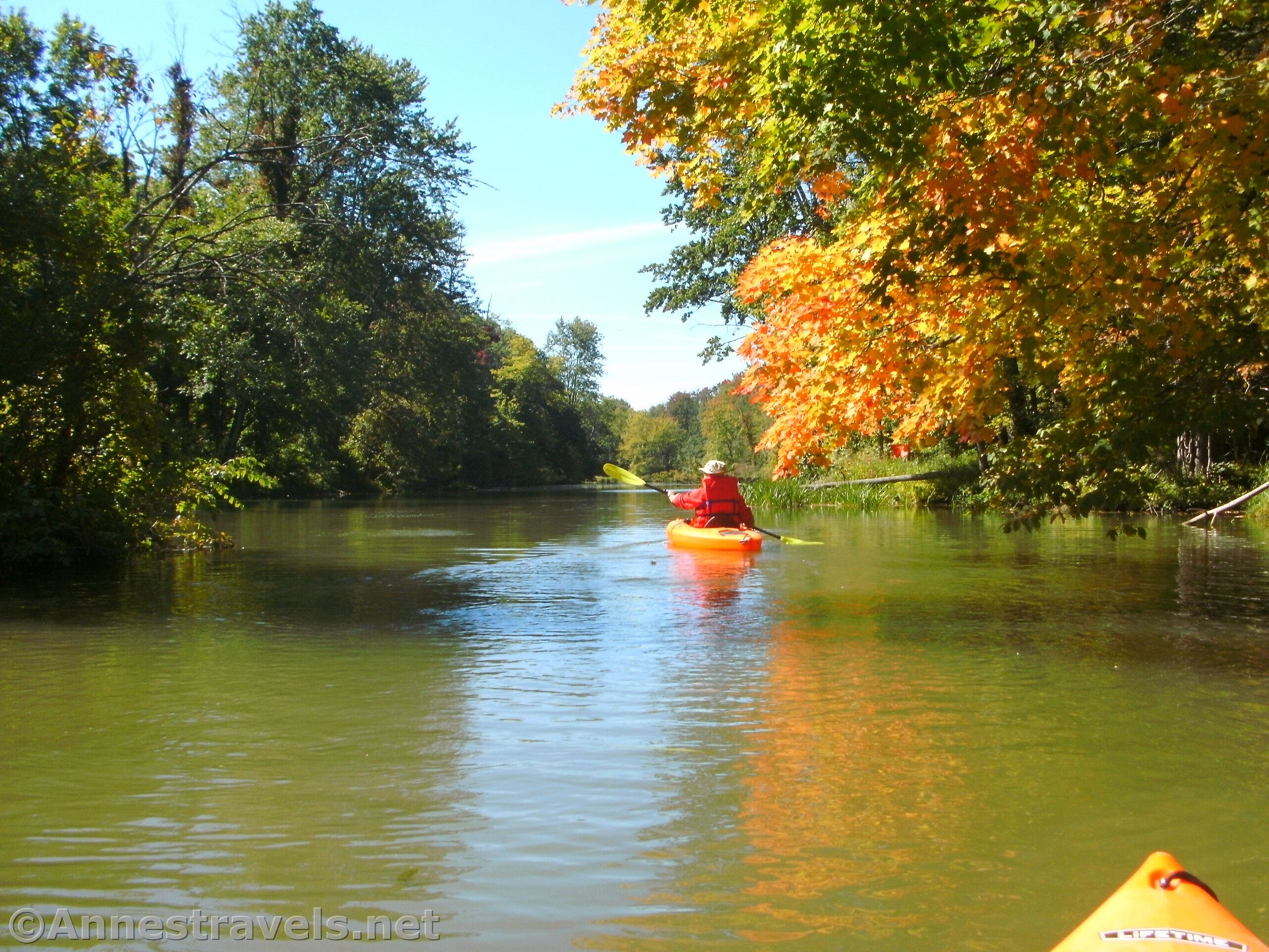
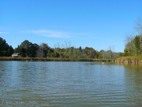
Stay right around a small island and then left just after passing the boat launch in Churchville Park. The river grows more wild after this, with trees on either side of the creek. Stay right at the next island – while my GPS track shows a straight line, we actually made a lot of wrong turns in this section of the creek!

The river winds in oxbows to come to the last of the tricky islands. Neither direction is good; with the low water and kayaks we went right, cutting the oxbow and passing over sunken logs and under tree branches. We also scared a few painted turtles that were sunning themselves on the logs protruding out of the water. It was a short distance after this that we saw the eagle.

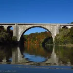
At 4.2 miles, pass under the bride that carries North Lake Road/Rt-19 across Black Creek. It’s a huge bridge; you can’t miss it. This is an alternate launch point if you want to only paddle downstream from Rt-19 to Churchville.

We didn’t know anything about the creek above this, but we figured the worst that could happen as that we couldn’t get through. So after eating lunch in the shade of the bridge, we continued paddling upstream.

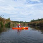
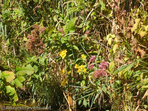
Black Creek – which has been getting narrower ever since Churchville Park – becomes a real stream at this point. In other words, it twists and winds between brush-covered banks and you’re never sure what will be beyond the next bend. There are branches to duck under, alternate passageways to not go into, and a wild feeling about the river.

The only really scary thing was a sportsman’s club right along the river – we heard someone target shooting while we were eating lunch and were debating about whether or not to continue. Chances are they don’t shoot toward the river, but I wouldn’t trust that. If there are shots, you might want to come back and paddle another day.
About mile 6.2 we ran across a log jam across the creek. We could have portaged – there isn’t even all that much poison ivy at this junction – but it was going to be complicated, and we didn’t have a lot more time. So instead we turned around and paddled back downstream. If we’d portaged, we’d have wanted to take the right fork of the stream and we’d have gotten to West Sweden Road about a mile later.

As it was, the 12.5 mile paddle was a full-day adventure. I’m not sure how much conditions would change with higher water levels, but as it was, with the drought, the lake backed up about to Rt-19. You could easily make this paddle shorter by starting at Churchville Park or at Route-19. There is also a launch point at West Sweden Road if you’d rather begin (or end) that far up the creek. You can also paddle downstream below the Churchville Dam.

Round Trip Paddle Length: 12.5 miles to the log jam and back – it can be done as a ~7 mile shuttle between West Sweden Road and Churchville or as a 4.2 mile shuttle between Churchville and Rt-19 or cut off about a mile (each way) by starting in Churchville Park.
Elevation Gain: 89ft.
Facilities: I hear there are restrooms in Churchville Park, as well as picnic tables. Churchville has conveniences you’d expect – convenience stores, restaurants, gas stations, etc.
Fees: None
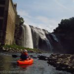
Paddle Notes: Don’t get too close to the dam, as the currents make it very dangerous. There seems to be a little park on the other side of the dam from where we parked – it didn’t look easy to climb out there, so we went back and climbed out where we’d launched. Be sure to keep an eye out for wildlife – there’s lots!

Paddle ease 
![]()
![]()
Road ![]()
Signs ![]()
![]()
![]()
![]()
Scenery ![]()
![]()
![]()
Would I go 100 miles out of my way for this? ![]()
![]()
Overall Rating: 
![]()
![]()

GPS Coordinates for Paddling Black Creek Churchville to West Sweden Road
Parking area: 43.104798, -77.881890 (43°06.28788′, -077°52.91340′ / 43°06’17.2728″, -077°52’54.8040″) (571ft.)
Boat launch at Churchville Park: 43.105666, -77.894403 (43°06.33996′, -077°53.66418′ / 43°06’20.3976″, -077°53’39.8508″) (561ft.) (0.8)
Rt-19 Bridge: 43.105655, -77.933176 (43°06.33930′, -077°55.99056′ / 43°06’20.3580″, -077°55’59.4336″) (564ft.) (4.17)
Approximately where I ended: 43.102683, -77.962214 (43°06.16098′, -077°57.73284′ / 43°06’09.6588″, -077°57’43.9704″) (565ft.) (6.2)
The gpx file for Black Creek from Churchville to 6.2 miles can be downloaded – please note that this and the GPS Coordinates are for reference only and should not be used as a sole resource when hiking this trail.
Download GPX File size: 23.8 KB Downloaded 475 times
(Note: I do my best to ensure that all downloads, the webpage, etc. are virus-free and accurate; however, I cannot be held responsible for any damage that might result, including but not limited to loss of data, damages to hardware, harm to users, from use of files, information, etc. from this website. Thanks!)

Getting to the Churchville Launch on Black Creek
From I-490, take Exit 3 toward Churchville. At the top of the exit ramp, turn north toward Churchville (right if you’re coming from Rochester, left if you’re coming from Buffalo). After 0.75 miles, turn right onto E Buffalo Street. Almost immediately cross over Black Creek with a view of the dam on the left. Take the first left after the bridge into an unmarked gravel parking area – across the road is the old fire station. Social trails lead down to the creek.
If you’d rather go to the Churchville Launch, turn left on E Buffalo Street (actually W Buffalo Street) for 0.3 miles, then turn right onto Park Road. At 0.1 miles, turn left at the split down to the boat launch, on right.
To get to the Rt-19 launch, get off of I-490 at Exit 2. Turn west onto 33 toward Bergen and Batavia and take the third right onto Rt-19. Drive north about 0.3 miles to cross over Black Creek. The launch (such as it is) is on the right (east) side of the road.

This Week’s Featured Product!
If you want more places to go paddling in western New York, try this book. I find it a great resource when I need new places to take my kayak.