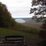

It’s a tiny bit of forest tucked between a neighborhood and farm fields. But within that sheltered glen, Catlin Mill Creek tumbles over three(ish) ledges to create a scene better known as Deckertown Falls. The falls are as beautiful as others in the area (it’s very near Montour Falls, not that distant from Watkins Glen, and just up the hill from Havana Glen), but it’s often overlooked. I’d guess that’s partially because it’s so small… but if you get a chance to visit Deckertown Falls, you won’t be disappointed.
Quick Stats
(Affiliate links are present on this page.)

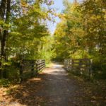
The parking area is at the end of a neighborhood street. In fact, unless you know it’s there, you’d never guess. There is a trailhead sign and a small parking area (~3 cars), so unless it’s crowded, you should be able to park somewhere other than the street (I believe street parking is illegal – it’s one way to make sure the area doesn’t get too crowded!) On a Friday afternoon in late September, we saw only one other group (a family) who was leaving about the time we arrived.

It just happened that I was on a bicycle (I was on a tangent off of the Catharine Trail, but that’s a post unto itself), so I walked my bike up the dirt trail. It’s well-worn enough to be easy to follow, but not much more than that.
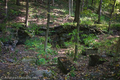
On the right are the remains of a structure – probably a mill of some sort. The creek is on the left; before long, one of the paths leads down toward the creek and one of the lower waterfalls. I had to leave my bike near the mill; the trails just aren’t bike-friendly.
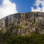
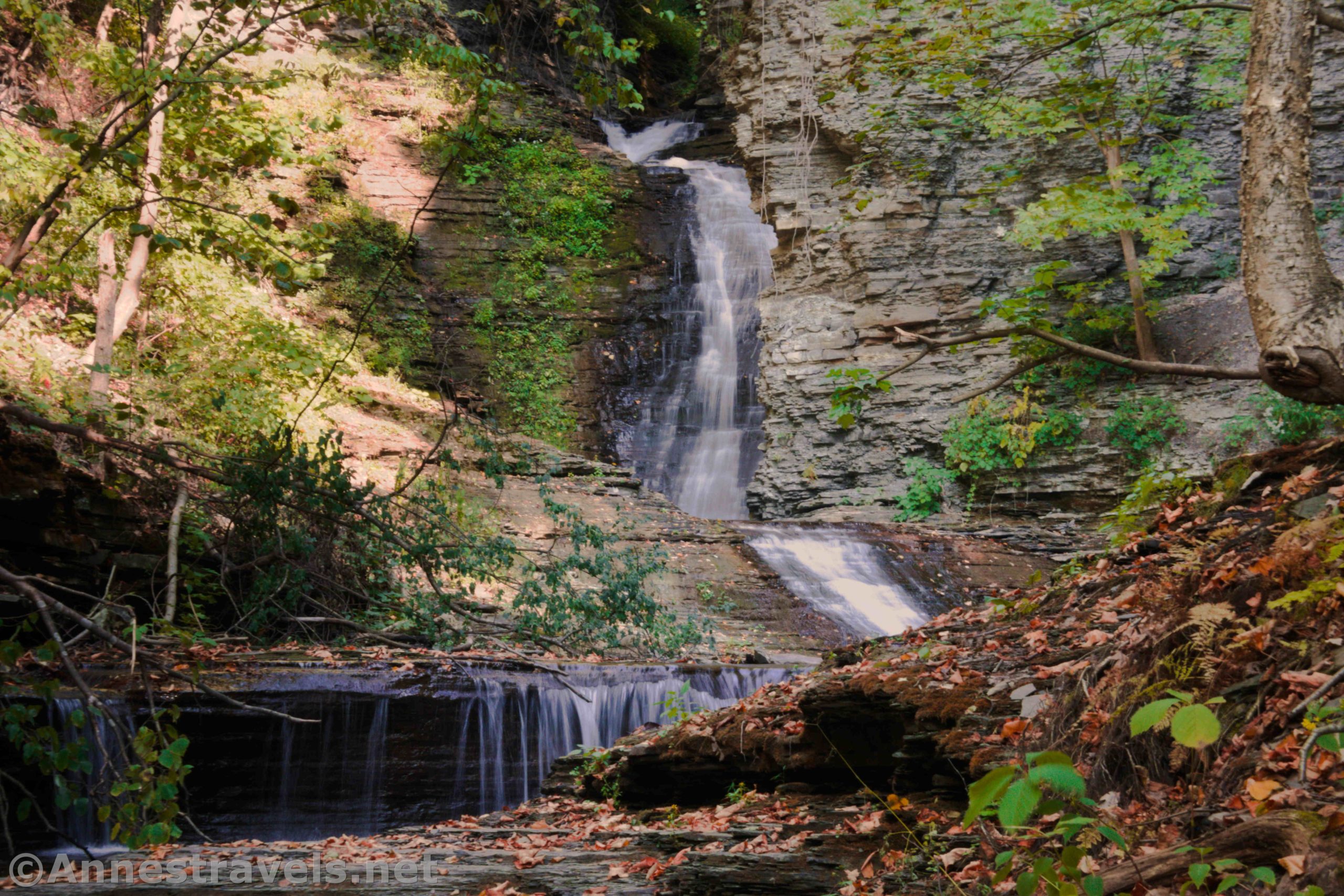
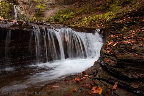
I’ve heard that there are three waterfalls; honestly, it depends on how you want to count them. I’d call them four falls; this is the lowest one: a simple chute down a shale ledge. If you’re tall, you can see more falls up above.

By scrambling along a slippery shale ledge, I could see more waterfalls. But you’re better off going back up the bank to the trail. A sketchy path leads upstream up a hill high above the stream. A pipe (it probably once brought water to the mill) runs beside the trail.

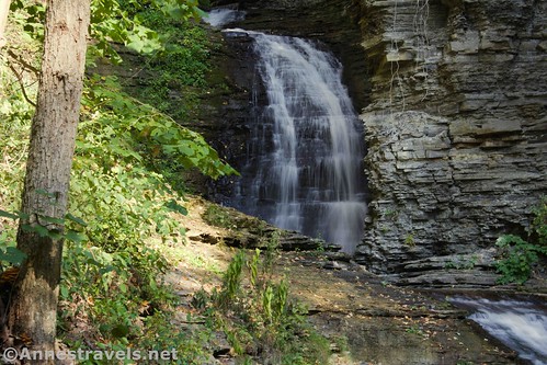
Scramble up and over the hill, using caution near the cliff edges. (Don’t go off-trail, as the park is bordered closely by private property to the south.) This will bring you down above the middle falls (second falls) in view of the third and fourth falls (upper falls) which is also the tallest. You can cross over to the far bank (use care; the rocks are slippery) to get a better view at about 0.1 mile from the parking area.

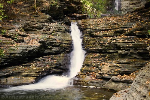
You can also scramble closer to the falls (be careful; shale is notoriously unstable), but I opted to go back down to the middle falls. It’s a short drop, but picturesque in its own way.
Retrace your steps to your vehicle. I’ve heard swimming isn’t prohibited, but be careful and always follow signs. Chances are that you won’t spend more than 20 minutes max here even if you take tons of pictures (the path just isn’t that long!) but it’s well worth a stop if you’re in the area.

Round Trip Trail Length: 0.25 miles (depending on how much you scramble)
Elevation Gain: About 200ft.
Facilities: None
Fees: None
Trail Notes: I visited during a drought, so take that into consideration. When the trails are wet, it’s a muddy, slippery mess – so either go when it’s dry or come prepared to get muddy!

Trail 
![]()
![]()
Road ![]()
Signs ![]()
Scenery ![]()
Would I go 100 miles out of my way for this? ![]()
Overall Rating: ![]()
GPS Coordinates for Deckertown Falls
Parking: 42.3434167°, -076.8308833° (N42° 20.605′ W76° 49.853′ / 42°20’36.3000″, -076°49’51.1800″) (521ft.) (25.09)
I did not record any other waypoints because my GPS usually doesn’t handle gorges and canyons very well.
The gpx file for Deckertown Falls can be downloaded – please note that this and the GPS Coordinates are for reference only and should not be used as a sole resource when hiking this trail.
Download GPX File size: 1.3 KB Downloaded 363 times
(Note: I do my best to ensure that all downloads, the webpage, etc. are virus-free and accurate; however, I cannot be held responsible for any damage that might result, including but not limited to loss of data, damages to hardware, harm to users, from use of files, information, etc. from this website. Thanks!)
Getting to Deckertown Falls
From Watkins Glen, head south on NY-14 (aka N Franklin Street). After 2.8 miles (just after the road curves sharply east then sharply south again), turn left onto Clawson Blvd. Cross over the diversion channel and, after 0.5 miles, turn right onto S Lhommedieu Street. Drive for 0.4 miles and turn left onto E Catlin Street. The parking area is a dead end 0.1 miles later.
From the south, head north on NY-14. Just before the town of Montour Falls, turn right onto Havana Glen Road. Only 0.2 miles later, turn left onto S Lhommedieu Street for 0.4 miles. Turn right onto E Catlin Street; the parking area is a dead end 0.1 miles later.

This Week’s Featured Product!
For even more waterfall hikes in the Finger Lakes and across New York State, this book from Rochester natives fits the bill.