

I suppose any trip isn’t complete until we’ve been off-trail. On a recent trip to Wyoming, though, we did a bit more than just leaving the trail behind: we did a hike that was entirely without a trail. No signs, no official route, nada, nothing. (Actually, by the end of the trip, we were making up silly songs about never letting a day go by without some off-trail bushwacking, we’d left the path behind so many times, but this trail was especially memorable since there wasn’t even a trailhead, let alone a trail leading into the forest…)
Quick Stats
(Affiliate links are present on this page.)
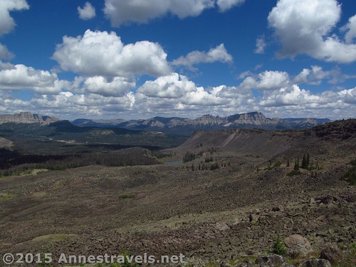
But it turned out just fine. There was a fence and social trails nearly the entire way up Lava Mountain near Togwotee Pass, just east of Grand Teton National Park. And the views, oh, the views! I never knew there was such a view of the southern Absaroka Range!
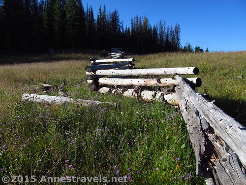
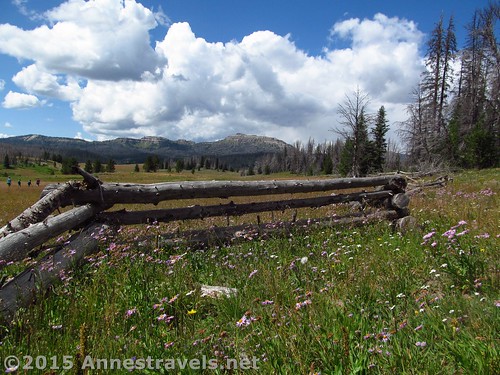
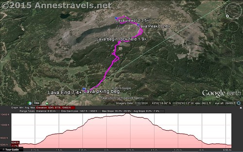
We parked near the gate on the Continental Divide that separates the two national forests. Follow the fence as it zigzags up and then over the hillside – follow the fence exactly, or simply keep it in view as you follow one road or trail or another. You’ll be following this fence almost all the way to the top of Lava Mountain, though it changes appearance several times. It looks like it does here, then becomes a marked line of haphazard tree trunks (see that photo, above?), then switches to fence posts stuck into the ground, then back to the original log fence. It ends as haphazard logs leading up to a lava field, but more on that later.
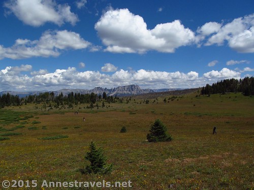
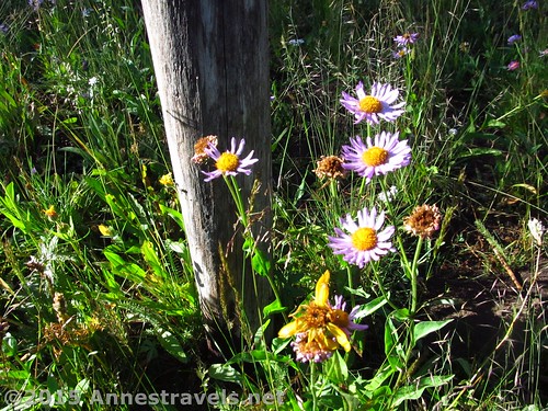
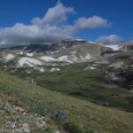
The fence climbs a few small hills, then skirts a meadow. It then enters the forest and begins to climb in earnest. From here on out, social trails or routes seem to more or less follow the fence. My best advice is to somewhat keep the fence in view and definitely stick to the social trails that lead uphill in generally the right direction (same direction as the fence).
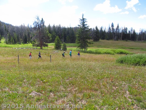
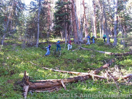
The route wanders through forests and meadows, always upward, almost always without too much bushwacking (a tree to climb over here, a branch to push aside there, but mostly no real impediments). Ever upward, ever upward: don’t worry if you’re puffing and panting; you’re around 10,000ft. here!
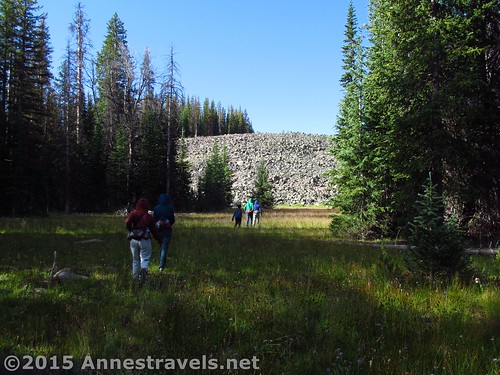
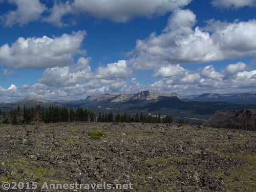
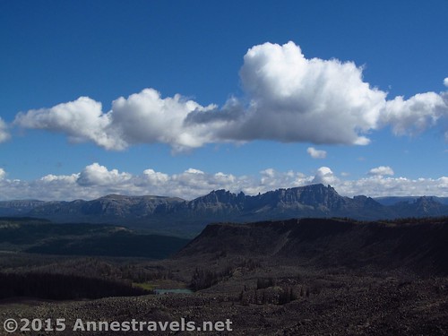
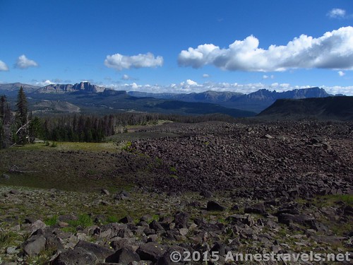
At last the route enters a meadow with a huge volcanic rockslide. Skirt to the left of the rockfield, following the stream (at first, at least). Continue following the route to the last of the remains of the fence, which ends at a ginormous lava rockfield, stretching as far as the eye can see, all the way to the top of (the now we see why aptly named) Lava Mountain!
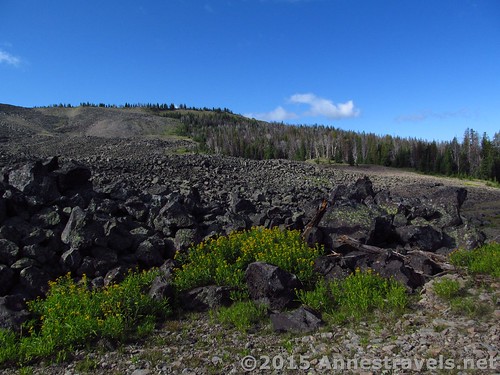
Turn right here to skirt the edge of the rock fields. Although there is little trail now, it is possible to (more or less) completely skirt the rock fields by staying to the right of them through meadows and forests. As you approach the top of the mountain, the forest becomes thicker, and the ground steeper, but keep at it. I came down it, so it must be possible to come up it!
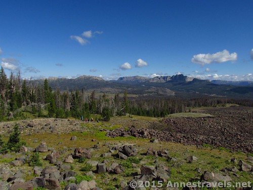
At last break out of the trees and onto a stoney, grassy land, so very steep it’s hard to hike. Keep going upward as best you can; it may help to edge left crosswise across the breccia and rock fields.
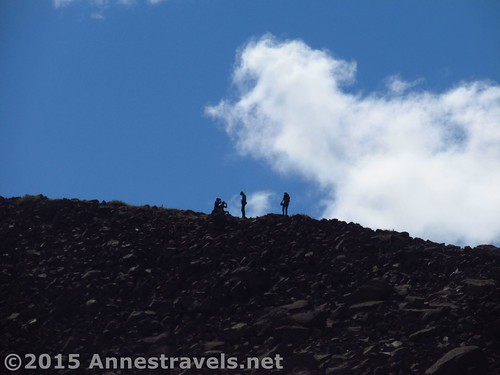
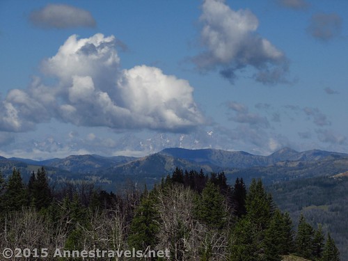
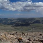
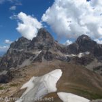
At last reach the top ridge! Turn left, up the mountain ridge, until you come to a place where a radio tower sits, looking so foreign in such a wild land. (We saw absolutely no one, nor signs of anyone other than the social trails. Be prepared to be totally alone on this hike!) This is probably the best far-reaching view from the top of Lava Mountain: the Absarokas almost all around, their craggy cliffs and spires invoking awe, the Gros Ventres to the west, and the high crags of the Tetons spiking up not so far away. Unfortunately, the Tetons were mostly in clouds the day we were there.
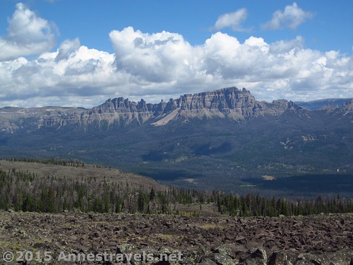
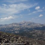
If you (like us) haven’t had enough views, continue left along the edge of the Lava Mountain. The views just keep getting better (closer) of the Pinnacle Peaks. Round the end of this section of Lava Mountain and take to the rock field. Just as the slope begins to go down, a good view of Pinnacle Mountain presents itself.
Return the way you came, or go back over the top of one of the higher peaks atop Lava Mountain for peek-a-boo views into the Wind River Range.
Overall? Highly recommended for someone with a sense of adventure and who’d like to have an entire mountain to themselves! I had a marvelous time, and it was such a great first hike, even if it wasn’t the easiest thing we did 🙂
Round Trip Trail Distance: About 8 miles
Starting Elevation: 9,233ft. (Parking area)
Highest Point: 10,326ft. (Up on Lava Mountain)
Net Elevation Gain: 1,093ft.
Facilities: None
Fees: None
Trail 
![]()
![]()
![]()
![]()
Road ![]()
![]()
Signs ![]()
![]()
![]()
![]()
Scenery
Would I go 100 miles out of my way for this?
Overall Rating: ![]()
![]()
Key GPS Coordinates for Lava Mountain
Parking: 43.70487N / -110.04996W (43° 42′ 17.5314″ / -110° 2′ 59.8554″) (9,233ft.)
Beginning: 43.70480N / -110.04993W (43° 42′ 17.2794″ / -110° 2′ 59.748″) (9,254ft.) (0.0; ended 7.9)
End of National Forest Boundary “Fence”; begin rockfield: 43.68480N / -110.03957W (43° 41′ 5.28″ / -110° 2′ 22.4514″) (9,796ft.) (2.4)
Lava Peak 1: 43.67667N / -110.03815W (43° 40′ 36.012″ / -110° 2′ 17.34″) (10,267ft.) (3.3)
Viewpoint 2: 43.68027N / -110.02749W (43° 40′ 48.972″ / -110° 1′ 38.964″) (10,326ft.) (4.0)
The gpx file for Lava Mountain can be downloaded – please note that this and the GPS Coordinates are for reference only and should not be used as a sole resource when hiking this trail.
Download GPX File size: 194.5 KB Downloaded 570 times
(Note: I do my best to ensure that all downloads, the webpage, etc. are virus-free and accurate; however, I cannot be held responsible for any damage that might result, including but not limited to loss of data, damages to hardware, harm to users, from use of files, information, etc. from this website. Thanks!)
Getting to Lava Mountain
From the east: drive US-26 west from the down of Dubois, WY toward Togwotee Pass As you approach the pass, there will be a sign for Brooks Lake Road, on right. Continue straight another 3.3 miles to an unmarked road on the left; a bridge is clearly visible from the main road. Turn onto this unmarked dirt road (known as Moccasin Basin Road on Google Maps) and drive 2.8 miles to the (likely locked) gate separating the two national forests. Park here.
From the west: from Moran Junction in Grand Teton National Park, turn onto US-26 W toward Togwotee Pass. Go through the pass, and about 4 miles later come to the unmarked, dirt Moccasin Basin Road (per Google Maps) on right – a bridge will be clearly visible from the paved road. Drive 2.8 miles to the (likely locked) gate separating the two national forests. Park here.
The road is dirt, but it’s not in terrible condition. It’s fully passible by high clearance vehicles and would also likely to passible to low clearance vehicles if they take it slow.
Zoom map out to browse nearby hikes & places of interest
This Week’s Featured Product!
Covering more than just the traditional national parks, this trail guide to Wyoming spans day hikes and backpacking treks, with detailed maps, good directions, and a personal-knowledge-approach to hiking this often-overlooked state.


3 responses to “Lava Mountain: No Trail, but Awesome Views!”
[…] Lava Mountain: […]
[…] Peaks from Lava Mountain, […]
[…] Lava Mountain (about 8 miles RT) […]