
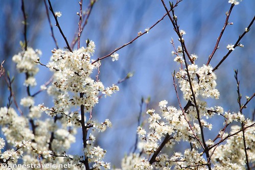
A few weeks ago, I got to ride a “new” (to me) bike path in western New York State! (I almost hate to call it in the Finger Lakes, since it’s so far west, but it could still be classified under that region.) The Clarence Pathways is a collection of five trails (West Shore Trail/Newstead-Akron Bike Path; Peanut Line Trail; Waterford Trail; and Spaulding Green Trail) that make up a total of 17.25 miles of paved paths that are great for biking, walking, jogging, and other non-motorized recreation. As two of the paths are hubs on a spoke (so to speak), I ended up doing a lollipop loop via some roads. I don’t necessarily recommend this, but it is an option. Overall, it was a fantastic way to spend a spring day, with an easy ride, flowering trees, swamps, fields, parks, and more!
Quick Stats

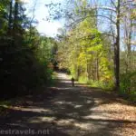
We started at the east terminus of the Clarence Pathways, aka in Akron. There is safe street-side parking near the trailhead for about a half a dozen cars. (Chances are that’s plenty.) The trail begins by crossing a bridge, then it settles down to traveling through the country with woods on either side of the trail.
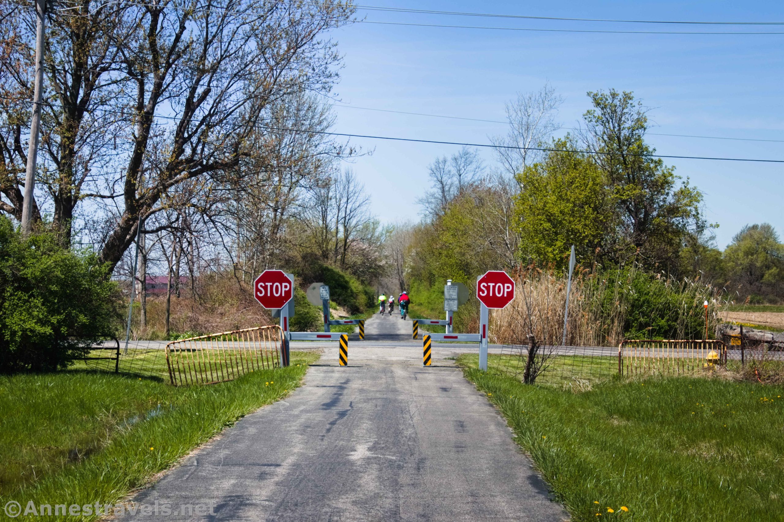
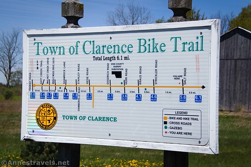
After 2.1 miles, the trail splits in two at Akron Junction (it’s a very obvious junction, so it would be hard to miss whether or not you were paying attention). The left trail is the West Shore Trail; the right trail is the Peanut Line. (Interestingly, the “Peanut Line” was not used to transport peanuts – instead, it was so small (what today’s railroaders would call a “short line”) compared to the rest of the railroad’s miles of tracks that it was “peanut sized” in comparison.)

From here, the western terminuses of the West Shore Trail and the Peanut Line are 6.75 miles and 10.5 miles, respectively. Not being entirely sure of what we wanted to do that day, we decided to turn right on the Peanut Line (the northerly of the two trails).

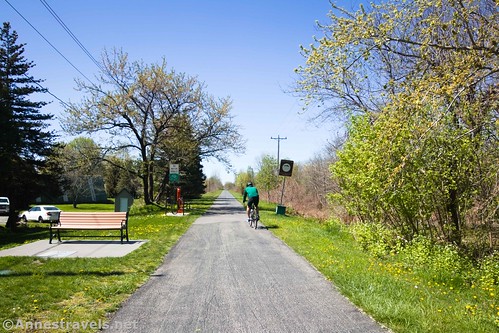
The scenery along the Peanut Line is varied. At first, the trail goes back and forth between woods/swamps and agricultural fields. About 4 miles from Akron Junction, the trail passes through Clarence Park (actually Clarence Soccer Center per OpenStreetMap). There are restrooms and water usually available here, along with a gazebo for bikers to rest for a few minutes.

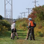
After the park, the tune of the trail changes to suburbs. It’s the strangest thing to be riding through posh suburban neighborhoods with McMansions on both sides of the trail. I never felt like I was invading anyone’s personal space, or in any kind of danger; it’s just not what I’m used to on a rails-to-trails.

There’s one more stretch of swamp just before the Peanut Line ends in East Amherst. We saw some Canadian geese in these swamps, but sadly I didn’t get a picture.

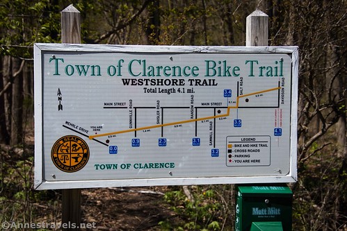
We ate lunch on a park bench a short distance back east down the path and finally decided we were up for the challenge of taking roads down to the western terminus of the West Shore Trail so we could complete the trails as a loop. So we biked back to Conner Road (which junctions with the N/S Shimmerville Road and the E/W Clarence Center Road right about the place where the trail crosses Conner Road). From here, we turned south on Shimmerville Road until it T’s into Wehrle Drive 4.0 miles later. We turned left (east) on Wehrle Drive for a little over half a mile to the parking area that marks the southern/western terminus of the West Shore Trail.
I don’t necessarily recommend taking this road route. For one thing, it’s pretty hilly, so the ride is nowhere near as easy as riding the trail. Second, Shimmerville Road is pretty busy (at least on a Saturday afternoon in early May) and there isn’t a whole lot of shoulder. Still, I’ve rarely seen so many considerate drivers. They all gave us plenty of space, which was comforting.
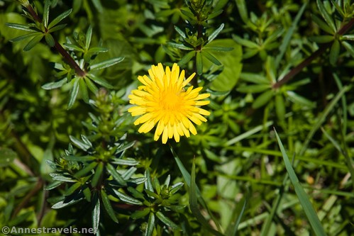
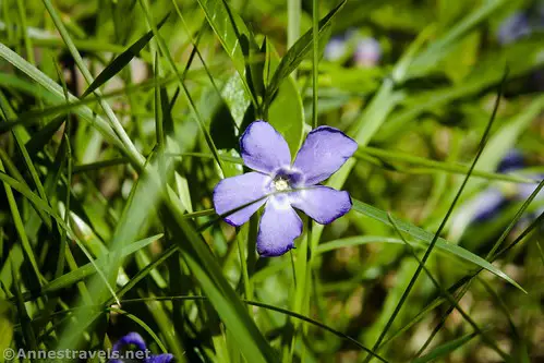
Near the west end of the West Shore Trail, I found some pretty purple flowers. We headed up the trail after I’d shot my photos. The West Shore Trail is much more rural than the Peanut Line. There are fewer fields, much fewer houses, and more woods and swamps. What houses there are tend to be more like trailer parks. Again, I never felt particularly in danger, and I enjoyed the more wooded experience.
About 2.75 miles from the West Shore Trailhead, the path goes through Clarence Park. It’s a nice place. We continued up the trail and found the one snag in the trail: a road crossing in the town of Clarence. Follow the signs to go through the parking lot for the Clarence Hollow Farmer’s Market, out to the sidewalk, east to cross Academy Street and an immediate crossing north (left) over the “big road” of Main Street. A sidewalk along Salt Road takes you down to where the trail picks up again. As I said, if you follow the signs, you’ll be fine.
From Clarence, it’s another 3.1 miles up to Akron Junction. We were pretty tired by this point, so we pushed on back up the path 2.1 miles to the eastern terminus where we’d parked.

If I had to sum up the Clarence Pathways in one sentence, it would be that it’s just a nice ride! The paved surface is great for almost all bike types, and with the little change in elevation, it’s a pretty easy 6+ miles each way.
Round Trip Trail Length: 8.8 mile shuttle from Akron to the W terminus of the West Shore Trail; 10.5 mile shuttle from Akron to the W terminus of the Peanut Line. I did a 25.3 mile loop.
Elevation gain: My GPS says 943ft., but I don’t believe it’s even close to that, even with all of the hills on Shimmerville Road.
Facilities: Restrooms, water, and picnicking usually available in the two Clarence Parks. A restroom is usually available at Akron Junction. There are restaurants and shops near the trailheads in Akron and East Amherst. Just south from the Peanut Trail’s western terminus is a shopping center.
Fees: None
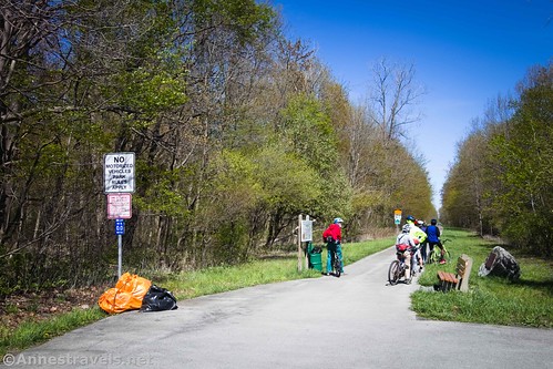
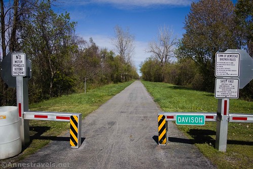
Trail Notes: The entire trail is paved and fairly smooth. I saw a ton of bikers and walkers (including families) with a few joggers and at least one person on roller blades. Be sure to respect the privacy of the home owners along the trail. Rules include that the trail is open dawn to dusk; no alcoholic beverages; no glass bottles; and dog leash and cleanup law in effect.
Trail 
Road ![]()
Signs
Scenery ![]()
![]()
Would I go 100 miles out of my way for this? ![]()
![]()
![]()
Overall Rating: ![]()

GPS Coordinates for the Clarence Pathways
Trailhead in Akron (east terminus): 43.022964,-78.501199 (43°01.37784′, -078°30.07194′ / 43°01’22.6704″, -078°30’04.3164″) (679ft.) (0.0)
Akron Junction: 43.004907,-78.534531 (43°00.29442′, -078°32.07186′ / 43°00’17.6652″, -078°32’04.3116″) (691ft.) (2.12) (return 23.24)
Clarence Park: 43.013697,-78.611182 (43°00.82182′, -078°36.67092′ / 43°00’49.3092″, -078°36’40.2552″) (632ft.) (6.09)
Peanut Line west terminus in East Amherst: 43.018624,-78.696626 (43°01.11744′, -078°41.79756′ / 43°01’07.0464″, -078°41’47.8536″) (595ft.) (10.48)
Where we turned south: 43.016623,-78.662138 (43°00.99738′, -078°39.72828′ / 43°00’59.8428″, -078°39’43.6968″) (608ft.) (11.92)
West Shore Trail west terminus: 42.960555,-78.647687 (42°57.63330′, -078°38.86122′ / 42°57’37.9980″, -078°38’51.6732″) (723ft.) (16.55)
Clarence Park: 42.976017,-78.601649 (42°58.56102′, -078°36.09894′ / 42°58’33.6612″, -078°36’05.9364″) (733ft.) (19.22)
End at the east terminus: 43.022979,-78.501221 (43°01.37874′, -078°30.07326′ / 43°01’22.7244″, -078°30’04.3956″) (679ft.) (25.34)
The gpx file for the Clarence Pathways can be downloaded – please note that this and the GPS Coordinates are for reference only and should not be used as a sole resource when hiking this trail.
Download GPX File size: 92.9 KB Downloaded 482 times
(Note: I do my best to ensure that all downloads, the webpage, etc. are virus-free and accurate; however, I cannot be held responsible for any damage that might result, including but not limited to loss of data, damages to hardware, harm to users, from use of files, information, etc. from this website. Thanks!)

Getting to the Clarence Pathways
Akron (east terminus) Trailhead
Take I-90 Exit 48A toward Pembroke. At the bottom of the exit ramp, turn left onto NY-77S. After 0.7 miles, turn right onto NY-5W for 5 miles. Turn right onto NY-93W for 1.6 miles, then turn left onto Buffalo Street and take the first left onto Cedar Street. The trailhead is another 0.1 miles north. Streetside parking allows for about a half a dozen cars at the trailhead.
East Amherst (west Peanut Line terminus) Trailhead
Take I-90 Exit 49 toward NY-78N and Transit Road. At the bottom of the entrance ramp, turn left on NY-78N. The trailhead is 5 miles up the road. Note that there isn’t much in the way of parking at this trailhead.
West Shore Trail (west terminus) Trailhead
Take I-90 Exit 49 toward NY-78N and Transit Road. At the bottom of the entrance ramp, turn left on NY-78N. After 0.7 miles, turn right onto Wehrle Drive. The ample parking area is on the left after 2.5 miles.

This Week’s Featured Product!
For even more rails-to-trails in New York and also New Jersey, check out this guidebook! With nearly 60 different multiuse paths, there is a wide variety of trails to explore.