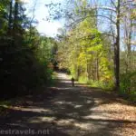

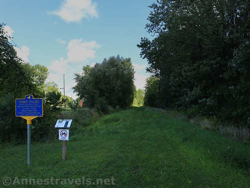
Over the long weekend last week, I had the opportunity to check out a new (to me) rails-to-trails from Wallington, New York (you’ve never heard of it? Neither had I) to Sodus Point. It’s very well-maintained – very small gravel two-track – and while the trail doesn’t go all the way out to Sodus Point, it’s not a difficult ride out to the park, pier, and lighthouse at the entrance to Sodus Bay. The entire bike ride is about 11.2 miles. I’ve heard the trail is also good for hiking, but that you’d better bring mosquito repellant.
Quick Stats
(Affiliate links are present on this page.)
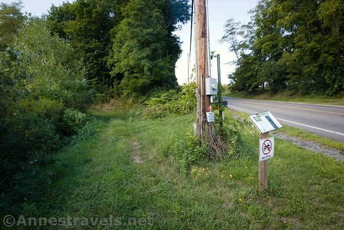
The south end of the Sodus-Wallington Trail begins at the junction of Geneva Road and Old Ridge Road (it’s just north of Rt-104, so that makes for very easy access). The trailhead is marked and there’s space in the grassy area beside the road for three or four cars. We were the only people parked there on a Friday in September.

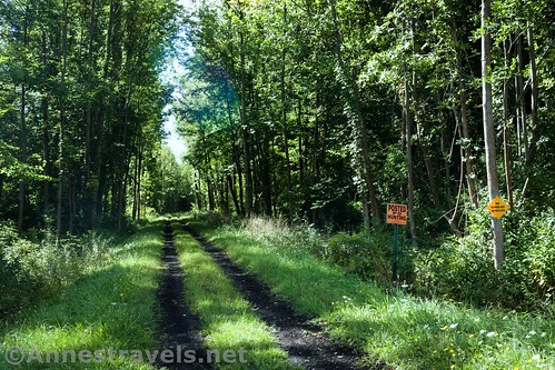
For the next 2.25 miles, the trail gradually descends on the old railroad bed. It’s two-track (despite the fact that signs say ATVs are welcome and ATVs are not allowed – I’d guess they’re not allowed) between the trees. Occasionally views extend to farms or historic houses along the trail.

At 2.25 miles, the trail turns left to leave the railroad bed. The rest of the railroad must be owned by a local business or something. At any rate, the trail suddenly becomes somewhat hilly the last 0.75 miles to Margaretta Road, where the trail officially ends.
Now, what we should have done was to continue on the non-official trail that continues across the road (it should – technically – take you to the old roundhouse and turntable). However, my biking companion missed the trail and was well east down Margaretta Road by the time I saw it. So I turned right and followed him to the T with Rt-14. The good thing about going this way is that there is a little park directly across the street from the Margaretta Road/RT-14 junction. There are a few picnic tables and a few views out onto Sodus Bay as well as parking if you want to park at this end of the trail.

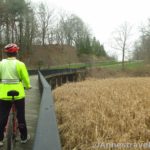
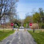
To get to Sodus Point from here, head north (left turn at the end of Margaretta Road, right turn out of the driveway to the park) on Rt-14. There is a fair-sized bike lane, so the traffic didn’t bother me. After 0.4 miles, you’ll pass a side street on the left. We’ll be revisiting that side street later. Continue to where the road takes a sharp left turn northward next to the marina. At the next cross street, turn right to pass by the church and fire station.

The only tricky turn is 0.4 miles later, where you’ll want to turn left onto Bay Street Ext (next to the gas station), following the sign for the beach. If you miss the junction, you’ll find yourself in the finest part of downtown Sodus… aka in an area with restaurants, shops, etc. I removed it from the map, but we did miss the junction and had to come back up to turn toward the beach. At the next cross street, turn right onto Wickham Blvd for 0.3 miles to the parking lot for Sodus Point Beach Park.
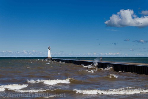
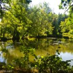
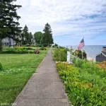
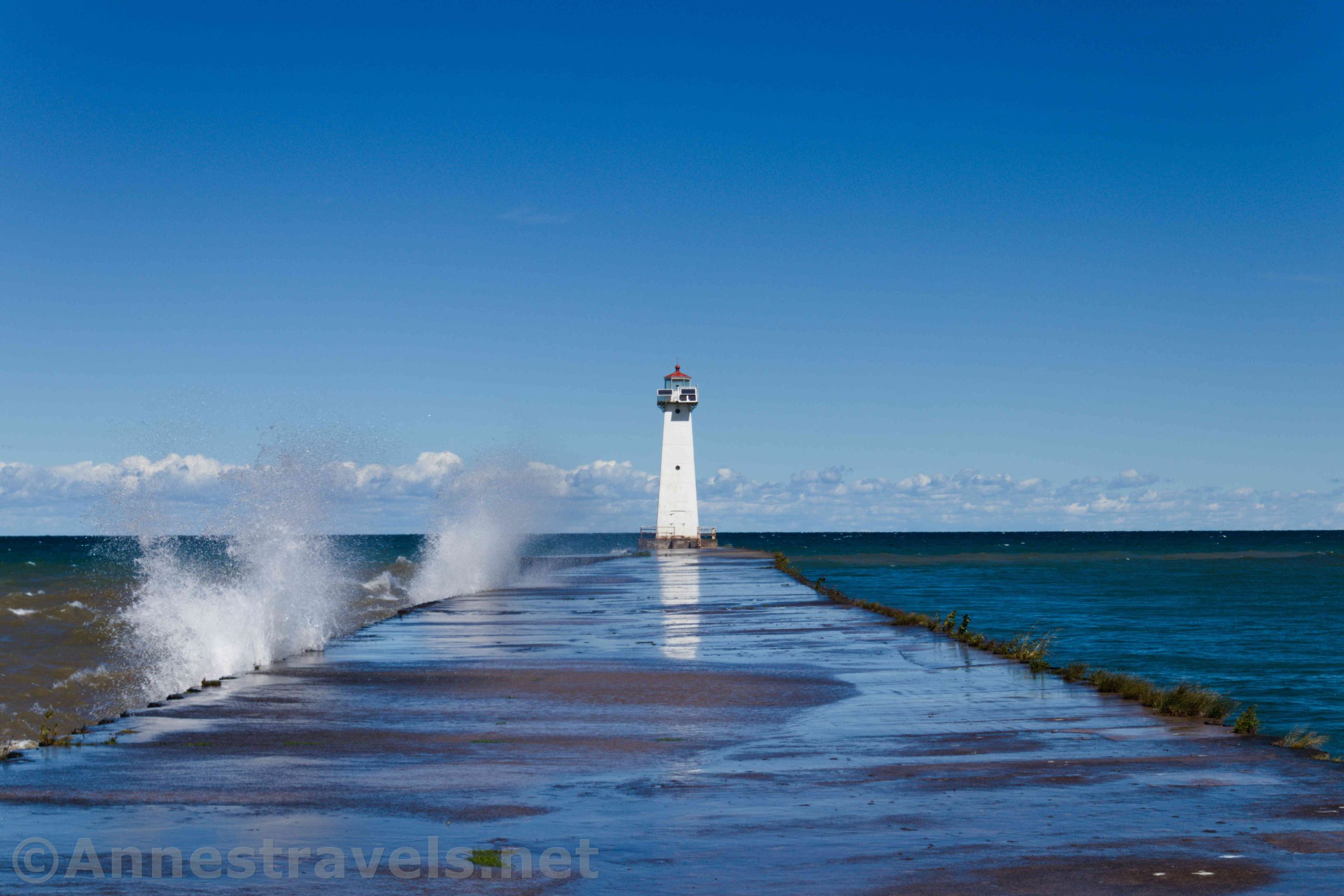
The park (usually) has restrooms, concessions, a beach, possible swimming, and (my favorite) a pier with a lighthouse on the end of it. The views are pretty good from the parking area, but of course I’ll tell you that I recommend hiking out to the end of the pier.

The pier is 0.25 miles long (OW). The day I visited was very, very windy and the waves were really breaking over the pier (I suspect that’s not normal given what I know about Lake Ontario). Most people were getting a few feet out and then turning around. We left our bikes at the end and made a dash for it – and for the most part, we stayed dry.

Be sure to look over to the east, across the inlet to Sodus Bay – you can see the Chimney Bluffs from here!

Back on solid, dry ground, we biked back down to Bay Street Ext and back down Rt-14. Just before we reached Sentell Street (remember that side street I mentioned earlier?), we could see that the railroad had gone behind some old industrial buildings and grain silos. We didn’t see any signs forbidding us, so we turned right onto the gravel driveway that went behind the buildings.

On the other side, we could see the old rails under the road (this is very typical along the Sodus-Wallington Line – the rails are removed everywhere except under the roads). So we turned down the driveway toward boat sheds (there is also a thriving RV storage business here). No one more than looked at us as we slowly biked past the boats, past the RVs, and, by always staying straight (right), arrived at the old turntable and roundhouse.

It was super cool, and not vandalized at all (which is amazing). Someone has put a basketball court in on top of part of the old turntable, but you can still see exactly where it was. The brick walls are also well-preserved.

We looked around, but we couldn’t locate the trail from this end. So we gave up, went back out to Rt-14, and then… well, I had seen that we could get to Bentley Bend’s Preserve if we rode back along Rt-14, so we checked that out (warning: that is a hilly 2.4 mile ride down Rt-14; turn left on Red Mill Road). But that’s a topic for another post!
Round Trip Trail Length: Just the official Sodus-Wallington Trail is 6 miles RT. Adding on Sodus Point is 10.4 miles RT. Adding on the side trip to the roundhouse put us at 11.2 miles RT.
Elevation Gain: About 500ft. overall; the Sodus-Wallington Trail loses only about 150ft. of elevation
Facilities: Restrooms, picnic tables, concessions, and more at Sodus Point Beach Park. Picnic tables at the end of Margaretta Street.
Fees: None
Trail Notes: My biking companion said this was one of the best-maintained rails-to-trails he’s been on. My caveat is that it’s the best maintained extremely rural rails-to-trails – there is vegetation in the middle of the trail! The Sodus-Wallington Trail is obviously used by snowmobiles in the winter. Be very sensitive to local owners’ property, since parts of the trail are more or less official than others. Bring bug spray for the trail if you’re hiking.

Trail 
![]()
Road
Signs ![]()
![]()
Scenery ![]()
Would I go 100 miles out of my way for this? ![]()
![]()
Overall Rating: ![]()

GPS Coordinates for the Sodus-Wallington Trail
Trailhead: 43.2219833°, -077.0124167° (N43° 13.319′ W77° 00.745′ / 43°13’19.1400″, -077°00’44.7000″) (415ft.) (0.0) (end 16.23)
Northern “Trailhead”: 43.2630167°, -077.0013333° (N43° 15.781′ W77° 00.080′ / 43°15’46.8600″, -077°00’04.8000″) (312ft.) (3.05)
Park along Rt-14: 43.2628500°, -076.9939500° (N43° 15.771′ W76° 59.637′ / 43°15’46.2600″, -076°59’38.2200″) (279ft. (3.47)
Lighthouse: 43.2773167°, -076.9739667° (N43° 16.639′ W76° 58.438′ / 43°16’38.3400″, -076°58’26.2800″) (244ft.) (5.89 with jaunt through downtown)
Roundhouse: To protect the privacy of the boatshed owners, I’m not going to give GPS coordinates of the roundhouse. (265ft.) (7.0)

The gpx file for the Sodus-Wallington Trail from Geneva Road to Sodus Point can be downloaded – please note that this and the GPS Coordinates are for reference only and should not be used as a sole resource when hiking this trail.
Download GPX File size: 75.8 KB Downloaded 518 times
You can also download the GPS file for my entire ride (Sodus-Wallington Trail, Sodus Point, Rt-14 to Bentley Bond’s Preserve, Glover Road to the rail trail, and back to the trailhead).
Download GPX File size: 102.9 KB Downloaded 490 times
(Note: I do my best to ensure that all downloads, the webpage, etc. are virus-free and accurate; however, I cannot be held responsible for any damage that might result, including but not limited to loss of data, damages to hardware, harm to users, from use of files, information, etc. from this website. Thanks!)

Getting to the Sodus-Wallington Trailhead
From the Rochester area, take either Rt-104E or Rt-590 and Rt-104E to the bridge over Irondequoit Bay (even if you’ve never seen it before, you can’t miss it). Keep driving on Rt-104E 27 miles to S Geneva Road. Turn left for 0.2 miles. At the crossroad with Old Ridge Road, go sort of straight sort of left to continue on Geneva Road. The trailhead is immediately after the road junction, on the right.

From I-90, take Exit 42 toward Geneva and Lyons. After the toll booth, turn north (left) on Rt-14. After 8 miles, take a left onto Lawrence Street and an almost immediate right onto William Street for 0.2 miles. Turn right onto Broad Street and another almost immediate turn left onto Maple Street. Stay on Maple Street (sometimes known as S Geneva Road) for 10.9 miles to the trailhead, on the right, shortly after crossing Rt-104 and immediately after crossing Old Ridge Road.

This Week’s Featured Product!
For more adventures in western and central New York, check out this guide to waterfalls. From paved trails to creek walks, there are some truly beautiful and fun hikes in this book.