
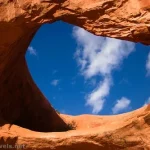
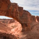
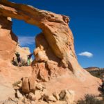
Gold Bar Arch has a colloquial name – Jeep Arch. It’s not hard to figure out why; the opening looks like a jeep, all ready for an adventure! With such a cool arch to see as well as some nice views, the trail sees plenty of foot traffic, even if it’s located away from the main sights around Moab, down toward Potash. I did it on a gray autumn day, but even so, I had company on the trail.
Quick Stats
I hear that the BLM has gone through and marked the trail with green paint since my visit. I’m very happy to hear about that. Because when I went, there were dozens and dozens of cairned trails, most of which petered out after a half a dozen cairns or so – just far enough to leave you completely lost. By the time we finally came in sight of the arch, I was so totally done with trying to find a trail! So be glad for this improvement that will make your life much easier.
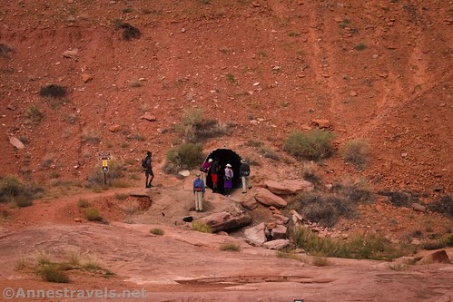
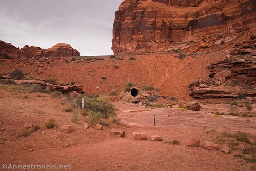
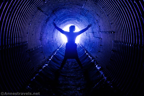
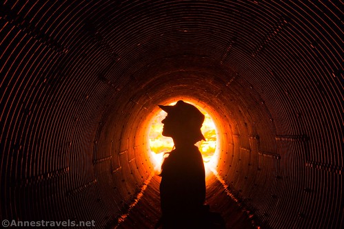
The path begins at the right (when you’re facing away from the road) end of the parking area, just down the road from Corona Arch and the Gold Bar Campground. The trail wanders north to where it passes under the railroad tracks via a culvert, likely installed specifically for this purpose. It’s pretty neat!

Once in the wash on the other side, the trail turns sharply left to rise up to (and above) the elevation of the tracks. As with most railroads, it’s illegal to walk along the tracks or the ballast. But that doesn’t stop you from being able to see them!
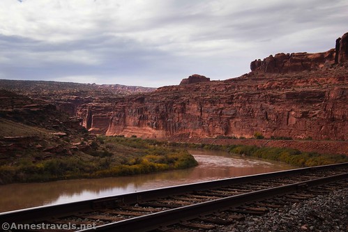
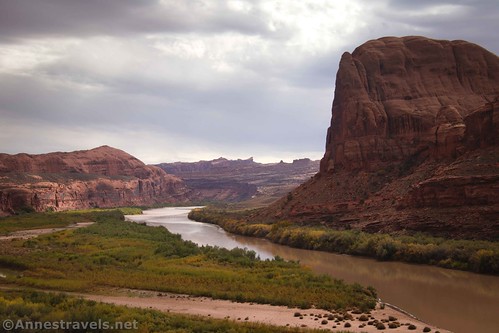
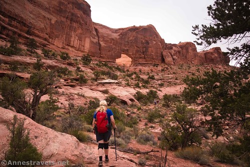
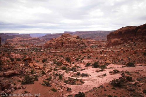
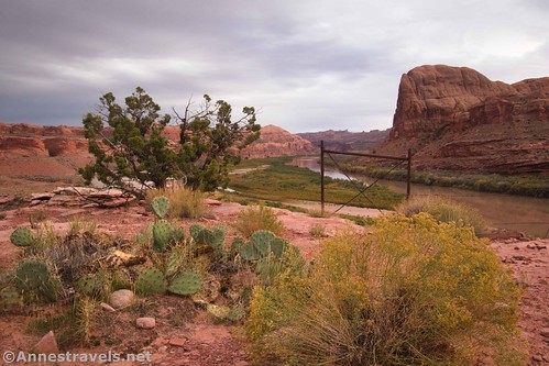
At last, the trail seems to find some equilibrium of altitude as it turns right up the side of the canyon. Be sure to look back near here, as the views of the Colorado River are excellent.
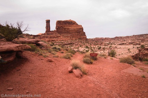
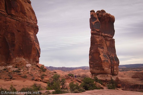
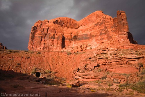
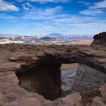
About 1.5 miles from the trailhead, the path splits at a junction marked “Loop.” You can go either way; however, for the best views of the “jeep,” I recommend turning right. From the junction, if you look slightly left, you can see the Gold Bar formation that gives so many features in the area their name.
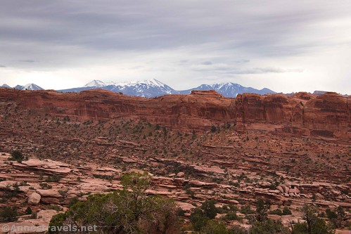
Follow the path and painted blazes across several slickrock shelves. Views range from down into nearby Dragonfly Canyon to the La Sal Mountains, far away across the Colorado River.
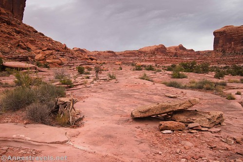
This was where I got lost many, many times. If I’d been in the mood for an exploration, it would have been fun. As it was, be glad you have the paint job that should keep you on track.
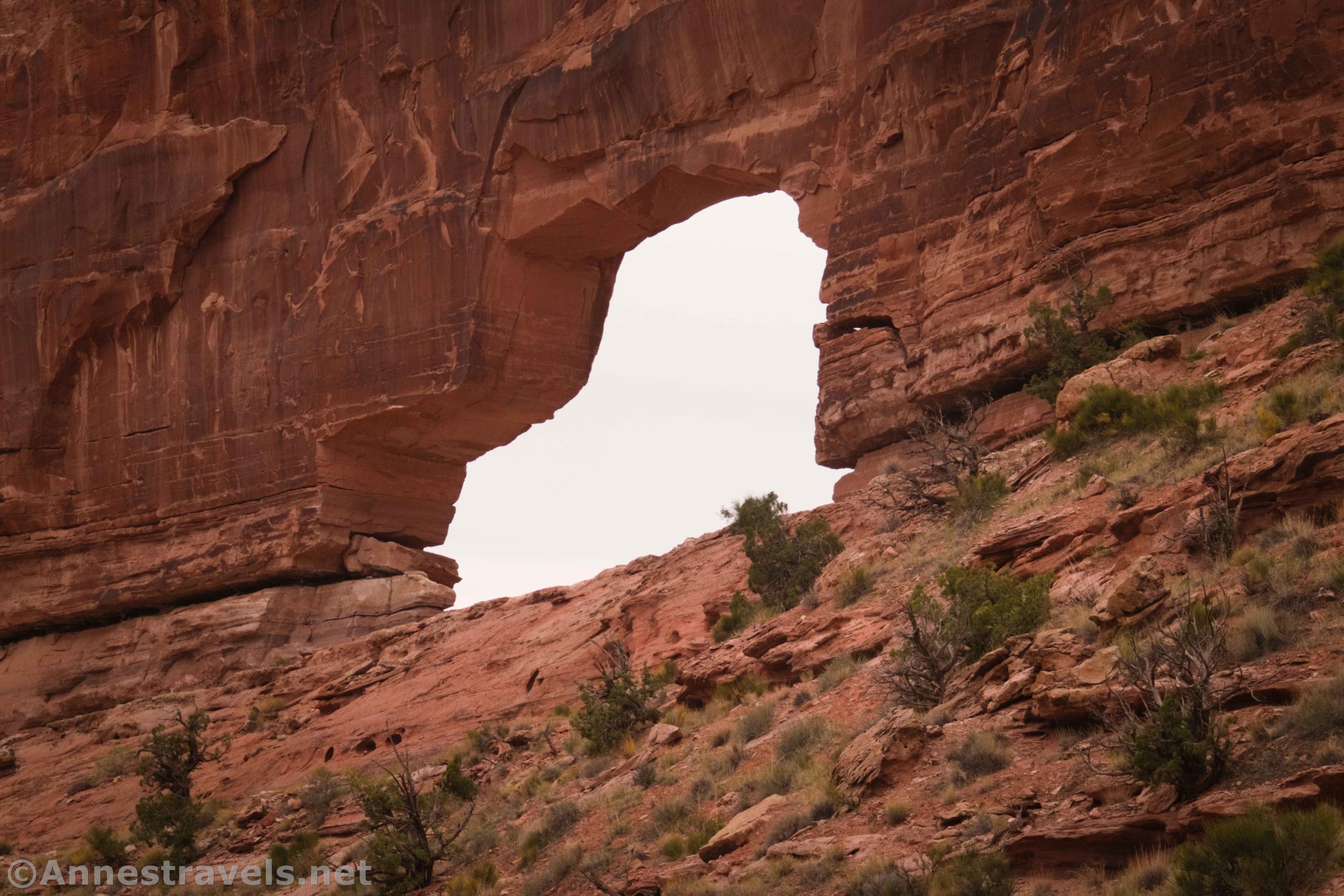
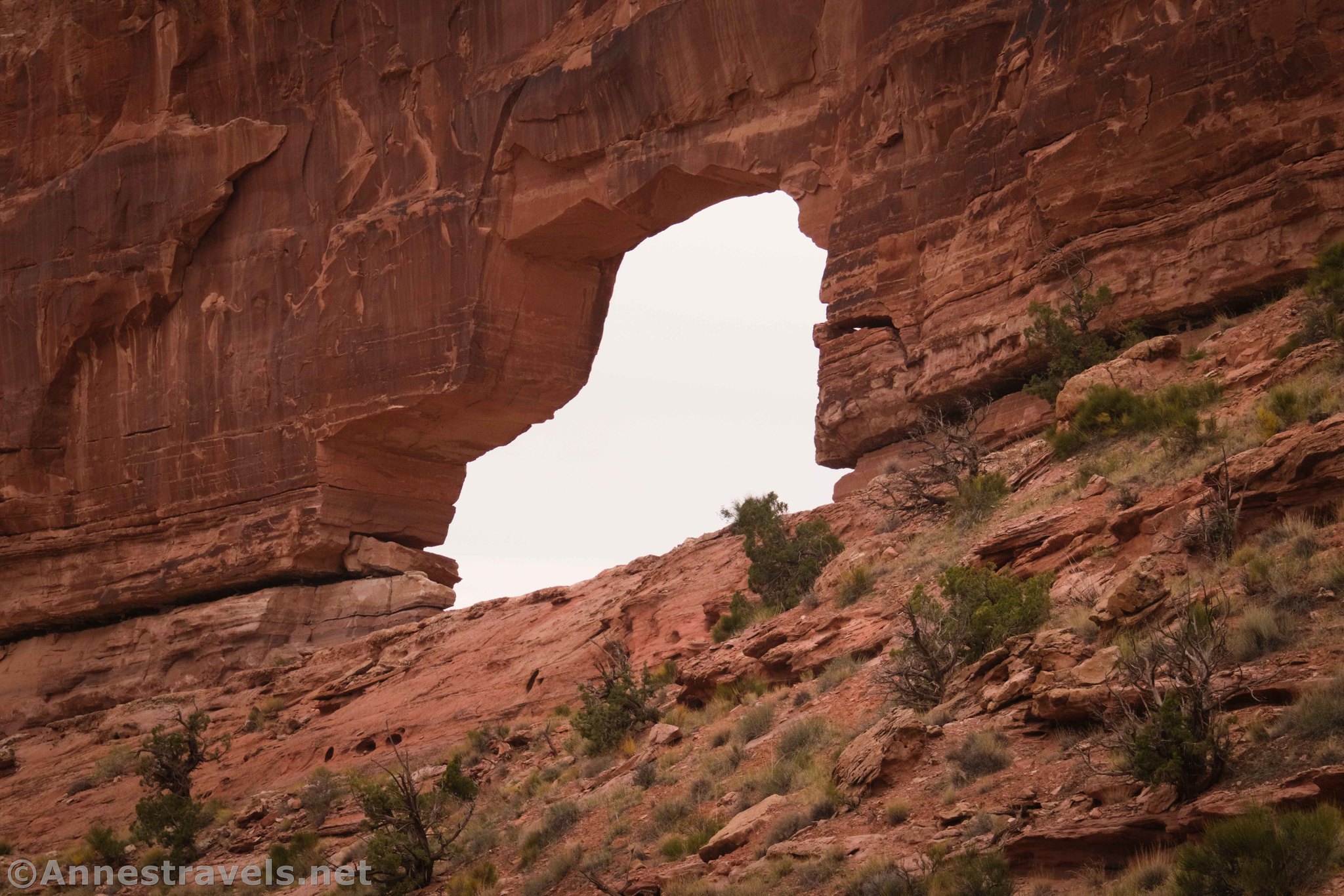
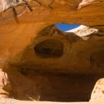
At last, Gold Bar Arch comes into sight, looking very much like Jeep Arch. (As in the arch is shaped like a jeep.) The route waggles its way up to pass through the arch.

The view from inside the arch is quite good. Since people were on both sides of the arch, trying to take pictures, I did my best to only stand in it long enough to take photos, myself. There are ledges on either side of the arch that are a comfortable place to enjoy the view. Over to the west, the Poison Spider Jeep Trails are just out of sight. But they can be heard sometimes.
Hike down the other side. Maybe it was just because we were heading down, but I found the trail to be much easier to follow on this side of the arch. Looking back, the arch appeared more like a stubby car in a hurry (or a shoe, or a pig?) than a jeep.

The trail ahead is quite scenic, heading down to pass by the Gold Bar.
Once you arrive back at the loop junction, turn right to return to the parking area. We ended up having to wait for a few of our group members, so the rest of us played around in the culvert under the railroad tracks for a few minutes. We’re just slightly obsessed with tunnels!
Most of the crowds had petered out by the time we made it back to the parking area. But the sun just before sunset was very nice!
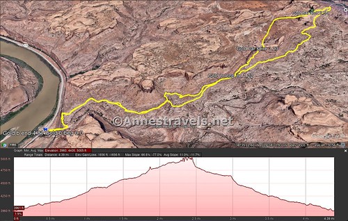
Round Trip Trail Length: I hiked 4.8 miles
Elevation Gain: 1,656ft. (3,960ft. to 5,005ft.)
Facilities: None
Fees: None
Trail Notes: Dogs must be on a leash due to desert bighorn sheep. Bicycles and camping are not allowed. My GPX track is probably not super accurate, though it should get you to the trailhead just fine. Even on the “stick” of the lollipop, I got off-track and ended up with two “lollies” instead of just the one that loops through the arch (see the map below).
Trail 
![]()
![]()
Road ![]()
Signs ![]()
![]()
Scenery ![]()
Would I go 100 miles out of my way for this? ![]()
Overall Rating: 
![]()

Gold Bar Arch (Jeep Arch) GPS Coordinates
Gold Bar Arch TH: 38.578448,-109.635910 (38°34.70688′, -109°38.15460′ / 38°34’42.4128″, -109°38’09.2760″) (3,963ft.) (0.0)
Loop Junction: 38.590367,-109.635001 (38°35.42202′, -109°38.10006′ / 38°35’25.3212″, -109°38’06.0036″) (4,412ft.) (1.22)
Gold Bar Arch/Jeep Arch: 38.599068,-109.639343 (38°35.94408′, -109°38.36058′ / 38°35’56.6448″, -109°38’21.6348″) (4,939ft.) (2.55)

Gold Bar Spire: 38.593135,-109.636770 (38°35.58810′, -109°38.20620′ / 38°35’35.2860″, -109°38’12.3720″) (4,645ft.) (3.23)
Return to Loop Junction: 38.590368,-109.634978 (38°35.42208′, -109°38.09868′ / 38°35’25.3248″, -109°38’05.9208″) (4,410ft.) (3.52)
End: 38.578475,-109.635875 (38°34.70850′, -109°38.15250′ / 38°34’42.5100″, -109°38’09.1500″) (3,963ft.) (4.81)
The gpx file for Gold Bar Arch/Jeep Arch can be downloaded – please note that this and the GPS Coordinates are for reference only and should not be used as a sole resource when hiking this trail.
Download GPX File size: 101.4 KB Downloaded 445 times
(Note: I do my best to ensure that all downloads, the webpage, etc. are virus-free and accurate; however, I cannot be held responsible for any damage that might result, including but not limited to loss of data, damages to hardware, harm to users, from use of files, information, etc. from this website. Thanks!)

Getting to Gold Bar Arch (Jeep Arch) Trailhead
From Moab, drive north on US-191 (toward Arches National Park). Shortly after crossing the bridges over the Colorado River and Courthouse Wash (but before the entrance to Arches National Park), turn left on UT-279 (toward Potash). Drive 10.2 miles to a parking lot on the right.
Today’s Featured Product!
Explore 20 hikes in the Moab area, most outside of Arches National Park. Canyons, arches, overlooks, and more can be found within these pages. Buy your copy here!


2 responses to “Hiking Gold Bar Arch (Jeep Arch)”
[…] the Gold Bar Arch Trail, […]
[…] on track (more or less!), we hiked up to Jeep Arch (Gold Bar Arch). Personal opinion of me: The scenery is great, but the trail is awful. There are so many cairn […]