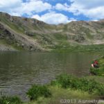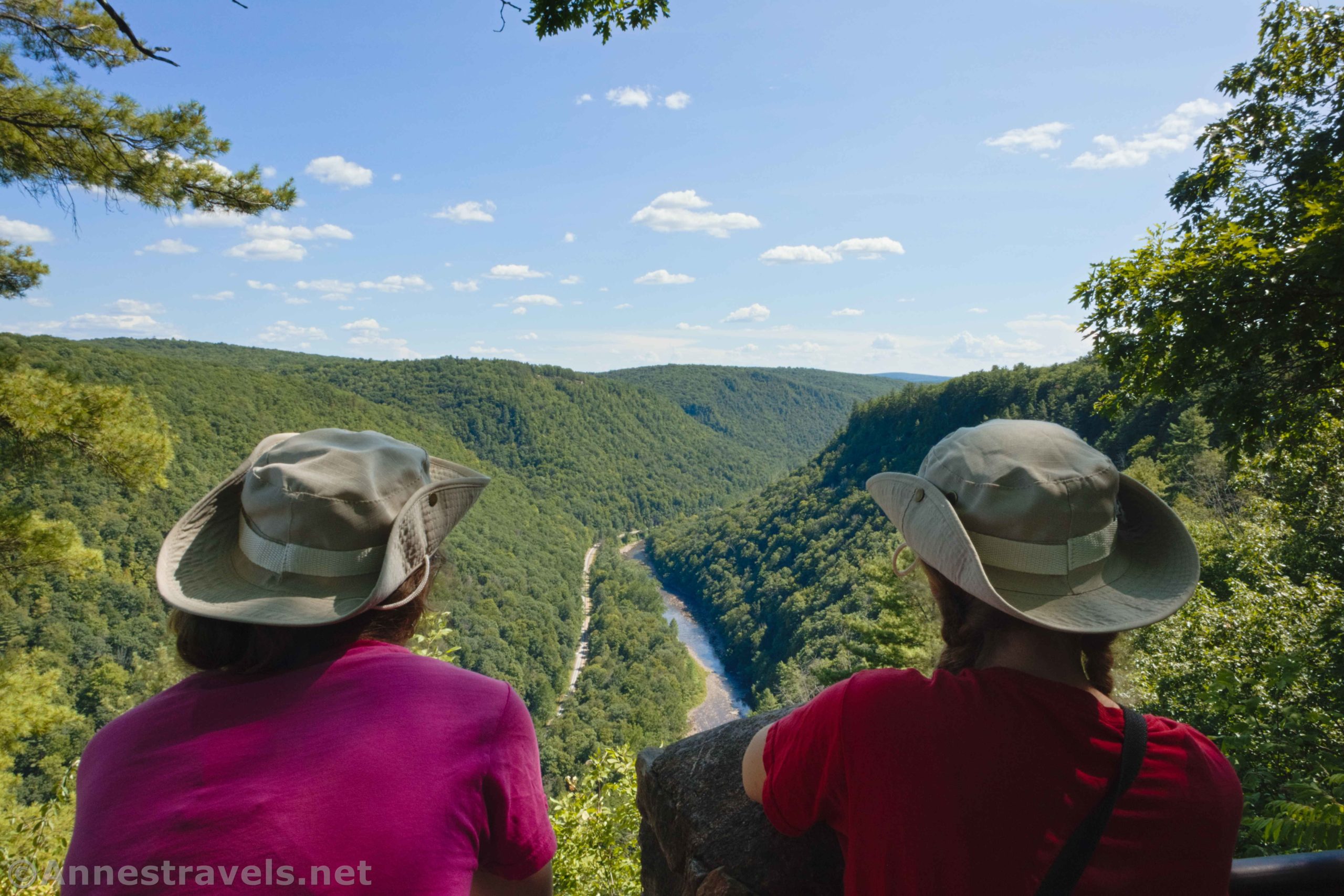

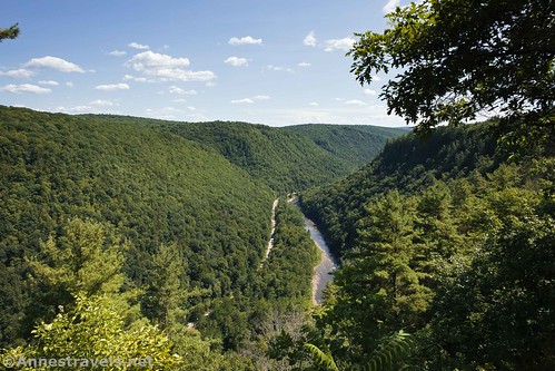
There is one classic view of the Grand Canyon of Pennsylvania from Colton Point State Park. It’s just a little viewpoint along the road, but it gives great views of Pine Creek, the Pine Creek Rail Trail, the Grand Canyon, and the surrounding hills that Easterners call mountains. It was a very pretty place to stop for a few minutes on a sunny August afternoon.
Quick Stats
Note: Some of the links in this post are affiliate links. If you click one and purchase something, I may earn a small commission without an extra cost to you.
We were on our way back from hiking the Turkey Path down to the bottom of the canyon (which is a great hike if you don’t mind almost 2,000ft. of elevation gain in 1.75 miles). We decided to stop at the overlook on our way out of the park, and I’m so glad we did!

The trail to get to the overlook isn’t far – in fact, you may walk further from the parking area to cross the road than once you get to the trail. A couple of steps take you up onto the observation platform.
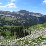
I’m going to guess that someone keeps the trees trimmed around the viewpoint. If they didn’t, it would probably be pretty grown in with trees. We are in the northeastern US here!
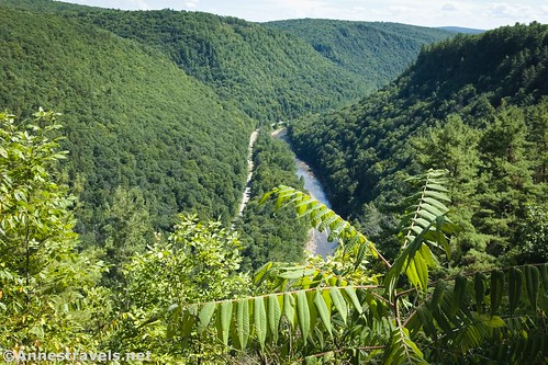
The overlook offers views both south downcanyon (the classic view) and also north upcanyon. It’s hard to say which view is better – downcanyon has the S curve, but upcanyon you can see mountains and a farmer’s field.
I also tried to catch a photo of a soaring turkey vulture, but that proved difficult. I was trying out my new camera on that trip, and it didn’t have a zoom lens worth talking about. I fixed that later (and now people think I must know what I’m doing based on the size of my camera lens…) But it was still so cool to see a bird soaring below us instead of above us!

I hear that there is another overlook at the far southern point of the road and also across the canyon in Leonard Harrison State Park. In fact, the trail out to Otter View looks like it has some great views as well as a seasonal waterfall or two. But this one is so easy to get to you might as well check it out if you happen to be in Colton Point State Park!
Round Trip Trail Length: A couple hundred feet, including walking from the parking area
Elevation Gain: N/A. You’re at about 1,765ft. here
Facilities: None here. There are primitive restrooms in the campground (to the north) and near some of the picnic pavilions (to the south).
Fees: None
Trail 
![]()
Road ![]()
Signs ![]()
![]()
Scenery ![]()
Would I go 100 miles out of my way for this? ![]()
![]()
Overall Rating: 
![]()
GPS Coordinates for the Colton Point State Park Viewpoint
Grand Canyon of PA Viewpoint: 41.7082167°, -077.4651000° (N41° 42.493′ W77° 27.906′ / 41°42’29.5800″, -077°27’54.3600″) (1,764ft.)

Getting to the Turkey Path Trailhead in Colton State Park
From Williamsport, drive north on US-15 (future I-99 Corridor). After 27 miles, take Exit 162 for PA-414 toward Liberty and Morris. At the bottom of the ramp, turn left onto PA-414W for 9.8 miles; continue straight when the road becomes PA-287N in the town of Morris. After another 5.6 miles, turn left onto Dean Hill Road for 0.3 miles, then turn left onto Balsam Road for 3.0 miles. Continue straight on Pheasant Hill Road for 1.8 miles. Turn right as the road changes names to Kendrick Road for 0.7 miles, then becomes Airport Road for 0.8 miles. Turn left onto PA-362W (aka Pine Creek Road) for 3.4 miles and then turn left onto US-6W for 0.4 miles. At this point you’re probably tired of making turns, but you’ll need to make another left turn onto Colton Road for 4.4 miles to a small parking area on the right.
From Wellsboro, drive 2.5 miles west on PA-660 aka West Avenue. Continue straight when the road changes names to PA-362W for 5.3 miles. At US-6, turn left for 0.4 miles; make another left turn onto Colton Road for 4.4 miles to a small parking area on the right.
You can also come in on US-6E; the turn into Colton State Park is 78 miles from the US-6/US-219 junction.

This Week’s Featured Product!
There are so many hiking trails in the state of Pennsylvania, and many have great views, waterfalls, or both. Hershey-based author Matthew Cathcart takes you on 50 hikes across the state in this book.