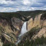
The premier hiking trail in the Grand Canyon of Pennsylvania is the Turkey Path. The trail goes from the rim of the canyon to Pine Creek at the bottom of the Grand Canyon. However, the term is misleading: There are actually two Turkey Paths, one down from the eastern rim in Leonard Harrison State Park and one from the western rim in Colton Point State Park. The two can be connected if you don’t mind getting your feet wet, but most people just hike one or the other.
Quick Stats
(Affiliate links are present on this page.)
I hiked down the Turkey Path from Colton Point State Park. It’s only 3.5 miles RT, but what a 3 miles! The trail is definitely steep and narrow, so wear good shoes and be ready to puff and pant even if you’re in good physical condition.
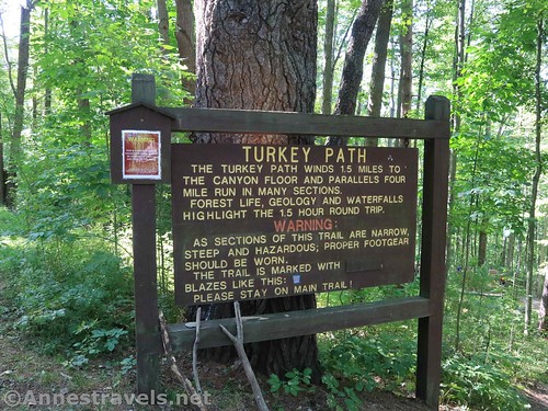
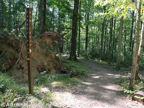
The trail begins near the huge signboard warning hikers that the trail isn’t as easy as it sounds. It joins the Rim Trail almost immediately (turn left) and then stays on the Rim Trail until mile 0.1, when the Rim trail goes left and the Turkey Path goes right. After this, the Turkey Path is blazed in blue (the Rim Trail is blazed in yellow).
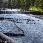
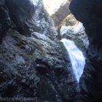
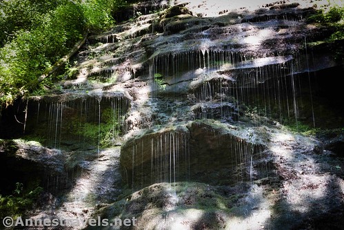
The trail almost immediately begins steep switchbacks down into the Fourmile Run gully. A waterfall (mostly dry in mid-August) greats you part way down the switchbacks.

The trail goes around the side of the hill to continue switchbacking. A social trail at the end of a switchback takes you back around to another waterfall – it would be beautiful with more water on it. As it was, the dripping moss was ample inspiration for slow-shutter-speed shots.
One of the awkward things about the Turkey Path is the number of social trails. Most go down to the stream (you don’t want any of those). In general, it’s not hard to follow the right path, but at one point about halfway from the top, the trail comes to a major junction. Right goes steeply down to the stream, while left stays about level on the hillside. Thankfully my GPS helped us out after we’d taken the right-hand trail (which is the wrong trail) – you want the left trail if you’re trying to get down to Pine Creek. The other (right-hand) trail takes you down to Fourmile Creek, which goes through private property on its trickle down to Pine Creek.
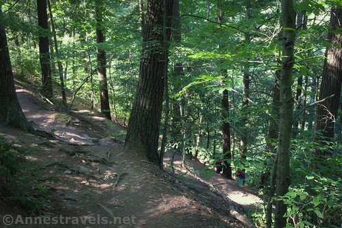
The trail does descend a bit more, finally taking a long switchback through the forest and passing by a camping area (though I don’t think camping is allowed) just before dropping down to the rocky beach along Pine Creek.

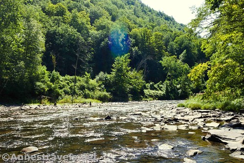
The views here are nice of the creek. The leaves were just starting to color on some of the trees (in August?!?), which made it even more beautiful. Directly across Pine Creek is an old rail bridge over Little Fourmile Run (can you see why it’s confusing?) The bridge is part of the Pine Creek Rail Trail, and chances are you’ll see lots of bikers and hikers on the bridge.

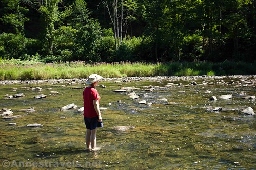
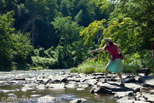
Several of us took off our socks and shoes and waded across Pine Creek (in mid-August, the water wasn’t even up to my knees). At the other side, we scrambled up under the railroad bridges (one was built in 1904!) and inspected them from underneath. One of my group (who works for a railroad) commented on the construction – and why they’d have wanted to make one of the two bridge with four I-beams instead of two. I walked up the stream and discovered some waterfalls and the other Turkey Path, which comes down from Leonard Harrison State Park. I believe it was closed the summer of 2020 for repairs. But in general, there’s no reason why you couldn’t hike down one side, wade across Pine Creek, and climb up the other side.

On my way back, some people called down to me from the rail trail. “Could you tell me where the Grand Canyon is?” the man asked. “Sure,” I said, straight-faced. “It’s in Arizona!” I did explain that they were in Pennsylvania’s Grand Canyon right then, but that it’s hard to see it from the bottom, and they’d be better off seeing it from the rim. They went off to see if they could find the rim, and I waded back across Pine Creek to the western side.
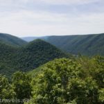
But it brought up a good point: Pennsylvania’s Grand Canyon is nothing at all compared to Arizona’s Grand Canyon. In fact, I would go so far as to say that Letchworth State Park in New York is better because it has waterfalls (and it’s much more canyon than the Grand Canyon of PA). The scenery here reminds me of the Delaware Water Gap, especially from Mount Tammany, although it’s also similar to the views from Mt. Minsi (though the Delaware River is definitely bigger than Pine Creek).
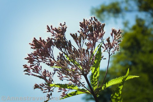
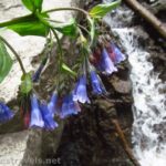
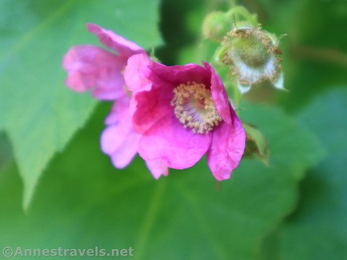
We ate lunch on the beach, then we put our socks and shoes back on and explored downstream for a short distance. There were quite a few trout near where Fourmile Run came out of the forest (I’m not altogether sure we weren’t on private property there, but no one seemed to mind). We admired the trout, skipped a few stones (not where the trout were!), took pictures of wildflowers on the bank and leaves in the water, and then retraced our steps back to the parking area.

Overall? It’s really hard to get a good view of the Grand Canyon of Pennsylvania except from the Viewpoint (post coming soon!) And even that doesn’t live up to Grand Canyon standards. But the Turkey Path is an excellent place to enjoy a forest walk, see waterfalls, and explore the shores of Pine Creek. Also, be sure to stop at the overlook on your way out of the park!
Round Trip Trail Length: My GPS came out at 3.5 miles, which didn’t include crossing Pine Creek or exploring downstream.
Elevation Gain: 1,986ft. (1,684ft. at the trailhead to 1,102ft. at Pine Creek)
Facilities: From the parking area, walk up the stairs and keep going straight and you’ll get to some primitive restrooms. There is a picnic area not too far away.
Fees: None
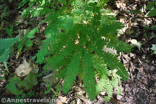
Trail Notes: The trail is steep! Don’t underestimate the time/energy required to hike it. Much of the trail is in the forest. I saw one small patch of something that could have been poison ivy along the trail, but no one in my group had any issues, so it’s possible that I misidentified it. I’d recommend hiking the trail after a good rain or in the spring for the full effect of the waterfalls – though the trail might be a bit muddy!
Trail 
![]()
![]()
Road ![]()
Signs
Scenery ![]()
Would I go 100 miles out of my way for this? ![]()
![]()
Overall Rating: ![]()

GPS Coordinates for the Turkey Path in Colton Point State Park
Trailhead: 41.7010333°, -077.4659500° (N41° 42.062′ W77° 27.957′ / 41°42’03.7200″, -077°27’57.4200″) (1,684ft.) (0.0) (end 3.47)
Rim Trail Junction (final junction): 41.6997000°, -077.4662500° (N41° 41.982′ W77° 27.975′ / 41°41’58.9200″, -077°27’58.5000″) (1,534ft.) (0.13)
Pine Creek (bottom of trail): 41.6989667°, -077.4596333° (N41° 41.938′ W77° 27.578′ / 41°41’56.2800″, -077°27’34.6800″) (1,102ft.) (1.69)
The gpx file for the Turkey Path in Colton State Park can be downloaded – please note that this and the GPS Coordinates are for reference only and should not be used as a sole resource when hiking this trail. Also, note that this is only the Turkey Path and does not include wading across the Pine Creek or exploring downstream to Fourmile Run.
Download GPX File size: 53.5 KB Downloaded 409 times
(Note: I do my best to ensure that all downloads, the webpage, etc. are virus-free and accurate; however, I cannot be held responsible for any damage that might result, including but not limited to loss of data, damages to hardware, harm to users, from use of files, information, etc. from this website. Thanks!)
Getting to the Turkey Path Trailhead in Colton Point State Park
From Williamsport, drive north on US-15 (future I-99 Corridor). After 27 miles, take Exit 162 for PA-414 toward Liberty and Morris. At the bottom of the ramp, turn left onto PA-414W for 9.8 miles; continue straight when the road becomes PA-287N in the town of Morris. After another 5.6 miles, turn left onto Dean Hill Road for 0.3 miles, then turn left onto Balsam Road for 3.0 miles. Continue straight on Pheasant Hill Road for 1.8 miles. Turn right as the road changes names to Kendrick Road for 0.7 miles, then becomes Airport Road for 0.8 miles. Turn left onto PA-362W (aka Pine Creek Road) for 3.4 miles and then turn left onto US-6W for 0.4 miles. At this point you’re probably tired of making turns, but you’ll need to make another left turn onto Colton Road for 4.5 miles; take another left across from the campground. Stay left on the one-way road to go around the circle to the fairly large parking area just beyond the sign for the Turkey Path.
From Wellsboro, drive 2.5 miles west on PA-660 aka West Avenue. Continue straight when the road changes names to PA-362W for 5.3 miles. At US-6, turn left for 0.4 miles; make another left turn onto Colton Road for 4.5 miles. Take another left across from the campground. Stay left on the one-way road to go around the circle to the fairly large parking area just beyond the sign for the Turkey Path.
You can also come in on US-6E; the turn into Colton State Park is 78 miles from the US-6/US-219 junction.

(Note: I do my best to ensure that all downloads, the webpage, etc. are virus-free and accurate; however, I cannot be held responsible for any damage that might result, including but not limited to loss of data, damages to hardware, harm to users, from use of files, information, etc. from this website. Thanks!)
This Week’s Featured Product!
Explore the waterfalls of Pennsylvania with this guide. With more than 50 waterfalls to explore across the state (though it seems to be skewed toward the northern part of PA), it’s truly a book for waterfall-lovers and hikers alike.